

Notices to Mariners
January 30, 2026

Safety First, Service Always
Monthly Eastern Edition
CONTENTS
| Section 1 | General and Safety Information |
| Section 1A | Temporary and Preliminary Notices |
| Section 2 | Chart Corrections |
| Section 3 | Radio Aids to Marine Navigation Corrections |
| Section 4 | Canadian Sailing Directions Corrections |
| Section 5 | List of Lights, Buoys and Fog Signals Corrections |
Notices to Mariners – Monthly Eastern Edition
Edition No. 01/2026
Aussi disponible en français :
Avis aux navigateurs – Édition mensuelle de l’Est
Édition n° 01/2026
Published under the Authority of:
Canadian Coast Guard Programs
Aids to Navigation and Waterways
Montreal, QC H2Y 2E7
For more information, contact DFO.Notmar-Notmar.MPO@dfo-mpo.gc.ca.
© His Majesty the King in Right of Canada,
as represented by the Canadian Coast Guard, 2026.
Cat. No. Fs152-8E-PDF (Electronic PDF, English)
ISSN 2817-0075
Cat. No. Fs152-8F-PDF (Electronic PDF, French)
ISSN 2817-0083

Explanatory Notes – Notices to Mariners (NOTMAR)
Geographical positions refer directly to the graduations of the largest scale Canadian Hydrographic Service chart (unless otherwise indicated).
Bearings refer to the true compass and are measured clockwise from 000° (North) clockwise to 359°; those relating to lights are from seaward.
Visibility of lights is that in clear weather.
Depths - The units used for soundings (metres, fathoms or feet) are stated in the title of each chart.
Elevations are normally given above Higher High Water, Large Tide (unless otherwise indicated).
Distances may be calculated as follows:
1 nautical mile = 1,852 metres (6,076.1 feet)
1 statute mile = 1,609.3 metres (5,280 feet)
1 metre = 3.28 feet
Temporary and Preliminary Notices to Mariners – Section 1A of Notices to Mariners
These notices are indicated by a (T) or a (P), respectively. Please note that nautical charts are not amended by the Canadian Hydrographic Service for temporary (T) and preliminary (P) notices. It is recommended that mariners chart these corrections in pencil. For the list of charts affected by (T) & (P) notices, please refer to the current Notices to Mariners - Monthly Summary of Temporary and Preliminary Notices publication.
Suggestions and Corrections Form
This form is specifically for suggestions and corrections to Notices to Mariners publications. It is available online and also in fillable PDF format included with the monthly publication ZIP file.
To submit comments and suggestions on possible improvements to the various publications and services: DFO.Notmar-Notmar.MPO@dfo-mpo.gc.ca.
To report chart discrepancies and/or corrections to the Canadian Sailing Directions booklets: Fill out the Marine Information Reporting Form and/or email chsinfo@dfo-mpo.gc.ca.
To report emergencies or navigational hazards: Contact your nearest MCTS centre
- VHF channel 16 (156.8 MHz)
- MF/HF frequency 2182 kHz/4125 kHz (where available)
- ∗16 on a cellphone (where available)
NOTMAR Website – Monthly Editions, Chart Corrections and Chart Patches
The NOTMAR website allows users to access the monthly publications,
chart corrections, and chart patches.
Users can subscribe for free to the email notification service
to receive notifications when charts of interest are updated, including their patches, as well as when a new Monthly Edition of Notices to Mariners is published.
In addition, the monthly publication and related
files to download, such as chart patches, can be obtained
all together through the download of a single ZIP file.
Explanatory Notes – Canadian Hydrographic Service (CHS)
Chart Corrections – Section 2 of Notices to Mariners
Corrections to nautical charts will be listed in numerical order by chart number. Each chart correction listed applies only to that particular chart. Related charts, if any, will have their own specific correction listed separately.
Users should also refer to CHS Chart 1: Symbols, Abbreviations and Terms for additional information pertaining to the correction of charts.
The illustration below describes the elements that will comprise a typical Section 2 chart correction:

The last correction number is identified with the LNM/D or Last Notice to Mariners Number / Date.
Mariners are advised that only the most critical changes that directly affect safety to navigation are issued in “Section 2 – Chart Corrections.” This limitation is required to ensure that charts remain as clear and easy to read as possible. As a result, mariners may see minor discrepancies of a non-critical nature between information in official publications. For example, a small change in the nominal range or focal height of a light may not result in the production of a chart correction in Notices to Mariners, but may result in a correction in the List of Lights, Buoys and Fog Signals publication.
Note: In the case of a discrepancy between information provided on CHS charts relating to aids to navigation, and the List of Lights, Buoys and Fog Signals publication, the latter shall be deemed as containing the most up-to-date information.
Explanatory Notes – Marine Communications and Traffic Services (MCTS)
Navigational Warnings / Notices to Shipping
The Canadian Coast Guard (CCG) is implementing a number of changes to the aids to navigation system in Canada.
These changes are advertised as Navigational Warnings, formerly called Notices to ShippingFootnote 1, that are broadcast by the CCG, and are then followed up with Notices to Mariners, then charts are updated by hand correction, reprints or new editions.
Mariners are advised that all relevant Navigational Warnings (NAVWARN) should be kept until superseded by Notices to Mariners or through revised charts issued by the Canadian Hydrographic Service (CHS).
NAVWARN are accessible on the applicable regional page on the CCG Navigational Warnings.
CHS is reviewing the impact of these changes with CCG and together are preparing an action plan on the issuing of chart revisions.
For further information, contact your regional NAVWARN Issuing Desk.
Atlantic Region (North)
* Port aux Basques MCTS Centre
“N” Series NAVWARN
Canadian Coast Guard
49 Stadium Rd.
P.O. Box 99
Port aux Basques, NL A0M 1C0
Telephone: 709-695-2168 or 1-800-563-9089
Facsimile: 709-695-7784
Email: NAVWARN.MCTSPortAuxBasques@innav.gc.ca
Central Region
* Prescott MCTS Centre
“C” Series NAVWARN
Canadian Coast Guard
401 King Street West
P.O. Box 1000
Prescott, ON K0E 1T0
Telephone: 613-925-0666
Facsimile: 613-925-4519
Email: NAVWARN.MCTSPrescott@innav.gc.ca
Atlantic Region (South)
* Sydney MCTS Centre
“M” Series NAVWARN
Canadian Coast Guard
1190 Westmount Road
Sydney, NS B1R 2J6
Telephone: 902-564-7751 or 1-800-686-8676
Facsimile: 902-564-7662
Email: NAVWARN.MCTSSydney@innav.gc.ca
Arctic Region
* Iqaluit MCTS Centre
Operational from approximately mid-May until late December.
“A” Series NAVWARN
Canadian Coast Guard
P.O. Box 189
Iqaluit, NU X0A 0H0
Telephone: 867-979-5269
Facsimile: 867-979-4264
Email: NAVWARN.MCTSIqaluit@innav.gc.ca
* Service available in English and French.
Index
Numerical Index of Canadian Charts Affected
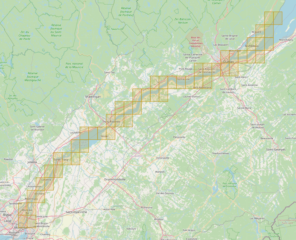
This numerical index lists all nautical charts mentioned in this monthly edition of Notices to Mariners. Only charts appearing in Section 2 of this publication require a chart correction. The appearance of charts in all other sections, particularly those related to the correction of other nautical publications, is included here for reference.
| 1310 | 4013 | 4209 | 5628 |
| 1316 | 4015 | 4321 | 7194 |
| 1317 | 4020 | 4374 | 7371 |
| 1433 | 4045 | 4486 | 7940 |
| 1438 | 4049 | 4644 | 7950 |
| 1439 | 4099 | 4827 | 8007 |
| 2085 | 4116 | 4920 | 8012 |
| 2314 | 4117 | 5340 | |
| 4010 | 4141 | 5412 |
SECTION 1 - GENERAL AND SAFETY INFORMATION
*505/23Canadian Hydrographic Service – Magnetic Declination Calculations
(Recurrent publication of notice *505/23, originally published in the Notices to Mariners – Monthly Eastern Edition 05/2023 publication.)
Mariners are advised that CHS has adopted the harmonized World Magnetic Model (WMM), as found on the NCEI/NOAA website. Old compass rose declination information on CHS navigational products can be updated using this website: https://www.ngdc.noaa.gov/geomag/calculators/magcalc.shtml#declination. While the differences in the model declinations are small each year, they can become more significant over a large period of time.
*1207/23Canadian Hydrographic Service – Inappropriate Geographical Names Review Process
(Recurrent publication of notice *1207/23, originally published in the Notices to Mariners – Monthly Eastern Edition 12/2023 publication.)
The records of the Canadian Hydrographic Service could contain geographical names that may be considered inappropriate, offensive and derogatory. Geographical naming authorities are in the process of addressing many offensive place names, the review process is underway. For more information, about inappropriate geographical names, please see the following announcement.
*1001/25Pilot Project – Guidelines for the Transit of Container Vessels up to 310 metres in Length x 40 metres in Beam – Québec–Montréal Segment
(Recurrent publication of notice *1001/25, originally published in the Notices to Mariners – Monthly Eastern Edition 10/2025 publication.)
NOTICE
This notice sets out the conditions under which container ships, with a maximum length of 310 metres and a beam of up to 40 metres, may safely transit the St. Lawrence waterway between Québec and Montréal.
Effective Date: September 30, 2025
Duration: This pilot project remains in effect until further notice or until permanent guidelines are established.
Scope of the Pilot Project
This pilot project applies to container vessels with following dimensions:
Length Overall: Between 300.01 metres and not exceeding 310.0 metres; and,
Moulded Breadth: Equal to or greater than 32.5 metres, not exceeding 40.0 metres.
Application of Notice to Mariners 27A
Notice to Mariners 27A remains applicable, except for the following sections, which are amended or replaced by the directives specified in this pilot project:
Section 2: Meetings in Risk Areas (R)
Section 3: Overtaking in Risk Areas (D)
Section 6: Maneuverability Assessment
Note: Any changes in the status of the vessel (e.g. hull, navigational equipment, propulsion, etc.) must be reported immediately to the Escoumins Marine Communication and Traffic Services Centre (MCTS Escoumins) prior to entering pilotage area.
Should a deficiency occur, it will be analyzed and reviewed by Canadian Coast Guard, Pilotage Authority and Transport Canada to determine steps to resolve the issue. A reauthorization will be required to proceed into pilotage areas as a vessel participating in a pilot project.
Specific Guidelines – Container Ships up to 310 m x 40 m
1. Meetings and Overtaking
All meetings and overtaking are permitted in accordance with
Notice 27A for all vessels, except for Wide Beam and Long
vessels.
For these vessels, the authorized zones for meeting and overtaking with vessel up to 310 m x 40m will be determined by the expert committee and communicated to MCTS within 48-hours prior to the transit, based on scheduled traffic of other Wide Beam and Long vessels.
2. Transit Safety Conditions and Measures
2.1 Transits will mostly occur during daylight between Québec and Montréal, depending on weather, traffic, and other navigational risk factors.
2.1.1 During hours of darkness, in favourable
conditions, passage is allowed for upbound container vessels
until Grondines.
2.1.2 The “Good Manoeuvrability” (BM)
classification, as defined in Sections 6 and 7 of Notice 27A,
cannot be assigned to the vessels covered by this pilot
project.
2.2 Minimum engine speed is required when approaching the Québec bridges and the Laviolette Bridge, provided environmental conditions allow.
2.3 Maximum speed over ground between
Île-aux-Vaches and Contrecoeur is 9 knots upbound and 11 knots
downbound.
2.4 During pilot changeovers at
Trois-Rivières, the handover of conduct shall take place,
upstream or downstream after the vessel has cleared the
Laviolette Bridge, weather conditions permitting.
2.5 At least 30 minutes before passing under
the Québec bridges and the Laviolette Bridge, qualified crew
members must be stationed:
•In the steering gear room, ready to activate emergency steering systems; and,
•On the forecastle, ready to drop anchors.
Each station must be equipped with independent communication means with the bridge.
2.6 An operational tug with a minimum bollard pull of 40 tonnes must be assigned and available during the vessel’s transit under the Laviolette Bridge. The tug must:
•Be within a 15-nautical-mile radius of the Laviolette Bridge;
•Ready to respond within one hour’s notice
Passage Management Framework
1. Coordination and Follow-up Procedures
Any shipowner or agent planning a transit under this pilot
project must notify the Laurentian Pilotage Authority (LPA)
at transit@apl.gc.ca
as soon as possible, and at least 10 days in advance.
2. Expert Committee
The expert committee responsible for monitoring this pilot
project consists of representatives from:
•Canadian Coast Guard (CCG)
•Corporation of Central St. Lawrence Pilots
(CPSLC)
•Laurentian Pilotage Authority (LPA)
•Montreal Port Authority (MPA)
•Transport Canada (TC)
Roles and Responsibilities:
•Pre-transit assessment: Hold a
meeting before each transit to analyze environmental,
operational, and safety conditions.
•Transit Planning: Coordinate vessel
arrival and ensure measures are implemented.
•Transit monitoring: Oversee and
study each transit
•Decision-making: Authorize or
postpone passage based on observed conditions and evaluated
risks.
3. Operational Flexibility
The expert committee may:
•Ease, reinforce, or modify safety measures based on weather, tides, or other risk factors.
•Place representatives on board for study and verification purposes within the pilot project.
Safety and Responsibility Clause
In applying these guidelines, it is understood that the pilot and bridge team must take into account all navigational hazards, collision risks, and special circumstances, as well as vessel limitations, which may require deviation from these measures to avoid immediate danger.
In such cases of deviation, or in any incident or situation,
the pilot must inform the nearest MCTS officer.
The pilot conducting the vessel is responsible to the master
for the safety navigation of the vessel.
(Section
38.01(3) of the Pilotage Act)
Pilot Project Progress
As part of this pilot project, safety measures will be continuously monitored and may be progressively adjusted by the expert committee based on:
•Operational experience acquired during transits under
varied conditions;
•Results of complementary technical studies;
•Assessment of the potential impact on traffic
fluidity; and,
•Recommendations made by the expert committee.
Any adjustment must be submitted to the Standing Committee on Navigational Safety (SCNS) for review and, if required, communicated through additional notices.
Reporting and Data Collection
After each voyage, pilots must submit to the expert committee a detailed report on vessel maneuverability and on meetings that occurred during the passage. MCTS will also submit a transit report.
The Laurentian Pilotage Authority will maintain a consolidated database of all transit and maneuverability reports related to this pilot project.
Contact Information
Laurentian Pilotage Authority
Phone: 514-657-2041 option 2
Email: transit@apl.gc.ca
*101/26Canadian Hydrographic Service – Electronic Navigational Charts
|
S-57 ENC Number |
Chart Title |
ENC Compilation Scale |
Published |
|
New Charts |
|||
|
CA547RGA (Edn 1.000) |
Main-à-dieu Passage |
1:11 000 |
2026-01-09 |
|
CA547RHA (Edn 1.000) |
Main-à-dieu Passage |
1:11 000 |
2026-01-09 |
|
CA548RGA (Edn 1.000) |
Main-à-dieu Passage |
1:11 000 |
2026-01-09 |
|
CA548RHA (Edn 1.000) |
Main-à-dieu Passage |
1:11 000 |
2026-01-09 |
|
CA556RWA (Edn 1.000) |
CA556RWA |
1:11 000 |
2026-01-23 |
|
CA55WSUA (Edn 1.000) |
CA55WSUA |
1:11 000 |
2026-01-03 |
|
CA55XSUA (Edn 1.000) |
CA55XSUA |
1:11 000 |
2026-01-03 |
|
CA5AFB0A (Edn 1.000) |
Port6650N10770W |
1:11 000 |
2026-01-09 |
|
CA5AFB1A (Edn 1.000) |
Port6650N10760W |
1:11 000 |
2026-01-09 |
|
CA5AFB2A (Edn 1.000) |
Port6650N10750W |
1:11 000 |
2026-01-09 |
|
CA5AXAWA (Edn 1.000) |
Port6809N10800W |
1:11 000 |
2026-01-23 |
|
CA5AXAXA (Edn 1.000) |
Port6809N10790W |
1:11 000 |
2026-01-23 |
|
CA5AXAYA (Edn 1.000) |
Port6809N10780W |
1:11 000 |
2026-01-23 |
|
CA5AXB9A (Edn 1.000) |
Port6809N10680W |
1:11 000 |
2026-01-23 |
|
CA5AXBAA (Edn 1.000) |
Port6809N10670W |
1:11 000 |
2026-01-23 |
|
CA5AYB9A (Edn 1.000) |
Port6820N10680W |
1:11 000 |
2026-01-23 |
|
CA5AYBAA (Edn 1.000) |
Port6820N10670W |
1:11 000 |
2026-01-23 |
|
CA5AYBBA (Edn 1.000) |
Port6820N10660W |
1:11 000 |
2026-01-23 |
|
CA5AYDAA (Edn 1.000) |
Port6820N10010W |
1:6 000 |
2026-01-02 |
|
CA5AYDBA (Edn 1.000) |
Port6820N10000W |
1:6 000 |
2026-01-02 |
|
CA5B0DAA (Edn 1.000) |
Port6830N10010W |
1:6 000 |
2026-01-02 |
|
CA5B0DBA (Edn 1.000) |
Port6830N10000W |
1:6 000 |
2026-01-02 |
|
CA5B19AA (Edn 1.000) |
Port6840N11330W |
1:6 000 |
2026-01-09 |
|
CA5B3EJA (Edn 1.000) |
Port6859N09600W |
1:6 000 |
2026-01-23 |
|
CA5B3EKA (Edn 1.000) |
Port6859N09590W |
1:6 000 |
2026-01-23 |
|
CA5B48UA (Edn 1.000) |
Port6870N11480W |
1:6 000 |
2026-01-09 |
|
Port6870N10900W |
1:6 000 |
2026-01-02 |
|
|
CA5B4CRA (Edn 1.000) |
Port6860N1019W |
1:11 000 |
2026-01-23 |
|
CA5B4CSA (Edn 1.000) |
Port6860N10180W |
1:11 000 |
2026-01-23 |
|
CA5B6BQA (Edn 1.000) |
Port6890N10530W |
1:11 000 |
2026-01-02 |
|
CA5B6BRA (Edn 1.000) |
Port6890N10520W |
1:11 000 |
2026-01-02 |
|
CA5B6BSA (Edn 1.000) |
Port6890N10510W |
1:11 000 |
2026-01-02 |
|
CA5B7BQA (Edn 1.000) |
Port6900N10530W |
1:11 000 |
2026-01-02 |
|
CA5B7BRA (Edn 1.000) |
Port6900N10520W |
1:11 000 |
2026-01-02 |
|
CA5B7BSA (Edn 1.000) |
Port6900N10510W |
1:11 000 |
2026-01-02 |
|
CA5B7BTA (Edn 1.000) |
Port6900N10500W |
1:11 000 |
2026-01-02 |
|
CA5B7BUA (Edn 1.000) |
Port6900N10490W |
1:11 000 |
2026-01-02 |
|
CA5B8BQA (Edn 1.000) |
Port6909N10530W |
1:11 000 |
2026-01-09 |
|
CA5B8BRA (Edn 1.000) |
Port6909N10520W |
1:11 000 |
2026-01-02 |
|
CA5B8BSA (Edn 1.000) |
Port6909N10510W |
1:11 000 |
2026-01-02 |
|
CA5BCF8A (Edn 1.000) |
Port6950N09370W |
1:11 000 |
2026-01-02 |
|
CA5BCF9A (Edn 1.000) |
Port6950N09360W |
1:11 000 |
2026-01-02 |
|
CA5BCFAA (Edn 1.000) |
Port6950N09350W |
1:11 000 |
2026-01-02 |
|
CA5CAKYA (Edn 1.000) |
CA5CAKYA |
1:4 000 |
2026-01-23 |
|
CA5CAL0A (Edn 1.000) |
CA5CAL0A |
1:4 000 |
2026-01-23 |
|
CA5CBKYA (Edn 1.000) |
CA5CBKYA |
1:4 000 |
2026-01-23 |
|
CA5CBL0A (Edn 1.000) |
CA5CBL0A |
1:4 000 |
2026-01-23 |
|
New Editions |
|||
|
CA24URFB (Edn 3.000) |
CA24URFB |
1:175 000 |
2026-01-23 |
|
CA24USNA (Edn 3.000) |
CA24USNA |
1:1 750 000 |
2026-01-23 |
|
CA262Q8A (Edn 3.000) |
CA262Q8A |
1:1 750 000 |
2026-01-23 |
|
CA262SNA (Edn 3.000) |
CA262SNA |
1:350 000 |
2026-01-23 |
|
CA279Q8A (Edn 3.000) |
CA279Q8A |
1:1 750 000 |
2026-01-23 |
|
CA279Q8B (Edn 4.000) |
CA279Q8B |
1:175 000 |
2026-01-23 |
|
CA43MMHA (Edn 2.000) |
Transit4400N07300W |
1:11 000 |
2025-12-27 |
|
CA43XPXA (Edn 4.000) |
CA43XPXA |
1:72 500 |
2026-01-16 |
|
CA448M7A (Edn 6.000) |
Transit4600N07400W |
1:11 000 |
2025-12-27 |
|
CA448MHA (Edn 6.000) |
Transit4600N07300W |
1:11 000 |
2026-01-16 |
|
CA448MTA (Edn 7.000) |
Transit4600N07200W |
1:22 500 |
2025-12-27 |
|
CA448N4A (Edn 4.000) |
Transit4600N07100W |
1:22 500 |
2026-01-09 |
|
CA44JN4A (Edn 6.000) |
Transit4700N07100W |
1:22 500 |
2026-01-09 |
|
CA44UN4A (Edn 4.000) |
Transit4800N07100W |
1:11 000 |
2025-12-27 |
|
CA455Q8A (Edn 2.000) |
Transit4900N06400W |
1:11 000 |
2025-12-27 |
|
CA45RRFA (Edn 2.000) |
Transit5100N06000W |
1:11 000 |
2025-12-27 |
|
CA45RRRA (Edn 3.000) |
Transit5100N05900W |
1:11 000 |
2025-12-27 |
|
Transit5100N05800W |
1:11 000 |
2025-12-27 |
|
|
CA542M9A (Edn 6.000) |
Port4540N07380W |
1:6 000 |
2026-01-02 |
|
CA542MAA (Edn 4.000) |
Port4540N07370W |
1:6 000 |
2026-01-09 |
|
CA542MBA (Edn 4.000) |
Port4540N07360W |
1:6 000 |
2026-01-02 |
|
CA542MCA (Edn 4.000) |
Port4540N07350W |
1:6 000 |
2026-01-02 |
|
CA543MBA (Edn 4.000) |
Port4550N07360W |
1:6 000 |
2026-01-09 |
|
CA543MCA (Edn 5.000) |
Port4550N07350W |
1:6 000 |
2026-01-02 |
|
CA544MBA (Edn 3.000) |
Port4560N07360W |
1:6 000 |
2026-01-03 |
|
CA544MCA (Edn 4.000) |
Port4560N07350W |
1:6 000 |
2026-01-03 |
|
CA545MBA (Edn 3.000) |
Port4570N07360W |
1:6 000 |
2026-01-09 |
|
CA545MCA (Edn 3.000) |
Port4570N07350W |
1:6 000 |
2026-01-09 |
|
CA545MDA (Edn 3.000) |
Port4570N07340W |
1:2 000 |
2026-01-09 |
|
CA546MDA (Edn 3.000) |
Port4580N07340W |
1:4 000 |
2026-01-09 |
|
CA546MEA (Edn 3.000) |
Port4580N07330W |
1:4 000 |
2026-01-02 |
|
CA547MFA (Edn 3.000) |
Port4590N07320W |
1:6 000 |
2026-01-02 |
|
CA548MFA (Edn 4.000) |
Port4600N07320W |
1:4 000 |
2026-01-02 |
|
CA548MGA (Edn 3.000) |
Port4600N07310W |
1:4 000 |
2026-01-02 |
|
CA54AMLA (Edn 3.000) |
Port4620N07270W |
1:2 000 |
2026-01-02 |
|
CA54BMMA (Edn 3.000) |
Port4630N07260W |
1:6 000 |
2026-01-02 |
|
CA54BMNA (Edn 3.000) |
Port4630N07250W |
1:6 000 |
2026-01-02 |
|
CA54BMPA (Edn 3.000) |
Port4630N07240W |
1:6 000 |
2026-01-03 |
|
CA54CMPA (Edn 3.000) |
Port4640N07240W |
1:6 000 |
2026-01-03 |
|
CA54DMRA (Edn 3.000) |
Port4650N07220W |
1:2 000 |
2026-01-03 |
|
CA54EMUA (Edn 3.000) |
Port4660N07190W |
1:2 000 |
2026-01-03 |
|
CA54EMXA (Edn 3.000) |
Port4660N07160W |
1:2 000 |
2026-01-03 |
|
CA54FN0A (Edn 3.000) |
Port4670N07140W |
1:6 000 |
2026-01-02 |
|
CA54FN1A (Edn 4.000) |
Port4670N07130W |
1:6 000 |
2026-01-03 |
|
CA54FN2A (Edn 3.000) |
Port4670N07120W |
1:6 000 |
2026-01-03 |
|
CA54GN1A (Edn 4.000) |
Port4680N07130W |
1:6 000 |
2025-12-27 |
|
CA54GN2A (Edn 3.000) |
Port4680N07120W |
1:6 000 |
2025-12-27 |
|
CA55WSTA (Edn 4.000) |
Port5150N05550W |
1:11 000 |
2025-12-27 |
|
CA571557 (Edn 2.000) |
CA571557 |
1:11 000 |
2026-01-16 |
|
CA571564 (Edn 2.000) |
CA571564 |
1:6 000 |
2026-01-03 |
|
CA571580 (Edn 2.000) |
CA571580 |
1:11 000 |
2026-01-16 |
|
CA571581 (Edn 2.000) |
CA571581 |
1:11 000 |
2026-01-16 |
|
Chart Title |
ENC Compilation Scale |
Published |
|
|
Charts Permanently Withdrawn |
|||
|
CA271102 |
Mainland Washington |
|
|
|
CA473232 |
Île Saint-Regis to Croil Islands |
Cancelled by CA473233,CA473233,CA473233,CA473233,CA473233,CA473233,CA473111,CA473111,CA473111,CA473111,CA473111 |
|
|
CA473332 |
Cambridge Bay |
|
|
|
CA572008 |
Jenny Lind |
|
|
|
CA573333 |
Cambridge Bay Harbour |
|
|
|
CA573335 |
Sinclair Creek |
Cancelled by CA5B4AMA |
|
|
CA573339 |
Bernard Harbour |
Cancelled by CA5B48UA |
|
|
CA573340 |
Lady Franklin Point |
Cancelled by CA5B19AA |
|
|
CA573347 |
Cape Croker |
|
|
|
CA573348 |
Roberts Bay |
|
|
|
CA573391 |
Gjoa Haven |
|
|
|
CA573393 |
Taloyoak |
|
|
|
CA573401 |
Pond Inlet |
|
|
|
CA573478 |
Putulik (Hat Island) |
|
|
|
CA576191 |
Little Port |
Cancelled by CA556RWA |
|
*102/26Canadian Hydrographic Service – Raster Digital Charts (BSB V3)
|
Charts |
Main Title |
Scale |
Edition Date |
Published |
|
|
Charts Permanently Withdrawn |
|||||
|
RM-4376 |
Louisbourg Harbour |
|
|
||
|
RM-4377 |
Main-à-Dieu Passage |
|
|
||
|
RM-4391 |
LaHave River: Conquerall Bank to / à Bridgewater |
|
|
||
|
RM-4504 |
Great Cat Arms and / et Little Cat Arm |
|
|
||
|
RM-4511 |
Sacred Bay |
|
|
||
|
RM-4640 |
Isle aux Morts and Approaches / et les approches |
|
|
||
|
RM-4659 |
Port au Port |
|
|
||
|
RM-5043 |
Quaker Hat to / à Cape Harrison |
|
|
||
|
RM-5044 |
Cape Harrison to / à Dog Islands |
|
|
||
|
RM-5045 |
Dog Islands to / à Cape Makkovik |
|
|
||
*103/26Transport Canada - Ship Safety Bulletins #18/2025, #19/2025 and #20/2025
New Ship Safety Bulletins have recently been posted on the Transport Canada website.
To view or download these bulletins, please click on the links below:
SSB#18/2025 – Wearing and using flotation devices on small non-pleasure craft
SSB#19/2025 – Implementation of the International Maritime Organization’s (IMO) Prohibition on the use and carriage for use as fuel of heavy fuel oil (HFO) by ships in Canadian Arctic waters
SSB#20/2025 – Risk assessments and mitigation measures for a navigation bridge visibility blocked by cargo
Sign up for e-Bulletin to receive an e-mail notice each time a new Ship Safety Bulletin is published on our website.
Contact us at marinesafety-securitemaritime@tc.gc.ca or 1-855-859-3123 (Toll Free).
*104/26Canadian Coast Guard Publication – New Edition of the List of Lights, Buoys and Fog Signals Publication
Reference: Notice 1114(P)/25 is cancelled.
The 2026 edition of the List of Lights, Buoys and Fog
Signals publication is now available on the Notices to Mariners
website. The 2026 edition has been revised up to January
30, 2026 and supersedes the 2009/2010 editions.
Notable updates in this edition:
•Addition of a dedicated Arctic Coast volume: Covering all lights and lighted buoys in the Canadian Arctic from the Alaska/Yukon border to Happy Valley-Goose Bay, including Hudson Bay, the Mackenzie River, and Great Slave Lake.
oRenumbering of aids to navigation: All aids to navigation in the Arctic Coast volume have been renumbered in a west‑to‑east sequence.
oThe publication now consists of five volumes: Newfoundland and Labrador Coast, Atlantic Coast, Inland Waters, Pacific Coast, and Arctic Coast.
•Revised introductory pages: Updated
to align with international standards and featuring an
improved “Record of Changes” section for easier tracking of
corrections.
•Expanded buoy descriptions: All buoy
shapes are now indicated in the description column.
•Removal of paper chart references: All references to paper chart numbers have been removed throughout the publication.
Numerous other refinements have been made to improve clarity and usability.
Impact on related publications: The addition of the Arctic Coast volume will also be reflected in other Canadian Coast Guard publications, including Section 1A of the Monthly Editions of Notices to Mariners and the Monthly Summary of Temporary and Preliminary Notices.
For any questions concerning the new 2026 edition of the List of Lights, Buoys and Fog Signals publication please contact to following email address: DFO.Notmar-Notmar.MPO@dfo-mpo.gc.ca.
*105/26 Canadian Coast Guard - VHF marine radio channel requirements during the VHF Data Exchange System transition
All vessels navigating in Canadian waters must ensure that their radios can access VHF channels 24, 25, 26, 84, 85 and 86. These channels remain required for voice communications in Canada even as they transition to digital-only use internationally by 2030. Because some manufacturers have already removed or disabled these channels from International mode, operators must verify channel availability and switch to Canadian mode before entering Canadian waters. Analog VHF voice communications remain essential for safety, and vessels are responsible for maintaining access to these channels to comply with Canadian regulations.
Refer to Ship Safety Bulletin # 16/2025.
*106/26Canadian Hydrographic Service – Bathymetric Surface
The Member States of the International Hydrographic Organization (IHO) have adopted the first set of operational standards under the S-100 framework (Edition 5.2.0). Among these, the S-102 standard for Bathymetric Surface Products (Edition 3.0.0) has been officially published.
The Canadian Hydrographic Service (CHS) has produced and released its first 298 Level 6 cells (2-meter resolution) and 54 Level 5 cells (10-meter resolution) of S-102 products for the Saint Lawrence River corridor. This milestone represents a significant advancement in the implementation of the IHO’s S-100 strategy and demonstrates operational capability to deliver next-generation navigational data.
Compliant with IHO Circular Letters and resolutions, these products enhance navigational safety, support interoperability with related datasets such as S-101 ENCs and S-104 water levels, and strengthen the resilience of maritime information services. This achievement serves as a benchmark for hydrographic offices engaged in the global transition to S-100 standards.
Level 6 cells (2-metre resolution)
|
CA0064588N07324W |
CA0064618N07290W |
CA0064638N07244W |
|
|
CA0064550N07356W |
CA0064588N07326W |
CA0064618N07292W |
CA0064638N07246W |
|
CA0064552N07354W |
CA0064590N07322W |
CA0064620N07280W |
CA0064638N07248W |
|
CA0064552N07356W |
CA0064590N07324W |
CA0064620N07282W |
CA0064640N07238W |
|
CA0064554N07352W |
CA0064594N07322W |
CA0064620N07284W |
CA0064640N07240W |
|
CA0064554N07354W |
CA0064596N07320W |
CA0064620N07286W |
CA0064640N07242W |
|
CA0064556N07352W |
CA0064596N07322W |
CA0064620N07288W |
CA0064642N07228W |
|
CA0064556N07354W |
CA0064598N07318W |
CA0064622N07276W |
CA0064642N07230W |
|
CA0064558N07350W |
CA0064598N07320W |
CA0064622N07278W |
CA0064642N07236W |
|
CA0064558N07352W |
CA0064600N07318W |
CA0064622N07280W |
CA0064642N07238W |
|
CA0064560N07350W |
CA0064600N07320W |
CA0064622N07282W |
CA0064644N07226W |
|
CA0064560N07352W |
CA0064602N07316W |
CA0064624N07266W |
CA0064644N07228W |
|
CA0064562N07348W |
CA0064602N07318W |
CA0064624N07268W |
CA0064644N07230W |
|
CA0064562N07350W |
CA0064604N07308W |
CA0064624N07272W |
CA0064644N07232W |
|
CA0064562N07352W |
CA0064604N07310W |
CA0064624N07274W |
CA0064644N07234W |
|
CA0064564N07348W |
CA0064604N07312W |
CA0064624N07276W |
CA0064646N07224W |
|
CA0064564N07350W |
CA0064604N07314W |
CA0064624N07278W |
CA0064646N07226W |
|
CA0064566N07346W |
CA0064604N07316W |
CA0064626N07262W |
CA0064650N07222W |
|
CA0064566N07348W |
CA0064604N07318W |
CA0064626N07264W |
CA0064650N07224W |
|
CA0064568N07346W |
CA0064606N07302W |
CA0064626N07266W |
CA0064652N07218W |
|
CA0064570N07344W |
CA0064606N07304W |
CA0064626N07268W |
CA0064652N07220W |
|
CA0064570N07346W |
CA0064606N07306W |
CA0064626N07270W |
CA0064652N07222W |
|
CA0064572N07342W |
CA0064606N07308W |
CA0064626N07272W |
CA0064654N07214W |
|
CA0064572N07344W |
CA0064606N07310W |
CA0064628N07258W |
CA0064654N07216W |
|
CA0064574N07340W |
CA0064606N07312W |
CA0064628N07260W |
CA0064654N07218W |
|
CA0064574N07342W |
CA0064606N07314W |
CA0064628N07262W |
CA0064656N07204W |
|
CA0064576N07336W |
CA0064608N07298W |
CA0064628N07264W |
CA0064656N07206W |
|
CA0064576N07338W |
CA0064608N07300W |
CA0064630N07256W |
CA0064656N07208W |
|
CA0064576N07340W |
CA0064608N07302W |
CA0064630N07258W |
CA0064656N07210W |
|
CA0064578N07334W |
CA0064610N07296W |
CA0064632N07252W |
CA0064656N07212W |
|
CA0064578N07336W |
CA0064610N07298W |
CA0064632N07254W |
CA0064656N07214W |
|
CA0064578N07338W |
CA0064610N07300W |
CA0064632N07256W |
CA0064658N07200W |
|
CA0064580N07332W |
CA0064612N07296W |
CA0064634N07250W |
CA0064658N07202W |
|
CA0064580N07334W |
CA0064612N07298W |
CA0064634N07252W |
CA0064658N07204W |
|
CA0064582N07328W |
CA0064614N07294W |
CA0064634N07254W |
CA0064660N07196W |
|
CA0064582N07330W |
CA0064614N07296W |
CA0064636N07246W |
CA0064660N07198W |
|
CA0064582N07332W |
CA0064616N07292W |
CA0064636N07248W |
CA0064660N07200W |
|
CA0064584N07328W |
CA0064616N07294W |
CA0064636N07250W |
CA0064662N07192W |
|
CA0064584N07330W |
CA0064616N07296W |
CA0064636N07252W |
CA0064662N07194W |
|
CA0064586N07326W |
CA0064618N07286W |
CA0064638N07240W |
CA0064662N07196W |
|
CA0064586N07328W |
CA0064618N07288W |
CA0064638N07242W |
CA0064662N07198W |
|
CA0064668N07158W |
CA0064684N07120W |
CA0064692N07086W |
|
|
CA0064664N07192W |
CA0064670N07136W |
CA0064682N07104W |
CA0064692N07088W |
|
CA0064664N07194W |
CA0064670N07138W |
CA0064682N07106W |
CA0064692N07090W |
|
CA0064666N07180W |
CA0064670N07140W |
CA0064682N07108W |
CA0064694N07084W |
|
CA0064666N07182W |
CA0064670N07142W |
CA0064682N07110W |
CA0064694N07086W |
|
CA0064666N07184W |
CA0064670N07144W |
CA0064682N07112W |
CA0064696N07082W |
|
CA0064666N07186W |
CA0064670N07146W |
CA0064682N07114W |
CA0064696N07084W |
|
CA0064666N07188W |
CA0064670N07148W |
CA0064682N07116W |
CA0064698N07080W |
|
CA0064666N07190W |
CA0064670N07150W |
CA0064682N07118W |
CA0064698N07082W |
|
CA0064668N07184W |
CA0064670N07152W |
CA0064684N07098W |
CA0064700N07078W |
|
CA0064668N07186W |
CA0064670N07154W |
CA0064684N07100W |
CA0064700N07080W |
|
CA0064668N07188W |
CA0064672N07132W |
CA0064684N07102W |
CA0064700N07082W |
|
CA0064668N07190W |
CA0064672N07134W |
CA0064684N07104W |
CA0064702N07076W |
|
CA0064662N07170W |
CA0064672N07136W |
CA0064684N07106W |
CA0064702N07078W |
|
CA0064662N07172W |
CA0064672N07138W |
CA0064684N07108W |
CA0064702N07080W |
|
CA0064662N07174W |
CA0064672N07140W |
CA0064684N07110W |
CA0064704N07074W |
|
CA0064664N07162W |
CA0064672N07142W |
CA0064684N07112W |
CA0064704N07076W |
|
CA0064664N07164W |
CA0064674N07126W |
CA0064684N07114W |
CA0064704N07078W |
|
CA0064664N07166W |
CA0064674N07128W |
CA0064684N07116W |
CA0064706N07074W |
|
CA0064664N07168W |
CA0064674N07130W |
CA0064684N07118W |
CA0064706N07076W |
|
CA0064664N07170W |
CA0064674N07132W |
CA0064686N07094W |
CA0064708N07072W |
|
CA0064664N07172W |
CA0064674N07134W |
CA0064686N07096W |
CA0064708N07074W |
|
CA0064664N07174W |
CA0064674N07136W |
CA0064686N07098W |
CA0064710N07070W |
|
CA0064664N07176W |
CA0064676N07122W |
CA0064686N07100W |
CA0064710N07072W |
|
CA0064664N07178W |
CA0064676N07124W |
CA0064688N07088W |
CA0064712N07068W |
|
CA0064664N07180W |
CA0064676N07126W |
CA0064688N07090W |
CA0064712N07070W |
|
CA0064666N07156W |
CA0064676N07128W |
CA0064688N07092W |
CA0064712N07072W |
|
CA0064666N07158W |
CA0064678N07120W |
CA0064688N07094W |
CA0064714N07066W |
|
CA0064666N07160W |
CA0064678N07122W |
CA0064688N07096W |
CA0064714N07068W |
|
CA0064666N07162W |
CA0064678N07124W |
CA0064688N07098W |
CA0064714N07070W |
|
CA0064666N07164W |
CA0064680N07120W |
CA0064690N07088W |
CA0064716N07066W |
|
CA0064668N07152W |
CA0064680N07122W |
CA0064690N07090W |
CA0064716N07068W |
|
CA0064668N07154W |
CA0064682N07120W |
CA0064690N07092W |
|
|
CA0064668N07156W |
CA0064682N07122W |
CA0064690N07094W |
|
Level 5 cells (10-metre resolution)
|
CA0054540N07360W |
CA0054610N07300W |
CA0054650N07210W |
CA0054680N07130W |
|
CA0054550N07360W |
CA0054610N07290W |
CA0054650N07200W |
CA0054680N07120W |
|
CA0054550N07350W |
CA0054620N07290W |
CA0054660N07210W |
CA0054680N07110W |
|
CA0054560N07360W |
CA0054620N07280W |
CA0054660N07200W |
CA0054680N07100W |
|
CA0054560N07350W |
CA0054620N07270W |
CA0054660N07190W |
CA0054680N07090W |
|
CA0054570N07350W |
CA0054620N07260W |
CA0054660N07180W |
CA0054690N07100W |
|
CA0054570N07340W |
CA0054630N07260W |
CA0054660N07170W |
CA0054690N07090W |
|
CA0054580N07340W |
CA0054630N07250W |
CA0054660N07160W |
CA0054690N07080W |
|
CA0054580N07330W |
CA0054630N07240W |
CA0054660N07150W |
CA0054700N07090W |
|
CA0054590N07330W |
CA0054640N07250W |
CA0054670N07160W |
CA0054700N07080W |
|
CA0054590N07320W |
CA0054640N07240W |
CA0054670N07150W |
CA0054710N07080W |
|
CA0054600N07320W |
CA0054640N07230W |
CA0054670N07140W |
CA0054710N07070W |
|
CA0054600N07310W |
CA0054650N07230W |
CA0054670N07130W |
|
|
CA0054600N07300W |
CA0054650N07220W |
CA0054670N07120W |
|
*107/26Canadian Hydrographic Service – Electronic Navigational Charts
The Member States of the International Hydrographic Organization (IHO) have adopted the first set of operational standards under the S-100 framework (Edition 5.2.0). Among these, the S-101 standard for Electronic Navigational Charts (ENC), Edition 2.0.0, has been officially published and has entered into force on January 1, 2026.
The Canadian Hydrographic Service (CHS) has produced and released its first 35 S-101 products for the St. Lawrence River corridor. This milestone represents a significant advancement in the implementation of the IHO’s S-100 strategy and demonstrates operational capability to deliver next-generation navigational data. To this end, S-57 and S-101 electronic charts are carefully synchronized in their respective versions to ensure the “Dual Fuel” concept, enabling a gradual transition to S-100 standards while maintaining operational continuity.
Compliant with IHO Circular Letters and resolutions, these products contribute to improved navigational safety, support interoperability with complementary datasets such as S-102 bathymetry and S-104 water levels, and strengthen the resilience of maritime information services. This achievement serves as a reference for hydrographic offices engaged in the global transition to S-100 standards.
|
S-57 ENC Number |
S-101 ENC Number |
S-57 Chart Title |
S-101 Chart Title |
ENC Compilation Scale |
Published |
|
New Editions (S-57) and New Charts (S-101) |
|||||
|
CA43XM7A (Edn 4.000) |
101CA00T450N0740W (Edn 4.000) |
CA43XM7A |
101CA00T450N0740W |
1:22 000 |
2025-11-17 |
|
CA448M7A (Edn 6.000) |
101CA00T460N0740W (Edn 6.000) |
CA448M7A |
101CA00T460N0740W |
1:22 000 |
2025-11-24 |
|
CA448MHA (Edn 6.000) |
101CA00T460N0730W (Edn 6.000) |
CA448MHA |
101CA00T460N0730W |
1:22 000 |
2025-12-15 |
|
CA448MTA (Edn 7.000) |
101CA00T460N0720W (Edn 7.000) |
CA448MTA |
101CA00T460N0720W |
1:22 000 |
2025-11-24 |
|
CA448N4A (Edn 4.000) |
101CA00T460N0710W (Edn 4.000) |
CA448N4A |
101CA00T460N0710W |
1:45 000 |
2025-12-08 |
|
CA44JN4A (Edn 6.000) |
101CA00T470N0710W (Edn 6.000) |
CA44JN4A |
101CA00T470N0710W |
1:45 000 |
2025-12-08 |
|
CA542M9A (Edn 6.000) |
101CA00P454N0738W (Edn 6.000) |
CA542M9A |
101CA00P454N0738W |
1:12 000 |
2025-12-08 |
|
CA542MAA (Edn 4.000) |
101CA00P454N0737W (Edn 4.000) |
CA542MAA |
101CA00P454N0737W |
1:12 000 |
2025-12-08 |
|
CA542MBA (Edn 4.000) |
101CA00P454N0736W (Edn 4.000) |
CA542MBA |
101CA00P454N0736W |
1:12 000 |
2025-12-08 |
|
CA542MCA (Edn 4.000) |
101CA00P454N0735W (Edn 4.000) |
CA542MCA |
101CA00P454N0735W |
1:12 000 |
2025-12-08 |
|
CA543MBA (Edn 4.000) |
101CA00P455N0736W (Edn 4.000) |
CA543MBA |
101CA00P455N0736W |
1:12 000 |
2025-12-08 |
|
CA543MCA (Edn 5.000) |
101CA00P455N0735W (Edn 5.000) |
CA543MCA |
101CA00P455N0735W |
1:12 000 |
2025-12-08 |
|
CA544MBA (Edn 3.000) |
101CA00P456N0736W (Edn 3.000) |
CA544MBA |
101CA00P456N0736W |
1:12 000 |
2025-12-01 |
|
CA544MCA (Edn 4.000) |
101CA00P456N0735W (Edn 4.000) |
CA544MCA |
101CA00P456N0735W |
1:12 000 |
2025-12-01 |
|
CA545MBA (Edn 3.000) |
101CA00P457N0736W (Edn 3.000) |
CA545MBA |
101CA00P457N0736W |
1:12 000 |
2025-12-08 |
|
CA545MCA (Edn 3.000) |
101CA00P457N0735W (Edn 3.000) |
CA545MCA |
101CA00P457N0735W |
1:12 000 |
2025-12-08 |
|
101CA00P457N0734W (Edn 3.000) |
CA545MDA |
101CA00P457N0734W |
1:4 000 |
2025-12-08 |
|
|
CA546MDA (Edn 3.000) |
101CA00P458N0734W (Edn 3.000) |
CA546MDA |
101CA00P458N0734W |
1:8 000 |
2025-12-08 |
|
CA546MEA (Edn 3.000) |
101CA00P458N0733W (Edn 3.000) |
CA546MEA |
101CA00P458N0733W |
1:8 000 |
2025-12-08 |
|
CA547MFA (Edn 3.000) |
101CA00P459N0732W (Edn 3.000) |
CA547MFA |
101CA00P459N0732W |
1:12 000 |
2025-12-08 |
|
CA548MFA (Edn 4.000) |
101CA00P460N0732W (Edn 4.000) |
CA548MFA |
101CA00P460N0732W |
1:8 000 |
2025-12-08 |
|
CA548MGA (Edn 3.000) |
101CA00P460N0731W (Edn 3.000) |
CA548MGA |
101CA00P460N0731W |
1:8 000 |
2025-12-08 |
|
CA54AMLA (Edn 3.000) |
101CA00P462N0727W (Edn 3.000) |
CA54AMLA |
101CA00P462N0727W |
1:4 000 |
2025-12-08 |
|
CA54BMMA (Edn 3.000) |
101CA00P463N0726W (Edn 3.000) |
CA54BMMA |
101CA00P463N0726W |
1:12 000 |
2025-12-08 |
|
CA54BMNA (Edn 3.000) |
101CA00P463N0725W (Edn 3.000) |
CA54BMNA |
101CA00P463N0725W |
1:12 000 |
2025-12-08 |
|
CA54BMPA (Edn 3.000) |
101CA00P463N0724W (Edn 3.000) |
CA54BMPA |
101CA00P463N0724W |
1:12 000 |
2025-12-01 |
|
CA54CMPA (Edn 3.000) |
101CA00P464N0724W (Edn 3.000) |
CA54CMPA |
101CA00P464N0724W |
1:12 000 |
2025-12-01 |
|
CA54DMRA (Edn 3.000) |
101CA00P465N0722W (Edn 3.000) |
CA54DMRA |
101CA00P465N0722W |
1:4 000 |
2025-12-01 |
|
CA54EMUA (Edn 3.000) |
101CA00P466N0719W (Edn 3.000) |
CA54EMUA |
101CA00P466N0719W |
1:4 000 |
2025-12-01 |
|
CA54EMXA (Edn 3.000) |
101CA00P466N0716W (Edn 3.000) |
CA54EMXA |
101CA00P466N0716W |
1:4 000 |
2025-12-01 |
|
CA54FN0A (Edn 3.000) |
101CA00P467N0714W (Edn 3.000) |
CA54FN0A |
101CA00P467N0714W |
1:12 000 |
2025-12-01 |
|
CA54FN1A (Edn 4.000) |
101CA00P467N0713W (Edn 4.000) |
CA54FN1A |
101CA00P467N0713W |
1:12 000 |
2025-12-01 |
|
CA54FN2A (Edn 3.000) |
101CA00P467N0712W (Edn 3.000) |
CA54FN2A |
101CA00P467N0712W |
1:12 000 |
2025-12-01 |
|
CA54GN1A (Edn 4.000) |
101CA00P468N0713W (Edn 4.000) |
CA54GN1A |
101CA00P468N0713W |
1:12 000 |
2025-11-24 |
|
CA54GN2A (Edn 3.000) |
101CA00P468N0712W (Edn 3.000) |
CA54GN2A |
101CA00P468N0712W |
1:12 000 |
2025-11-24 |
Reminder – Comment Period for Active Preliminary Notices
This is a reminder that the comment period is still open for the following active Preliminary notices:
|
Notice # |
Reference Chart # |
Aids Affected |
Intent of Notice |
|
Newfoundland and Labrador Coast |
|||
|
4020 |
234 |
Aid to Navigation to be Discontinued |
|
|
Atlantic Coast |
|||
|
4209 |
360.11, 5360.12 |
Notice of Proposed Changes |
|
|
4486 |
1325.1 |
Aid to Navigation to be Discontinued |
|
|
4920 |
1314, 1314.1, 1314.12 |
Notice of Proposed Changes |
|
Please refer to the Notices to Mariners - Monthly Summary of Temporary and Preliminary Notices publication for details.
Newfoundland and Labrador Coast
Temporary Notices
No notices applicable for this edition.
Preliminary Notices
No notices applicable for this edition.
Atlantic Coast
Temporary Notices
*108(T)/26Port de Québec – Waterway Information: Pier Closed
Reference chart: 1316
Port of Quebec pier 25 is closed. A portion of the pier has
collapsed.
Minimum wake requested. Keep clear 50 metres.
For any questions or additional information contact the Port
of Québec Harbour Master's Office.
(NW-C-0054-26)
*109/26Port de Québec – Marine Works : Wharf Construction
Reference: Notice 513(T)/25 is cancelled (Chart 1316).
Wharf construction operations are on hold for the winter season.
No notices applicable for this edition.
Inland Waters
Temporary Notices
*110(T)/26Port of Thunder Bay – Aids to Navigation Temporarily Established
Reference chart: 2314
Red spar buoy D8 temporarily established at 48° 23.644’N 089° 12.809’W. Buoy is Fl R 5s.
(NW-C-0928-24)
*111/26Toronto Harbour – Construction Operations Completed
Reference: Notice 210(T)/25 is cancelled (Chart 2085).
Construction operations taking place at Ashbridge’s Bay are now completed.
Preliminary Notices
|
Comment
Submission |
Comments should be directed to the following:
Superintendent St. Lawrence Region: DFO.AtoNStLawrence-StLaurentAalaN.MPO@dfo-mpo.gc.ca Great Lakes Region: DFO.CCGCentralAtoNGreatLakes-GrandsLacsAalaNCentreGCC.MPO@dfo-mpo.gc.ca |
*112(P)/26St. Clair River – Buoys to be Discontinued
Reference chart: N/A
The Canadian Coast Guard proposes to permanently discontinue the following aids to navigation:
|
Aid Name |
LL No. |
Position |
|
Stag Island North End |
763 |
42° 53’ 45.0”N 082° 27’ 33.5”W |
|
Buoy AM2 |
7006 |
42° 51’ 23.0”N 082° 27’ 54.0”W |
Initial publication date: Friday, January 30, 2026
Comment submission
deadline: Thursday, April 23, 2026
(B2025-056)
Temporary Notices
No notices applicable for this edition.
Preliminary Notices
No notices applicable for this edition.
Other (T) & (P) Notices
Preliminary Notices
*113(P)/26 Canadian Coast Guard - Navigational Warning (NAVWARN) Issuing System Update
New NAVWARN categories and subjects have been added to the NAVWARN Issuing system to align with S-124 standards. Changes will come into effect February 10, 2026. Mariners who receive NAVWARNs by email must review and update their subscription settings to ensure that they continue to receive the information relevant to their operations.
SECTION 2 - CHART CORRECTIONS
1310 - Section A-B - New Edition - 07-JUN-2019 - NAD 1983
(See Chart 1, I21)
1310 - Section B-C - New Edition - 07-JUN-2019 - NAD 1983
(See Chart 1, I21)
1316 - Port de Québec - New Edition - 03-APR-2020 - NAD 1983
1317 - Continuation A - New Edition - 03-APR-2020 - NAD 1983
1433 - Île St-Régis to/à Croil Islands A-B - New Edition - 26-DEC-2014 - World Geodetic System 1984
(See Chart 1, Qb)
to 44°59′10.8″N 074°47′35.5″W
(See Chart 1, Qc)
to 44°59′16.2″N 074°45′17.2″W
1433 - Île St-Régis to/à Croil Islands B-C - New Edition - 26-DEC-2014 - World Geodetic System 1984
(See Chart 1, Qb)
to 44°59′10.8″N 074°47′35.5″W
(See Chart 1, Qb)
to 44°57′56.3″N 074°56′11.1″W
(See Chart 1, Qc)
to 44°57′49.7″N 074°56′28.2″W
1438 - Grindstone Island to/à Carleton Island - New Edition - 31-AUG-2012 - World Geodetic System 1984
(See Chart 1, I10)
(See Chart 1, I10)
(See Chart 1, I10)
1439 - Carleton Island to/au Charity Shoal - New Edition - 30-SEP-2020 - World Geodetic System 1984
(See Chart 1, I10)
(See Chart 1, I10)
(See Chart 1, I10)
4010 - Bay of Fundy / Baie de Fundy: Inner portion / partie intérieure - New Edition - 14-FEB-2003 - NAD 1983
(See Chart 1, Q58)
to 45°11′49.2″N 066°04′42.6″W
4013 - Halifax to / à Sydney - New Edition - 06-SEP-2002 - NAD 1983
(See Chart 1, R15)
(See Chart 1, L25)
(See Chart 1, N2.1)
(See Chart 1, L25)
(See Chart 1, N2.1)
4015 - Sydney to / à Saint-Pierre - New Edition - 28-MAR-2003 - NAD 1983
(See Chart 1, R15)
4045 - Sable Island Bank / Banc de I'Île de Sable to / au St. Pierre Bank / Banc de Saint-Pierre - New Edition - 10-OCT-2003 - NAD 1983
(See Chart 1, L25)
(See Chart 1, N2.1)
4049 - Grand Bank, Northern Portion / Grand Banc, Partie Nord to / à Flemish Pass / Passe Flamande - New Edition - 19-MAY-1995 - NAD 1983
(See Chart 1, Q22)
to 46°27′40.9″N 048°26′30.2″W
(See Chart 1, Q22)
(See Chart 1, Q22)
4099 - Sable Island / Île de Sable: Western Portion / Partie Ouest - New Edition - 28-DEC-2001 - NAD 1983
(See Chart 1, L25)
(See Chart 1, L25)
(See Chart 1, N2.1)
(See Chart 1, N2.1)
4116 - Approaches to / Approches à Saint John - New Edition - 31-AUG-2007 - NAD 1983
(See Chart 1, Q58)
to 45°11′49.2″N 066°04′42.6″W
(See Chart 1, K40)
(See Chart 1, Qi)
4117 - Saint John Harbour and Approaches / et les approches - New Edition - 29-MAY-2009 - NAD 1983
(See Chart 1, Q58)
to 45°11′49.2″N 066°04′42.6″W
4141 - Saint John to / à Grand Bay including / y compris Kennebecasis River - Sheet / Feuille A-B - New Edition - 30-OCT-2009 - NAD 1983
(See Chart 1, K40)
(See Chart 1, Qi)
4321 - Cape Canso to / à Liscomb Island - New Edition - 08-OCT-2004 - NAD 1983
(See Chart 1, L25)
(See Chart 1, N2.1)
4374 - Red Point to / à Guyon Island - New Edition - 08-NOV-2002 - NAD 1983
(See Chart 1, R15)
(See Chart 1, Qb)
(See Chart 1, Qb)
4644 - Bay D'Espoir and / et Hermitage Bay - New Edition - 25-JUN-1999 - NAD 1983
(See Chart 1, Q58)
4827 - Hare Bay to / à Fortune Head - New Chart - 13-AUG-2004 - NAD 1983
(See Chart 1, Q58)
5340 - Approach to/ Approches à Sorry Harbor - New Edition - 18-FEB-2005 - Unknown
(See Chart 1, Q120)
(See Chart 1, Q120)
5412 - Erik Cove to/à Nuvuk Harbour including/y compris Digges Islands - New Edition - 26-NOV-2004 - NAD 1983
(See Chart 1, Q80)
5628 - Rankin Inlet Including / Y Compris Melvin Bay And/ Et Prairie Bay - New Chart - 08-AUG-1997 - NAD 1983
(See Chart 1, Q80, Q81)
(See Chart 1, Q80, Q81)
(See Chart 1, Q80, Q81)
7194 - Cape Hooper to/à Arguyartu Point Including/y compris Ekalugad Fiord - New Edition - 25-MAR-2016 - NAD 1983
(See Chart 1, Q80, S4)
(See Chart 1, Q80, Q81)
(See Chart 1, Q81, S4)
7371 - Alexandra Fiord - New Edition - 08-JAN-2016 - World Geodetic System 1984
(See Chart 1, Q80, Q81)
7940 - Eureka South and Southern Approaches/et Les Approches Du Sud Including/y Compris Baumann Fiord - New Edition - 27-APR-1979 - NAD 1927
(See Chart 1, Q80, S4)
(See Chart 1, Q80, S4)
7950 - Jones Sound, Norwegian Bay and Queens Channel - New Edition - 21-JUN-2013 - NAD 1983
(See Chart 1, Q80, S4)
(See Chart 1, Q80, S4)
8007 - Halifax to / à Sable Island / Île de Sable, Including / y compris Emerald Bank / Banc d'Émeraude and / et Sable Island Bank / Banc de l'Île de Sable - New Edition - 30-AUG-2002 - NAD 1983
(See Chart 1, L25)
(See Chart 1, L25)
(See Chart 1, N2.1)
(See Chart 1, N2.1)
(See Chart 1, L25)
(See Chart 1, N2.1)
(See Chart 1, L25)
(See Chart 1, N2.1)
(See Chart 1, L25)
(See Chart 1, N2.1)
8012 - Flemish Pass / Passe Flamande - New Edition - 11-OCT-2002 - NAD 1983
(See Chart 1, Q22)
to 46°27′40.9″N 048°26′30.2″W
(See Chart 1, Q22)
(See Chart 1, Q22)
SECTION 3 - RADIO AIDS TO MARINE NAVIGATION CORRECTIONS
No corrections for this section.
SECTION 4 - CANADIAN SAILING DIRECTIONS CORRECTIONS
The following Canadian Sailing Directions volumes have recently been updated on the Canadian Hydrographic Service website.
|
No. |
Title |
|
Atlantic Coast |
|
|
ATL 110 |
St. Lawrence River, Cap Whittle / Cap Gaspé to Les Escoumins and Anticosti Island |
|
ATL 111 |
St. Lawrence River, Île Verte to Québec and Fjord du Saguenay |
|
Central Canada |
|
|
CEN 302 |
Lake Ontario |
|
Northern Canada |
|
|
ARC 402 |
Eastern Arctic |
Each volume includes a section entitled “Record of Changes” which lists all updates that are incorporated during the current calendar year.
SECTION 5 - LIST OF LIGHTS, BUOYS AND FOG SIGNALS CORRECTIONS
No corrections for this section due to the release of the new 2026 edition.
Report a problem on this page
- Date modified: