
Archived information
The Standard on Web Usability replaces this content. This content is archived because Common Look and Feel 2.0 Standards have been rescinded.
Archived information is provided for reference, research or recordkeeping purposes. It is not subject to the Government of Canada Web Standards and has not been altered or updated since it was archived.
Notices to Mariners
November 25, 2022

Safety First, Service Always
Monthly Eastern Edition
CONTENTS
| Section 1 | General and Safety Information |
| Section 1A | Temporary and Preliminary Notices |
| Section 2 | Chart Corrections |
| Section 3 | Radio Aids to Marine Navigation Corrections |
| Section 4 | Canadian Sailing Directions Corrections |
| Section 5 | List of Lights, Buoys and Fog Signals Corrections |
Notices to Mariners – Monthly Eastern Edition
Edition No. 11/2022
Aussi disponible en français :
Avis aux navigateurs – Édition mensuelle de l’Est
Édition n° 11/2022
Published under the Authority of:
Canadian Coast Guard Programs
Aids to Navigation and Waterways
Fisheries and Oceans Canada
Montreal, QC H2Y 2E7
For more information, contact Notmar.XNCR@dfo-mpo.gc.ca.
© His Majesty the King in Right of Canada,
as represented by the Minister of Fisheries, Oceans
and the Canadian Coast Guard, 2022.
Cat. No. Fs152-9E-PDF (Electronic PDF, English)
ISSN 1719-7708
Cat. No. Fs152-9F-PDF (Electronic PDF, French)
ISSN 1719-7716
Explanatory Notes – Notices to Mariners (NOTMAR)
Geographical positions refer directly to the graduations of the largest scale Canadian Hydrographic Service chart (unless otherwise indicated).
Bearings refer to the true compass and are measured clockwise from 000° (North) clockwise to 359°; those relating to lights are from seaward.
Visibility of lights is that in clear weather.
Depths - The units used for soundings (metres, fathoms or feet) are stated in the title of each chart.
Elevations are normally given above Higher High Water, Large Tide (unless otherwise indicated).
Distances may be calculated as follows:
1 nautical mile = 1,852 metres (6,076.1 feet)
1 statute mile = 1,609.3 metres (5,280 feet)
1 metre = 3.28 feet
Temporary and Preliminary Notices to Mariners – Section 1A of Notices to Mariners
These notices are indicated by a (T) or a (P), respectively. Please note that nautical charts are not amended by the Canadian Hydrographic Service for temporary (T) and preliminary (P) notices. It is recommended that mariners chart these corrections in pencil. For the list of charts affected by (T) & (P) notices, please refer to the current Notices to Mariners - Monthly Summary of Temporary and Preliminary Notices publication.
Suggestions and Corrections Form
This form is specifically for suggestions and corrections to Notices to Mariners publications. It is available online and also in fillable PDF format included with the monthly publication ZIP file.
To submit comments and suggestions on possible improvements to the various publications and services: Notmar.XNCR@dfo-mpo.gc.ca.
To report chart discrepancies and/or corrections to the Canadian Sailing Directions booklets: Fill out the Marine Information Reporting Form and/or email chsinfo@dfo-mpo.gc.ca.
To report emergencies or navigational hazards: Contact your nearest MCTS centre
- VHF channel 16 (156.8 MHz)
- MF/HF frequency 2182 kHz/4125 kHz (where available)
- ∗16 on a cellphone (where available)
NOTMAR Website – Monthly Editions, Chart Corrections and Chart Patches
The NOTMAR website allows users to access the monthly publications,
chart corrections, and chart patches.
Users can subscribe for free to the email notification service
to receive notifications when charts of interest are updated, including their patches, as well as when a new Monthly Edition of Notices to Mariners is published.
In addition, the monthly publication and related
files to download, such as chart patches, can be obtained
all together through the download of a single ZIP file.
Explanatory Notes – Canadian Hydrographic Service (CHS)
Chart Corrections – Section 2 of Notices to Mariners
Corrections to nautical charts will be listed in numerical order by chart number. Each chart correction listed applies only to that particular chart. Related charts, if any, will have their own specific correction listed separately.
Users should also refer to CHS Chart 1: Symbols, Abbreviations and Terms for additional information pertaining to the correction of charts.
The illustration below describes the elements that will comprise a typical Section 2 chart correction:

The last correction number is identified with the LNM/D or Last Notice to Mariners Number / Date.
Mariners are advised that only the most critical changes that directly affect safety to navigation are issued in “Section 2 – Chart Corrections.” This limitation is required to ensure that charts remain as clear and easy to read as possible. As a result, mariners may see minor discrepancies of a non-critical nature between information in official publications. For example, a small change in the nominal range or focal height of a light may not result in the production of a chart correction in Notices to Mariners, but may result in a correction in the List of Lights, Buoys and Fog Signals publication.
Note: In the case of a discrepancy between information provided on CHS charts relating to aids to navigation, and the List of Lights, Buoys and Fog Signals publication, the latter shall be deemed as containing the most up-to-date information.
Canadian Nautical Charts & Publications
A source list of Canadian nautical charts and publications is published in Notice No. 14 of the Notices to Mariners Annual Edition 2022. The source supply and the prices effective at the time of printing are listed. For current chart edition dates, please refer to the following website: www.chs-shc.gc.ca/charts-cartes/paper-papier/index-eng.asp
Explanatory Notes – Marine Communications and Traffic Services (MCTS)
Navigational Warnings / Notices to Shipping
The Canadian Coast Guard (CCG) is implementing a number of changes to the aids to navigation system in Canada.
These changes are advertised as Navigational Warnings, formerly called Notices to ShippingFootnote 1, that are broadcast by the CCG, and are then followed up with Notices to Mariners, then charts are updated by hand correction, reprints or new editions.
Mariners are advised that all relevant Navigational Warnings (NAVWARN) should be kept until superseded by Notices to Mariners or through revised charts issued by the Canadian Hydrographic Service (CHS).
NAVWARN are accessible on the applicable regional page on the CCG Navigational Warnings website at http://nis.ccg-gcc.gc.ca.
CHS is reviewing the impact of these changes with CCG and together are preparing an action plan on the issuing of chart revisions.
For further information, contact your regional NAVWARN Issuing Desk.
Atlantic Region (North)
* Port aux Basques MCTS Centre
“N” Series NAVWARN
Canadian Coast Guard
49 Stadium Rd.
P.O. Box 99
Port aux Basques, NL A0M 1C0
Telephone: 709-695-2168 or 1-800-563-9089
Facsimile: 709-695-7784
Email: NAVWARN.MCTSPortAuxBasques@innav.gc.ca
Central Region
* Prescott MCTS Centre
“Q” and “C” Series NAVWARN
Canadian Coast Guard
401 King Street West
P.O. Box 1000
Prescott, ON K0E 1T0
Telephone: 613-925-0666
Facsimile: 613-925-4519
Email: NAVWARN.MCTSPrescott@innav.gc.ca
Atlantic Region (South)
* Sydney MCTS Centre
“M” Series NAVWARN
Canadian Coast Guard
1190 Westmount Road
Sydney, NS B1R 2J6
Telephone: 902-564-7751 or 1-800-686-8676
Facsimile: 902-564-7662
Email: NAVWARN.MCTSSydney@innav.gc.ca
Arctic Region
* Iqaluit MCTS Centre
Operational from approximately mid-May until late December.
“A” and “H” Series NAVWARN
Canadian Coast Guard
P.O. Box 189
Iqaluit, NU X0A 0H0
“A” Series NAVWARN
Telephone: 867-979-5269
“H” Series NAVWARN
Telephone: 867-979-0310
Facsimile: 867-979-4264
Email: NAVWARN.MCTSIqaluit@innav.gc.ca
* Service available in English and French.
Index
Numerical Index of Canadian Charts Affected
This numerical index lists all nautical charts mentioned in this monthly edition of Notices to Mariners. Only charts appearing in Section 2 of this publication require a chart correction. The appearance of charts in all other sections, particularly those related to the correction of other nautical publications, is included here for reference.
| 1220 | 4021 | 4644 | 4881 |
| 1233 | 4022 | 4667 | 4886 |
| 1234 | 4140 | 4669 | 4905 |
| 1310 | 4202 | 4682 | 4909 |
| 1311 | 4203 | 4745 | 4911 |
| 1312 | 4237 | 4820 | 4921 |
| 1313 | 4244 | 4821 | 4935 |
| 1314 | 4281 | 4825 | 4940 |
| 1315 | 4301 | 4827 | 5045 |
| 1316 | 4320 | 4841 | 5046 |
| 1320 | 4335 | 4845 | 5052 |
| 1430 | 4385 | 4846 | 5055 |
| 1550 | 4425 | 4847 | 5349 |
| 2274 | 4448 | 4848 | 5390 |
| 4001 | 4459 | 4850 | 5464 |
| 4003 | 4460 | 4852 | 6035 |
| 4006 | 4462 | 4855 | 7565 |
| 4011 | 4466 | 4856 | 7621 |
| 4012 | 4491 | 4861 | 7665 |
| 4013 | 4509 | 4862 | 7750 |
| 4017 | 4587 | 4863 | 8007 |
| 4020 | 4640 | 4865 |
SECTION 1 - GENERAL AND SAFETY INFORMATION
*401/20Transport Canada – COVID-19 Measures, Updates and Guidance
(Recurrent publication of notice *401/20, originally published in the Notices to Mariners – Monthly Eastern Edition 04/2020 publication.)
Please refer to the link below for the latest updates to
transportation related measures taken by Transport Canada in
response to the evolving novel Coronavirus disease
(COVID-19):
https://www.tc.gc.ca/en/initiatives/covid-19-measures-updates-guidance-tc.html.
For travel advice and all other updates, please visit: Canada.ca/coronavirus.
*206/22Transport Canada – Annual Edition of Notices to Mariners 2022 - Section A3, Notice 7A: Voyage Planning for Vessels Intending to Navigate in Canada's Northern Waters
(Recurrent publication of notice *206/22, originally published in the Notices to Mariners – Monthly Eastern Edition 02/2022 publication.)
Transport Canada has revised notice 7A, Voyage Planning for Vessels Intending to Navigate in Canada’s Northern Waters, of the Annual Edition of Notices to Mariners to reflect Arctic Shipping Safety and Pollution Prevention Regulations (ASSPPR) and to provide further guidance on voyage planning.
*1101/22Canadian Hydrographic Service – Nautical Charts
|
Charts |
Main Title |
Scale |
Published |
Cat# |
Price |
|
New Editions |
|||||
|
1233 |
Cap aux Oies à/to Sault-au-Cochon |
1:50 000 |
2022-11-18 |
1 |
$20.00 |
|
5349 |
Hopes Advance Bay |
1:24 000 |
2022-11-18 |
4 |
$20.00 |
|
5390 |
Wakeham Bay and Fisher Bay et les Approches/and Approaches |
1:37 500 |
2022-11-18 |
4 |
$20.00 |
|
5464 |
Diana Bay (Partie Sud/Southern Portion) |
1:20 000 |
2022-11-18 |
4 |
$20.00 |
*1102/22Canadian Hydrographic Service – Electronic Navigational Charts
|
S-57 ENC Number |
Chart Title |
ENC Compilation Scale |
Published |
|
New Charts |
|||
|
CA473521 (Edn 1.000) |
Wakeham Bay and Fisher Bay et les Approches/and Approaches |
1:18 750 |
2022-11-04 |
|
CA571114 (Edn 1.000) |
Otard Bay |
1:6 000 |
2022-11-04 |
|
CA571115 (Edn 1.000) |
Port Louis |
1:6 000 |
2022-11-04 |
|
CA571116 (Edn 1.000) |
Port Louis and Otard Bay |
1:6 000 |
2022-11-04 |
|
CA571117 (Edn 1.000) |
Port Louis and Otard Bay |
1:6 000 |
2022-11-04 |
|
CA573522 (Edn 1.000) |
Diana Bay (Partie Sud/Southern Portion) |
1:10 000 |
2022-11-18 |
|
New Editions |
|||
|
CA373504 (Edn 2.000) |
Pelly Bay |
1:62 500 |
2022-11-04 |
|
CA376361 (Edn 4.000) |
Cape Makkovik to/à Winsor Harbour Island |
1:30 000 |
2022-11-25 |
|
CA379131 (Edn 5.000) |
Baie Piashti à/to Île au Marteau |
1:35 000 |
2022-11-18 |
|
CA379216 (Edn 9.000) |
Iles de la Madeleine |
1:75 000 |
2022-11-25 |
|
CA471020 (Edn 2.000) |
Selwyn Inlet |
1:45 000 |
2022-11-18 |
|
CA473413 (Edn 2.000) |
Hopes Advance Bay |
1:12 000 |
2022-11-18 |
|
CA473505 (Edn 2.000) |
Korvigdjuak Island Channels |
1:25 000 |
2022-11-04 |
|
CA473506 (Edn 2.000) |
St. Peter Bay |
1:15 000 |
2022-11-04 |
|
CA570127 (Edn 10.000) |
Vancouver Harbour Eastern Portion/Partie Est |
1:5 000 |
2022-11-11 |
|
CA571077 (Edn 3.000) |
CA571077 |
1:22 000 |
2022-11-11 |
|
CA576720 (Edn 3.000) |
Fogo Harbour |
1:5 000 |
2022-11-25 |
|
CA579102 (Edn 5.000) |
Pointe-Basse |
1:2 500 |
2022-11-25 |
|
CA579134 (Edn 2.000) |
Baie Johan-Beetz et/and Baie Piashti |
1:6 000 |
2022-11-25 |
*1103/22Canadian Hydrographic Service – Raster Digital Charts (BSB V3)
|
Charts |
Main Title |
Scale |
Published |
|
Charts Permanently Withdrawn |
|||
|
RM-5390 |
Wakeham Bay and Fisher Bay et les Approches/and Approaches |
|
|
*1104/22 Transport Canada – Ship Safety Bulletins #23, #24, #25 and #26/2022
New Ship Safety Bulletins have recently been posted on the Transport Canada website.
To view or download these bulletins, please click on the links below:
SSB#23/2022 – Clarifying engine
emission standards for small Canadian
vessels
RDIMS#
18860009
SSB#24/2022 – British Columbia
North Coast Waterway Management
Guidelines
RDIMS#
18946498
SSB#25/2022 – Clarifying “hull
length” measurement as per the Fishing Vessel Safety
Regulations Part 0.1
Definition
RDIMS#
18816300
SSB#26/2022 – Guidance for
carriage requirements of EPIRBS on small fishing
vessels
RDIMS#
18816422
Sign up for e-Bulletin to receive an e-mail notice each time a new Ship Safety Bulletin is published on our website.
Contact us at marinesafety-securitemaritime@tc.gc.ca or 1-855-859-3123 (Toll Free).
*1105/22Québec à/to Donnacona – Fixed Aid to Navigation Permanently Discontinued
Reference chart: 1315
The following fixed aid to navigation has been permanently discontinued:
|
Aid Name |
LL # |
Position |
|
August |
6970.3 |
46° 43’ 16.9”N 071° 29’ 47.6”W |
(Q2022-074)
*1106/22Canso Harbour and Approaches / et les Approches – Unlit Buoys Name Change
Reference chart: 4281
The names of the following unlit buoys have been changed:
|
New Aid Name |
LL # |
Position |
|
Pea Island South |
5664.06 |
45° 17’ 01.4”N 060° 58’ 28.0”W |
|
Pea Island buoy PN7 |
5664.07 |
45° 17’ 14.2”N 060° 58’ 20.8”W |
(G2022-117, 118)
*1107/22Harbours on the North Shore / Hâvres sur la Côte Nord – Unlit Buoys Permanently Established
Reference chart: 4425
The following unlit buoys have been permanently established:
|
Aid Name |
LL # |
Position |
|
Covehead Bay Entrance buoy JJ14 |
5050.94 |
46° 25’ 18.0”N 063° 08’ 59.9”W |
|
Covehead Bay buoy JJ15 |
5050.95 |
46° 25’ 18.0”N 063° 08’ 54.4”W |
(G2022-133, 134)
*1108/22Hillsborough Bay – Unlit Buoys Name Change
Reference chart: 4466
The names of the following unlit buoys have been changed:
|
New Aid Name |
LL # |
Position |
|
Charlottetown Arms Range |
6001.1 |
46° 09’ 50.2”N 063° 04’ 24.7”W |
|
Charlottetown Arms Range |
6001.5 |
46° 09’ 32.2”N 063° 03’ 08.7”W |
(G2022-123, 124)
*1109/22Bay D'Espoir and / et Hermitage Bay – Light Buoy Permanently Discontinued
Reference chart: 4644
The following light buoy has been permanently discontinued:
|
Aid Name |
LL # |
Position |
|
Blackfish Cove Shoal light buoy VG2 |
5517 |
47° 40’ 10.0”N 055° 56’ 00.2”W |
(N2022-227)
*1110/22Murray Harbour to/à Boughton Bay – Unlit Buoy Repositioned
Reference chart: 4935
The following unlit buoy has been repositioned to the following coordinates:
|
Aid Name |
LL # |
Position |
|
Annandale Grand River East buoy NE1 |
5949.6 |
46° 14’ 55.9”N 062° 24’ 02.9”W |
(G2022-141)
Section 1A: Temporary and Preliminary Notices
Reminder – Comment Period for Active Preliminary Notices
This is a reminder that the comment period is still open for the following active Preliminary notices:
|
Notice # |
Reference Chart # |
Aids Affected |
Intent of Notice |
|
Newfoundland and Labrador Coast |
|||
|
4863 |
355.11, 355.12, |
Light Buoys to be Discontinued |
|
|
Atlantic Coast |
|||
|
4466 |
1007 |
Aid to Navigation to be Discontinued |
|
|
Inland Waters |
|||
|
1550 |
1299 |
Aid to Navigation to be Discontinued |
|
|
Other Preliminary Notices |
|||
|
|
N/A |
Differential Global Positioning System (DGPS) in Canada |
|
Please refer to the Notices to Mariners - Monthly Summary of Temporary and Preliminary Notices publication for details.
Newfoundland and Labrador Coast
Temporary Notices
*1111(T)/22Seniartlit Islands to / à Nain – Waterway Information
Reference chart: 5052
Tide Gauge 01430 located at Nain is undergoing maintenance. Observation and forecast data unavailable, however, prediction data still available.
(NW-N-1555-22)
Preliminary Notices
Atlantic Region
|
Comment
Submission |
Comments should be directed to the following: |
*1112(P)/22Holyrood and / et Long Pond – Range Lights to be Discontinued
Reference chart: 4848
The Canadian Coast Guard proposes to permanently discontinue the following aids to navigation:
|
Aid Name |
LL # |
Position |
|
Holyrood Bay front range |
492.7 |
47° 23’ 19.6”N 053° 07’ 39.8”W |
|
Holyrood Bay rear range |
492.8 |
183°32' 279.6 m from front |
Initial publication date: Friday, November 25, 2022
Comment submission
deadline: Thursday, February 23, 2023
(N2022-264)
*1113(P)/22Bonavista Bay: Southern Portion / Partie sud – Aid to Navigation to be Discontinued
Reference chart: 4855
The Canadian Coast Guard proposes to permanently discontinue the following aid to navigation:
|
Aid Name |
LL # |
Position |
|
Jamestown Wharf |
441.25 |
48° 26’ 36.7”N 053° 48’ 17.4”W |
Initial publication date: Friday, November 25, 2022
Comment submission
deadline: Thursday, February 23, 2023
(N2022-266)
Atlantic Coast
Temporary Notices
*1114(T)/22Rivière-du-Loup – Waterway Information: Shallow Depths Reported
Reference: Notice 1008(T)/22 is cancelled.
Reference chart: 1234, 1320
Shallower depths located at:
|
47° 55’ 29.8”N 069° 38’ 57.7”W |
(9.7 metres) |
|
47° 56’ 58.4”N 069° 47’ 24.2”W |
(3.2 metres) |
|
48° 00’ 07.0”N 069° 45’ 43.1”W |
(8.5 metres) |
(NW-Q-1058-22)
Preliminary Notices
No notices applicable for this edition.
Inland Waters
Temporary Notices
*1115(T)/22Cape Hurd to/à Tobermory and/et Cove Island – Marine Works: Breakwater Construction
Reference chart: 2274
Little Tub Harbour breakwater rehabilitation works taking
place Monday to Friday at 45° 15.348’N 081° 39.803’W
since October 26, 2022.
(NW-C-1889-22)
Preliminary Notices
Central Region
|
Comment
Submission |
Comments should be directed to the following:
Superintendent, Mathieu Roy |
*1116(P)/22Lake Nipissing / Lac Nipissing(Eastern Portion / Partie est) – Aids to Navigation to be Discontinued
Reference chart: 6035
The Canadian Coast Guard proposes to permanently discontinue the following aids to navigation:
|
Aid Name |
LL # |
Position |
|
Fixed Aids |
||
|
Callander |
1423 |
46° 13’ 13.1”N 079° 22’ 07.9”W |
|
South East Bay sector |
1424 |
46° 11’ 48.2”N 079° 25’ 19.9”W |
|
Floating Aid |
||
|
Buoy J13 |
9324 |
46° 12’ 54.5”N 079° 21’ 50.4”W |
Initial publication date: Friday, November 25, 2022
Comment submission
deadline: Thursday, February 23, 2023
(D2022-037, 038, 039)
SECTION 2 - CHART CORRECTIONS
1311 - Sorel-Tracy à/to Varennes - New Edition - 17-MAY-2019 - NAD 1983
(See Chart 1, N12.3)
46°00′18.9″N 073°10′12.9″W
46°00′07.8″N 073°10′20.2″W
46°00′10.2″N 073°10′27.9″W
and 46°00′21.2″N 073°10′20.6″W
(See Chart 1, N11.1)
(See Chart 1, N12.3)
46°00′44.1″N 073°10′03.3″W
46°00′33.1″N 073°10′10.6″W
46°00′35.4″N 073°10′18.3″W
and 46°00′46.4″N 073°10′11.0″W
(See Chart 1, N11.1)
(See Chart 1, N12.3)
46°00′31.9″N 073°10′09.7″W
46°00′20.8″N 073°10′17.0″W
46°00′23.2″N 073°10′24.7″W
and 46°00′34.3″N 073°10′17.5″W
(See Chart 1, N11.1)
(See Chart 1, N12.3)
46°00′57.3″N 073°10′00.3″W
46°00′46.1″N 073°10′07.4″W
46°00′48.3″N 073°10′15.1″W
and 46°00′59.6″N 073°10′08.1″W
(See Chart 1, N11.1)
1311 - Terminal de Contrecoeur - New Edition - 17-MAY-2019 - NAD 1983
(See Chart 1, I10)
(See Chart 1, I10)
(See Chart 1, I10)
(See Chart 1, I10)
(See Chart 1, I10)
(See Chart 1, I10)
1311 - Terminal pétrolier / Oil terminal - New Edition - 17-MAY-2019 - NAD 1983
(See Chart 1, N12.3)
46°00′18.9″N 073°10′12.9″W
46°00′07.8″N 073°10′20.2″W
46°00′10.2″N 073°10′27.9″W
and 46°00′21.2″N 073°10′20.6″W
(See Chart 1, N11.1)
(See Chart 1, N12.3)
46°00′23.2″N 073°10′24.7″W
46°00′20.8″N 073°10′17.0″W
46°00′24.0″N 073°10′14.9″W
and 46°00′24.0″N 073°10′24.2″W
1315 - Québec à/to Donnacona - New Edition - 24-MAY-2019 - NAD 1983
(See Chart 1, I10)
(See Chart 1, I10)
(See Chart 1, I10)
(See Chart 1, I10)
(See Chart 1, I10)
(See Chart 1, I10)
(See Chart 1, I10)
1316 - Port de Québec - New Edition - 03-APR-2020 - NAD 1983
(See Chart 1, I10)
(See Chart 1, I10)
(See Chart 1, I10)
(See Chart 1, I10)
(See Chart 1, I10)
(See Chart 1, I10)
(See Chart 1, I10)
(See Chart 1, I10)
(See Chart 1, I10)
(See Chart 1, I10)
(See Chart 1, I10)
(See Chart 1, I10)
(See Chart 1, K41)
(See Chart 1, I22)
(See Chart 1, I22)
4001 - Gulf of Maine to Strait of Belle Isle / au Detroit de Belle Isle - New Edition - 01-DEC-1995 - NAD 1983
(See Chart 1, L25)
(See Chart 1, K40)
(See Chart 1, L25)
4003 - Cape Breton to / à Cape Cod - New Edition - 21-MAR-2003 - NAD 1983
(See Chart 1, Q58)
(See Chart 1, K28, B7)
(See Chart 1, L25)
(See Chart 1, K40)
(See Chart 1, L25)
4006 - Newfoundland and Labrador/Terre-Neuve-et-Labrador to Bermuda / aux Bermudes - New Edition - 08-AUG-2003 - NAD 1983
(See Chart 1, L25)
(See Chart 1, L25)
4011 - Approaches to / Approches à Bay of Fundy / Baie de Fundy - New Edition - 03-JAN-2003 - NAD 1983
(See Chart 1, K41)
(See Chart 1, L25)
4012 - Yarmouth to / à Halifax - New Edition - 14-FEB-2003 - NAD 1983
(See Chart 1 R20)
(See Chart 1, K40)
(See Chart 1, L25)
4013 - Halifax to / à Sydney - New Edition - 06-SEP-2002 - NAD 1983
Download Patch - https://www.notmar.gc.ca/chsftp/patches/4013_6310338_1_202210100857.pdf
(See Chart 1 R20)
(See Chart 1, K40)
4017 - Cape Race to / à Cape Freels - New Edition - 07-MAR-2003 - NAD 1983
(See Chart 1, K40)
4020 - Strait of Belle Isle / Détroit de Belle Isle - New Edition - 26-JUL-2002 - NAD 1983
Download Patch - https://www.notmar.gc.ca/chsftp/patches/4020_6310338_2_202210100858.pdf
4140 - Avon River and Approaches / et les approches - New Edition - 15-NOV-2002 - NAD 1983
Download Patch - https://www.notmar.gc.ca/chsftp/patches/4140_6310338_3_202210100858.pdf
4202 - Halifax Harbour: Point Pleasant to / à Bedford Basin - New Edition - 26-FEB-2016 - NAD 1983
(See Chart 1, K46.1)
44°37′20.2″N 063°33′36.9″W
44°37′13.3″N 063°33′36.9″W
44°37′13.9″N 063°33′43.1″W
44°37′27.1″N 063°33′47.3″W
and 44°37′28.8″N 063°33′42.1″W
(See Chart 1, K46.2)
4202 - Ocean Terminals - New Edition - 26-FEB-2016 - NAD 1983
(See Chart 1, K46.1)
44°37′28.8″N 063°33′42.1″W
44°37′27.1″N 063°33′47.3″W
and 44°37′24.0″N 063°33′46.3″W
4203 - Halifax Harbour: Black Point to / à Point Pleasant - New Edition - 28-DEC-2018 - NAD 1983
(See Chart 1, Qb)
(See Chart 1, K46.1)
44°37′20.2″N 063°33′36.9″W
44°37′13.3″N 063°33′36.9″W
44°37′13.9″N 063°33′43.1″W
44°37′27.1″N 063°33′47.3″W
and 44°37′28.8″N 063°33′42.1″W
(See Chart 1, K46.2)
4237 - Approaches to / Approches de Halifax Harbour - New Edition - 28-MAY-2021 - World Geodetic System 1984
(See Chart 1 R20)
(See Chart 1, K40)
(See Chart 1, K46.1)
4301 - Canso Harbour to Strait of Canso - New Chart - 31-MAY-2019 - World Geodetic System 1984
Download Patch - https://www.notmar.gc.ca/chsftp/patches/4301_6310338_4_202210100859.pdf
4320 - Egg Island to / à West Ironbound Island - New Edition - 26-SEP-1997 - NAD 1983
(See Chart 1 R20)
(See Chart 1, K40)
4335 - Strait of Canso and Approaches / et les approches - New Edition - 04-JAN-2008 - NAD 1983
Download Patch - https://www.notmar.gc.ca/chsftp/patches/4335_6310338_5_202210100900.pdf
4385 - Chebucto Head to / à Betty Island - New Edition - 07-JUN-1996 - NAD 1983
(See Chart 1 R20)
(See Chart 1, I10)
(See Chart 1, I10)
4448 - Port Hood - New Edition - 13-DEC-2002 - NAD 1983
Download Patch - https://www.notmar.gc.ca/chsftp/patches/4448_6310338_6_202210100901.pdf
4460 - Charlottetown Harbour - New Edition - 09-DEC-2005 - NAD 1983
(See Chart 1, Qc)
(See Chart 1, Qb)
4462 - St George's Bay - New Edition - 07-MAR-2003 - NAD 1983
Download Patch - https://www.notmar.gc.ca/chsftp/patches/4462_6310338_8_202210100902.pdf
4644 - Bay D'Espoir and / et Hermitage Bay - New Edition - 25-JUN-1999 - NAD 1983
(See Chart 1, F14)
47°33′32.6″N 055°55′24.0″W
and 47°33′31.1″N 055°55′21.4″W
(See Chart 1, Qc)
(See Chart 1, Qb)
(See Chart 1, Qc)
(See Chart 1, Qb)
to 47°46′35.7″N 055°50′55.5″W
4644 - Hermitage - New Edition - 25-JUN-1999 - NAD 1983
Download Patch - https://www.notmar.gc.ca/chsftp/patches/4644_6310337_1_202209221243.pdf
4669 - Red Bay - New Edition - 06-DEC-2002 - NAD 1983
Download Patch - https://www.notmar.gc.ca/chsftp/patches/4669_6310338_10_202210100904.pdf
4820 - Cape Freels to / à Exploits Islands - New Chart - 01-JUL-2005 - NAD 1983
Download Patch - https://www.notmar.gc.ca/chsftp/patches/4820_6310338_11_202210100905.pdf
4821 - White Bay and / et Notre Dame Bay - New Chart - 23-APR-2004 - NAD 1983
Download Patch - https://www.notmar.gc.ca/chsftp/patches/4821_6310338_12_202210100905.pdf
4827 - Hare Bay to / à Fortune Head - New Chart - 13-AUG-2004 - NAD 1983
(See Chart 1, F14)
47°33′32.6″N 055°55′24.0″W
and 47°33′31.1″N 055°55′21.4″W
4841 - Cape St Mary's to / à Argentia - New Edition - 29-MAY-2015 - NAD 1983
(See Chart 1, F16)
and 47°15′13.1″N 053°57′38.1″W
(See Chart 1, F16)
and 47°15′12.3″N 053°57′39.7″W
4841 - Placentia Road - New Edition - 29-MAY-2015 - NAD 1983
(See Chart 1, F16)
and 47°15′13.4″N 053°57′37.9″W
(See Chart 1, F16)
and 47°15′12.3″N 053°57′39.7″W
4847 - Conception Bay - New Edition - 03-AUG-2001 - NAD 1983
(See Chart 1, R1, R20)
4847 - Portugal Cove - New Edition - 03-AUG-2001 - NAD 1983
(See Chart 1, R1, R20)
4856 - Bonavista Bay: Western Portion / Partie ouest - New Chart - 13-OCT-2000 - NAD 1983
(See Chart 1, K40)
(See Chart 1, I10)
(See Chart 1, I10)
(See Chart 1, I10)
(See Chart 1, I10)
(See Chart 1, I10)
4861 - Fogo Harbour - New Chart - 26-APR-2019 - NAD 1983
(See Chart 1, Qb)
to 49°43′09.2″N 054°16′27.4″W
4861 - Joe Batt's Arm - New Chart - 26-APR-2019 - NAD 1983
(See Chart 1, Qc)
to 49°43′46.7″N 054°09′54.1″W
(See Chart 1, Qb)
to 49°43′55.5″N 054°09′53.7″W
(See Chart 1, Qb)
4863 - Bacalhao Island to / à Black Island - New Edition - 30-NOV-2001 - NAD 1983
(See Chart 1, K40, I3.2)
4865 - Approaches to / Approches à Lewisporte and / et Loon Bay - New Edition - 27-MAY-2005 - NAD 1983
Download Patch - https://www.notmar.gc.ca/chsftp/patches/4865_6310338_13_202210100906.pdf
4905 - Cape Tormentine - New Edition - 29-DEC-2000 - NAD 1983
(See Chart 1, P16)
4905 - Cape Tormentine à / to West Point - New Edition - 29-DEC-2000 - NAD 1983
(See Chart 1, P16)
(See Chart 1, I10)
(See Chart 1, I10)
4909 - Cocagne et / and Shediac - New Chart - 17-JUN-1988 - NAD 1983
(See Chart 1, I10)
(See Chart 1, I10)
(See Chart 1, I10)
(See Chart 1, I10)
(See Chart 1, I10)
(See Chart 1, I10)
(See Chart 1, I10)
(See Chart 1, I10)
(See Chart 1, I10)
(See Chart 1, I10)
(See Chart 1, I10)
(See Chart 1, I10)
(See Chart 1, I10)
(See Chart 1, I10)
(See Chart 1, I10)
4911 - Entrée à / Entrance to Miramichi River - New Edition - 27-JAN-2006 - NAD 1983
(See Chart 1, F33)
4911 - Escuminac - New Edition - 27-JAN-2006 - NAD 1983
(See Chart 1, F33)
4921 - Port-Daniel-Gascons - New Edition - 02-DEC-2016 - NAD 1983
(See Chart 1, I10)
(See Chart 1, K41)
4935 - Murray Harbour to/à Boughton Bay - New Chart - 18-JAN-2019 - NAD 1983
(See Chart 1, Qc)
to 46°15′04.3″N 062°24′17.4″W
(See Chart 1, Qb)
to 46°15′05.6″N 062°24′14.2″W
(See Chart 1, Qb)
to 46°15′26.8″N 062°25′20.8″W
4940 - Approaches to Wood Islands - New Chart - 24-SEP-2021 - NAD 1983
(See Chart 1, R15)
5045 - Dog Islands to / à Cape Makkovik - New Edition - 01-MAR-2002 - NAD 1983
(See Chart 1, P1)
7565 - Clyde Inlet - New Edition - 03-JUN-2022 - World Geodetic System 1984
and 70°17′42.0″N 068°30′23.0″W
7621 - Amundsen Gulf - New Edition - 25-FEB-2022 - NAD 1983
(See Chart 1, K41)
(See Chart 1, I10)
7665 - Franklin Bay and/et Darnley Bay - New Chart - 13-JUN-1986 - NAD 1927
(See Chart 1, K41)
(See Chart 1, I10)
(See Chart 1, I10)
7750 - Cambridge Bay - New Edition - 06-MAY-2022 - NAD 1983
(See Chart 1, Qb)
(See Chart 1, Qc)
(See Chart 1, Qb)
(See Chart 1, Qc)
8007 - Halifax to / à Sable Island / Île de Sable, Including / y compris Emerald Bank / Banc d'Émeraude and / et Sable Island Bank / Banc de l'Île de Sable - New Edition - 30-AUG-2002 - NAD 1983
(See Chart 1, L25)
(See Chart 1, L25)
(See Chart 1, K40)
SECTION 3 - RADIO AIDS TO MARINE NAVIGATION CORRECTIONS
*1117/22 Radio Aids to Marine Navigation 2022 (Atlantic, St. Lawrence, Great Lakes, Lake Winnipeg, Arctic and Pacific)
First Page
DELETE AS FOLLOWS:
Page 2-32
DELETE AS FOLLOWS:
2.1.8Prince Rupert, British Columbia
…
VHF Direction Finding Advisory Service
A VHF/DF advisory service is
available to vessels within range of the receiver sites located
at Mount Hays, Dundas Island, Cumshewa, Van Inlet, Naden
Harbour, Mount Gil, Klemtu and Calvert Island. Information
concerning position, bearing and distance information may be
provided for use at the discretion of the user.
Page 2-33, 2-34
DELETE AS FOLLOWS:
Table 2-17 - Prince Rupert MCTS/VAJ - Ship/Shore Communications
|
Cumshewa
53°09'33"N |
Ch11 |
- |
- |
|
|
Dundas Island
54°31'16"N |
Ch16 |
- |
- |
|
|
Kitimat
54°03'20"N |
Ch11 |
- |
- |
Site to be permanently relocated to Maitland Island in 2021. Site currently on standby and not monitored while Maitland Island undergoes operational testing. |
|
Maitland Island
53°44’05”N |
Ch11 |
- |
- |
Site in operational test mode. Formal commissioning of site will be announced in the monthly edition of Notices to Mariners. |
|
Porcher Island
53°55’04”N |
Ch11 |
- |
- |
Site in operational test mode. Formal commissioning of site will be announced in the monthly edition of Notices to Mariners. |
|
Klemtu
52°34'45"N |
Ch11 |
- |
- |
|
|
Rose Inlet
52°13'18"N |
Ch11 |
- |
- |
- |
|
Mount Dent
55°12'58"N |
Ch16 |
- |
- |
CMB site is solar powered and is available during winter months upon request. |
|
Mount Gil
53°15'46"N |
Ch11 |
- |
- |
|
|
Mount Hays
54°17'12"N |
Ch11 |
- |
- |
|
|
Naden Harbour
53°57'18"N |
Ch11 |
- |
- |
|
|
Van Inlet
53°15'08"N |
Ch11 |
- |
- |
|
|
Calvert Island
51°35'21"N |
Ch11 |
- |
- |
|
Page 2-48
DELETE AS FOLLOWS:
2.1.12Victoria, British Columbia
…
VHF Direction Finding Advisory Service
A VHF/DF advisory service is
available to vessels within range of the Bowen Island, Mount
Parke, Mount Newton and Mount Helmcken receiver sites.
Information concerning position, bearing and distance
information may be provided for use at the discretion of the
user.
Page 2-49
DELETE AS FOLLOWS:
Table 2-25 - Victoria MCTS/VAK - Ship/Shore Communications
|
Sites located at |
Channels |
Frequencies |
Remarks |
|
|
Transmit |
Receive |
|||
|
Annacis Island
49°11'35"N |
Ch16 |
- |
- |
- |
|
Bowen Island
49°20'41"N |
Ch11 |
- |
- |
|
|
Gabriola Island
49°09'11"N |
Ch11 |
- |
- |
Ch83A is not monitored 24/7. |
|
Mount Parke
48°50'23"N |
Ch11 |
- |
- |
|
|
Mount Newton
48°36'48"N |
Ch11 |
- |
- |
|
|
Mount Helmcken
48°24'07"N |
Ch11 |
- |
- |
|
Page 3-8
DELETE AS FOLLOWS:
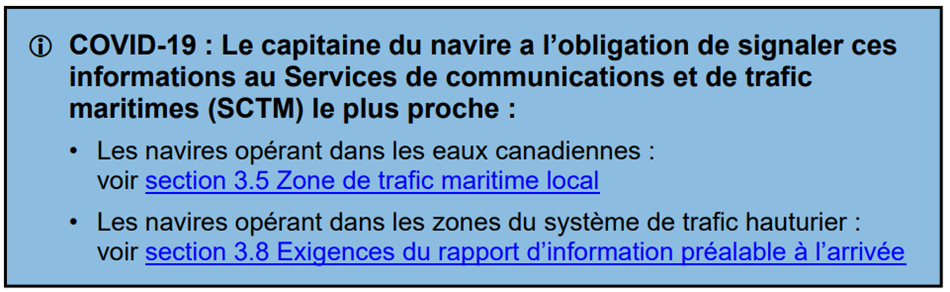
3.5.6Non-Routine Reports
…
The following is also requested:
k)the notification of any person
or crew member on board that has a serious illness or any
COVID-19 symptoms.
Page 3-14
MODIFY AS FOLLOWS:
3.8.1VTS
Offshore Zone Report
…
The following is also requested:
i.the date and expiration of the ISM Safety Management
Certificate:
ii.the ISM document of compliance;
iii.the International Convention on Civil Liability for
Bunker Oil Pollution Damage, 2001 Certificate (known as Bunkers
Convention Certificate), if any, issued to the ship;
and
iv.Certificate of Insurance or Other Financial Security
in Respect of Liability for the Removal of Wrecks; and,
v.the notification of any person
or crew member on board that has a serious illness or any
COVID-19 symptoms.
Page 3-15
MODIFY AS FOLLOWS:
3.8.2ECAREG Zone Report
…
The following is also requested:
i.the date and expiration of the ISM Safety Management
Certificate:
ii.the ISM document of compliance;
iii.the International Convention on Civil Liability for
Bunker Oil Pollution Damage, 2001 Certificate (known as Bunkers
Convention Certificate), if any, issued to the ship;
and
iv.Certificate of Insurance or Other Financial Security in
Respect of Liability for the Removal of Wrecks; and,
v.the notification of any person
or crew member on board that has a serious illness or any
COVID-19 symptoms.
Page 3-18
MODIFY AS FOLLOWS:
3.8.3.7Other Situations
A position report (PR) shall be provided with designators A, B, C or D, E, F, S and X as soon as feasible after a vessel’s master becomes aware of any of the following:
a)another
vessel in apparent difficulty;
b)any
obstruction to navigation;
c)any aid
to navigation that is not functioning properly or is damaged,
out of position or missing;
d)any ice
or weather conditions that are hazardous to safe navigation;
and
e)a
pollutant in the water;
and,
f)the notification of any person
or crew member on board that has a serious illness or any
COVID-19 symptoms.
SECTION 4 - CANADIAN SAILING DIRECTIONS CORRECTIONS
The following Canadian Sailing Directions volumes have recently been updated on the Canadian Hydrographic Service website.
|
No. |
Title |
|
Atlantic Coast |
|
|
ATL110 |
St. Lawrence River, Cap Whittle / Cap Gaspé to Les Escoumins and Anticosti Island |
|
ATL111 |
St. Lawrence River, Île Verte to Québec and Fjord du Saguenay |
|
Central Canada |
|
|
CEN308 |
Rideau Canal and Ottawa River |
Each volume includes a section entitled “Record of Changes” which lists all updates that are incorporated during the current calendar year.
SECTION 5 - LIST OF LIGHTS, BUOYS AND FOG SIGNALS CORRECTIONS
The amendments are highlighted and deletions are crossed out. For general and region-specific
information on the List of Lights, click on the following links:
Newfoundland and Labrador Coast,
Atlantic Coast,
Inland Waters and
Pacific Coast.
NEWFOUNDLAND AND LABRADOR COAST
| No. | Name |
Position ----- Latitude N. Longitude W. |
Light Characteristics |
Focal Height in m. above water |
Nominal Range |
Description ----- Height in meters above ground |
Remarks ----- Fog Signals |
|||
|---|---|---|---|---|---|---|---|---|---|---|
PLACENTIA BAY (LL 14.4 – 79) |
||||||||||
| 15.5 | Gibraltor Rock light buoy PX2 |
Point
Verde. 47 13 41.4 054 02 51.3 |
Fl | R | 4s | ..... | ..... | Red, marked “PX2”. |
Year round. Chart:4841 Edn 11/22 (N22-231) |
|
|
64.8 H0372.4 |
Duck Rock Light |
Mortier
Bay. 47 08 33.9 055 04 43.3 |
Fl | R | 4s | 6.7 | ….. |
Red pipe
swing pole. 4.0 |
Flash 1 s; eclipse
3 s. Year round. Chart:4587 Edn 11/22 (N21-112) |
|
SOUTHWEST COAST (LL 121 – 172) |
||||||||||
|
133 H0278 |
Roti Point Light |
S. of St. Alban’s, Bay d’Espoir. 47 47 26.8 055 50 28.9 |
Fl | G | 5s | 6.7 | 6 |
Square skeleton tower, green and white rectangular
daymark.
|
Flash 1 s; eclipse 4 s. Year round. Chart:4644 Edn 11/22 (N22-242) |
|
|
133.2 H0277 |
Cape Mark Light |
E. of Bois
Island. 47 44 32.0 055 52 06.9 |
Fl | R | 5s | 7.9 | 6 |
Square skeleton tower, red and white square daymark. 4.3 |
Flash 1 s; eclipse
4 s. Year round. Chart:4644 Edn 11/22 (N22-241) |
|
| 133.3 | Gimlet Point light buoy VG3 |
Delete from
list. Chart:4644 Edn 11/22 (N22-228) |
||||||||
|
133.4 H0282 |
Day Point Light |
Bay
d’Espoir. 47 41 20.9 055 55 21.0 |
Fl | W | 5s | 10.1 | 6 |
Square skeleton tower, red and white square daymark.
|
Flash 1 s; eclipse
4 s. Year round. Chart:4644 Edn 11/22 (N22-240) |
|
| 133.44 | Deer Cove Shoal Light Buoy VG4 |
Delete from
list. Chart:4644 Edn 11/22 (N22-229) |
||||||||
| 133.5 | Cold Harbour Shoal light buoy VG5 |
Delete from
list. Chart:4644 Edn 11/22 (N22-230) |
||||||||
|
133.6 H0283 |
Little Island Light |
E. of Stickland
Cove. 47 39 34.9 055 56 04.0 |
Fl | R | 5s | 10.4 | 6 |
Square skeleton tower, red and white square daymark.
|
Flash 1 s; eclipse
4 s. Year round. Chart:4644 Edn 11/22 (N22-239) |
|
| 133.66 | Riches Island light buoy VG6 |
Dawson’s Point 47 46 35.7 055 50 55.5 |
Q | R | 1s | ….. | ..... | Red, marked “VG6”. |
Operates 24
h. Year round. Chart:4644 Edn 11/22 (N22-232) |
|
| 144.56 | Morgan Island light buoy QV4 |
Burgeo Islands. 47 36 16.7 057 36 53.6 |
Fl | R | 4s | ..... | ..... | Red spar, marked “QV4”. |
Operates 24 h. Year round. Chart:4825 Edn 11/22 (N22-234) |
|
|
156.8 H0232.4 |
Isle aux Morts Wharf Light |
47 34 56.0 058 58 42.4 |
Fl | G | 4s | 3.8 | 4 |
2.6 |
Flash 1 s;
eclipse 3 s. Year round. Chart:4640 Edn 11/22 (N22-198) |
|
WEST COAST (LL 173 – 208.2) |
||||||||||
| 174.12 | Codroy light buoy XY3 |
47 52 39.6 059 23 50.5 |
Fl | G | 4s | ..... | ..... | Green spar, marked “XY3”. |
Seasonal. Chart:4682 Edn 11/22 (N22-260) |
|
| 174.2 | Codroy Outer light buoy XY2 |
47 52 27.1 059 23 32.6 |
Fl | R | 4s | ..... | ..... | Red spar, marked “XY2”. |
Seasonal. Chart:4682 Edn 11/22 (N22-256) |
|
| 176.1 | Crabbes River Harbour light buoy XD5 |
48 13 10.3 058 51 50.2 |
Fl | G | 4s | ..... | ..... | Green spar, marked “XD5”. |
Seasonal. Chart:4022 Edn 11/22 (N22-259) |
|
| 176.2 | Crabbes River Harbour light buoy XD4 |
48 13 13.9 058 51 54.7 |
Fl | R | 4s | ..... | ..... | Red spar, marked “XD4”. |
Seasonal. Chart:4022 Edn 11/22 (N22-257) |
|
| 176.4 | Crabbes River Inner Cautionary light buoy X |
48 13 08.0 058 51 44.5 |
Fl | Y | 4s | ..... | ..... | Yellow spar, marked “X”. |
Seasonal. Chart:4022 Edn 11/22 (N22-258) |
|
|
183.82 H0203 |
Rouzes Brook West Breakwater Light |
Cape St.
George. 48 28 36.2 059 11 58.8 |
Fl | G | 5s | ..... | 4 |
2.6 |
Flash 1 s; eclipse
4 s. Seasonal. Chart:4021 Edn 11/22 (N22-189, 195) |
|
|
184.83 H0204 |
Rouzes Brook East Breakwater Light |
Cape St.
George. 48 28 37.6 059 11 57.7 |
Fl | R | 5s | ..... | 4 |
2.6 |
Flash 1 s; eclipse
4 s. Seasonal. Chart:4021 Edn 11/22 (N22-190, 194) |
|
|
199.4 H0176 |
Trout River Wharf Light |
49 28 51.1 058 07 57.2 |
Fl | G | 3s | 2.6 | 3 |
Mast. 2.2 |
Flash 1 s; eclipse 2 s. Seasonal. Chart:4881 Edn 11/22 (N22-193) |
|
STRAIT OF BELLE ISLE (LL 211 – 234) |
||||||||||
|
219.5 H0137 |
Raleigh Breakwater Light |
Raleigh
harbour. 51 33 50.3 055 43 57.4 |
Fl | G | 4s | 4.5 | 2 |
Mast. 2.4 |
Flash 1 s; eclipse 3 s. Seasonal. Chart:4509 Edn 11/22 (N22-207) |
|
| 222.12 | Cooper Island light buoy XV2 |
51 19 55.0 056 42 17.8 |
Fl | R | 4s | ..... | ..... | Red spar, marked “XV2”. |
Seasonal. Chart:4667 Edn 11/22 (N22-237) |
|
NEWFOUNDLAND AND LABRADOR COAST (LL 269.99 – 325.23) |
||||||||||
| 281.7 | St. Mary Island South light buoy N12 |
53 33 02.2 055 58 35.6 |
Fl | R | 4s | ..... | ..... |
Red |
Seasonal. Chart:4745 Edn 11/22 (N22-235) |
|
| 281.8 | Terra Nova Point light buoy N14 |
53 33 35.3 055 59 23.5 |
Fl | R | 4s | ..... | ..... | Red spar, marked “N14”. |
Seasonal. Chart:4745 Edn 11/22 (N22-236) |
|
|
319.6 H0071.3 |
Pigeon Island Light |
55 11 07.7 059 23 01.2 |
Fl | W | 4s | 27.1 | 5 |
Square skeleton tower, red and white rectangular
daymark. 7.2 |
Seasonal. Chart:5046 Edn 11/22 (N22-247) |
|
| 321.25 | Makkovik Cautionary Wharf Light |
55 05
06.2 059 10 15.4 |
Fl | Y | 5s | ….. | 4 | Pipe tower. |
Flash 1 s; eclipse
4 s. Operates 24 h. Seasonal. Chart:5045 Edn 11/22 (N22-209) |
|
|
324.35 H0059.25 |
Beachy Island Light |
57 08 06.3 061 20 09.5 |
Fl | W | 5s | 65.9 | 5 |
Square skeleton tower, red rectangular daymark with white horizontal
stripe. 4.7 |
Flash 1 s; eclipse
4 s. Seasonal. Chart:5055 Edn 11/22 (N22-222) |
|
NOTRE DAME BAY (LL 326 – 395) |
||||||||||
| 360.1 | Harbour Rock light buoy DPU1 |
Purcell’s
Harbour. 49 36 48.5 054 42 03.0 |
Fl | G | 4s | ….. | ….. | Green spar, marked “DPU1”. |
Seasonal. Chart:4863 Edn 11/22 (N22-199) |
|
| 360.2 | Shiphouse Rock light buoy DPU2 |
Purcell’s
Harbour. 49 36 47.2 054 42 06.8 |
Fl | R | 4s | ….. | ….. | Red spar, marked “DPU2”. |
Seasonal. Chart:4863 Edn 11/22 (N22-201) |
|
| 361.62 | Durrell Arm light buoy DUL5 |
49 39
54.1 054 44 12.5 |
Fl | G | 4s | ….. | ….. | Green spar, marked “DUL5”. |
Operates 24
h. Seasonal. Chart:4886 Edn 11/22 (N22-154, 281) |
|
| 361.63 | Durrell Arm Wharf light buoy DUL7 |
49 39
47.2 054 44 13.5 |
Fl | G | 4s | ….. | ….. | Green spar, marked “DUL7”. |
Operates 24
h. Seasonal. Chart:4886 Edn 11/22 (N22-153, 282) |
|
| 365.508 | Fogo Harbour light buoy DF4/2 |
49 43 09.2 054 16 27.4 |
Fl | R | 4s | ..... | ..... | Red spar, marked “DF4/2”. |
Seasonal. Chart:4861 Edn 11/22 (N22-262) |
|
| 383.551 | Joe Batt’s Arm Outer light buoy DJ13 |
Fogo Island. 49 43 46.7 054 09 54.1 |
Q | G | 1s | ..... | ..... | Green spar, marked “DJ13”. |
Seasonal. Chart:4861 Edn 11/22 (N22-233) |
|
| 383.552 | Joe Batt’s Arm Inner light buoy DJ14 |
Fogo Island. 49 43 40.7 054 09 58.6 |
Fl | R | 4s | ..... | ..... | Red spar, marked “DJ14”. |
Seasonal. Chart:4861 Edn 11/22 (N22-261) |
|
| 383.8 | Pomeroy Rock light buoy DJ2 |
Joe Batt’s Arm, Fogo Island. 49 43 55.5 054 09 53.7 |
Fl | R | 4s | ..... | ..... | Red spar, marked “DJ2”. |
Seasonal. Chart:4861 Edn 11/22 (N22-263) |
|
| 388.1 | Noggin Cove light buoy DN2 |
Delete from
list. Chart:4862 Edn 11/22 (N22-220) |
||||||||
TRINITY BAY (LL 450.1 – 471.51) |
||||||||||
|
465.6 H0515 |
Little Heart’s Ease Wharf Light |
48 00 53.8 053 41 22.1 |
Fl | R | 4s | 3.0 | 4 |
2.6 |
Seasonal. Chart:4852 Edn 11/22 (N22-191) |
|
CONCEPTION BAY (LL 471.7 – 498.5) |
||||||||||
|
475.3 H0496 |
Job's Cove Wharf Light |
47 58 11.2 053 00 59.4 |
Fl | Y | 5s | ..... | ….. |
Mast. 2.1 |
Flash 1 s; eclipse
4 s. Seasonal. Chart:4850 Edn 11/22 (N22-192, 278) |
|
|
490 H0477 |
Conception Harbour Wharf Light |
At eastern end of public wharf. 47 26 26.0 053 12 32.0 |
Fl | R | 4s | 3.7 | 3 |
Pipe
tower. 3.3 |
Year round. Chart:4847 Edn 11/22 (N22-210) |
|
|
497 H0472 |
Portugal Cove Breakwater Light
|
47 37 34.7 052 51 31.2 |
Fl | G | 4s | 6.1 | 7 | Square skeleton tower, green and white rectangular daymark. |
Flash 1 s; eclipse 3 s. Year round. Chart:4847 Edn 11/22 (N22-204) |
|
CAPE ST. FRANCIS TO RENEWS (LL 499 – 516) |
||||||||||
|
504 505H0459 H459.1 |
St. John's Harbour range |
| | | | | | | | | | | |
47 34 02.0 052 42 09.0 |
F
F
|
G
G
|
.....
.....
|
28.6
58.9
|
24
.....
|
Red and white skeleton tower, white daymark with red vertical
stripe.
White rectangular structure, red diamond in
centre.14.0 |
Visible in line of range. Visible in line of range.Operates 24 h. Year round. Year round. Chart:4846 Edn 11/22 (N22-211) |
|
508.2 H0451.3 |
Bauline East Wharf Light |
47 10 48.3 052 50 37.2 |
Fl | R | 4s | ..... | 2 |
Mast. 2.6 |
Seasonal. Chart:4845 Edn 11/22 (N22-188) |
|
ATLANTIC COAST
| No. | Name |
Position ----- Latitude N. Longitude W. |
Light Characteristics |
Focal Height in m. above water |
Nominal Range |
Description ----- Height in meters above ground |
Remarks ----- Fog Signals |
|||
|---|---|---|---|---|---|---|---|---|---|---|
NOVA SCOTIA, SOUTHWEST COAST (LL 271 – 300.5) |
||||||||||
|
281 |
The Sluice West |
W. side of rock. 43 40 13.1 066 00 53.1 |
Fl | W | 5s | 4.5 | 4 |
Cylindrical mast.
|
Flash 1 s; eclipse
4 s. Year round. Chart:4244 Edn 11/22 (F22-023) |
|
|
282 H3816 |
The Sluice East |
E. side of rock. 43 40 12.1 066 00 48.1 |
Fl | W | 5s | 4.5 | 4 |
Cylindrical mast with 3 reflective bands. 3.6 |
Flash 1 s; eclipse
4 s. Year round. Chart:4244 Edn 11/22 (F22-024) |
|
NOVA SCOTIA, SOUTHEAST COAST (LL 327 – 684.02) |
||||||||||
|
513 H3600 |
Chebucto Head Racon - -.. (Z) X Band |
On summit. 44 30 26.6 063 31 21.8 |
Fl | W | 20s | 47.8 | 10 |
White tower with red upper
portion. 12.9 |
Flash 0.5 s; eclipse 19.5 s. Connected by telephone with Halifax. Operates 24 h. Year round. blast 3 s;sil. 51 s. Horn points 113°. Chart:4385 Edn 11/22 (F22-018) |
|
| 521.3 | Herring Cove light buoy HM4 |
Near
breakwater. 44 34 09.2 063 33 25.8 |
Q | R | 1s | ….. | ….. | Red spar, marked “HM4”. |
Operates 24
h. Year round. Chart:4203 Edn 11/22 (F22-020) |
|
NORTHUMBERLAND STRAIT – EAST (LL 883.2 – 940.3) |
||||||||||
| 896.8 | Merigomish Harbour light buoy SA14 |
45 38 33.7 062 27 07.7 |
Q | R | 1s | ….. | ….. | Red spar, marked “SA14”. |
Seasonal. Chart:4940 Edn 11/22 (G22-122) |
|
PRINCE EDWARD ISLAND (LL 942 – 1084.7) |
||||||||||
| 950.12 | Annandale Grand River East light buoy NE7 |
46 15 18.2 062 24 51.1 |
Q | G | 1s | ….. | ….. | Green, marked “NE7”. |
Seasonal. Chart:4935 Edn 11/22 (G22-147) |
|
| 950.2 | Annandale Grand River East light buoy NE10 |
SE. of Annandale wharf. 46 15 26.8 062 25 20.8 |
Fl | R | 4s | ….. | ….. | Red, marked “NE10”. |
Seasonal. Chart:4935 Edn 11/22 (G22-148) |
|
| 977 | Bell Point light and whistle buoy N8 |
SW. of rocks. 45 54 54.2 062 49 11.5 |
Fl | R | 4s | ….. | ….. |
Red, marked |
Seasonal. Chart:4940 Edn 11/22 (G22-121) |
|
| 1019 | Summerside Harbour light buoy DE6 |
46 22 42.2 063 49 21.7 |
Q | R | 1s | ….. | ….. | Red spar, marked “DE6”. |
(Winter
spar.) Seasonal (in place year round). Chart:4459 Edn 11/22 (G22-120) |
|
|
1020 H1048 |
Summerside Harbour Wharf Light |
On outer end of breakwater. 46 22 47.0 063 49 01.1 |
Iso | W | 10s | 14.0 | ….. |
White octagonal tower with red upper
portion. 12.9 |
Year round. Chart:4459 Edn 11/22 (G22-119) |
|
|
1027.31 H1060 |
Abrams Village Wharf Light |
46 26 25.9 064 06 48.4 |
Fl | G | 4s | ….. | 3 | Pipe swing pole, green-white-black square daymark. |
Flash 1 s; eclipse
3 s. Seasonal. Chart:4905 Edn 11/22 (G22-116) |
|
| 1071.89 | Hardys Channel light buoy JS12 |
46 38 58.7 063 52 03.1 |
Fl | R | 4s | ….. | ….. | Red, marked “JS12”. |
Buoy may be repositioned due to shifting channel. Seasonal. Chart:4491 Edn 11/22 (G22-139) |
|
| 1071.9 | Hardys Channel light buoy JS13 |
46 39 14.2 063 52 28.0 |
Fl | G | 4s | ….. | ….. | Green spar, marked “JS13”. |
Buoy may be repositioned due to shifting channel. Seasonal. Chart:4491 Edn 11/22 (G22-155) |
|
| 1071.95 | Hardys Channel light buoy JS14 |
46 39 14.8 063 52 26.6 |
Q | R | 1s | ….. | ….. | Red spar, marked “JS14”. |
Buoy may be repositioned due to shifting channel. Seasonal. Chart:4491 Edn 11/22 (G22-156) |
|
| 1071.96 | Hardys Channel light buoy JS21 |
46 39 24.6 063 52 46.3 |
Q | G | 1s | ….. | ….. | Green, marked “JS21”. |
Buoy may be repositioned due to shifting channel. Seasonal. Chart:4491 Edn 11/22 (G22-142) |
|
| 1071.961 | Hardys Channel light buoy JS22 |
46 39 25.2 063 52 45.2 |
Q | R | 1s | ….. | ….. | Red, marked “JS22”. |
Buoy may be repositioned due to shifting channel. Seasonal. Chart:4491 Edn 11/22 (G22-143) |
|
| 1071.962 | Hardys Channel light buoy JS23 |
46 39 32.8 063 52 54.6 |
Q | G | 1s | ….. | ….. | Green, marked “JS23”. |
Buoy may be repositioned due to shifting channel. Seasonal. Chart:4491 Edn 11/22 (G22-144) |
|
| 1071.963 | Hardys Channel light buoy JS24 |
46 39 33.2 063 52 53.6 |
Fl | R | 4s | ….. | ….. | Red, marked “JS24”. |
Buoy may be repositioned due to shifting channel. Seasonal. Chart:4491 Edn 11/22 (G22-149) |
|
| 1071.977 | Hardys Channel light buoy JS27 |
46 39 43.6 063 53 05.3 |
Q | G | 1s | ….. | ….. | Green, marked “JS27”. |
Buoy may be repositioned due to shifting channel. Seasonal. Chart:4491 Edn 11/22 (G22-153) |
|
| 1071.98 | Hardys Channel light buoy JS32 |
46 39 38.5 063 53 29.4 |
Q | R | 1s | ….. | ….. | Red, marked “JS32”. |
Buoy may be repositioned due to shifting channel. Seasonal. Chart:4491 Edn 11/22 (G22-150) |
|
| 1071.99 | Hardys Channel light buoy JS33 |
46 39 36.7 063 53 44.5 |
Q | G | 1s | ….. | ….. | Green, marked “JS33”. |
Buoy may be repositioned due to shifting channel. Seasonal. Chart:4491 Edn 11/22 (G22-140) |
|
| 1072.1 | Hardys Channel light buoy JS39 |
46 39 24.5 063 53 46.3 |
Q | G | 1s | ….. | ….. | Green, marked “JS39”. |
Buoy may be repositioned due to shifting channel. Seasonal. Chart:4491 Edn 11/22 (G22-151) |
|
| 1072.4 | Hardys Channel light buoy JS42 |
46 39 21.5 063 54 05.2 |
Fl | R | 4s | ….. | ….. | Red, marked “JS42”. |
Buoy may be repositioned due to shifting channel. Seasonal. Chart:4491 Edn 11/22 (G22-152) |
|
| 1072.5 | Hardys Channel light buoy JS43 |
46 39 20.5 063 54 26.6 |
Q | G | 1s | ….. | ….. | Green, marked “JS43”. |
Buoy may be repositioned due to shifting channel. Seasonal. Chart:4491 Edn 11/22 (G22-138) |
|
| 1072.59 | Hardys Channel light buoy JS40 |
46 39 25.4 063 53 47.4 |
Fl | R | 4s | ….. | ….. | Red, marked “JS40”. |
Buoy may be repositioned due to shifting channel. Operates 24 h. Seasonal. Chart:4491 Edn 11/22 (G22-157) |
|
| 1072.6 | Hardys Channel light buoy JS44 |
46 39 21.7 063 54 26.4 |
Fl | R | 4s | ….. | ….. | Red, marked “JS44”. |
Buoy may be repositioned due to shifting channel. Seasonal. Chart:4491 Edn 11/22 (G22-154) |
|
NORTHUMBERLAND STRAIT – WEST (LL 1085 – 1165.9) |
||||||||||
|
1091.5 H1316 |
Cape Tormentine Breakwater |
At NE. end of breakwater. 46 08 02.8 063 46 11.8 |
Fl | G | 4s | 5.5 | 4 |
Square skeleton tower, 3.6 |
Flash 1 s; eclipse 3 s. Seasonal. Chart:4905 Edn 11/22 (G22-115) |
|
|
1118.5 H1359 |
Cormierville |
On SE. corner of wharf. 46 24 28.3 064 36 55.3 |
Fl | R | 3s | 5.7 | 5 |
Pipe swing
pole. 5.1 |
Flash 1 s; eclipse 2s. Seasonal. Chart:4909 Edn 11/22 (G22-112) |
|
| 1154.4 | Goulet de Terre-noire light buoy XX14 |
46 46 00.6 064 51 30.8 |
Q | R | 1s | ….. | ….. | Red, marked “XX14”. |
Buoy may be repositioned due to shifting channel. Seasonal. Chart:N/A Edn 11/22 (G22-111) |
|
| 1159 | Kouchibouguac Gully Inner light buoy XY21 |
46 50 34.3 064 54 49.2 |
Q | G | 1s | ….. | ….. |
Green |
Buoy may be repositioned due to shifting channel. Seasonal. Chart:N/A Edn 11/22 |
|
GULF OF ST. LAWRENCE (LL 1169.1 – 1426, 1477.5 – 1584) |
||||||||||
|
1246.8 H1526.4 |
Pokemouche Gully Wharf |
On SW. corner. 47 40 20.3 064 48 42.9 |
Fl | R | 5s | 5.7 | 4 | Pipe swing pole, red and white triangular daymark. |
Flash 1 s; eclipse
4 s. Seasonal. Chart:N/A Edn 11/22 (G22-137) |
|
ST. LAWRENCE RIVER (LL 1584.5 – 1772, 1823.8 – 2185.7, 2273 – 2365.95) |
||||||||||
|
1666.3 H1994.3 |
|
On end of breakwater. 50 12 04.6 066 23 10.1 |
Iso | W | 2s | 4.5 | 5 |
Pyramid tower.
|
Private
aid. Year round. Chart:1220 Edn 11/22 (Q22-075) |
|
| 2029.5 | Deschaillons-sur-Saint-Laurent light buoy D30 |
Route de
Sainte-Emmélie. 46 33 58.9 072 06 10.7 |
Fl | R | 4s | ..... | ..... | Red spar, marked “D30”. |
Year round. Chart:1314 Edn 11/22 (Q22-077) |
|
| 2033 | Poulier Villeneuve light buoy D36 |
Route de la
Pointe-des-Grondines. 46 33 49.3 072 07 27.4 |
Fl | R | 4s | ..... | ..... | Red spar, marked “D36”. |
Year round. Chart:1314 Edn 11/22 (Q22-076) |
|
|
2042
H2366
2042.1
2043 2043.1
H2366.1 |
Traverse de Batiscan range |
| | | | | | | | | | | | | | | | | |
46 30 33.6 072 14 22.9 240°13' 440.2 m from front. |
F F F F |
G G G G |
..... ..... ..... ..... |
13.7 13.1 24.6 24.7 |
12 6 12 6 |
Square skeleton tower, orange daymark
with black
vertical stripe. 8.1 Square skeleton tower. 8.1 Skeleton tower, orange daymark with black vertical stripe. 21.7 Skeleton tower. 21.7 |
Visible in line of range. Operates 24 h. Emergency mode. Year round. Edn 11/22 (Q22-045) Year round. Visible 360°. Visible in line of range. Operates 24 h. Emergency mode. Year round. Edn 11/22 (Q22-046) Visible 360°. Chart:1314 |
| 2057.5 | Champlain light buoy C14 |
Route de
Champlain. 46 26 13.5 072 20 37.1 |
Fl | R | 4s | ..... | ..... | Red spar, marked “C14”. |
Year round. Chart:1313 Edn 11/22 (Q22-073) |
|
|
2112 2113H2398 H2398.1 |
Route de Port-Saint-François range |
| | | | | | | | | | | |
Pointe aux
Sables. 068°12' 1372.1 m from front.
46 16 16.5 072 37 11.0 |
F F |
G G |
..... ..... |
10.8 18.8 |
11 11 |
Red octagonal Trapezoidal skeleton tower, fluorescent red daymark
with black
vertical stripe.1.6 14.3 |
Visible in line of range. Visible in line of range.Radar reflector. Operates 24 h. Emergency mode. Year round. Operates 24 h. Emergency mode. Year round. Chart:1313 Edn 11/22 (Q22-071, 072) |
| 2114 | Battures Laforce light buoy S4 |
46 16 06.7 072 38 05.3 |
Fl | R | 4s | ..... | ..... | Red spar, marked “S4”. |
Year round. Chart:1312 Edn 11/22 (Q22-049) |
|
| 2118.5 | Battures au Fer light buoy S6 |
46 15 56.5 072 38 42.0 |
Q | R | 1s | ..... | ..... | Red spar, marked “S6”. |
Year round. Chart:1312 Edn 11/22 (Q22-050) |
|
| 2281 |
|
Route de l’Île
Saint-Ours. 45 54 59.4 073 12 56.9 |
Fl | R | 4s | ..... | ..... | Red spar, marked “M16”. |
Year round. Chart:1311 Edn 11/22 (Q22-063) |
|
| 2325 | Île aux Prunes light buoy M82 |
Chenal de
Verchères – Contrecoeur. 45 47 26.3 073 20 40.8 |
Q | R | 1s | ..... | ..... | Red spar, marked “M82”. |
Year round. Chart:1311 Edn 11/22 (Q22-070) |
|
| 2325.2 | Île Marie light buoy M84 |
Traverse de
Verchères. 45 47 07.5 073 21 10.9 |
Fl | R | 4s | ..... | ..... | Red spar, marked “M84”. |
Year round. Chart:1311 Edn 11/22 (Q22-069) |
|
| 2327.5 | Île Marie light buoy M88 |
Traverse de
Verchères. 45 46 37.6 073 22 14.4 |
Q | R | 1s | ..... | ..... | Red spar, marked “M88”. |
Year
round. Chart:1311 Edn 11/22 (Q22-064) |
|
| 2333 | Île Saint-Laurent light buoy M118 |
Chenal du
Cap-Saint-Michel - Verchères. 45 43 09.6 073 26 02.9 |
Fl | R | 4s | ..... | ..... | Red spar, marked “M118”. |
Year round. Chart:1310 Edn 11/22 (Q22-068) |
|
| 2334 | Îlet Vert light buoy M124 |
Chenal de
Varennes. 45 42 13.6 073 26 37.9 |
Fl | R | 4s | ..... | ..... | Red spar, marked “M124”. |
Year round. Chart:1310 Edn 11/22 (Q22-067) |
|
| 2337 | Poulier du Calvaire light buoy M129 |
Chenal de
Varennes. 45 41 45.6 073 26 50.2 |
Fl | G | 4s | ..... | ..... | Green spar, marked “M129”. |
Year round. Chart:1310 Edn 11/22 (Q22-066) |
|
| 2337.3 | Île Sainte-Thérèse light buoy M130 |
Chenal de
Varennes. 45 41 43.2 073 27 05.9 |
Q | R | 1s | ..... | ..... | Red spar, marked “M130”. |
Year
round. Chart:1310 Edn 11/22 (Q22-065) |
|
| 2337.7 | Île Sainte-Thérèse light buoy M132 |
Chenal de
Varennes. 45 41 22.7 073 27 17.0 |
Fl | R | 4s | ..... | ..... | Red spar, marked “M132”. |
Year
round. Chart:1310 Edn 11/22 (Q22-062) |
|
| 2349.1 | Pointe-aux-Trembles Anchorage light buoy PATB |
45 38 38.4 073 28 29.6 |
Fl | Y | 4s | ..... | ..... | Yellow spar, marked “PATB”. |
Year round. Chart:1310 Edn 11/22 (Q22-061) |
|
| 2350.5 | Pointe-aux-Trembles Anchorage light buoy PATG |
45 37 51.4 073 29 00.5 |
Fl | Y | 4s | ..... | ..... | Yellow spar, marked “PATG”. |
Year round. Chart:1310 Edn 11/22 (Q22-057) |
|
ST. LAWRENCE RIVER SEAWAY (LL 2369 – 2384) |
||||||||||
| 2378 | Cap sur Mer light buoy M191 |
Canal de la
Rive Sud entrance. 45 32 05.4 073 31 39.8 |
Fl | G | 4s | ..... | ..... | Green spar, marked “M191”. |
Year round. Chart:1310 Edn 11/22 (Q22-060) |
|
| 2379 | Port Sainte-Hélène light buoy M192 |
Canal de la
Rive Sud entrance. 45 31 43.8 073 31 42.7 |
Fl | R | 4s | ..... | ..... | Red spar, marked “M192”. |
Year round. Chart:1310 Edn 11/22 (Q22-056) |
|
| 2379.7 | Port Sainte-Hélène bifurcation light buoy PSH |
Port
Sainte-Hélène Marina. 45 31 53.2 073 31 46.9 |
Fl(2+1) | R | 6s | ..... | ..... | Red, green and red spar, marked “PSH”. |
Year
round. Chart:1310 Edn 11/22 (Q22-055) |
|
INLAND WATERS
| No. | Name |
Position ----- Latitude N. Longitude W. |
Light Characteristics |
Focal Height in m. above water |
Nominal Range |
Description ----- Height in meters above ground |
Remarks ----- Fog Signals |
|||
|---|---|---|---|---|---|---|---|---|---|---|
ST. LAWRENCE RIVER SEAWAY (LL 0.05 - 401, 1193 – 1204.5) |
||||||||||
|
32.3 32.4H2522.6 H2522.61 |
Melocheville range |
| | | | | | | | | | |
45 19 10.3 241°29' 1294 m073 56 33.0 from front. |
F
F
|
G
G
|
.....
.....
|
10.8
29.6
|
14
14
|
Square skeleton tower, orange daymark with black vertical
stripe. Square skeleton tower, orange daymark with black vertical
stripe.8.0 14.1 |
Visible in line of range. Visible in line of range.Operates 24 h. Seasonal. Operates 24 h. Seasonal. Chart:1430 Edn 11/22 (Q22-078, 079) |
MACKENZIE RIVER AND BAY (LL 1716.96 – 2540) |
||||||||||
| 2526 | Cambridge Bay light buoy 2 |
Near Flagstaff
Point. 69 02 43.0 105 05 12.0 |
Fl | R | 4s | ….. | ….. | Red spar, marked “2”. |
Seasonal. Chart:7750 Edn 11/22 (A22-014) |
|
| 2527 | Cambridge Bay light buoy 7 |
Near Napaqtilik
Island. 69 02 38.0 104 59 23.0 |
Fl | G | 4s | ….. | ….. | Green spar, marked “7”. |
Seasonal. Chart:7750 Edn 11/22 (A22-015) |
|
| 2528 | Cambridge Bay light buoy 8 |
Near Napaqtilik
Island. 69 02 45.0 104 58 48.0 |
Fl | R | 4s | ….. | ….. | Red spar, marked “8”. |
Seasonal. Chart:7750 Edn 11/22 (A22-016) |
|
| 2529 | Cambridge Bay light buoy 11 |
Near Napaqtilik
Island. 69 03 00.0 104 58 52.0 |
Fl | G | 4s | ….. | ….. | Green spar, marked “11”. |
Seasonal. Chart:7750 Edn 11/22 (A22-017) |
|
Report a problem on this page
- Date modified: