
Archived information
The Standard on Web Usability replaces this content. This content is archived because Common Look and Feel 2.0 Standards have been rescinded.
Archived information is provided for reference, research or recordkeeping purposes. It is not subject to the Government of Canada Web Standards and has not been altered or updated since it was archived.
NOTICE TO USERS MAILING LIST SUBSCRIPTION RENEWAL |
Dear Client: We appreciate your continued interest in receiving the Monthly Edition of Notices to Mariners. As technology evolves, the Canadian Coast Guard is looking at means to reduce printing and distribution costs while continuing to provide quality service to the marine community. Internet technology has become the primary information source worldwide for organizations and individuals to receive information and various publications. As the use of the internet grows in popularity, our organization feels it is the right time to limit our mail distribution and rely primarily on the internet for distribution of the Notices to Mariners. The information, supplied by the internet, has the advantage of being relayed to the mariner immediately and efficiently. We also encourage you to visit the Notices to Mariners web site available at the following internet address www.notmar.gc.ca . This user-friendly site is available 24 hours a day, 7 days a week. You may also register online to receive an automatic e-mail notification when a new Notice to Mariners is issued against any nautical chart(s) that you frequently use. We encourage users to frequently visit the site to access all the latest Notices and related information. The Coast Guard is committed to meeting the needs of our clients. Therefore, should you wish to remain on the hard-copy mailing list, we ask that you complete the following form. The renewal form is required no later than March 31 st , 2008 ; at that time any renewals not received will be removed from the hard-copy mailing list. We thank you very much for your cooperation.
Manager, Aids to navigation |
|
|
Fisheries and Oceans Canada |
Pêches et Océans Canada |
VOL. 33, MONTHLY EDITION NO 04 APRIL 25, 2008 Publication Number 40063779 |
NOTICES TO MARINERS PUBLICATION EASTERN EDITION |
|||
Published monthly by the CANADIAN COAST GUARD |
|||
|
CONTENTS |
|||
Page |
|||
| Section 1 |
Safety and General Information | 1 - 5 |
|
| Section 2 |
Chart Corrections | 6 - 26 |
|
| Section 3 |
Corrections to Radio Aids to Marine Navigation | 27, 28 |
|
| Section 4 |
Sailing Directions and Small Craft Guide Corrections | 29 - 35 |
|
| Section 5 |
List of Lights, Buoys and Fog signals Corrections | 36 |
|
Maritime Services Directorate Aids to Navigation Internet: www.notmar.gc.ca | |||
EXPLANATORY NOTES |
Geographical positions refer directly to the graduations of the largest scale Canadian Hydrographic chart unless otherwise indicated. |
Bearings refer to the true compass and are measured clockwise from 000° (North) clockwise to 359°; those relating to lights are from seaward. |
Visibility of lights is that in clear weather. |
Depths - The units used for soundings (metres, fathoms or feet) are stated in the title of each chart. |
Elevations are normally given above Higher High Water, Large Tides unless otherwise indicated. |
Distances may be calculated as follows: |
1 nautical mile = 1 852 metres (6,076.1 feet) 1 statute mile = 1 609.3 metres (5,280 feet) 1 metre = 3.28 feet |
Temporary & Preliminary Notices are indicated by a (T) or a (P) before the chart action. Please note that Nautical charts are not hand amended by the Canadian Hydrographic Service for Temporary (T) and Preliminary (P) Notices. It is recommended that mariners chart these corrections in pencil. Listing of charts affected by Temporary and Preliminary Notices are revised and promulgated quarterly in Section 1 of the Monthly Edition. |
Please note that, in addition to the temporary and preliminary changes normally advertised as (T) and (P) Notices, there are a significant number of permanent changes to navigational aids that have been advertised as Preliminary Notices to Mariners while charts are being updated for new editions. |
Marine Information Report & Suggestion Sheet - Mariners are requested to notify the responsible authorities when new or suspected dangers to navigation are discovered, changes observed in aids to navigation or corrections to publications are seen to be necessary. Such communications can be made using the Marine Information Report & Suggestion Sheet inserted on the last page of each monthly edition of Notices to Mariners. |
Monthly edition of Notices to Mariners - Notices to Mariners are issued free of charge on a monthly basis. Mariners now have a choice between specific Regional issue(s) they wish to receive. Requests to be placed on or removed from the mailing list should be made by using the form inserted on page vi of each monthly edition. Notification of changes to the mailing addresses, regional issues and/or number of copies required should also be transmitted by means of this form. |
Canadian Nautical Charts & Publications - A source list of Canadian Nautical Charts & publications is published in Notice No. 14 of the current Annual Edition of Notices to Mariners. The source supply and the prices effective at the time of printing are listed. This list is periodically updated in the monthly edition of Notices to Mariners. |
NOTE: Cette publication est aussi disponible en français. |
|
CHART CORRECTIONS - SECTION 2 |
|
Corrections to nautical charts will be listed in numeric order by chart number. Each chart correction listed applies only to that particular chart. Related charts, if any, will have their own specific correction listed separately. Users should also refer to CHS Chart 1 Symbols, Abbreviations Terms for additional information pertaining to the correction of charts. The illustration below describes the elements that will comprise a typical Section 2 chart correction. |

ADVISORY |
|
NOTICES TO SHIPPING (WRITTEN AND BROADCAST) |
|
The Canadian Coast Guard is implementing a number of changes to the aids to navigation system in Canada . |
|
These changes are advertised as Notices to Shipping (Broadcast and Written) by the Canadian Coast Guard and are followed up with Notices to Mariners, then charts are updated by hand correction, reprints or new editions. |
|
Mariners are advised that all relevant Written Notices to Shipping should be kept until superseded by Notices to Mariners or through revised charts issued by the Canadian Hydrographic Service. |
|
Written Notices to Shipping are published weekly and are available from local Canadian Coast Guard Offices. |
|
The Canadian Hydrographic Service is reviewing the impact of these changes with the Canadian Coast Guard and together we are preparing an action plan on the issuing of chart revisions. |
|
For further information contact your local Regional Notices to Shipping (Notships) issuing authorities. |
|
|
| * Services provided in English and French |

|
MONTHLY EDITION OF NOTICES TO MARINERS |
MAILING LIST CHANGES |
|
Leader, Notices to Mariners Navigation Aids Navigation Systems Canadian Coast Guard 200 Kent Street, Station 5N186 Ottawa, ON K1A 0E6 Telephone (613) 993-6974 Facsimile (613) 998-8428 Internet www.notmar.gc.ca |

|
INDEX | |
|
CANADIAN COAST GUARD PUBLICATION - AMENDMENT TO THE RADIO AIDS TO MARINE NAVIGATION (ATLANTIC, ST-LAWRENCE, GREAT LAKES, LAKE WINNIPEG AND EASTERN ARCTIC) PUBLICATION 2008. |
28 |
|
CANADIAN HYDROGRAPHIC SERVICE - ANNOUNCEMENT REGARDING CANADIAN HYDROGRAPHIC SERVICE CHART PATCHES. |
1 |
|
CANADIAN HYDROGRAPHIC SERVICE - ARCTIC CHARTS. |
2 |
|
CANADIAN HYDROGRAPHIC SERVICE - CUMULATIVE CHART CORRECTIONS. |
1 |
|
CANADIAN HYDROGRAPHIC SERVICE - CURRENT CHART EDITION DATES. |
1 |
|
CANADIAN HYDROGRAPHIC SERVICE - PRINT ON DEMAND CHARTS - CARE AND USE. |
1 |
|
*409 CANADA, EAST COAST - CHEDABUCTO BAY - TRAFFIC SEPARATION SCHEME - EASTERN APPROACHES TO CANSO STRAIT. |
5 |
|
*405 CANADIAN COAST GUARD - LIST OF CHARTS AND REFERENCE CHARTS (SECTION I) AFFECTED BY TEMPORARY AND PRELIMINARY NOTICES. |
3 |
|
*406 CANADIAN COAST GUARD PUBLICATION - NEW EDITION OF THE ANNUAL EDITION OF NOTICES TO MARINERS - 2008. |
4 |
|
*407 CANADIAN COAST GUARD PUBLICATION - NEW EDITION OF THE RADIO AIDS TO MARINE NAVIGATION (ATLANTIC, ST. LAWRENCE, GREAT LAKES, LAKE WINNIPEG AND EASTERN ARCTIC) PUBLICATION - 2008. |
4 |
|
*402 CANADIAN HYDROGRAPHIC SERVICE - ELECTRONIC NAVIGATION CHARTS. |
2 |
|
*401 CANADIAN HYDROGRAPHIC SERVICE - NAUTICAL CHARTS. |
2 |
|
*404 CANADIAN HYDROGRAPHIC SERVICE - NON EQUIVALENT ELECTRONIC NAVIGATION CHARTS. |
3 |
|
*403 CANADIAN HYDROGRAPHIC SERVICE - RASTER DIGITAL CHART CD. |
3 |
|
*412 CASCUMPEQUE BAY - ALBERTON - LIGHT DISCONTINUED. |
5 |
|
*410 TRANSPORT CANADA - MARINE SAFETY, OPERATIONS AND ENVIRONMENTAL PROGRAMS - GPS. |
5 |
|
*411(P) WEDGEPORT AND VICINITY/ET LES ABORDS - LIGHT TO BE DISCONTINUED. |
5 |
|
NUMERICAL INDEX OF CANADIAN CHARTS AFFECTED | |||||
|
Chart No. |
Page |
Chart No. |
Page |
Chart No. |
Page |
|
1220 |
6, 7 |
4459 |
13 |
7600 |
25 |
|
1233 |
8 |
4466 |
13 |
7776 |
26 |
|
1234 |
8 |
4492 |
5, 13 |
7980 |
26 |
|
1236 |
9 |
4587 |
2 |
8007 |
26 |
|
1409 |
9 |
4724 |
13, 14 |
8012 |
26 |
|
2050 |
9 |
4765 |
14 | ||
|
L/C2201 |
9 |
4847 |
14 | ||
|
2235 |
9 |
L/C4851 |
14 | ||
|
2298 |
9 |
4864 |
14 | ||
|
2307 |
9 |
4865 |
14, 15 | ||
|
4001 |
9, 10 |
4905 |
15 | ||
|
4003 |
10 |
4921 |
15 | ||
|
4006 |
10 |
5043 |
15 | ||
|
4012 |
10 |
5044 |
15 | ||
|
4013 |
10 |
5399 |
15 | ||
|
4015 |
11 |
5628 |
15, 16 | ||
|
4016 |
11 |
6408 |
16 | ||
|
4045 |
11 |
6409 |
17 | ||
|
L/C4049 |
11 |
6410 |
18 | ||
|
4098 |
11 |
6414 |
19 | ||
|
4233 |
11 |
6415 |
20 | ||
|
4244 |
5 |
6433 |
21 | ||
|
L/C4320 |
11 |
6436 |
22 | ||
|
4394 |
12 |
6437 |
23 | ||
|
4405 |
12 |
6438 |
24 | ||
|
L/C4406 |
12 |
6441 |
25 | ||
|
4416 |
12 |
7082 |
25 | ||
SECTION 1 – Edition 04/2008
SAFETY AND GENERAL INFORMATION
CANADIAN HYDROGRAPHIC SERVICE - ANNOUNCEMENT REGARDING CANADIAN HYDROGRAPHIC SERVICE CHART PATCHES.
CHS is introducing a new initiative with a full colour Patch on the Web. A link in the Notices to Mariners web site will be provided so clients can access the colour Patch. The colour Patch will be published in HTML and PDF format. Providing the Patches in colour (accessible to all via remote access to the Web) is an enhanced form of alternative service delivery in line with CHS strategic objectives.
Colour Web Patches are free to the mariner, and given the quality of many printers, should reproduce well. They will be available in real time all around the world which is an improvement since clients had to wait for the paper copy to be mailed.
Previously, in the Notices to Mariners (NTM) booklet, Patches were produced in full colour or a minimum of black and magenta.
Due to current budgetary constraints, Patches will now only be produced in black and white for publication in the NTM booklet.
Our level of service will change with this initiative and CHS intends to analyze market reaction to this innovation.
CHS welcomes your feedback on this new service at chsinfo@dfo-mpo.gc.ca
CANADIAN HYDROGRAPHIC SERVICE - CUMULATIVE CHART CORRECTIONS.
The cumulative Notice to Mariners corrections for charts can now be accessed at http://www.notmar.gc.ca/search/notmar_e.php
CANADIAN HYDROGRAPHIC SERVICE - CURRENT CHART EDITION DATES.
|
CHART EDITIONS |
|
The three terms described below are used to indicate the publication status of Canadian charts. |
|
NEW CHART - "NEWCHT" |
|
The first publication of a Canadian chart embracing an area not previously charted to the scale shown, or embracing an area different from any existing Canadian chart. |
|
NEW EDITION - "NEWEDT" |
|
A new issue of an existing chart containing amendments essential to navigation in addition to those issued in Notice to Mariners and making existing editions obsolete. |
|
REPRINTS |
|
A new issue of the current edition of a chart incorporating no amendments of navigational significance other than those previously promulgated in Notice to Mariners. It may also contain amendments from other sources provided they are not essential to navigation. Previous printings of the current edition remain in force. |
The current chart edition dates can now be accessed at http://www.chs-shc.gc.ca/pub/en/products/core.cfm
CANADIAN HYDROGRAPHIC SERVICE - PRINT ON DEMAND CHARTS - CARE AND USE.
|
Background By providing nautical charts to the public, the goal of the Canadian Hydrographic Service (CHS) is to provide services for safe navigation in a fiscally responsible manner. As a result, CHS continues to expand its portfolio of nautical paper charts that are printed using Print On Demand (POD) technology. These charts are easily recognized by their whiter paper and the coloured logo of the Canadian Hydrographic Service. This new technology enables CHS to print charts in a more efficient manner while enhancing chart content through being able to quickly add new and important information. POD technology provides customers with up-to-date charts without the historical hand-drawn corrections or glued-on patches. Additionally, this technology eliminates out-of-stock situations which arise with the traditional printing and warehousing methods. In the event of a national emergency, CHS can respond to the appropriate authorities with best available information very quickly. Care of Your POD Chart CHS encourages its customers to handle the POD charts more carefully than the traditional lithographic charts. When plotting information on POD charts, use HB pencils and apply limited pressure. Testing has suggested that an Indian gum eraser is more effective than alternatives when used on the product. This eraser is also suitable for charts printed using lithographic processes. |
CANADIAN HYDROGRAPHIC SERVICE - ARCTIC CHARTS.
Please be advised that effective February 2007 all Arctic notices will appear in both the Eastern and Western paper editions of Notices to Mariners.
Mariners may obtain all Arctic chart notices via the Canadian Coast Guard Notices to Mariners online service www.notmar.gc.ca or by contacting the Canadian Coast Guard, Notices to Mariners office at the following coordinates:
Leader, Notices to Mariners
Aids to Navigation
Navigation Systems
Canadian Coast Guard
200 Kent Street, Station 5N186
Ottawa, ON
K1A 0E6
Telephone (613) 993-6974
Facsimile (613) 998-8428
*401 CANADIAN HYDROGRAPHIC SERVICE - NAUTICAL CHARTS.
|
CHARTS |
MAIN TITLE |
SCALE |
PUBLISHED |
CAT# |
PRICE |
|
New Edition |
All temporary and preliminary notices affecting the previous versions of the following chart(s) (is / are) now cancelled. For any outstanding notices please consult section 2 of this edition. | ||||
|
4587 |
Mortier Bay |
1:12000 |
25-JAN-2008 |
1 |
$20.00 |
*402 CANADIAN HYDROGRAPHIC SERVICE - ELECTRONIC NAVIGATION CHARTS.
|
RELEASED PRODUCTS |
|
|
S-57 ENC NUMBER |
CHART TITLE |
|
CA376011 |
Approaches to Saint John / Approches a Saint John |
|
CA376045 |
Liverpool Harbour to/à Lockeport Harbour |
|
CA579001 |
Port de Montréal - Repentigny à/to Montréal Est |
|
CA579002 |
Quai Alexandra |
|
CA479014 |
Batiscan au/to Lac Saint-Pierre |
|
CA579022 |
Saint-Joseph-de-la-Rive |
|
CA579080 |
Port de Montréal/Montréal Est to/à Point Victoria |
|
CA579089 |
Havre de Gaspé |
|
CA479099 |
Chenal du Bic et les approches/and approaches |
|
CA479155 |
Sorel à/to Varennes |
|
CA579156 |
Terminal Contrecoeur |
|
CA179171 |
Golfe du Saint-Laurent / Gulf of St. Lawrence |
*403 CANADIAN HYDROGRAPHIC SERVICE - RASTER DIGITAL CHART CD.
|
CHARTS |
MAIN TITLE |
|
|
|
|
|
|
New Edition | ||||||
|
R/M4307 |
Canso Harbour to/au Strait of Canso |
|
04-JAN-2008 |
|
See Note 2 |
|
|
R/M4335 |
Strait of Canso and Approaches/et les approches |
|
04-JAN-2008 |
|
See Note 2 |
|
|
R/M4587 |
Mortier Bay |
|
25-JAN-2008 |
|
See Note 2 | |
*404 CANADIAN HYDROGRAPHIC SERVICE - NON EQUIVALENT ELECTRONIC NAVIGATION CHARTS.
|
Note: |
The following ENC products are not equivalent to the current editions of their corresponding paper charts and should not be used as a replacement. | |
|
NON EQUIVALENT PRODUCTS | ||
|
S-57 ENC NUMBER |
PAPER CHART NUMBER |
CHART TITLE |
|
CA276286 |
4023 |
Northhumberland Strait / Détroit de Northumberland |
|
CA376093 |
4367 |
Flint Island to/à Cape Smoky |
|
CA376094 |
4020 |
Strait of Belle Isle/Détroit de Belle Isle |
|
CA476179 |
4466 |
Hillsborough Bay |
|
CA476202 |
4211 |
Cape Lahave to/à Liverpool Bay |
|
CA476327 |
4596 |
Bay of Exploits Sheet/feuille II (Middle/centre) |
|
CA476328 |
4597 |
Bay of Exploits Sheet/feuille III (South/sud) |
|
CA576226 |
4587 |
Fishery Products International Wharves / Quais |
*405 CANADIAN COAST GUARD - LIST OF CHARTS AND REFERENCE CHARTS (SECTION I) AFFECTED BY TEMPORARY AND PRELIMINARY NOTICES.
IN EFFECT MARCH 28, 2008
(REVISED AND PROMULGATED QUARTERLY)
|
1220 |
28-MAY(T)/04 |
|
1351 |
196(T)/87, 636(P)/93, 510(P)/98 |
|
1361 |
1101(P)/99 |
|
1410 |
211(P)/07 |
|
1433 |
810(P)/07 |
|
1434 |
03-AUG(P)/01 |
|
1509 |
506(T)/07 |
|
1510 |
507(T)/07 |
|
2006 |
1214(P)/07 |
|
2218 |
28-APR(P)/00 |
|
2241 |
28-APR(P)/00, 811(P)/07 |
|
2250 |
361(P)/97 |
|
2260 |
106(P)/06 |
|
2283 |
31-MAR(P)/00, 04-JAN(P)/02, 1207(P)/06 |
|
LC 3000 |
2346(P)/99, 28-APR(P)/00, 03-NOV(P)/00, 23-MAR(P)/01 |
|
3053 |
19-JAN(P)/01 |
|
3313 |
30-MAY(P)/03 |
|
3458 |
14-FEB(P)/03 |
|
3490 |
110(P)/08 |
|
LC 3604 |
23-MAR(P)/01 |
|
3802 |
1103(T)/06 |
|
3891 |
24-AUG(P)/01 |
|
3955 |
15-SEP(P)/00 |
|
4001 |
01-DEC(T)/06, 08-FEB(T)/08 |
|
4003 |
01-DEC(T)/06 |
|
4006 |
01-DEC(T)/06 |
|
4098 |
1102(P)/03 |
|
4117 |
06-JUL(T)/07 |
|
4142 |
211(P)/08 |
|
4210 |
607(P)/04 |
|
4234 |
1107(P)/07, 210(P)/08, 304(P)/08, 305(P)/08 |
|
4237 |
1108(P)/07 |
|
4240 |
405(P)/05 |
|
4244 |
21-DEC(T)/07 |
|
4275 |
707(P)/07 |
|
4281 |
1207(P)/07, 107(P)/08 |
|
4308 |
108(P)/08 |
|
4385 |
902(P)/04 |
|
4404 |
01-JUL(T)/05 |
|
4405 |
24-MAR(T)/06 |
|
4416 |
26-APR(T)/02, 15-NOV(T)/02, 29-NOV(T)/02, 25-FEB(T)/05 |
|
4425 |
306(P)/08 |
|
4437 |
01-JUL(T)/05 |
|
4466 |
24-MAR(T)/06 |
|
4486 |
04-JAN(T)/02, 24-JAN(T)/03 |
|
4492 |
808(P)/07, 809(P)/07 |
|
4615 |
02-NOV(T)/07 |
|
4619 |
02-NOV(T)/07 |
|
4622 |
02-NOV(T)/07 |
|
L/C 4624 |
02-NOV(T)/07 |
|
4625 |
02-NOV(T)/07 |
|
4626 |
02-NOV(T)/07 |
|
L/C 4832 |
02-NOV(T)/07 |
|
L/C 4841 |
02-NOV(T)/07 |
|
4855 |
02-NOV(T)/07 |
|
4856 |
02-NOV(T)/07 |
|
4857 |
02-NOV(T)/07 |
|
4905 |
27-JUL(T)/07 |
|
4954 |
16-MAY(T)/03, 18-JUL(T)/03, 17-DEC(T)/04 |
|
5449 |
808(P)/04 |
|
5707 |
807(P)/04 |
|
6267 |
112(P)/06 |
|
7010 |
153(T)/99 |
|
LC 7011 |
153(T)/99 |
|
7083 |
847(P)/89, 1510(P)/98, 1727(P)/98 |
|
7371 |
634(P)/96 |
|
7760 |
1510(P)/98, 1727(P)/98 |
|
8007 |
01-DEC(T)/06 |
|
8012 |
08-FEB(T)/08 |
|
8015 |
26-APR(T)/02 |
|
8048 |
06-JUL(T)/07 |
*406 CANADIAN COAST GUARD PUBLICATION - NEW EDITION OF THE ANNUAL EDITION OF NOTICES TO MARINERS - 2008.
|
The new edition of the Annual Edition of Notices to Mariners for the year 2008 is now available at a cost of $22.95. This publication is available through authorized Canadian Hydrographic Service Chart Dealers. A complete listing of authorized CHS chart dealers is available at the following Internet address: http://www.charts.gc.ca This publication can also be downloaded from the Notices to Mariners Internet site at http://www.notmar.gc.ca |
*407 CANADIAN COAST GUARD PUBLICATION – NEW EDITION OF THE RADIO AIDS TO MARINE NAVIGATION (ATLANTIC, ST. LAWRENCE, GREAT LAKES, LAKE WINNIPEG AND EASTERN ARCTIC) PUBLICATION – 2008.
|
The 2008 edition of the Radio aids to marine navigation (Atlantic, St. Lawrence, Great Lakes, Lake Winnipeg and Eastern Arctic) has been published. Information contained in Notices to Mariners section 3 up to and including Monthly Edition No. 12 of 2007 has been embodied in this publication. The price of this publication is $ 18.95. This publication is available through authorized Canadian Hydrographic Service Chart dealers. A complete listing of authorized CHS chart dealers is available at the following Internet address: http://charts.gc.ca This publication can also be downloaded from Marine Communications and Traffic Services Internet site at http://ccg-gcc.ncr.dfo-mpo.gc.ca/mcts-sctm/ramn/index_e.htm |
*409 CANADA, EAST COAST - CHEDABUCTO BAY - TRAFFIC SEPARATION SCHEME - EASTERN APPROACHES TO CANSO STRAIT.
|
Effective 0000 hrs UTC May 01, 2008, amendments to the Traffic Separation Scheme in Chedabucto Bay will come into force. These amendments include the addition of traffic lanes between call-in points 4 and 6, as well as corresponding changes to the aids to navigation in the area. Chart patches of the amended traffic separation scheme for charts 4013, 4233 and 4308 were printed and promulgated through Monthly Notices to Mariners edition 01/08; mariners should ensure that the patches are not used prior to the changeover date but are affixed as of the changeover date. Copies of the new editions of charts 4307 and 4335 as well as print-on-demand charts showing the amended system are now available but they should not be used until the in-force date; mariners should ensure that the latest up-to-date editions are on board as of the changeover date. Mariners will be advised of changes to the aids to navigation in the area through future Notices to Mariners and Notices to Shipping. |
*410 TRANSPORT CANADA - MARINE SAFETY, OPERATIONS AND ENVIRONMENTAL PROGRAMS - GPS.
|
Due to an increase of satellites in the GPS constellation (PRN 32), some older GPS equipment may now be unable to properly calculate a position. All GPS users are advised to monitor the operation of their GPS equipment and equipment embedded with GPS such as Automatic Identification Systems and to check with manufacturers for possible solutions if malfunctions are experienced. For further information and a list of affected equipment, mariners may refer to the USCG Special Notice "REPORTED GPS/AIS USER EQUIPMENT PROBLEMS INVOLVING PRN32. |
*411(P) WEDGEPORT AND VICINITY/ET LES ABORDS - LIGHT TO BE DISCONTINUED.
|
Reference chart: 4244 The Canadian Coast Guard intends to permanently discontinue the following aid to navigation: Deadmans Ledge light (LL 294.5) (43° 44' 02" N 65° 56' 37.8" W) Comments on this action are solicited from mariners and other interested parties. Comments should be directed to: Darren Gaudet, A/Superintendent, Aids to Navigation Operations, Canadian Coast Guard, P.O. Box 1000, Dartmouth, N. S., B2Y 3Z8, Tel: (506) 426-3151, e-mail GaudetD@mar.dfo-mpo.gc.ca, within three months from this date of notice. Any objections raised must state the facts on which they based and should include supporting information on safety, commerce and public benefit. (F2008-016) |
*412 CASCUMPEQUE BAY - ALBERTON - LIGHT DISCONTINUED.
|
Reference: Notice 808(P)/2007 is cancelled (Chart 4492). (G2007-131) |
SECTION 2 – Edition 04/2008
CHART CORRECTIONS
1220 - Sept-Îles - New Edition - 09-JAN-2004 – NAD 1983
|
25-APR-2008 |
LNM/D. 10-DEC-2004 |
|
|
Delete |
depth of 5 metres 4 decimetres (See Chart No. 1, I10) |
50°12'25.8"N 066°23'59.9"W |
|
DFO(6407610-01) | ||
|
This notice might affect Electronic Navigation Chart: CA579008 | ||
|
Delete |
depth of 4 metres 9 decimetres (See Chart No. 1, I10) |
50°12'18.3"N 066°23'34.9"W |
|
DFO(6407610-03) | ||
|
This notice might affect Electronic Navigation Chart: CA579008 | ||
|
Delete |
depth of 5 metres 6 decimetres (See Chart No. 1, I10) |
50°12'08.5"N 066°23'25.4"W |
|
DFO(6407610-06) | ||
|
This notice might affect Electronic Navigation Chart: CA579008 | ||
|
Delete |
depth of 5 metres 4 decimetres (See Chart No. 1, I10) |
50°11'57.5"N 066°23'12.6"W |
|
DFO(6407623-01) | ||
|
This notice might affect Electronic Navigation Chart: CA579008 | ||
|
Delete |
depth of 7 metres 7 decimetres (See Chart No. 1, I10) |
50°11'53.2"N 066°23'14.6"W |
|
DFO(6407623-02) | ||
|
This notice might affect Electronic Navigation Chart: CA579008 | ||
|
Delete |
depth of 7 metres 6 decimetres (See Chart No. 1, I10) |
50°11'52.6"N 066°23'11.9"W |
|
DFO(6407623-03) | ||
|
This notice might affect Electronic Navigation Chart: CA579008 | ||
|
Add |
depth of 4 metres 9 decimetres (See Chart No. 1, I10) |
50°12'24.5"N 066°24'00.4"W |
|
DFO(6407610-02) | ||
|
This notice might affect Electronic Navigation Chart: CA579008 | ||
|
Add |
depth of 4 metres 2 decimetres (See Chart No. 1, I10) |
50°12'18.0"N 066°23'37.1"W |
|
DFO(6407610-04) | ||
|
This notice might affect Electronic Navigation Chart: CA579008 | ||
|
Add |
depth of 5 metres 7 decimetres (See Chart No. 1, I10) |
50°12'08.1"N 066°23'31.9"W |
|
DFO(6407610-05) | ||
|
This notice might affect Electronic Navigation Chart: CA579008 | ||
|
Add |
depth of 4 metres 9 decimetres (See Chart No. 1, I10) |
50°12'08.5"N 066°23'25.8"W |
|
DFO(6407610-07) | ||
|
This notice might affect Electronic Navigation Chart: CA579008 | ||
|
Add |
depth of 1metre 9 decimetres (See Chart No. 1, I10) |
50°12'07.2"N 066°23'10.9"W |
|
DFO(6407610-11) | ||
|
This notice might affect Electronic Navigation Chart: CA579008 | ||
|
Add |
depth of 3 metres 1 decimetre (See Chart No. 1, I10) |
50°11'57.0"N 066°23'00.3"W |
|
DFO(6407610-12) | ||
|
This notice might affect Electronic Navigation Chart: CA579008 | ||
|
Add |
depth of 4 metres 1 decimetre (See Chart No. 1, I10) |
50°12'00.8"N 066°23'00.9"W |
|
DFO(6407610-13) | ||
|
This notice might affect Electronic Navigation Chart: CA579008 | ||
|
Add |
depth of 4 metres 9 decimetres (See Chart No. 1, I10) |
50°11'57.4"N 066°23'12.5"W |
|
DFO(6407623-04) | ||
|
This notice might affect Electronic Navigation Chart: CA579008 | ||
|
Add |
depth of 7 metres 1 decimetre (See Chart No. 1, I10) |
50°11'53.2"N 066°23'13.1"W |
|
DFO(6407623-05) | ||
|
This notice might affect Electronic Navigation Chart: CA579008 | ||
1220 - Pointe Noire - New Edition - 09-JAN-2004 - NAD 1983
|
25-APR-2008 |
LNM/D. 10-DEC-2004 |
|
|
Delete |
depth of 12 metres 7 decimetres (See Chart No. 1, I10) |
50°10'01.9"N 066°28'07.7"W |
|
DFO(6407616-01) | ||
|
This notice might affect Electronic Navigation Chart: CA579007 | ||
|
Delete |
depth of 11 metres 8 decimetres (See Chart No. 1, I10) |
50°09'55.7"N 066°28'06.4"W |
|
DFO(6407616-04) | ||
|
This notice might affect Electronic Navigation Chart: CA579007 | ||
|
Add |
depth of 11 metres 1 decimetre (See Chart No. 1, I10) |
50°10'01.8"N 066°28'08.0"W |
|
DFO(6407616-02) | ||
|
This notice might affect Electronic Navigation Chart: CA579007 | ||
|
Add |
depth of 10 metres 7 decimetres (See Chart No. 1, I10) |
50°10'03.3"N 066°28'23.2"W |
|
DFO(6407616-03) | ||
|
This notice might affect Electronic Navigation Chart: CA579007 | ||
|
Add |
depth of 11 metres 3 decimetres (See Chart No. 1, I10) |
50°09'55.7"N 066°28'06.7"W |
|
DFO(6407616-05) | ||
|
This notice might affect Electronic Navigation Chart: CA579007 | ||
|
Add |
depth of 9 metres (See Chart No. 1, I10) |
50°09'53.2"N 066°28'02.8"W |
|
DFO(6407616-06) | ||
|
This notice might affect Electronic Navigation Chart: CA579007 | ||
1233 - Cap aux Oies à/to Sault-au-Cochon - New Edition - 09-NOV-2001 - NAD 1983
|
11-APR-2008 |
LNM/D. 29-FEB-2008 |
|
|
Delete |
private orange and white mooring spherical buoy (See Chart No. 1, Q40) |
47°25'00.0"N 070°23'48.0"W |
|
(Q2008006) DFO(6407609-01) | ||
|
This notice might affect Electronic Navigation Chart: CA479021 | ||
1234 - Port de Gros-Cacouna - New Edition - 25-MAY-2001 - NAD 1983
|
25-APR-2008 |
LNM/D. 08-FEB-2008 |
|
|
Delete |
depth of 8 metres (See Chart No. 1, I10) |
47°55'50.5"N 069°31'05.9"W |
|
DFO(6407620-01) | ||
|
This notice might affect Electronic Navigation Chart: CA579030 | ||
|
Delete |
depth of 8 metres 3 decimetres (See Chart No. 1, I10) |
47°55'47.3"N 069°31'02.2"W |
|
DFO(6407620-02) | ||
|
This notice might affect Electronic Navigation Chart: CA579030 | ||
|
Delete |
depth of 8 metres 8 decimetres (See Chart No. 1, I10) |
47°55'43.3"N 069°30'55.0"W |
|
DFO(6407620-03) | ||
|
This notice might affect Electronic Navigation Chart: CA579030 | ||
|
Delete |
depth of 8 metres 3 decimetres (See Chart No. 1, I10) |
47°55'45.7"N 069°31'05.8"W |
|
DFO(6407620-04) | ||
|
This notice might affect Electronic Navigation Chart: CA579030 | ||
|
Delete |
depth of 8 metres 1 decimetre (See Chart No. 1, I10) |
47°55'45.3"N 069°31'01.5"W |
|
DFO(6407620-05) | ||
|
This notice might affect Electronic Navigation Chart: CA579030 | ||
|
Add |
depth of 7 metres 3 decimetres (See Chart No. 1, I10) |
47°55'50.6"N 069°31'06.2"W |
|
DFO(6407620-06) | ||
|
This notice might affect Electronic Navigation Chart: CA579030 | ||
|
Add |
depth of 7 metres 8 decimetres (See Chart No. 1, I10) |
47°55'47.3"N 069°31'02.3"W |
|
DFO(6407620-07) | ||
|
This notice might affect Electronic Navigation Chart: CA579030 | ||
|
Add |
depth of 7 metres 8 decimetres (See Chart No. 1, I10) |
47°55'44.5"N 069°31'04.6"W |
|
DFO(6407620-08) | ||
|
This notice might affect Electronic Navigation Chart: CA579030 | ||
|
Add |
depth of 8 metres (See Chart No. 1, I10) |
47°55'43.6"N 069°30'55.1"W |
|
DFO(6407620-09) | ||
|
This notice might affect Electronic Navigation Chart: CA579030 | ||
1236 - Pointe des Monts aux/to Escoumins - New Edition - 23-JUL-2004 - NAD 1983
|
25-APR-2008 |
LNM/D. 06-JUL-2007 |
|
|
Add |
depth of 4 metres 2 decimetres (See Chart No. 1, I10) |
49°00'10.8"N 068°33'03.4"W |
|
DFO(6407621-01) | ||
|
This notice might affect Electronic Navigation Chart: CA279037 | ||
1409 - Canal de la Rive Sud - New Edition - 12-APR-2002 - NAD 1983
|
18-APR-2008 |
LNM/D. 22-FEB-2008 |
|
|
Amend |
vertical clearance of 151 feet, to read 148 feet (See Chart No. 1, D20) |
45°29'19.8"N 073°30'55.0"W |
|
DFO(6407619-01) | ||
|
Amend |
vertical clearance of 157 feet, to read 220 feet (See Chart No. 1, D20) |
45°29'49.6"N 073°30'59.9"W |
|
DFO(6407619-02) | ||
2050 - Oshawa Harbour - New Chart - 10-MAY-1985 - NAD 1927
|
25-APR-2008 |
LNM/D. 07-SEP-2001 |
|
|
Delete |
red starboard hand spar buoy, marked MV16 |
43°52'03.5"N 078°49'41.7"W |
|
DFO(6603184-01) | ||
|
This notice might affect Electronic Navigation Chart: CA573013 | ||
|
Delete |
green port hand spar buoy, marked MV17 |
43°52'03.5"N 078°49'42.5"W |
|
DFO(6603184-02) | ||
|
This notice might affect Electronic Navigation Chart: CA573013 | ||
L/C2201 - Georgian Bay / Baie Georgienne - New Edition - 18-NOV-1998 - NAD 1983
|
25-APR-2008 |
LNM/D. 13-APR-2007 |
|
|
Amend |
legend Fl R 4s 48ft to read Fl R against light |
45°23'36.1"N 081°45'58.6"W |
|
(D2008015) LL(804) DFO(6603191-01) | ||
|
This notice might affect Electronic Navigation Chart: CA273097 | ||
2235 - Cape Hurd to/à Lonely Island - New Edition - 24-SEP-1999 - NAD 1983
|
25-APR-2008 |
LNM/D. 28-JAN-2005 |
|
|
Amend |
legend Fl R 4s 48ft to read Fl R against light |
45°23'35.5"N 081°45'58.6"W |
|
(D2008015) LL(804) DFO(6603191-01) | ||
|
This notice might affect Electronic Navigation Chart: CA373281 | ||
2298 - Cove Island to Duck Islands - New Edition - 02-JUL-1958 - Unknown
|
25-APR-2008 |
LNM/D. 20-FEB-2004 |
|
|
Amend |
legend Fl R 4 sec 48ft 5M to read Fl R against light |
45°23'38.0"N 081°46'06.0"W |
|
(D2008015) LL(804) DFO(6603191-01) | ||
2307 - Coppermine Point to/à Cape Gargantua - New Edition - 09-JUN-2006 - NAD 1983
|
25-APR-2008 | ||
|
Amend |
legend Iso to read Fl against light |
46°59'02.8"N 084°47'14.7"W |
|
(D2008011) LL(1087) DFO(6603187-01) | ||
|
This notice might affect Electronic Navigation Chart: CA373110 | ||
4001 - Gulf of Maine to Strait of Belle Isle au Détroit de Belle Isle - New Edition - 01-DEC-1995 - NAD 1983
|
04-APR-2008 |
LNM/D. 07-MAR-2008 |
|
|
(T)Add |
scientific subsurface mooring at a depth of 2345 metres below the surface |
42°52'35.0"N 060°49'12.0"W |
|
Proposed date of removal is November 2008. | ||
|
DFO(6303820-01) | ||
|
(T)Add |
scientific subsurface mooring at a depth of 3282 metres below the surface |
42°31'32.0"N 060°35'35.0"W |
|
Proposed date of removal is November 2008. | ||
|
DFO(6303820-02) | ||
4003 - Cape Breton to/à Cape Cod – New Edition - 21-MAR-2003 - NAD 1983
|
04-APR-2008 |
LNM/D. 07-MAR-2008 |
|
|
(T)Add |
scientific subsurface mooring at a depth of 1282 fathoms below the surface |
42°52'35.0"N 060°49'12.0"W |
|
Proposed date of removal is November 2008. | ||
|
DFO(6303820-01) | ||
|
This notice might affect Electronic Navigation Chart: CA176140 | ||
|
(T)Add |
scientific subsurface mooring at a depth of 1795 fathoms below the surface |
42°31'32.0"N 060°35'35.0"W |
|
Proposed date of removal is November 2008. | ||
|
DFO(6303820-02) | ||
|
This notice might affect Electronic Navigation Chart: CA176140 | ||
4006 - Newfoundland and Labrador/Terre-Neuve-et-Labrador to Bermuda / aux Bermudes - New Edition - 08-AUG-2003 - NAD 1983
|
04-APR-2008 |
LNM/D. 07-MAR-2008 |
|
|
(T)Add |
scientific subsurface mooring at a depth of 2345 metres below the surface |
42°52'35.0"N 060°49'12.0"W |
|
Proposed date of removal is November 2008. | ||
|
DFO(6303820-01) | ||
|
(T)Add |
scientific subsurface mooring at a depth of 3282 metres below the surface |
42°31'32.0"N 060°35'35.0"W |
|
Proposed date of removal is November 2008. | ||
|
DFO(6303820-02) | ||
4012 - Yarmouth to/à Halifax - New Edition - 14-FEB-2003 - NAD 1983
|
04-APR-2008 |
LNM/D. 07-MAR-2008 |
|
|
(T)Add |
scientific subsurface mooring at a depth of 196 metres fathoms below the surface |
44°02'58.0"N 063°04'58.0"W |
|
Proposed date of removal is June 2008. | ||
|
DFO(6303821-01) | ||
|
This notice might affect Electronic Navigation Chart: CA276801 | ||
4013 - Halifax to/à Sydney - New Edition – 06-SEP-2002 - NAD 1983
|
04-APR-2008 |
LNM/D. 01-FEB-2008 |
|
|
Add |
private yellow lighted spherical buoy Fl(5) Y 20s (See Chart No 1 Q22) |
44°00'00.0"N 059°32'00.0"W |
|
DFO(6303827-02) | ||
|
This notice might affect Electronic Navigation Chart: CA276204 | ||
|
(T)Add |
scientific subsurface mooring at a depth of 107 fathoms below the surface |
44°02'58.0"N 063°04'58.0"W |
|
Proposed date of removal is June 2008. | ||
|
DFO(6303821-01) | ||
4015 - Sydney to/à Saint-Pierre – New Edition - 28-MAR-2003 - NAD 1983
|
04-APR-2008 |
LNM/D. 01-FEB-2008 |
|
|
Reposition |
red starboard hand lighted pillar buoy QR, marked V30 (See Chart No 1 Qf) |
from 47°29'00.0"N 056°01'30.0"W |
|
to 47°28'01.0"N 056°01'00.5"W |
||
|
LL(130.32) DFO(6303795-01) | ||
4016 - Saint-Pierre to/à St. John's - New Edition - 06-JUN-2003 - NAD 1983
|
04-APR-2008 |
LNM/D. 05-MAY-2006 |
|
|
Reposition |
red starboard hand lighted pillar buoy QR, marked V30 (See Chart No 1 Qf) |
from 47°29'00.0"N 056°01'30.0"W |
|
to 47°28'01.0"N 056°01'00.5"W |
||
|
LL(130.32) DFO(6303795-01) | ||
4045 - Sable Island Bank/Banc de I'Île de Sable to/au St. Pierre Bank/Banc de Saint Pierre - New Edition - 10-OCT-2003 - NAD 1983
|
04-APR-2008 |
LNM/D. 01-FEB-2008 |
|
|
Add |
private yellow lighted spherical buoy Fl(5) Y 20s (See Chart No 1 Q22) |
44°00'00.0"N 059°32'00.0"W |
|
DFO(6303827-02) | ||
L/C4049 - Grand Bank, Northern Portion Grand Banc, Partie Nord to/à Flemish Pass/Passe Flamande - New Edition - 19-MAY-1995 - NAD 1983
|
04-APR-2008 |
LNM/D. 17-MAR-2006 |
|
|
(T)Add |
lighted offshore platform |
46°47'22.0"N 048°02'37.0"W |
|
Drilling rig Global Sante Fe Grand Banks is moored on eight anchors. It will move it's White Rose location perodically until its expected departure in December 2010. | ||
|
DFO(6303825-01) | ||
|
This notice might affect Electronic Navigation Chart: CA276101 | ||
4098 - Sable Island/Île de Sable - New Edition - 30-NOV-2001 - NAD 1983
|
04-APR-2008 |
LNM/D. 25-NOV-2005 |
|
|
Add |
private yellow lighted spherical buoy Fl(5) Y 20s (See Chart No 1 Q22) |
44°00'00.0"N 059°32'00.0"W |
|
DFO(6303827-02) | ||
|
This notice might affect Electronic Navigation Chart: CA376289 | ||
4233 - Cape Canso to/à Country Island - New Chart - 11-JAN-1991 - NAD 1983
|
04-APR-2008 |
LNM/D. 18-JAN-2008 |
|
|
Delete |
red and white fairway lighted pillar buoy Mo(A), marked CE (See Chart No 1 Qh) |
45°23'54.0"N 060°58'45.0"W |
|
DFO(6303792-01) | ||
|
This notice might affect Electronic Navigation Chart: CA376067 | ||
L/C4320 - Egg Island to/à West ironbound Island - New Edition - 26-SEP-1997 - NAD 1983
|
04-APR-2008 |
LNM/D. 14-DEC-2007 |
|
|
(T)Add |
scientific subsurface mooring at a depth of 107 fathoms below the surface |
44°02'58.0"N 063°04'58.0"W |
|
Proposed date of removal is June 2008. | ||
|
DFO(6303821-01) | ||
4394 - Lahave River West Ironbound Island to/à Riverport - New Edition - 26-JUL-2002 - NAD 1983
|
04-APR-2008 |
LNM/D. 14-DEC-2007 |
|
|
Delete |
BELL against green port hand lighted pillar bell buoy FlG, marked T63 (See Chart No 1 Qg) |
44°16'22.4"N 064°20'54.8"W |
|
(F2008005) LL(430) DFO(6303828-01) | ||
4405 - Pictou Island to/aux Tryon Shoals - New Edition - 21-FEB-2003 - NAD 1983
|
04-APR-2008 |
LNM/D. 14-DEC-2007 |
|
|
CANCELS |
dangerous wreck |
46°08'00.0"N 063°05'30.0"W |
|
Wreck removed. Notice 24-March-2006(T), DFO(6302753) is now cancelled. | ||
|
DFO(6302753-01) | ||
L/C4406 - Tryon Shoals to/à Cape Egmont - New Edition - 27-FEB-1998 - NAD 1983
|
04-APR-2008 |
LNM/D. 23-DEC-2005 |
|
|
Add |
private yellow cautionary spar buoy, marked SCBL. |
46°11'40.8"N 063°46'38.0"W |
|
DFO(6303793-01) | ||
|
Add |
wreck WK with known depth of 11 metres 8 decimetres (See Chart No 1 K26) |
46°11'53.2"N 063°41'55.9"W |
|
DFO(6303818-01) | ||
4416 - Havre de Gaspé – New Edition - 16-NOV-2001 - NAD 1983
|
11-APR-2008 |
LNM/D. 04-MAR-2005 |
|
|
Delete |
depth of 10 metres 4 decimetres (See Chart No. 1, I10) |
48°49'28.7"N 064°26'09.6"W |
|
DFO(6407617-01) | ||
|
This notice might affect Electronic Navigation Chart: CA579089 | ||
|
Add |
depth of 9 metres 6 decimetres (See Chart No. 1, I10) |
48°49'28.6"N 064°26'09.8"W |
|
DFO(6407617-02) | ||
|
This notice might affect Electronic Navigation Chart: CA579089 | ||
4416 - Quai Public/Public Wharf - New Edition - 16-NOV-2001 - NAD 1983
|
11-APR-2008 |
LNM/D. 04-MAR-2005 |
|
|
Delete |
depth of 2 metres 7 decimetres (See Chart No. 1, I10) |
48°49'26.6"N 064°26'16.0"W |
|
DFO(6407617-03) | ||
|
This notice might affect Electronic Navigation Chart: CA579091 | ||
|
Delete |
depth of 12 metres 1 decimetre (See Chart No. 1, I10) |
48°49'33.9"N 064°26'20.2"W |
|
DFO(6407617-05) | ||
|
This notice might affect Electronic Navigation Chart: CA579091 | ||
|
Add |
depth of 2 metres 2 decimetres (See Chart No. 1, I10) |
48°49'26.6"N 064°26'16.1"W |
|
DFO(6407617-04) | ||
|
This notice might affect Electronic Navigation Chart: CA579091 | ||
|
Add |
depth of 11 metres 3 decimetres (See Chart No. 1, I10) |
48°49'34.0"N 064°26'20.6"W |
|
DFO(6407617-06) | ||
|
This notice might affect Electronic Navigation Chart: CA579091 | ||
4459 - Summerside Harbour - New Edition - 25-JUN-1999 - NAD 1983
|
04-APR-2008 |
LNM/D. 16-FEB-2007 |
|
|
Add |
depth of 4 metres 5 decimetres (See Chart No 1 I10) |
46°22'51.1"N 063°49'00.2"W |
|
DFO(6303796-01) | ||
4466 - Hillsborough Bay - New Edition - 21-MAR-2003 - NAD 1983
|
04-APR-2008 |
LNM/D. 14-JUL-2006 |
|
|
CANCELS |
dangerous wreck |
46°08'00.0"N 063°05'30.0"W |
|
Wreck removed. Notice 24-March-2006(T), DFO(6302753) is now cancelled. | ||
|
DFO(6302753-01) | ||
|
This notice might affect Electronic Navigation Chart: CA476179 | ||
4492 - Cascumpeque Bay - New Edition - 08-NOV-2002 - NAD 1983
|
18-APR-2008 |
LNM/D. 22-FEB-2008 |
|
|
Delete |
front range/leading light QG (See Chart No 1Pe ) |
46°48'24.0"N 064°01'51.0"W |
|
(G2007130) LL(1077) DFO(6303619-01) | ||
|
Delete |
rear range/leading lights 2Lts Iso G Iso with leading line (See Chart No 1Pe ) |
46°48'26.0"N 064°01'55.0"W |
|
(G2007131) LL(1078) DFO(6303619-02) | ||
|
Delete |
front range/leading light FY (See Chart No 1Pe ) |
46°48'15.5"N 064°03'16.4"W |
|
LL(1079) DFO(6303850-01) | ||
|
Delete |
rear range/leading light FY with leading line (See Chart No 1Pe ) |
46°48'15.8"N 064°03'23.7"W |
|
LL(1080) DFO(6303850-02) | ||
4492 - Alberton Harbour - New Edition - 08-NOV-2002 - NAD 1983
|
18-APR-2008 |
LNM/D. 22-FEB-2008 |
|
|
Delete |
front range/leading light FY (See Chart No 1Pe ) |
46°48'15.5"N 064°03'16.4"W |
|
LL(1079) DFO(6303850-01) | ||
|
Delete |
rear range/leading light FY with leading line (See Chart No 1Pe ) |
46°48'15.8"N 064°03'23.7"W |
|
LL(1080) DFO(6303850-02) | ||
|
Affix |
patch |
46°48'09.0"N 064°01'30.0"W |
Download Patch - http://www.chs-shc.gc.ca/patches/4492_PA_222917.pdf |
||
|
(G2007130) LL(1077) DFO(6303829-01) | ||
4724 - Ticoralak Island to/à Carrington Island - New Edition - 04-OCT-2002 - NAD 1983
|
04-APR-2008 |
LNM/D. 13-MAY-2005 |
|
|
Add |
ferry route (See chart No. 1 M50) |
joining 53°57'58.0"N 058°48'00.0"W |
|
53°58'21.0"N 058°44'12.0"W |
||
|
and 53°58'26.0"N 058°44'00.0"W |
||
|
DFO(6303310-02) | ||
|
This notice might affect Electronic Navigation Chart: CA476218 | ||
|
Add |
ferry route |
joining 53°58'36.8"N 058°43'34.0"W |
|
54°02'48.0"N 058°33'04.8"W |
||
|
54°02'57.8"N 058°33'00.5"W |
||
|
54°03'47.4"N 058°33'54.7"W |
||
|
54°04'12.0"N 058°33'54.7"W |
||
|
54°04'39.2"N 058°33'46.7"W |
||
|
54°05'12.1"N 058°33'13.0"W |
||
|
54°06'30.2"N 058°30'31.9"W |
||
|
54°08'33.0"N 058°26'03.0"W |
||
|
54°11'35.0"N 058°23'51.0"W |
||
|
54°13'42.0"N 058°21'06.0"W |
||
|
54°14'42.0"N 058°10'00.0"W |
||
|
and 54°14'41.4"N 058°08'55.4"W |
||
|
DFO(6303310-03) | ||
|
This notice might affect Electronic Navigation Chart: CA476218 | ||
4765 - Saglek Bay to/à Hebron Fiord – New Edition - 31-MAY-2002 - Unknown
|
04-APR-2008 |
LNM/D. 28-DEC-2007 |
|
|
Add |
non-dangerous wreck (See Chart No 1 K29) |
58°10'05.0"N 062°25'45.0"W |
|
DFO(6303798-01) | ||
4847 - Conception Bay - New Edition – 03-AUG-2001 - NAD 1983
|
04-APR-2008 |
LNM/D. 23-NOV-2007 |
|
|
Add |
pipeline (See Chart No 1 L41.1) |
between 47°32'48.8"N 053°13'58.6"W |
|
and 47°32'56.8"N 053°14'01.8"W |
||
|
DFO(6303823-01) | ||
|
This notice might affect Electronic Navigation Chart: CA376120 | ||
L/C4851 - Trinity Bay Southern Portion/Partie sud - New Edition - 04-APR-1997 - NAD 1983
|
04-APR-2008 |
LNM/D. 01-FEB-2008 |
|
|
Delete |
dangerous underwater rock of 2m or less with legend PA Rep (1991) (See Chart No 1 K13) |
47°50'27.0"N 053°53'36.0"W |
|
DFO(6303831-01) | ||
|
Add |
dangerous underwater rock with depth of 0 metres, 1 decimetre (See Chart No 1 K14) |
47°50'25.1"N 053°53'38.0"W |
|
DFO(6303831-02) | ||
4864 - Black Island to/à Little Denier Island - New Chart - 25-AUG-2006 - NAD 1983
|
04-APR-2008 |
LNM/D. 28-DEC-2007 |
|
|
Delete |
depth of 3 metres (See Chart No 1 I10) |
49°21'01.5"N 054°59'05.7"W |
|
DFO(6303832-01) | ||
|
Add |
dangerous underwater rock with depth of 1 metre, 3 decimetres (See Chart No 1 K14) |
49°21'01.8"N 054°59'05.7"W |
|
DFO(6303832-02) | ||
4865 - Approaches to/Approches à Lewisporte and/et Loon Bay - New Edition - 27-MAY-2005 - NAD 1983
|
04-APR-2008 |
LNM/D. 01-DEC-2006 |
|
|
Delete |
depth of 3 metres (See Chart No 1 I10) |
49°21'01.5"N 054°59'05.7"W |
|
DFO(6303832-01) | ||
|
Add |
dangerous underwater rock with depth of 1 metre, 3 decimetres (See Chart No 1 K14) |
49°21'01.8"N 054°59'05.7"W |
|
DFO(6303832-02) | ||
4905 - Cape Tormentine à/to West Point - New Edition - 29-DEC-2000 - NAD 1983
|
04-APR-2008 |
LNM/D. 14-DEC-2007 |
|
|
Add |
private yellow cautionary spar buoy, marked SCBL. |
46°11'40.8"N 063°46'38.0"W |
|
DFO(6303793-01) | ||
|
Add |
wreck WK with known depth of 11 metres 8 decimetres (See Chart No 1 K26) |
46°11'53.2"N 063°41'55.9"W |
|
DFO(6303818-01) | ||
4921 - Sainte-Thérèse-de-Gaspé - Sheet 1 - New Edition - 06-MAR-1998 - NAD 1983
|
18-APR-2008 |
LNM/D. 08-FEB-2008 |
|
|
Add |
depth of 2 metres 9 decimetres (See Chart No. 1, I10) |
48°24'51.8"N 064°23'33.5"W |
|
DFO(6407618-01) | ||
|
This notice might affect Electronic Navigation Chart: CA579064 | ||
5043 - Quaker Hat to/à Cape Harrison - New Edition - 20-AUG-1999 - NAD 1983
|
04-APR-2008 |
LNM/D. 09-JAN-2004 |
|
|
Delete |
Radio Tower Ro (395) (See Chart No 1 E28) |
54°55'30.0"N 057°56'18.0"W |
|
DFO(6303800-01) | ||
|
Delete |
Dome Ra Dm (See Chart No 1 Ea) |
54°54'03.0"N 057°53'26.0"W |
|
DFO(6303801-01) | ||
5044 - CAPE HARRISON TO/A DOG ISLAND - New Edition - 20-AUG-1999 - NAD 1983
|
04-APR-2008 |
LNM/D. 15-SEP-2006 |
|
|
Delete |
Radio Tower Ro (395) (See Chart No 1 E28) |
54°55'30.0"N 057°56'18.0"W |
|
DFO(6303800-01) | ||
5399 - Egg Island to/à Eskimo Point - New Edition - 04-SEP-1981
|
11-APR-2008 |
LNM/D. 24-JAN-2003 |
|
|
Amend |
Note "See Inset on Chart 5398/Voir cartouche sur la carte 5398" to read, "See Inset on Chart 5641/Voir cartouche sur la carte 5641" |
61°05'56.0"N 094°05'30.0"W |
|
DFO(6603181-01) | ||
5628 - Rankin Inlet Including / Y Compris Melvin Bay And/ Et Prairie Bay - New Chart - 08-AUG-1997 - NAD 1983
|
11-APR-2008 |
LNM/D. 24-NOV-2000 |
|
|
ON CERTAIN COPIES | ||
|
Add |
depth of 12.2m |
62°46'08.7"N 091°55'18.0"W |
|
DFO(6603179-01) | ||
|
This notice might affect Electronic Navigation Chart: CA573301 | ||
|
ON CERTAIN COPIES | ||
|
Add |
depth of 7.4m |
62°46'13.0"N 091°55'38.0"W |
|
DFO(6603179-02) | ||
|
This notice might affect Electronic Navigation Chart: CA573301 | ||
|
ON CERTAIN COPIES | ||
|
Add |
depth of 11.1m |
62°46'15.3"N 091°55'47.5"W |
|
DFO(6603179-03) | ||
|
This notice might affect Electronic Navigation Chart: CA573301 | ||
6408 - Cache Island to/à Rabbitskin River - New Edition - 25-OCT-2002 - Unknown
|
11-APR-2008 |
LNM/D. 13-APR-2007 |
|
|
Delete |
note AIDS TO NAVIGATION AND DEPTHS Mariners are cautioned that owing to continuous silting, depths are constantly changing. Aids to navigation and the "Track usually followed" are revised to indicate the best channels via Notices to Shipping or Notices to Mariners. New Editions incorporate these changes but do not attempt to revise other depth information unless specifically mentioned in a notice. AIDES À LA NAVIGATION ET PROFONDEURS Nous avisons les navigateurs que les profondeurs sont constamment modifiées, en raison de l'ensablement continu. Les aides à la navigation et la "Route généralement suivie" ont été révisées, afin de publiciser les meilleurs chenaux par voie d'Aides à la navigation ou d'Avis aux navigateurs. Ces modifications ont été incorporées dans les nouvelles éditions, mais ces dernières ne comportent pas d'autres révisions de profondeurs, à moins qu'une note en fasse expressément la mention. |
61°25'50.0"N 120°07'54.0"W |
|
DFO(6603180-01) | ||
|
Add |
note AIDS TO NAVIGATION AND DEPTHS Mariners are cautioned that owing to continuous silting, depths are constantly changing. Aids to navigation and the "Track usually followed" are revised to indicate the best channels via Notices to Shipping or Notices to Mariners. New Editions incorporate these changes but do not attempt to revise other depth information unless specifically mentioned in a notice. AIDES À LA NAVIGATION ET PROFONDEURS Nous avisons les navigateurs que les profondeurs sont constamment modifiées, en raison de l'ensablement continu. Les aides à la navigation et la "Route généralement suivie" sont révisées, afin d'indiquer les meilleurs chenaux par voie d'Avis à la navigation ou d'Avis aux navigateurs. Ces modifications sont incorporées dans les nouvelles éditions, mais ces dernières ne comportent pas d'autres révisions de profondeurs, à moins qu'un Avis en fasse expressément la mention. |
61°21'25.0"N 120°09'12.0"W |
|
DFO(6603180-02) | ||
6409 - Rabbitskin River to Fort Simpson (Kilometre 300 to Killometre 330) - New Edition - 25-OCT-2002 - Unknown
|
11-APR-2008 |
LNM/D. 13-APR-2007 |
|
|
Delete |
note AIDS TO NAVIGATION AND DEPTHS Mariners are cautioned that owing to continuous silting, depths are constantly changing. Aids to navigation and the "Track usually followed" are revised to indicate the best channels via Notices to Shipping or Notices to Mariners. New Editions incorporate these changes but do not attempt to revise other depth information unless specifically mentioned in a notice. AIDES À LA NAVIGATION ET PROFONDEURS Nous avisons les navigateurs que les profondeurs sont constamment modifiées, en raison de l'ensablement continu. Les aides à la navigation et la "Route généralement suivie" ont été révisées, afin de publiciser les meilleurs chenaux par voie d'Aides à la navigation ou d'Avis aux navigateurs. Ces modifications ont été incorporées dans les nouvelles éditions, mais ces dernières ne comportent pas d'autres révisions de profondeurs, à moins qu'une note en fasse expressément la mention. |
61°49'13.0"N 121°08'09.5"W |
|
DFO(6603180-01) | ||
|
Add |
note AIDS TO NAVIGATION AND DEPTHS Mariners are cautioned that owing to continuous silting, depths are constantly changing. Aids to navigation and the "Track usually followed" are revised to indicate the best channels via Notices to Shipping or Notices to Mariners. New Editions incorporate these changes but do not attempt to revise other depth information unless specifically mentioned in a notice. AIDES À LA NAVIGATION ET PROFONDEURS Nous avisons les navigateurs que les profondeurs sont constamment modifiées, en raison de l'ensablement continu. Les aides à la navigation et la "Route généralement suivie" sont révisées, afin d'indiquer les meilleurs chenaux par voie d'Avis à la navigation ou d'Avis aux navigateurs. Ces modifications sont incorporées dans les nouvelles éditions, mais ces dernières ne comportent pas d'autres révisions de profondeurs, à moins qu'un Avis en fasse expressément la mention. |
61°51'02.0"N 121°00'44.0"W |
|
DFO(6603180-02) | ||
6410 - Fort Simpson to/à Trail River - New Edition - 25-OCT-2002 - Unknown
|
11-APR-2008 |
LNM/D. 13-APR-2007 |
|
|
Delete |
note AIDS TO NAVIGATION AND DEPTHS Mariners are cautioned that owing to continuous silting, depths are constantly changing. Aids to navigation and the "Track usually followed" are revised to indicate the best channels via Notices to Shipping or Notices to Mariners. New Editions incorporate these changes but do not attempt to revise other depth information unless specifically mentioned in a notice. AIDES À LA NAVIGATION ET PROFONDEURS Nous avisons les navigateurs que les profondeurs sont constamment modifiées, en raison de l'ensablement continu. Les aides à la navigation et la "Route généralement suivie" ont été révisées, afin de publiciser les meilleurs chenaux par voie d'Aides à la navigation ou d'Avis aux navigateurs. Ces modifications ont été incorporées dans les nouvelles éditions, mais ces dernières ne comportent pas d'autres révisions de profondeurs, à moins qu'une note en fasse expressément la mention. |
62°06'42.0"N 122°01'57.0"W |
|
DFO(6603180-01) | ||
|
Add |
note AIDS TO NAVIGATION AND DEPTHS Mariners are cautioned that owing to continuous silting, depths are constantly changing. Aids to navigation and the "Track usually followed" are revised to indicate the best channels via Notices to Shipping or Notices to Mariners. New Editions incorporate these changes but do not attempt to revise other depth information unless specifically mentioned in a notice. AIDES À LA NAVIGATION ET PROFONDEURS Nous avisons les navigateurs que les profondeurs sont constamment modifiées, en raison de l'ensablement continu. Les aides à la navigation et la "Route généralement suivie" sont révisées, afin d'indiquer les meilleurs chenaux par voie d'Avis à la navigation ou d'Avis aux navigateurs. Ces modifications sont incorporées dans les nouvelles éditions, mais ces dernières ne comportent pas d'autres révisions de profondeurs, à moins qu'un Avis en fasse expressément la mention. |
62°00'57.0"N 121°40'00.0"W |
|
DFO(6603180-02) | ||
6414 - Wrigley River to/à Three Finger Creek - New Edition - 29-APR-2005 - Unknown
|
11-APR-2008 |
LNM/D. 13-APR-2007 |
|
|
Delete |
note AIDS TO NAVIGATION AND DEPTHS Mariners are cautioned that owing to continuous silting, depths are constantly changing. Aids to navigation and the "Track usually followed" are revised to indicate the best channels via Notices to Shipping or Notices to Mariners. New Editions incorporate these changes but do not attempt to revise other depth information unless specifically mentioned in a notice. AIDES À LA NAVIGATION ET PROFONDEURS Nous avisons les navigateurs que les profondeurs sont constamment modifiées, en raison de l'ensablement continu. Les aides à la navigation et la "Route généralement suivie" ont été révisées, afin de publiciser les meilleurs chenaux par voie d'Aides à la navigation ou d'Avis aux navigateurs. Ces modifications ont été incorporées dans les nouvelles éditions, mais ces dernières ne comportent pas d'autres révisions de profondeurs, à moins qu'une note en fasse expressément la mention. |
63°50'00.0"N 123°56'24.0"W |
|
DFO(6603180-01) | ||
|
Add |
note AIDS TO NAVIGATION AND DEPTHS Mariners are cautioned that owing to continuous silting, depths are constantly changing. Aids to navigation and the "Track usually followed" are revised to indicate the best channels via Notices to Shipping or Notices to Mariners. New Editions incorporate these changes but do not attempt to revise other depth information unless specifically mentioned in a notice. AIDES À LA NAVIGATION ET PROFONDEURS Nous avisons les navigateurs que les profondeurs sont constamment modifiées, en raison de l'ensablement continu. Les aides à la navigation et la "Route généralement suivie" sont révisées, afin d'indiquer les meilleurs chenaux par voie d'Avis à la navigation ou d'Avis aux navigateurs. Ces modifications sont incorporées dans les nouvelles éditions, mais ces dernières ne comportent pas d'autres révisions de profondeurs, à moins qu'un Avis en fasse expressément la mention. |
63°44'17.0"N 123°50'47.0"W |
|
DFO(6603180-02) | ||
6415 - Three Finger Creek to/à Saline Island - New Edition - 29-APR-2005 - Unknown
|
11-APR-2008 |
LNM/D. 13-APR-2007 |
|
|
Delete |
note AIDS TO NAVIGATION AND DEPTHS Mariners are cautioned that owing to continuous silting, depths are constantly changing. Aids to navigation and the "Track usually followed" are revised to indicate the best channels via Notices to Shipping or Notices to Mariners. New Editions incorporate these changes but do not attempt to revise other depth information unless specifically mentioned in a notice. AIDES À LA NAVIGATION ET PROFONDEURS Nous avisons les navigateurs que les profondeurs sont constamment modifiées, en raison de l'ensablement continu. Les aides à la navigation et la "Route généralement suivie" ont été révisées, afin de publiciser les meilleurs chenaux par voie d'Aides à la navigation ou d'Avis aux navigateurs. Ces modifications ont été incorporées dans les nouvelles éditions, mais ces dernières ne comportent pas d'autres révisions de profondeurs, à moins qu'une note en fasse expressément la mention. |
64°01'18.0"N 124°15'57.0"W |
|
DFO(6603180-01) | ||
|
Add |
note AIDS TO NAVIGATION AND DEPTHS Mariners are cautioned that owing to continuous silting, depths are constantly changing. Aids to navigation and the "Track usually followed" are revised to indicate the best channels via Notices to Shipping or Notices to Mariners. New Editions incorporate these changes but do not attempt to revise other depth information unless specifically mentioned in a notice. AIDES À LA NAVIGATION ET PROFONDEURS Nous avisons les navigateurs que les profondeurs sont constamment modifiées, en raison de l'ensablement continu. Les aides à la navigation et la "Route généralement suivie" sont révisées, afin d'indiquer les meilleurs chenaux par voie d'Avis à la navigation ou d'Avis aux navigateurs. Ces modifications sont incorporées dans les nouvelles éditions, mais ces dernières ne comportent pas d'autres révisions de profondeurs, à moins qu'un Avis en fasse expressément la mention. |
64°08'01.0"N 124°17'34.0"W |
|
DFO(6603180-02) | ||
6433 - West Channel, Aklavik to/à Shallow Bay - New Edition - 25-OCT-2002 - Unknown
|
11-APR-2008 |
LNM/D. 13-APR-2007 |
|
|
Delete |
note AIDS TO NAVIGATION AND DEPTHS Mariners are cautioned that owing to continuous silting, depths are constantly changing. Aids to navigation and the "Track usually followed" are revised to indicate the best channels via Notices to Shipping or Notices to Mariners. New Editions incorporate these changes but do not attempt to revise other depth information unless specifically mentioned in a notice. AIDES À LA NAVIGATION ET PROFONDEURS Nous avisons les navigateurs que les profondeurs sont constamment modifiées, en raison de l'ensablement continu. Les aides à la navigation et la "Route généralement suivie" ont été révisées, afin de publiciser les meilleurs chenaux par voie d'Aides à la navigation ou d'Avis aux navigateurs. Ces modifications ont été incorporées dans les nouvelles éditions, mais ces dernières ne comportent pas d'autres révisions de profondeurs, à moins qu'une note en fasse expressément la mention. |
68°39'04.0"N 135°30'38.0"W |
|
DFO(6603180-01) | ||
|
Add |
note AIDS TO NAVIGATION AND DEPTHS Mariners are cautioned that owing to continuous silting, depths are constantly changing. Aids to navigation and the "Track usually followed" are revised to indicate the best channels via Notices to Shipping or Notices to Mariners. New Editions incorporate these changes but do not attempt to revise other depth information unless specifically mentioned in a notice. AIDES À LA NAVIGATION ET PROFONDEURS Nous avisons les navigateurs que les profondeurs sont constamment modifiées, en raison de l'ensablement continu. Les aides à la navigation et la "Route généralement suivie" sont révisées, afin d'indiquer les meilleurs chenaux par voie d'Avis à la navigation ou d'Avis aux navigateurs. Ces modifications sont incorporées dans les nouvelles éditions, mais ces dernières ne comportent pas d'autres révisions de profondeurs, à moins qu'un Avis en fasse expressément la mention. |
68°37'32.0"N 135°27'59.0"W |
|
DFO(6603180-02) | ||
6436 - Napoiak Channel, including / y compris Schooner and/et Taylor Channels - New Edition - 25-OCT-2002 - Unknown
|
11-APR-2008 |
LNM/D. 13-APR-2007 |
|
|
Delete |
note AIDS TO NAVIGATION AND DEPTHS Mariners are cautioned that owing to continuous silting, depths are constantly changing. Aids to navigation and the "Track usually followed" are revised to indicate the best channels via Notices to Shipping or Notices to Mariners. New Editions incorporate these changes but do not attempt to revise other depth information unless specifically mentioned in a notice. AIDES À LA NAVIGATION ET PROFONDEURS Nous avisons les navigateurs que les profondeurs sont constamment modifiées, en raison de l'ensablement continu. Les aides à la navigation et la "Route généralement suivie" ont été révisées, afin de publiciser les meilleurs chenaux par voie d'Aides à la navigation ou d'Avis aux navigateurs. Ces modifications ont été incorporées dans les nouvelles éditions, mais ces dernières ne comportent pas d'autres révisions de profondeurs, à moins qu'une note en fasse expressément la mention. |
68°48'27.0"N 135°05'43.0"W |
|
DFO(6603180-01) | ||
|
Add |
note AIDS TO NAVIGATION AND DEPTHS Mariners are cautioned that owing to continuous silting, depths are constantly changing. Aids to navigation and the "Track usually followed" are revised to indicate the best channels via Notices to Shipping or Notices to Mariners. New Editions incorporate these changes but do not attempt to revise other depth information unless specifically mentioned in a notice. AIDES À LA NAVIGATION ET PROFONDEURS Nous avisons les navigateurs que les profondeurs sont constamment modifiées, en raison de l'ensablement continu. Les aides à la navigation et la "Route généralement suivie" sont révisées, afin d'indiquer les meilleurs chenaux par voie d'Avis à la navigation ou d'Avis aux navigateurs. Ces modifications sont incorporées dans les nouvelles éditions, mais ces dernières ne comportent pas d'autres révisions de profondeurs, à moins qu'un Avis en fasse expressément la mention. |
68°47'24.0"N 135°10'35.0"W |
|
DFO(6603180-02) | ||
6437 - Peel Channel including/y compris Husky Channel and /et Phillips Channel - New Edition - 25-OCT-2002 - Unknown
|
11-APR-2008 |
LNM/D. 13-APR-2007 |
|
|
Delete |
note AIDS TO NAVIGATION AND DEPTHS Mariners are cautioned that owing to continuous silting, depths are constantly changing. Aids to navigation and the "Track usually followed" are revised to indicate the best channels via Notices to Shipping or Notices to Mariners. New Editions incorporate these changes but do not attempt to revise other depth information unless specifically mentioned in a notice. AIDES À LA NAVIGATION ET PROFONDEURS Nous avisons les navigateurs que les profondeurs sont constamment modifiées, en raison de l'ensablement continu. Les aides à la navigation et la "Route généralement suivie" ont été révisées, afin de publiciser les meilleurs chenaux par voie d'Aides à la navigation ou d'Avis aux navigateurs. Ces modifications ont été incorporées dans les nouvelles éditions, mais ces dernières ne comportent pas d'autres révisions de profondeurs, à moins qu'une note en fasse expressément la mention. |
67°58'41.0"N 135°13'42.0"W |
|
DFO(6603180-01) | ||
|
Add |
note AIDS TO NAVIGATION AND DEPTHS Mariners are cautioned that owing to continuous silting, depths are constantly changing. Aids to navigation and the "Track usually followed" are revised to indicate the best channels via Notices to Shipping or Notices to Mariners. New Editions incorporate these changes but do not attempt to revise other depth information unless specifically mentioned in a notice. AIDES À LA NAVIGATION ET PROFONDEURS Nous avisons les navigateurs que les profondeurs sont constamment modifiées, en raison de l'ensablement continu. Les aides à la navigation et la "Route généralement suivie" sont révisées, afin d'indiquer les meilleurs chenaux par voie d'Avis à la navigation ou d'Avis aux navigateurs. Ces modifications sont incorporées dans les nouvelles éditions, mais ces dernières ne comportent pas d'autres révisions de profondeurs, à moins qu'un Avis en fasse expressément la mention. |
67°56'44.0"N 135°13'11.0"W |
|
DFO(6603180-02) | ||
6438 - Peel River, Mackenzie River/Fleuve Mackenzie to/à Road Island Continuation A - New Edition - 25-OCT-2002 - Unknown
|
11-APR-2008 |
LNM/D. 13-APR-2007 |
|
|
Delete |
note AIDS TO NAVIGATION AND DEPTHS Mariners are cautioned that owing to continuous silting, depths are constantly changing. Aids to navigation and the "Track usually followed" are revised to indicate the best channels via Notices to Shipping or Notices to Mariners. New Editions incorporate these changes but do not attempt to revise other depth information unless specifically mentioned in a notice. AIDES À LA NAVIGATION ET PROFONDEURS Nous avisons les navigateurs que les profondeurs sont constamment modifiées, en raison de l'ensablement continu. Les aides à la navigation et la "Route généralement suivie" ont été révisées, afin de publiciser les meilleurs chenaux par voie d'Aides à la navigation ou d'Avis aux navigateurs. Ces modifications ont été incorporées dans les nouvelles éditions, mais ces dernières ne comportent pas d'autres révisions de profondeurs, à moins qu'une note en fasse expressément la mention. |
67°01'27.0"N 135°04'19.0"W |
|
DFO(6603180-01) | ||
|
Add |
note AIDS TO NAVIGATION AND DEPTHS Mariners are cautioned that owing to continuous silting, depths are constantly changing. Aids to navigation and the "Track usually followed" are revised to indicate the best channels via Notices to Shipping or Notices to Mariners. New Editions incorporate these changes but do not attempt to revise other depth information unless specifically mentioned in a notice. AIDES À LA NAVIGATION ET PROFONDEURS Nous avisons les navigateurs que les profondeurs sont constamment modifiées, en raison de l'ensablement continu. Les aides à la navigation et la "Route généralement suivie" sont révisées, afin d'indiquer les meilleurs chenaux par voie d'Avis à la navigation ou d'Avis aux navigateurs. Ces modifications sont incorporées dans les nouvelles éditions, mais ces dernières ne comportent pas d'autres révisions de profondeurs, à moins qu'un Avis en fasse expressément la mention. |
67°03'19.0"N 134°56'03.0"W |
|
DFO(6603180-02) | ||
6441 - West Channel including/y compris Anderton Channel, Ministicog Channel and/et Moose Channel to/à Shoalwater Bay - New Edition - 25-OCT-2002 - Unknown
|
11-APR-2008 |
LNM/D. 13-APR-2007 |
|
|
Delete |
note AIDS TO NAVIGATION AND DEPTHS Mariners are cautioned that owing to continuous silting, depths are constantly changing. Aids to navigation and the "Track usually followed" are revised to indicate the best channels via Notices to Shipping or Notices to Mariners. New Editions incorporate these changes but do not attempt to revise other depth information unless specifically mentioned in a notice. AIDES À LA NAVIGATION ET PROFONDEURS Nous avisons les navigateurs que les profondeurs sont constamment modifiées, en raison de l'ensablement continu. Les aides à la navigation et la "Route généralement suivie" ont été révisées, afin de publiciser les meilleurs chenaux par voie d'Aides à la navigation ou d'Avis aux navigateurs. Ces modifications ont été incorporées dans les nouvelles éditions, mais ces dernières ne comportent pas d'autres révisions de profondeurs, à moins qu'une note en fasse expressément la mention. |
68°48'40.0"N 136°33'30.0"W |
|
DFO(6603180-01) | ||
|
Add |
note AIDS TO NAVIGATION AND DEPTHS Mariners are cautioned that owing to continuous silting, depths are constantly changing. Aids to navigation and the "Track usually followed" are revised to indicate the best channels via Notices to Shipping or Notices to Mariners. New Editions incorporate these changes but do not attempt to revise other depth information unless specifically mentioned in a notice. AIDES À LA NAVIGATION ET PROFONDEURS Nous avisons les navigateurs que les profondeurs sont constamment modifiées, en raison de l'ensablement continu. Les aides à la navigation et la "Route généralement suivie" sont révisées, afin d'indiquer les meilleurs chenaux par voie d'Avis à la navigation ou d'Avis aux navigateurs. Ces modifications sont incorporées dans les nouvelles éditions, mais ces dernières ne comportent pas d'autres révisions de profondeurs, à moins qu'un Avis en fasse expressément la mention. |
68°47'04.0"N 136°35'31.0"W |
|
DFO(6603180-02) | ||
7082 - Cape Baring to/à Cambridge Bay - New Edition - 20-FEB-2004 - Unknown
|
11-APR-2008 |
LNM/D. 23-NOV-2007 |
|
|
Delete |
aeronautical radiobeacon (See Chart No. 1, S16) |
68°45'20.0"N 114°56'20.0"W |
|
DFO(6603178-01) | ||
7600 - Beaufort Sea/ Mer de Beaufort – New Chart - 26-JUL-1985
|
11-APR-2008 |
LNM/D. 23-NOV-2007 |
|
|
Delete |
aeronautical radiobeacon (See Chart No. 1, S16) |
68°45'15.0"N 114°56'06.0"W |
|
DFO(6603178-01) | ||
7776 - Dolphin and Union Strait - New Edition - 30-MAY-1997 - NAD 1983
|
11-APR-2008 |
LNM/D. 23-NOV-2007 |
|
|
Delete |
aeronautical radiobeacon (See Chart No. 1, S16) |
68°45'18.0"N 114°56'26.0"W |
|
DFO(6603178-01) | ||
|
This notice might affect Electronic Navigation Chart: CA373343 | ||
7980 - Byan Martin Channel to/au Maclean Strait - New Chart - 16-JAN-1987 - NAD 1927
|
11-APR-2008 |
LNM/D. (394-1990) |
|
|
ON CERTAIN COPIES | ||
|
Replace |
depth of 30 m with depth of 80 m |
75°30'00.0"N 100°33'30.0"W |
|
DFO(6603182-01) | ||
8007 - Halifax to/à Sable Island/Île de Sable, Including/y compris Emerald Bank/Banc d'Émeraude and/et Sable Island Bank/Banc de l'Île de Sable - New Edition - 30-AUG-2002 - NAD 1983
|
04-APR-2008 |
LNM/D. 02-JUN-2006 |
|
|
(T)Add |
scientific subsurface mooring at a depth of 1282 fathoms below the surface |
42°52'35.0"N 060°49'12.0"W |
|
Proposed date of removal is November 2008. | ||
|
DFO(6303820-01) | ||
|
(T)Add |
scientific subsurface mooring at a depth of 107 fathoms below the surface |
44°02'58.0"N 063°04'58.0"W |
|
Proposed date of removal is June 2008. | ||
|
DFO(6303821-01) | ||
|
(T)Add |
scientific subsurface mooring at a depth of 74 fathoms below the surface |
43°40'59.0"N 062°39'57.0"W |
|
Proposed date of removal is June 2008. | ||
|
DFO(6303821-02) | ||
8012 - Flemish Pass/Passe Flamande - New Edition - 11-OCT-2002 - NAD 1983
|
04-APR-2008 |
LNM/D. 17-MAR-2006 |
|
|
(T)Add |
lighted offshore platform |
46°47'22.0"N 048°02'37.0"W |
|
Drilling rig Global Sante Fe Grand Banks is moored on eight anchors. It will move it's White Rose location perodically until its expected departure in December 2010. | ||
|
DFO(6303825-01) | ||
SECTION 3– Edition 04/2008
CORRECTIONS TO RADIO AIDS TO MARINE NAVIGAITON
CANADIAN COAST GUARD PUBLICATION - AMENDMENT TO THE RADIO AIDS TO MARINE NAVIGATION (ATLANTIC, ST-LAWRENCE, GREAT LAKES, LAKE WINNIPEG AND EASTERN ARCTIC) PUBLICATION 2008.
Page 2-19
Amendment to MCTS Port aux Basques/VOJ – Broadcasts:
Amend:
|
Continuous |
Ch23B Pointe Riche Ch25B Bonne Bay Ch83B Pine Tree Mount Moriah |
RADIOTELEPHONY: (French) • Technical synopsis, forecasts and wave height forecasts for marine areas 220, 221, 222, 231, 232 and 235. • Weather forecast and wave height forecast for marine areas 215, 217 and 219. • 1. St. Paul Island 7. Rocky Harbour • 2. Burgeo 8. Daniel's Harbour • 3. Port aux Basques 9. Ferolle Point • 4. Wreckhouse 10. Blanc Sablon • 5. Stephenville 11. Burgeo Bank ODAS • 6. Corner Brook 12. Nickerson Bank ODAS • Notices to Shipping from Penguin Island to Cape Norman including Labrador between West Point (Red Bay) and the Quebec/Labrador border. • Loran C Notices to Shipping for Chains 5930 and 7270. • • Notices to Fishermen (when available). |
To read:
|
Continuous |
Ch23B Pointe Riche Bonne Bay Ch83B Pine Tree Mount Moriah |
RADIOTELEPHONY: (French) • Technical synopsis, forecasts and wave height forecasts for marine areas 220, 221, 222, 231, 232 and 235. • Weather forecast and wave height forecast for marine areas 215, 217 and 219. • 1. St. Paul Island 7. Rocky Harbour • 2. Burgeo 8. Daniel's Harbour • 3. Port aux Basques 9. Ferolle Point • 4. Wreckhouse 10. Blanc Sablon • 5. Stephenville 11. Burgeo Bank ODAS • 6. Corner Brook 12. Nickerson Bank ODAS • Notices to Shipping from Penguin Island to Cape Norman including Labrador between West Point (Red Bay) and the Quebec/Labrador border. • Loran C Notices to Shipping for Chains 5930 and 7270. • • Notices to Fishermen (when available). |
Page 3-35
FREQUENCY GUARD GREAT LAKES BASIN
Amendment to Radio Channels for communication with Seaway Clayton and Seaway Sodus.
Table: Frequency Guard Great Lakes Basin
Amend:
|
Location |
Monitor |
Remarks |
|
|
D) |
Crossover Island to Cape Vincent (Seaway Clayton) |
Bridge Ch 13 and Ch 16 |
CH 13 serves both as Bridge and Seaway in this area. |
|
E) |
Cape Vincent to mid Lake Ontario (Seaway Sodus) |
Bridge Ch 13 and Ch 16 |
Seaway Sodus also on CH 13 through this area. |
To read:
|
Location |
Monitor |
Remarks |
|
|
D) |
Crossover Island to Cape Vincent (Seaway Clayton) |
Bridge Ch 13 and Ch 16 |
CH 13 serves as Bridge in this area. Seaway Clayton on CH 12 through this area. |
|
E) |
Cape Vincent to mid Lake Ontario (Seaway Sodus) |
Bridge Ch 13 and Ch 16 |
Seaway Sodus also on CH 12 through this area. |
SECTION 4 – Edition 04/2008
SAILING DIRECTIONS AND SMALL CRAFT GUIDE CORRECTIONS
ATL 100 - General Information - Atlantic Coast , First Edition, 1992 -
The booklet ATL 100 - General Information - Atlantic Coast, First Edition, 1992 is now cancelled and replaced with the New Edition
ATL 100 - General Information - Atlantic Coast, Second Edition, 2007.
ATL 102 - Newfoundland -East and South Coasts , First Edition, 1995 -
Chapter 1 - Paragraph 184, line 5 to end of paragraph (Re: Correction promulgated in Monthly Edition No. 7/1999 and No. 7/2001)
Delete: "A well ... caution is advised."
Replace by: A well sheltered small boat harbour and a Public wharf are situated in the SE corner of the cove about 0.4 mile SSE of Long Cove Point. A fish plant is situated adjacent to the wharf. A 60 tonne mobile lift (Conolift) is available. Electricity, fresh water and waste oil collection are available. A submarine pipeline extends in a westerly direction from the mouth of the entrance channel; caution is advised.
(N2008-05.5)
Chapter 1 - Paragraph 185, lines 1 to 7 (Re: Correction promulgated in Monthly Edition No. 1/2002 and No. 7/1999)
Delete: "A Public ... this harbour."
Replace by: A light (466.9) is shown at an elevation of 11 m (36 ft) from a skeleton tower with a red and white daymark, situated on the south side of the entrance channel. A light (466.89) is shown from a mast on the NE end of the Public wharf. Starboard and port hand light buoys TL2 and TL1 (466.85, 466.84) mark the outer approach to the channel. Starboard and port hand light buoys TL4 and TL3 (466.87, 466.86) mark the channel inside the harbour.
(N2008-05.6)
Chapter 1 - In the vicinity of paragraph 185
Insert the LONG COVE Diagram published in Section IV of this Monthly Edition.
(N2008-05.7)
Chapter 2 - In the vicinity of paragraph 108, POINTE-AUX-LOUPS Diagram
ATL 108 - Gulf of St. Lawrence (Southwest Portion), First Edition, 2006 -
Delete 15 @ 037°13', 390 metres from the SW corner of the border.
Delete 08 @ 043°32', 433 metres from the SW corner of the border.
Delete 04 @ 048°10', 404 metres from the SW corner of the border.
Add 11 @ 038°10', 395 metres from the SW corner of the border.
Add 16 @ 035°54', 416 metres from the SW corner of the border.
Add 07 @ 041°04', 421 metres from the SW corner of the border.
Add 01 @ 043°31', 447 metres from the SW corner of the border.
Add 02 @ 045°42', 409 metres from the SW corner of the border.
(Q2008-017.1)
ATL 109 - Gulf of St. Lawrence (Northeast Portion), First Edition, 2006 -
Chapter 1 - Paragraph 10, line 4
Delete: Baie de
Replace by: at
(Q2008-002.1)
Chapter 1 - Delete paragraph 188
Replace by: 188 Vessels can anchor at Blanc-Sablon, NNE of Île au Bois, close to the island's shore, on a bottom of sand and gravel; it is exposed to East and SE winds.
(Q2008-002.2)
Chapter 1 - Paragraph 190, line 2
Delete: the anchorage and
(Q2008-002.3)
Chapter 3 - Paragraph 17, lines 16 and 17
Delete: "Port and ... (216.6, 216.5)"
Replace by: Port and starboard hand light buoys XK1, XK3 (216.6, 216.4) and XK2 (216.5)
(N2008-05.0)
Chapter 3 - Paragraph 118, lines 5 to 18
Delete: "The south face ... marginal wharf."
Replace by: A fish plant is located adjacent to the wharf, at the south end of the basin.
(N2008-05.1)
Chapter 3 - In the vicinity of paragaph 118
Insert the COW HEAD Diagram published in Section IV of this Monthly Edition.
(N2008-05.2)
Chapter 4 - Paragraph 151, line 16
Delete: 9.2 m (30 ft)
Replace by: 10.1 m (33 ft)
(N2008-05.3)
Chapter 4 - Paragraph 155, line 2
Delete: 8.7 m (29 ft)
Replace by: 9.8 m (32 ft)
(N2008-05.4)
ATL 110 - St. Lawrence River - Cap Whittle/Cap Gaspé to Les Escoumins and Anticosti Island , Second Edition, 2002 -
Chapter 1 - In the vicinity of paragraph 287, Table 1.3 Sept-Îles - Wharves
Make the following correction under the "Depth" column.
| Berth | Depth metres |
| Port de pêche | |
| 16 | 4.1 to 4.6 |
(Q2008-018.1)
Chapter 2 - In the vicinity of paragraph 54, CLORIDORME Diagram
Delete 33 @ 023°31', 904 metres from the SW corner of the border.
Add 26 @ 023°28', 907 metres from the SW corner of the border.
Add 32 @ 025°56', 816 metres from the SW corner of the border.
(Q2008-020.1)
ATL 111 - St. Lawrence River - Île Verte to Québec and Fjord du Saguenay, Third Edition, 2007 -
Chapter 4 - Paragraph 3, line 1
Delete: Cap des Roches (Cap de la Mer)
Replace by: Cap de la Mer
(Q2008-010.1)
Chapter 4 - Paragraph 4, line 8
Delete: des Roches
Replace by: de la Mer
(Q2008-010.2)
Chapter 4 - Paragraph 14, lines 1 and 2
Delete: Cap des Roches (Cap de la Mer)
Replace by: Cap de la Mer
(Q2008-010.3)
Chapter 4 - Paragraph 15, line 1
Delete: Cap des Roches (Cap de la Mer)
Replace by: Cap de la Mer
(Q2008-010.4)
Chapter 4 - Paragraph 18, line 17
Delete: des Roches
Replace by: de la Mer
(Q2008-010.5)
Chapter 4 - Delete paragraph 108
Replace by: 108 The municipality of Saint-Fulgence, with a population of 2,237, is situated on the north shore of the Saguenay, 3 miles above Pointe aux Pins. The municipality is at the base of Cap de la Mer and has a church with a spire visible only from upstream of the cape. A ramp is located just NE of Cap de la Mer. An outfall pipe, 820 feet (250 m) long, extends from the shore 0.7 mile east of Cap de la Mer. A crib, drying at 5 feet (1.4 m), lies at the outer end of the outfall pipe. The ruins of a submerged crib lie 0.6 mile SE of Cap de la Mer.
(Q2008-010.6)
Chapter 4 - Paragraph 110, lines 2 and 3
Delete: Cap des Roches (Cap de la Mer)
Replace by: Cap de la Mer
(Q2008-010.7)
Chapter 4 - Paragraph 125, line 3
Delete: Cap des Roches [Cap de la Mer]
Replace by: Cap de la Mer
(Q2008-010.8)
INDEX - After "Martinière, Pointe de la, C2/P44"
Insert: Mer, Cap de la, C4/P108
(Q2008-010.9)
INDEX - Delete: Roches, Cap des, C4/P108
(Q2008-010.10)
ATL 112 - St. Lawrence River - Cap-Rouge to Monréal and Rivière Richelieu, Second Edition, 2001 -
Chapter 1 - In the vicinity of paragraph 84
Replace the DESCHAILLONS-SUR-SAINT-LAURENT Diagram with the new one provided in Section IV of this Monthly Edition.
(Q2008-004.3)
Chapter 3 - Delete paragraph 25
Replace by: 25 Obstruction. - ? A cable ferry, abreast of the Saint-Ours church and linking Saint-Ours to Saint-Roch-de-Richelieu, ensures passengers and vehicles transport between the two river banks. There are lights on the cable ferry and on the river banks, on each end of the ferry cable between the two river banks; the lights are on 24 hours a day. The green light indicates there are no restrictions to navigation, for the cable rests on the bottom of the river. The red light indicates the cable does not rest on the bottom and forms an obstruction to navigation. According to the Ferry Cable Regulations, it is forbidden to any vessel to cross the cable guiding the ferry, over the whole width of the river, when the red lights on the ferry and the river banks are on.
(Q2008-023.1)
Chapter 3 - Delete paragraph 32
|
Replace by: |
|
32 Obstruction. - ? A cable ferry, abreast of Saint-Denis-sur-Richelieu, ensures passengers and vehicles transport between the two river banks. There are lights on the cable ferry and on the river banks, on each end of the ferry cable between the two river banks; the lights are on 24 hours a day. The green light indicates there are no restrictions to navigation, for the cable rests on the bottom of the river. The red light indicates the cable does not rest on the bottom and forms an obstruction to navigation. According to the Ferry Cable Regulations, it is forbidden to any vessel to cross the cable guiding the ferry, over the whole width of the river, when the red lights on the ferry and the river banks are on. |
(Q2008-023.2)
Chapter 3 - Delete paragraph 38
Replace by: 38 Obstruction. - ? A cable ferry, close upstream from the wharf, ensures passengers and vehicles transport between the two river banks. There are lights on the cable ferry and on the river banks, on each end of the ferry cable between the two river banks; the lights are on 24 hours a day. The green light indicates there are no restrictions to navigation, for the cable rests on the bottom of the river. The red light indicates the cable does not rest on the bottom and forms an obstruction to navigation. According to the Ferry Cable Regulations, it is forbidden to any vessel to cross the cable guiding the ferry, over the whole width of the river, when the red lights on the ferry and the river banks are on.
(Q2008-023.3)
CEN 301 - St. Lawrence River , Montréal to Kingston , First Edition, 1996 -
Chapter 1 - Paragraph 24, line 2
Delete: 151 feet (46 m)
Replace by: 148 feet (45 m)
(Q2008-022.1)
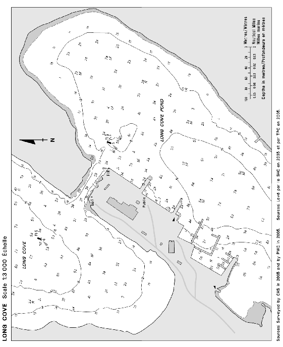
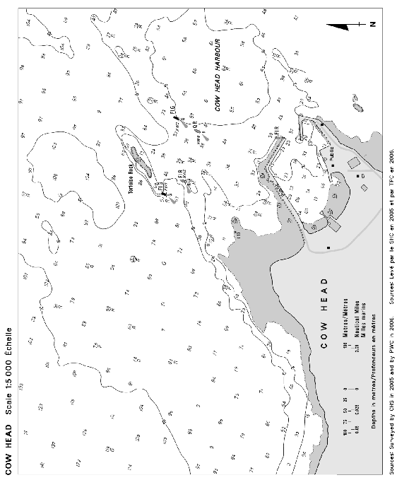
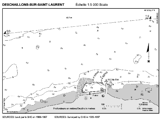
SECTION 5 – Edition 04/2008
LIST OF LIGHTS, BUOYS AND FOG SIGNALS CORRECTIONS
|
ATLANTIC | ||||||||||
|
294.3 H3805 |
Tusket Wedge |
43 42 47.7 65 56 38.2 |
Fl |
G |
4s |
8.3 |
4 |
Cylindrical mast. 6.2 |
Operates at night only. Year round. Chart:4244 Edn 04/08 (F08-009) |
|
|
430 |
Bull Rock light buoy T63 |
Entrance to La Have River. 44 16 22.4 64 20 54.8 |
Q |
G |
1s |
..... |
..... |
Green, marked "T63". |
Year round. Chart:4394 Edn 04/08 (F08-005) |
|
|
1075 |
Cascumpeque light and bell buoy JV2 |
Delete from list. Chart:4492 Edn 04/08 (G07-061) |
||||||||
|
1077 1078 |
Alberton range |
| | | | | | | |
Delete from List. Chart:4492 Edn 04/08 (G07-130, 131) |
|||||||
|
1343.7 H1619 1343.8 H1619.1 |
Dalhousie Harbour East range |
| | | | | | | | | |
48 04 15.2 66 21 57.3 268°30' 55.2m from front. |
Iso Iso |
G G |
1s 4s |
14.0 17.2 |
16 16 |
Square skeleton tower, white daymark, red vertical stripe. 12.7 Square skeleton tower, white daymark, red vertical stripe. 15.8 |
Visible in line of range. Year round. Visible in line of range. Year round. Chart:4426 Edn 02/08 (G07-029) |
|
INLAND WATERS | ||||||||||
|
804 |
Lucas Island |
N. side of island. 45 23 36.1 81 45 58.6 |
Fl |
R |
4s |
13.4 |
3 |
Cylindrical mast, red and white rectangular daymark, red triangle in centre. 6.4 |
Seasonal. Chart:4492 Edn 04/08(D08-015) |
|
|
1087 |
Coppermine Point |
On extremity of point. 46 59 02.8 84 47 14.7 |
Fl |
W |
4s |
14.4 |
5 |
Cylindrical mast, red and white rectangular daymark. 5.5 |
Seasonal. Chart:2307 Edn 04/08(D08-011) | |

