
Archived information
The Standard on Web Usability replaces this content. This content is archived because Common Look and Feel 2.0 Standards have been rescinded.
Archived information is provided for reference, research or recordkeeping purposes. It is not subject to the Government of Canada Web Standards and has not been altered or updated since it was archived.
NOTICE TO USERS MAILING LIST SUBSCRIPTION RENEWAL |
Dear Client: We appreciate your continued interest in receiving the Monthly Edition of Notices to Mariners. As technology evolves, the Canadian Coast Guard is looking at means to reduce printing and distribution costs while continuing to provide quality service to the marine community. Internet technology has become the primary information source worldwide for organizations and individuals to receive information and various publications. As the use of the internet grows in popularity, our organization feels it is the right time to limit our mail distribution and rely primarily on the internet for distribution of the Notices to Mariners. The information, supplied by the internet, has the advantage of being relayed to the mariner immediately and efficiently. We also encourage you to visit the Notices to Mariners web site available at the following internet address www.notmar.gc.ca . This user-friendly site is available 24 hours a day, 7 days a week. You may also register online to receive an automatic e-mail notification when a new Notice to Mariners is issued against any nautical chart(s) that you frequently use. We encourage users to frequently visit the site to access all the latest Notices and related information. The Coast Guard is committed to meeting the needs of our clients. Therefore, should you wish to remain on the hard-copy mailing list, we ask that you complete the following form. The renewal form is required no later than March 31 st , 2008 ; at that time any renewals not received will be removed from the hard-copy mailing list. We thank you very much for your cooperation.
Manager, Aids to navigation |
|
|
Fisheries and Oceans Canada |
Pêches et Océans Canada |
VOL. 33, MONTHLY EDITION NO 02 FEBRUARY 29, 2008 Publication Number 40063779 |
NOTICES TO MARINERS PUBLICATION EASTERN EDITION |
|||
Published monthly by the CANADIAN COAST GUARD |
|||
|
CONTENTS |
|||
Page |
|||
| Section 1 |
Safety and General Information | 1 - 9 |
|
| Section 2 |
Chart Corrections | 10 - 24 |
|
| Section 3 |
Corrections to Radio Aids to Marine Navigation | NIL |
|
| Section 4 |
Sailing Directions and Small Craft Guide Corrections | 25 - 29 |
|
| Section 5 |
List of Lights, Buoys and Fog signals Corrections | 30 - 35 |
|
Maritime Services Directorate Aids to Navigation Internet: www.notmar.gc.ca | |||
EXPLANATORY NOTES |
Geographical positions refer directly to the graduations of the largest scale Canadian Hydrographic chart unless otherwise indicated. |
Bearings refer to the true compass and are measured clockwise from 000° (North) clockwise to 359°; those relating to lights are from seaward. |
Visibility of lights is that in clear weather. |
Depths - The units used for soundings (metres, fathoms or feet) are stated in the title of each chart. |
Elevations are normally given above Higher High Water, Large Tides unless otherwise indicated. |
Distances may be calculated as follows: |
1 nautical mile = 1 852 metres (6,076.1 feet) 1 statute mile = 1 609.3 metres (5,280 feet) 1 metre = 3.28 feet |
Temporary & Preliminary Notices are indicated by a (T) or a (P) before the chart action. Please note that Nautical charts are not hand amended by the Canadian Hydrographic Service for Temporary (T) and Preliminary (P) Notices. It is recommended that mariners chart these corrections in pencil. Listing of charts affected by Temporary and Preliminary Notices are revised and promulgated quarterly in Section 1 of the Monthly Edition. |
Please note that, in addition to the temporary and preliminary changes normally advertised as (T) and (P) Notices, there are a significant number of permanent changes to navigational aids that have been advertised as Preliminary Notices to Mariners while charts are being updated for new editions. |
Marine Information Report & Suggestion Sheet - Mariners are requested to notify the responsible authorities when new or suspected dangers to navigation are discovered, changes observed in aids to navigation or corrections to publications are seen to be necessary. Such communications can be made using the Marine Information Report & Suggestion Sheet inserted on the last page of each monthly edition of Notices to Mariners. |
Monthly edition of Notices to Mariners - Notices to Mariners are issued free of charge on a monthly basis. Mariners now have a choice between specific Regional issue(s) they wish to receive. Requests to be placed on or removed from the mailing list should be made by using the form inserted on page vi of each monthly edition. Notification of changes to the mailing addresses, regional issues and/or number of copies required should also be transmitted by means of this form. |
Canadian Nautical Charts & Publications - A source list of Canadian Nautical Charts & publications is published in Notice No. 14 of the current Annual Edition of Notices to Mariners. The source supply and the prices effective at the time of printing are listed. This list is periodically updated in the monthly edition of Notices to Mariners. |
NOTE: Cette publication est aussi disponible en français. |
|
CHART CORRECTIONS - SECTION 2 |
|
Corrections to nautical charts will be listed in numeric order by chart number. Each chart correction listed applies only to that particular chart. Related charts, if any, will have their own specific correction listed separately. Users should also refer to CHS Chart 1 Symbols, Abbreviations Terms for additional information pertaining to the correction of charts. The illustration below describes the elements that will comprise a typical Section 2 chart correction. |

ADVISORY |
|
NOTICES TO SHIPPING (WRITTEN AND BROADCAST) |
|
The Canadian Coast Guard is implementing a number of changes to the aids to navigation system in Canada . |
|
These changes are advertised as Notices to Shipping (Broadcast and Written) by the Canadian Coast Guard and are followed up with Notices to Mariners, then charts are updated by hand correction, reprints or new editions. |
|
Mariners are advised that all relevant Written Notices to Shipping should be kept until superseded by Notices to Mariners or through revised charts issued by the Canadian Hydrographic Service. |
|
Written Notices to Shipping are published weekly and are available from local Canadian Coast Guard Offices. |
|
The Canadian Hydrographic Service is reviewing the impact of these changes with the Canadian Coast Guard and together we are preparing an action plan on the issuing of chart revisions. |
|
For further information contact your local Regional Notices to Shipping (Notships) issuing authorities. |
|
|
| * Services provided in English and French |

|
MONTHLY EDITION OF NOTICES TO MARINERS |
MAILING LIST CHANGES |
|
Leader, Notices to Mariners Navigation Aids Navigation Systems Canadian Coast Guard 200 Kent Street, Station 5N186 Ottawa, ON K1A 0E6 Telephone (613) 993-6974 Facsimile (613) 998-8428 Internet www.notmar.gc.ca |

INDEX |
|
CANADIAN HYDROGRAPHIC SERVICE - ANNOUNCEMENT REGARDING CANADIAN HYDROGRAPHIC SERVICE CHART PATCHES. |
1 |
CANADIAN HYDROGRAPHIC SERVICE - ARCTIC CHARTS. |
2 |
CANADIAN HYDROGRAPHIC SERVICE - CUMULATIVE CHART CORRECTIONS. |
1 |
CANADIAN HYDROGRAPHIC SERVICE - CURRENT CHART EDITION DATES. |
1 |
CANADIAN HYDROGRAPHIC SERVICE - PRINT ON DEMAND CHARTS - CARE AND USE. |
1 |
*202 CANADIAN HYDROGRAPHIC SERVICE - ELECTRONIC NAVIGATION CHARTS. |
3 |
*201 CANADIAN HYDROGRAPHIC SERVICE - NAUTICAL CHARTS. |
2 |
*213 CANADIAN COAST GUARD - LIST OF CHARTS AND REFERENCE CHARTS (SECTION I) AFFECTED BY TEMPORARY AND PRELIMINARY NOTICES. |
8 |
*204 CANADIAN HYDROGRAPHIC SERVICE - NON EQUIVALENT ELECTRONIC NAVIGATION CHARTS. |
4 |
*203 CANADIAN HYDROGRAPHIC SERVICE - RASTER NAVIGATION CHARTS. |
3 |
*205 CANADIAN HYDROGRAPHIC SERVICE - 2008 CANADIAN TIDE AND CURRENT TABLES. |
4 |
*210(P) COUNTRY ISLAND TO/À BARREN ISLAND - LIGHT TO BE DISCONTINUED. |
8 |
*211(P) EVANDALE TO/À ROSS ISLAND - BUOYS TO BE DISCONTINUED. |
8 |
*208 PRINCE EDWARD ISLAND - NAUFRAGE HARBOUR - LIGHT AND BELL BUOY DISCONTINUED. |
7 |
*209 SYDNEY HARBOUR - FOG SIGNAL DISCONTINUED. |
8 |
*206 TRANSPORT CANADA PUBLICATIONS - SHIP SAFETY BULLETIN. |
4 |
*207 TRANSPORT CANADA - SHIP SAFETY BULLETIN. |
7 |
NUMERICAL INDEX OF CANADIAN CHARTS AFFECTED |
|||||
Chart No. |
Page |
Chart No. |
Page |
Chart No. |
Page |
1233 |
10 |
4459 |
19 |
||
1234 |
10, 11 |
4470 |
19 |
||
1312 |
11 |
4486 |
19, 20 |
||
1313 |
11 |
4491 |
20 |
||
1315 |
11, 12 |
4492 |
21 |
||
1316 |
12 |
4585 |
21 |
||
1409 |
12 |
4667 |
21 |
||
1431 |
13 - 15 |
4821 |
21 |
||
2120 |
15 |
4843 |
21 |
||
2283 |
15 |
4885 |
21 - 23 |
||
4000 |
15 |
4921 |
23, 24 |
||
4001 |
15, 16 |
4980 |
24 |
||
4003 |
16, 17 |
5002 |
24 |
||
4011 |
17 |
5003 |
24 |
||
4020 |
18 |
5705 |
24 |
||
4023 |
7, 18 |
8012 |
24 |
||
L/C4118 |
18 |
||||
4142 |
8 |
||||
4201 |
19 |
||||
4210 |
19 |
||||
4211 |
19 |
||||
4234 |
8 |
||||
4241 |
19 |
||||
L/C4242 |
19 |
||||
4266 |
8 |
||||
4307 |
2 |
||||
4335 |
2 |
||||
SECTION 1 – Edition 02/2008
SAFETY AND GENERAL INFORMATION
CANADIAN HYDROGRAPHIC SERVICE - ANNOUNCEMENT REGARDING CANADIAN HYDROGRAPHIC SERVICE CHART PATCHES.
CHS is introducing a new initiative with a full colour Patch on the Web. A link in the Notices to Mariners web site will be provided so clients can access the colour Patch. The colour Patch will be published in HTML and PDF format. Providing the Patches in colour (accessible to all via remote access to the Web) is an enhanced form of alternative service delivery in line with CHS strategic objectives.
Colour Web Patches are free to the mariner, and given the quality of many printers, should reproduce well. They will be available in real time all around the world which is an improvement since clients had to wait for the paper copy to be mailed.
Previously, in the Notices to Mariners (NTM) booklet, Patches were produced in full colour or a minimum of black and magenta.
Due to current budgetary constraints, Patches will now only be produced in black and white for publication in the NTM booklet.
Our level of service will change with this initiative and CHS intends to analyze market reaction to this innovation.
CHS welcomes your feedback on this new service at chsinfo@dfo-mpo.gc.ca
CANADIAN HYDROGRAPHIC SERVICE - CUMULATIVE CHART CORRECTIONS.
The cumulative Notice to Mariners corrections for charts can now be accessed at http://www.notmar.gc.ca/search/notmar-eng.php
CANADIAN HYDROGRAPHIC SERVICE - CURRENT CHART EDITION DATES.
CHART EDITIONS |
The three terms described below are used to indicate the publication status of Canadian charts. |
NEW CHART - "NEWCHT" |
The first publication of a Canadian chart embracing an area not previously charted to the scale shown, or embracing an area different from any existing Canadian chart. |
NEW EDITION - "NEWEDT" |
A new issue of an existing chart containing amendments essential to navigation in addition to those issued in Notice to Mariners and making existing editions obsolete. |
REPRINTS |
A new issue of the current edition of a chart incorporating no amendments of navigational significance other than those previously promulgated in Notice to Mariners. It may also contain amendments from other sources provided they are not essential to navigation. Previous printings of the current edition remain in force. |
The current chart edition dates can now be accessed at http://www.chs-shc.gc.ca/pub/en/products/core.cfm
CANADIAN HYDROGRAPHIC SERVICE - PRINT ON DEMAND CHARTS - CARE AND USE.
Background By providing nautical charts to the public, the goal of the Canadian Hydrographic Service (CHS) is to provide services for safe navigation in a fiscally responsible manner. As a result, CHS continues to expand its portfolio of nautical paper charts that are printed using Print On Demand (POD) technology. These charts are easily recognized by their whiter paper and the coloured logo of the Canadian Hydrographic Service. This new technology enables CHS to print charts in a more efficient manner while enhancing chart content through being able to quickly add new and important information. POD technology provides customers with up-to-date charts without the historical hand-drawn corrections or glued-on patches. Additionally, this technology eliminates out-of-stock situations which arise with the traditional printing and warehousing methods. In the event of a national emergency, CHS can respond to the appropriate authorities with best available information very quickly. Care of Your POD Chart CHS encourages its customers to handle the POD charts more carefully than the traditional lithographic charts. When plotting information on POD charts, use HB pencils and apply limited pressure. Testing has suggested that an Indian gum eraser is more effective than alternatives when used on the product. This eraser is also suitable for charts printed using lithographic processes. |
CANADIAN HYDROGRAPHIC SERVICE - ARCTIC CHARTS.
Please be advised that effective February 2007 all Arctic notices will appear in both the Eastern and Western paper editions of Notices to Mariners.
Mariners may obtain all Arctic chart notices via the Canadian Coast Guard Notices to Mariners online service www.notmar.gc.ca or by contacting the Canadian Coast Guard, Notices to Mariners office at the following coordinates:
Leader, Notices to Mariners
Aids to Navigation
Navigation Systems
Canadian Coast Guard
200 Kent Street, Station 5N186
Ottawa, ON
K1A 0E6
Telephone (613) 993-6974
Facsimile (613) 998-8428
*201 CANADIAN HYDROGRAPHIC SERVICE - NAUTICAL CHARTS.
CHARTS |
MAIN TITLE |
SCALE |
PUBLISHED |
CAT# |
PRICE |
New Edition |
All temporary and preliminary notices affecting the previous versions of the following chart(s) (is / are) now cancelled. For any outstanding notices please consult section 2 of this edition. |
||||
4307 |
Canso Harbour to/au Strait of Canso |
1:37500 |
04-JAN-2008 |
1 |
$20.00 |
4335 |
Strait of Canso and Approaches/et les approches |
1:75000 |
04-JAN-2008 |
1 |
$20.00 |
NEW PUBLICATIONS |
|||||
MAIN TITLE |
PUBLISHED |
PRICE |
|||
Canadian Tide and Current Tables/Tables des marées et courants du Canada - 1 - Atlantic Coast and Bay of Fundy/Côte de l'Atlantique et baie de Fundy |
01-Jan-08 |
$6.50 |
|||
Canadian Tide and Current Tables/Tables des marées et courants du Canada - Volume 2 - Gulf of St. Lawrence/Golfe du Saint-Laurent |
01-Jan-08 |
$6.50 |
|||
Canadian Tide and Current Tables/Tables des marees et courants du Canada Volume 3 - St. Lawrence and Saguenay Rivers/Fleuve Saint-Laurent et rivière Saguenay |
01-Jan-08 |
$6.50 |
|||
NEW PUBLICATIONS |
|||||
MAIN TITLE |
PUBLISHED |
PRICE |
|||
Canadian Tide and Current Tables/Tables des marées et courants du Canada Volume 4 - Arctic and Hudson Bay/L'Arctique et la baie d'Hudson |
01-Jan-08 |
$6.50 |
|||
Canadian Tide and Current Tables/Tables des marees et courants du Canada Volume 5 - Juan de Fuca Strait and Strait of Georgia/Detroits de Juan de Fuca et de Georgia |
01-Jan-08 |
$6.50 |
|||
Canadian Tide and Current Tables/Tables des marees et courants du Canada Volume 6 - Discovery Passage and West Coast of Vancouver Island/Discovery Passage et côte Ouest de l'île de Vancouver |
01-Jan-08 |
$6.50 |
|||
Canadian Tide and Current Tables/Tables des marees et courants du Canada Volume 7 - Queen Charlotte Sound to Dixon Entrance/Queen Charlotte Sound à Dixon Entrance |
01-Jan-08 |
$6.50 |
|||
*202 CANADIAN HYDROGRAPHIC SERVICE - ELECTRONIC NAVIGATION CHARTS.
RELEASED PRODUCTS |
|
S-57 ENC NUMBER |
CHART TITLE |
CA470593 |
Grenville Channel Compartment A-B |
CA470594 |
Grenville Channel Compartment B-C |
CA570595 |
Union Passage |
CA570596 |
BAKER INLET |
CA470597 |
Grenville Channel to/à Chatham Sound |
CA573105 |
Port Burwell |
CA573314 |
Kingsville Harbour |
CA573316 |
Port Stanley |
CA373064 |
Port Hope to Port Darlington |
CA573326 |
West Dock |
CA576012 |
Dipper Harbour |
CA576013 |
Musquash Harbour |
CA176030 |
Gulf of Maine to/à Strait of Belle Isle including/y compris Gulf of St.Lawrence/Golfe Saint-Laurent |
CA579003 |
Port de Québec |
CA479021 |
Cap aux Oies à/to Sault-au-Cochon |
CA579031 |
Pointe de la Rivière du Loup |
CA379086 |
Cap des Rosiers à/to Chandler |
CA470058 |
Grenville Channel, Baker Inlet to/à Ogden Channel |
*203 CANADIAN HYDROGRAPHIC SERVICE - RASTER NAVIGATION CHARTS.
CHARTS |
MAIN TITLE |
||||
New Chart |
All temporary and preliminary notices affecting the previous versions of the following chart(s) (is / are) now cancelled. For any outstanding notices please consult section 2 of this edition. |
||||
R/M3946 |
Grenville Channel |
02-NOV-2007 |
See Note 2 |
||
Charts Permanently Withdrawn |
|||||
R/M3772 |
Grenville Channel, Sainty Point to Baker Inlet |
||||
*204 CANADIAN HYDROGRAPHIC SERVICE - NON EQUIVALENT ELECTRONIC NAVIGATION CHARTS.
Note: |
The following ENC products are not equivalent to the current editions of their corresponding paper charts and should not be used as a replacement. |
|
NON EQUIVALENT PRODUCTS |
||
S-57 ENC NUMBER |
PAPER CHART NUMBER |
CHART TITLE |
CA276286 |
4023 |
Northhumberland Strait / Détroit de Northumberland |
CA376045 |
4240 |
Liverpool Harbour to/à Lockeport Harbour |
CA376047 |
4241 |
Lockeport to/à Cape Sable |
CA376093 |
4367 |
Flint Island to/à Cape Smoky |
CA376094 |
4020 |
Strait of Belle Isle/Détroit de Belle Isle |
CA476179 |
4466 |
Hillsborough Bay |
CA476202 |
4211 |
Cape Lahave to/à Liverpool Bay |
CA476327 |
4596 |
Bay of Exploits Sheet/feuille II (Middle/centre) |
CA476328 |
4597 |
Bay of Exploits Sheet/feuille III (South/sud) |
CA576226 |
4587 |
Fishery Products International Wharves / Quais |
*205 CANADIAN HYDROGRAPHIC SERVICE - 2008 CANADIAN TIDE AND CURRENT TABLES.
Volume 3 (St. Lawrence River and Saguenay Fiord), pages 28 to 39.
Corrections for the following Reference Ports:
Saint-François
Quebec
Grondines
Correction to times of low waters:
Add 20 minutes to the time of low water predictions shown for the Reference Ports of Saint-François, Quebec and Grondines.
An update to these pages will be published in the near future.
*206 TRANSPORT CANADA - SHIP SAFETY BULLETIN.
Ship Safety Bulletins (TP-3231) - 2007
Ship Safety Bulletins address safety-related matters pertaining to vessels. Bulletins are available from Transport Canada's Marine Safety Directorate free of charge and are issued on an "as needed" basis.
A complete list of Ship Safety Bulletins are available on Transport Canada's Web site.
If you do not have access to our Web site and wish to be included in the Ship Safety Bulletins mailing list, please send your request to the Marine Safety location provided below. We ask your cooperation in distributing copies of this listing to your colleagues, to ship owners and/or maritime companies to let them know of the existence of these Bulletins.
If this is the first time you are receiving the Bulletin, your name is probably not on Transport Canada's mailing list. Should you wish to be included, please send your request to the Marine Safety location provided below.
As of December 31, 2007, the following Ship Safety Bulletins have been issued.
Bulletin Number |
Title |
Date of Creation |
01/2007 |
Marine Emergency Duties Training for Personnel on Small Fishing and Small Commercial Vessels (This Bulletin has been replaced by Bulletin 11/2007) |
2007-03-27 |
02/2007 |
Marine Medical Care and Marine First Aid (amendment 2007-11-01) |
2007-07-17 |
03/2007 |
Changes within the certificate structure and transitional period from the Marine Personnel Regulations |
2007-07-31 |
04/2007 |
Carbon Monoxide, Preventive Measures and Recognition of Danger |
2007-08-02 |
05/2007 |
Weight of Persons on Board, Calculation of Intact and Damaged Stability |
2007-08-02 |
06/2007 |
Information on Persons on Board, Counting, Recording, and Special Needs |
2007-08-02 |
07/2007 |
Inflatable Liferafts and Rescue Platforms, Stowage and Proper Access |
2007-08-02 |
08/2007 |
Vessel Clearance for Vessels Engaged on International Voyages |
2007-08-21 |
09/2007 |
Automatic Identification System (AIS) Requirement - July 1, 2008 |
2007-09-11 |
10/2007 |
Updated Damaged Stability Provisions for Non-Convention Passenger Vessels |
2007-10-12 |
11/2007 |
Marine Emergency Duties Training for Personnel on Small Commercial Vessels |
2007-11-01 |
12/2007 |
Adequacy of Single Cross-bar Type Hatch Covers |
2007-12-04 |
13/2007 |
Security Clearance Enrolment Process for Seafarers |
2007-12-07 |
Transport Publications (TPs) New and/or Amended - 2007
Publication No |
Title |
Date |
TP 4957 |
Marine Emergency Duties Training Program (1998) |
September 2007 |
TP 8129 |
Training Standards for Tanker Safety, Inert Gas and Crude Oil Washing, and Supervisor of Oil Transfer Operations Personnel (2007) |
June 2007 |
TP 8505 |
Receiver of Wreck (2007) |
November 2007 |
TP 8911 |
Marine Engineer Cadet Training Program (2007) |
October 2007 |
TP 10655 |
Approved Training Courses (2007) |
October 2007 |
TP 10933 |
Engine Room Rating Training Program (2007) |
September 2007 |
TP 10937 |
Mobile Offshore Units (MOUS) Training Courses |
June 2007 |
TP 10943 |
Passenger vessel Operations and Damaged Stability Standards (Non-convention vessels) (2007) |
October 2007 |
TP 11130 |
Training Course in Marine Cooking (2007) |
October 2007 |
TP 11343 |
Medical Examination of Seafarers - Physician's Guide (2007) |
August 2007 |
TP 12301 |
Standard for 5 ppm Bilge Alarms (for Canadian Inland Waters) |
July 2007 |
TP 13024 |
Training Standards for Ro-Ro Passenger Ships Personnel (2000) |
June 2007 |
TP 13430 |
Standard for the Tonnage Measurement of Vessels (2007) |
November 2007 |
TP 13617 |
A Guide to Canada's Ballast Water Control and Management Regulations (2007) |
November 2007 |
TP 13720 |
Practical Skills for Marine Engineers, Training Course (2007) |
October 2007 |
TP 13721 |
Training Record Book Requirements for Applicants to the Fourth-Class Engineer Certificate |
October 2007 |
TP 13741 |
Pilotage Risk Management Methodology (2001) |
July 2007 |
TP 13813 |
CANADA SHIPPING ACT, 2001 - 2007 Entry into Force: What you need to know - Brochure (2007) |
November 2007 |
TP 14349 |
Boat Safety with Pukta (2007) |
December 2007 |
TP 14352 |
Rules of the Road (2007) |
November 2007 |
TP 14508 |
First-Class Engineer Set of Specimen Examination Questions (2007) |
November 2007 |
TP 14509 |
Second-Class Engineer Set of Specimen Examination Questions (2007) |
November 2007 |
TP 14510 |
Third-class Engineer, Set of Specimen Examination Questions (2007) |
November 2007 |
TP 14511 |
Fourth-Class Engineer - Set of Specimen Examination Questions (2007) |
November 2007 |
TP 14512 |
Watchkeeping Engineer, Motor-Driven Fishing Vessel - Set of Specimen Examination Questions (2007) |
November 2007 |
TP 14590 |
The Navigable Waters Protection Act: Winter Crossings - Brochure (2007) |
September 2007 |
TP 14591 |
The Navigable Waters Protection Act: Water Intakes - Brochure |
July 2007 |
TP 14592 |
The Navigable Waters Protection Act: Submarine Cables (Hydro and Communication) - Brochure (2007) |
October 2007 |
TP 14593 |
The Navigable Waters Protection Act: Pipeline Crossings - Brochure (2007) |
September 2007 |
TP 14594 |
The Navigable Waters Protection Act: Erosion Protection Works - Brochure (2007) |
September 2007 |
TP 14595 |
The Navigable Waters Protection Act: Docks and Boathouses - Brochure (2007) |
July 2007 |
TP 14596 |
The Navigable Waters Protection Act: Aerial Cables (Hydro and Communication) - Brochure (2007) |
August 2007 |
TP 14597 |
The Navigable Waters Protection Act: Dredging - Brochure 2007 |
July 2007 |
TP 14609 |
Study Guide for Applicants to the Fourth-class Engineer Certificate with STCW Endorsement (2006) |
June 2007 |
TP 14658 |
Registration of non-pleasure craft (small commercial vessels) in the "Small Vessel Register" - New requirements under the Canada Shipping Act 2001 (CSA 2001) (2007) |
July 2007 |
TP 14673 |
Safety Stickers (2007) |
October 2007 |
TP 14674 |
Boat Maintenance Cards (2007) |
July 2007 |
TP 14692 |
Small Vessel Operator Proficiency Training Course (2007) |
August 2007 |
TP 14707 |
National Places of Refuge Contingency Plan (PORCP) (2007) |
October 2007 |
TP 14726 |
Sea Kayaking Safety Guide (2007) |
September 2007 |
TP 14737 |
Navigable Waters Protection Program (2007) |
October 2007 |
TP 14754 |
Small Vessel Machinery Operator - Set of Specimen Examination Questions (2007) |
November 2007 |
Copies of these publications may be obtained from:
Marine Safety
Transport Canada
Place de Ville, Tower "C"
330 Sparks Street, 9th floor
Ottawa, Ontario, K1A 0N8
E-mail: marinesafety@tc.gc.ca
Web site: Ship Safety Bulletins: http://www.tc.gc.ca/marinesafety/bulletins/toc_e.htm
Transport Publications: http://www.tc.gc.ca/MarineSafety/TP/menu.htm
Phone: 613-990-5931
Fax: 613-990-1879
*207 TRANSPORT CANADA - SHIP SAFETY BULLETIN.
A new Ship Safety Bulletin was published on January 15, 2008.
Title: FISHING VESSEL SAFETY
Record of Modifications
Number: 01/2008
Internet:http://www.tc.gc.ca/marinesafety/bulletins/2008/01-eng.htm
*208 PRINCE EDWARD ISLAND - NAUFRAGE HARBOUR - LIGHT AND BELL BUOY DISCONTINUED.
Reference: Notice 208(P)/2007 is cancelled (Chart 4023). (G2007-048) |
*209 SYDNEY HARBOUR - FOG SIGNAL DISCONTINUED.
Reference: Notice 411(P)/2007 is cancelled (Chart 4266). (G2007-178) |
*210(P) COUNTRY ISLAND TO/À BARREN ISLAND - LIGHT TO BE DISCONTINUED.
Reference chart:: 4234 The Canadian Coast Guard intends to permanently discontinue the following aid to navigation: Isaac's Harbour light LL 637 (45°09' 52.8" N 61° 39' 16.5" W) Mouton Harbour Inner rear range light LL 630.1 (45°05' 41.8" N 61° 43' 35" W) Comments on this action are solicited from mariners and other interested parties. Comments should be directed to: Glen Graham, Superintendent of Aids to Navigation, Canadian Coast Guard, PO Box 1000, Dartmouth, NS, B2Y 3Z8; e-mail GrahamG@mar.dfo-mpo.gc.ca within three months from this date of notice. Any objections raised must state the facts on which they based and should include supporting information on safety, commerce and public benefit. (G2008-001, 002) |
*211(P) EVANDALE TO/À ROSS ISLAND - BUOYS TO BE DISCONTINUED.
Reference chart: 4142 The Canadian Coast Guard intends to permanently discontinue the following aids to navigation: Bush Track Red spar buoy E36/4 (45°51' 30.2" N 66° 08' 31.9" W) Bush Track Entrance Red spar buoy E36 (45°51' 26.2" N 66° 08' 33.9" W) Comments on this action are solicited from mariners and other interested parties. Comments should be directed to: Glen Graham, Superintendent of Aids to Navigation, Canadian Coast Guard, PO Box 1000, Dartmouth, NS, B2Y 3Z8; e-mail GrahamG@mar.dfo-mpo.gc.ca within three months from this date of notice. Any objections raised must state the facts on which they based and should include supporting information on safety, commerce and public benefit. (F2008-001, 004) |
*213 CANADIAN COAST GUARD - LIST OF CHARTS AND REFERENCE CHARTS (SECTION I) AFFECTED BY TEMPORARY AND PRELIMINARY NOTICES.
IN EFFECT JANUARY 25, 2008 (REVISED AND PROMULGATED QUARTERLY) |
|
1220 |
28-MAY(T)/04 |
1351 |
196(T)/87, 636(P)/93, 510(P)/98 |
1361 |
1101(P)/99 |
1410 |
211(P)/07 |
1433 |
810(P)/07 |
1434 |
03-AUG(P)/01 |
1509 |
506(T)/07 |
1510 |
507(T)/07 |
2006 |
1214(P)/07 |
2218 |
28-APR(P)/00 |
2241 |
28-APR(P)/00, 811(P)/07 |
2250 |
361(P)/97 |
2260 |
106(P)/06 |
2283 |
31-MAR(P)/00, 04-JAN(P)/02, 1207(P)/06 |
LC 3000 |
2346(P)/99, 28-APR(P)/00, 03-NOV(P)/00, 23-MAR(P)/01 |
3053 |
19-JAN(P)/01 |
3313 |
30-MAY(P)/03 |
3458 |
14-FEB(P)/03 |
3490 |
110(P)/08 |
3601 |
907(P)/06 |
3602 |
907(P)/06 |
LC 3604 |
23-MAR(P)/01 |
3606 |
907(P)06 |
3802 |
1103(T)/06 |
3891 |
24-AUG(P)/01 |
3955 |
15-SEP(P)/00 |
4000 |
21-APR(T)/06 |
4001 |
21-APR(T)/06, 01-DEC(T)/06 |
4003 |
04-JUL(T)/03, 21-APR(T)/06, 01-DEC(T)/06, 06-JUL(T)/07 |
4006 |
21-APR(T)/06, 01-DEC(T)/06 |
4098 |
1102(P)/03 |
4117 |
06-JUL(T)/07 |
4210 |
607(P)/04 |
4234 |
1107(P)/07 |
4237 |
1108(P)/07 |
4240 |
405(P)/05 |
4244 |
21-DEC-2007 |
4266 |
504(P)/07 |
4275 |
707(P)/07 |
4281 |
1207(P)/07, 107(P)/08 |
4308 |
108(P)/08 |
4328 |
28-SEP(T)/07 |
4385 |
902(P)/04 |
4404 |
01-JUL(T)/05 |
4405 |
24-MAR(T)/06 |
4416 |
26-APR(T)/02, 15-NOV(T)/02, 29-NOV(T)/02, 25-FEB(T)/05 |
4437 |
01-JUL(T)/05 |
4466 |
24-MAR(T)/06 |
4486 |
04-JAN(T)/02, 24-JAN(T)/03, 16-MAY(T)/03, 31-OCT(T)/03 |
4492 |
808(P)/07, 809(P)/07, 908(P)/07, 1110(P)/07 |
4615 |
02-NOV(T)/07 |
4619 |
02-NOV(T)/07 |
4622 |
02-NOV(T)/07 |
L/C 4624 |
02-NOV(T)/07 |
4625 |
02-NOV(T)/07 |
4626 |
02-NOV(T)/07 |
L/C 4832 |
02-NOV(T)/07 |
L/C 4841 |
02-NOV(T)/07 |
4843 |
27-JUL(T)/07 |
4855 |
02-NOV(T)/07 |
4856 |
02-NOV(T)/07 |
4857 |
02-NOV(T)/07 |
4905 |
27-JUL(T)/07 |
4954 |
16-MAY(T)/03, 18-JUL(T)/03, 17-DEC(T)/04 |
5449 |
808(P)/04 |
5707 |
807(P)/04 |
6267 |
112(P)/06 |
7010 |
153(T)/99 |
LC 7011 |
153(T)/99 |
7083 |
847(P)/89, 1510(P)/98, 1727(P)/98 |
7371 |
634(P)/96 |
7760 |
1510(P)/98, 1727(P)/98 |
8006 |
21-APR(T)/06 |
8007 |
01-DEC(T)/06 |
8015 |
26-APR(T)/02 |
8048 |
06-JUL(T)/07 |
SECTION 2 – Edition 02/2008
CHART CORRECTIONS
1233 - Cap aux Oies à/to Sault-au-Cochon - New Edition - 09-NOV-2001 - NAD 1983
| 15-FEB-2008 | LNM/D. 18-JAN-2008 | |
| Add | non-dangerous wreck (See Chart No. 1, K29) |
47°18'26.8"N 070°17'35.1"W |
| DFO(6407594-01) | ||
1233 - Saint-Joseph-de-la-Rive - New Edition - 09-NOV-2001 - NAD 1983
| 29-FEB-2008 | LNM/D. 15-FEB-2008 | |
| Delete | depth of 1 metre (See Chart No. 1, I10) |
47°26'56.2"N 070°21'50.3"W |
| DFO(6407595-02) | ||
| Delete | depth of 3 metres 6 decimetres (See Chart No. 1, I10) |
47°26'55.1"N 070°21'55.9"W |
| DFO(6407595-04) | ||
| Delete | depth of 4 metres 3 decimetres (See Chart No. 1, I10) |
47°26'53.1"N 070°21'56.9"W |
| DFO(6407595-05) | ||
| Amend | legend 5.0m (2001) to read 5.0m (2007) (See Chart No. 1, I22) |
47°26'53.0"N 070°21'52.0"W |
| DFO(6407595-06) | ||
| Add | depth of 0 metre 9 decimetres (See Chart No. 1, I10) |
47°26'56.0"N 070°21'50.7"W |
| DFO(6407595-01) | ||
1234 - Pointe de la Rivière du Loup - New Edition - 25-MAY-2001 - NAD 1983
| 08-FEB-2008 | LNM/D. 18-MAY-2007 | |
| Delete | depth of 4 metres 3 decimetres (See Chart No. 1, I10) |
47°50'48.3"N 069°34'21.0"W |
| DFO(6407593-06) | ||
| Delete | depth of 3 metres 2 decimetres (See Chart No. 1, I10) |
47°50'48.9"N 069°34'20.0"W |
| DFO(6407593-07) | ||
| Delete | depth of 1 metre 5 decimetres (See Chart No. 1, I10) |
47°50'50.0"N 069°34'12.9"W |
| DFO(6407593-08) | ||
| Delete | depth of 3 metres 7 decimetres (See Chart No. 1, I10) |
47°50'50.9"N 069°34'11.6"W |
| DFO(6407593-09) | ||
| Delete | depth of 1 metre (See Chart No. 1, I10) |
47°50'49.2"N 069°34'17.2"W |
| DFO(6407593-10) | ||
| Delete | depth of 1 metre 2 decimetres (See Chart No. 1, I10) |
47°50'54.5"N 069°34'15.5"W |
| DFO(6407593-11) | ||
| Delete | depth of 2 metres 8 decimetres (See Chart No. 1, I10) |
47°50'49.6"N 069°34'19.2"W |
| DFO(6407593-12) | ||
| On certain copies | ||
| Delete | depth of 2 metres 3 decimetres (See Chart No. 1, I10) |
47°50'53.5"N 069°34'18.3"W |
| DFO(6407596-01) | ||
| Amend | legend 4.6m (2005) to read 4.6m (2007) (See Chart No. 1, I22) |
47°50'51.3"N 069°34'18.0"W |
| DFO(6407593-13) | ||
| Add | depth of 2 metres 8 decimetres (See Chart No. 1, I10) |
47°50'48.8"N 069°34'20.3"W |
| DFO(6407593-01) | ||
| Add | depth of 0 metre 7 decimetres (See Chart No. 1, I10) |
47°50'49.1"N 069°34'18.5"W |
| DFO(6407593-02) | ||
| Add | depth of 0 metre 7 decimetres (See Chart No. 1, I10) |
47°50'49.7"N 069°34'15.8"W |
| DFO(6407593-03) | ||
| Add | depth of 0 metre 5 decimetres (See Chart No. 1, I10) |
47°50'49.8"N 069°34'13.7"W |
| DFO(6407593-04) | ||
| Add | depth of 1 metre 2 decimetres (See Chart No. 1, I10) |
47°50'54.1"N 069°34'16.0"W |
| DFO(6407593-05) | ||
| On certain copies | ||
| Add | depth of 2 metres 3 decimetres (See Chart No. 1, I10) |
47°50'54.9"N 069°34'19.3"W |
| DFO(6407596-02) | ||
1312 - Lac Saint-Pierre - New Edition - 08-JUN-2007 - NAD 1983
| 22-FEB-2008 | LNM/D. 30-NOV-2007 | |
| Amend | legend 134| ° to read 154| ° (See Chart No. 1, Pe) |
46°12'43.5"N 072°54'58.9"W |
| DFO(6407600-01) | ||
| 29-FEB-2008 | LNM/D. 22-FEB-2008 | |
| Replace | green port hand lighted pillar buoy Fl G, marked S123 with green port hand lighted spar buoy Fl G, marked S123 (See Chart No. 1, Q24) |
46°04'57.0"N 073°00'37.5"W |
| (Q2008002) LL(2173) DFO(6407598-01) | ||
1313 - Batiscan au/to Lac Saint-Pierre - New Edition - 02-FEB-2007 - NAD 1983
| 29-FEB-2008 | LNM/D. 30-NOV-2007 | |
| Replace | red starboard hand lighted pillar buoy Fl R, marked C70 with red starboard hand lighted spar buoy Fl R, marked C70 (See Chart No. 1, Qf) |
46°18'05.4"N 072°34'36.1"W |
| (Q2007141) LL(2108) DFO(6407575-01) | ||
1315 - Québec à/to Donnacona - New Edition - 21-JUN-2002 - NAD 1983
| 15-FEB-2008 | LNM/D. 07-SEP-2007 | |
| Delete | depth of 10 metres 4 decimetres (See Chart No. 1, I10) |
46°47'31.3"N 071°13'27.0"W |
| DFO(6407565-09) | ||
| Add | depth of 9 metres 9 decimetres (See Chart No. 1, I10) |
46°47'30.4"N 071°13'25.5"W |
| DFO(6407565-02) | ||
1316 - Port de Québec - New Edition - 23-JUN-2006 - NAD 1983
| 15-FEB-2008 | LNM/D. 29-JUN-2007 | |
| Delete | depth of 12 metres 1 decimetre (See Chart No. 1, I10) |
46°49'24.8"N 071°12'13.7"W |
| DFO(6407565-07) | ||
| Replace | depth of 11 metres 7 decimetres with depth of 11 metres 4 decimetres (See Chart No. 1, I10) |
46°47'25.6"N 071°13'21.2"W |
| DFO(6407565-03) | ||
| Add | depth of 8 metres 3 decimetres (See Chart No. 1, I10) |
46°47'34.4"N 071°13'19.3"W |
| DFO(6407565-01) | ||
| Add | depth of 9 metres 9 decimetres (See Chart No. 1, I10) |
46°47'30.4"N 071°13'25.5"W |
| DFO(6407565-02) | ||
| Add | depth of 13 metres 8 decimetres (See Chart No. 1, I10) |
46°49'26.2"N 071°12'06.1"W |
| DFO(6407565-04) | ||
| Add | depth of 9 metres 5 decimetres (See Chart No. 1, I10) |
46°49'21.1"N 071°12'21.4"W |
| DFO(6407565-05) | ||
| Add | depth of 7 metres 2 decimetres (See Chart No. 1, I10) |
46°49'08.2"N 071°12'01.7"W |
| DFO(6407565-06) | ||
| Add | depth of 11 metres 8 decimetres (See Chart No. 1, I10) |
46°49'24.5"N 071°12'12.3"W |
| DFO(6407565-08) | ||
1409 - Canal de la Rive Sud - New Edition - 12-APR-2002 - NAD 1983
| 22-FEB-2008 | LNM/D. 10-AUG-2007 | |
| Add | submarine cable (See Chart No. 1, L30.1) |
joining 45°29'11.0"N 073°30'45.2"W |
| 45°29'10.4"N 073°30'44.3"W | ||
| and 45°29'09.4"N 073°30'44.3"W | ||
| DFO(6407602-01) | ||
| Add | submarine cable (See Chart No. 1, L30.1) |
joining 45°28'49.0"N 073°30'35.6"W |
| 45°28'46.0"N 073°30'32.1"W | ||
| and 45°28'43.2"N 073°30'32.3"W | ||
| DFO(6407602-02) | ||
| Add | submarine cable (See Chart No. 1, L30.1) |
joining 45°24'25.7"N 073°32'41.9"W |
| 45°24'16.0"N 073°32'42.5"W | ||
| 45°24'12.5"N 073°32'44.4"W | ||
| and 45°24'09.2"N 073°32'48.7"W | ||
| DFO(6407602-03) | ||
1431 - Canal de Beauharnois - New Chart - 17-JAN-2003 - NAD 1983
| 15-FEB-2008 | LNM/D. 11-JAN-2008 | |
| Replace | red starboard hand lighted pillar buoy Fl R, marked C2 with red starboard hand lighted spar buoy Fl R, marked C2. |
45°17'02.1"N 073°56'30.6"W |
| (B2008001) LL(36) DFO(6603087-01) | ||
| Replace | red starboard hand lighted pillar buoy QR, marked C6 with red starboard hand lighted spar buoy QR, marked C6 |
45°16'06.6"N 073°57'12.1"W |
| (B2008002) LL(39) DFO(6603088-01) | ||
| Replace | green port hand lighted pillar buoy Fl G, marked C7 with green port hand lighted spar buoy Fl G, marked C7 |
45°15'36.1"N 073°57'28.1"W |
| (B2008003) LL(40) DFO(6603089-01) | ||
| Replace | red starboard hand lighted pillar buoy Fl R, marked C8 with red starboard hand lighted spar buoy Fl R, marked C8 |
45°15'25.1"N 073°57'58.6"W |
| (B2008004) LL(43) DFO(6603090-01) | ||
| 22-FEB-2008 | LNM/D. 15-FEB-2008 | |
| Replace | red starboard hand lighted pillar buoy Fl R, marked C10 with red starboard hand lighted spar buoy Fl R, marked C10 |
45°14'40.1"N 073°59'04.6"W |
| (B2008005) LL(44) DFO(6603091-01) | ||
| Replace | green port hand lighted pillar buoy Fl G, marked C11 with green port hand lighted spar buoy Fl G, marked C11 |
45°14'35.6"N 073°58'58.6"W |
| (B2008006) LL(45) DFO(6603092-01) | ||
| Replace | green port hand lighted pillar buoy Fl G, marked C13 with green port hand lighted spar buoy Fl G, marked C13 |
45°14'14.1"N 073°59'27.6"W |
| (B2008007) LL(46) DFO(6603093-01) | ||
| Replace | red starboard hand lighted pillar buoy QR, marked C14 with red starboard hand lighted spar buoy QR, marked C14 |
45°14'17.1"N 073°59'38.6"W |
| (B2008008) LL(47) DFO(6603094-01) | ||
| Replace | yellow anchorage lighted pillar buoy Fl Y, marked CK with yellow anchorage lighted spar buoy Fl Y, marked CK |
45°13'15.2"N 074°01'41.1"W |
| (B2008009) LL(49) DFO(6603095-01) | ||
| Replace | red starboard hand lighted pillar buoy Fl R, marked C20 with red starboard hand lighted spar buoy Fl R, marked C20 |
45°13'48.6"N 074°00'45.8"W |
| (B2008010) LL(50) DFO(6603096-01) | ||
| Replace | red starboard hand lighted pillar buoy QR, marked C22 with red starboard hand lighted spar buoy QR, marked C22 |
45°13'26.3"N 074°02'07.3"W |
| (B2008011) LL(53) DFO(6603097-01) | ||
| Replace | green port hand lighted pillar buoy Fl G, marked C21 with green port hand lighted spar buoy Fl G, marked C21 |
45°13'24.2"N 074°01'47.6"W |
| (B2008012) LL(54) DFO(6603098-01) | ||
| Replace | green port hand lighted pillar buoy QG, marked C23 with green port hand lighted spar buoy QG, marked C23 |
45°13'14.2"N 074°02'26.1"W |
| (B2008013) LL(55.5) DFO(6603099-01) | ||
| Replace | red starboard hand lighted pillar buoy Fl R, marked C24 with red starboard hand lighted spar buoy Fl R, marked C24 |
45°13'20.2"N 074°02'51.6"W |
| (B2008014) LL(57) DFO(6603100-01) | ||
| Replace | green port hand lighted pillar buoy Fl G, marked C27 with green port hand lighted spar buoy Fl G, marked C27 |
45°13'14.7"N 074°03'42.6"W |
| (B2008015) LL(58) DFO(6603101-01) | ||
| Replace | red starboard hand lighted pillar buoy Fl R, marked C28 with red starboard hand lighted spar buoy Fl R, marked C28 |
45°13'20.2"N 074°03'42.6"W |
| (B2008016) LL(63) DFO(6603102-01) | ||
| Replace | green port hand lighted pillar buoy Fl G, marked C31 with green port hand lighted spar buoy Fl G, marked C31 |
45°13'15.1"N 074°04'56.6"W |
| (B2008017) LL(64) DFO(6603103-01) | ||
| Replace | green port hand lighted pillar buoy QG, marked C37 with green port hand lighted spar buoy QG, marked C37 |
45°13'15.8"N 074°05'35.7"W |
| (B2008019) LL(66) DFO(6603105-01) | ||
| Replace | green port hand lighted pillar buoy Fl G, marked C39 with green port hand lighted spar buoy Fl G, marked C39 |
45°13'18.0"N 074°05'58.8"W |
| (B2008020) LL(68) DFO(6603106-01) | ||
| Replace | red starboard hand lighted pillar buoy QR, marked C38 with red starboard hand lighted spar buoy QR, marked C38 |
45°13'24.2"N 074°05'56.6"W |
| (B2008021) LL(69) DFO(6603107-01) | ||
| Replace | green port hand lighted pillar buoy Fl G, marked C45 with green port hand lighted spar buoy Fl G, marked C45 |
45°13'47.2"N 074°08'14.1"W |
| (B2008022) LL(72) DFO(6603108-01) | ||
| Replace | yellow anchorage lighted pillar buoy Fl Y, marked CN with yellow anchorage lighted spar buoy Fl Y, marked CN |
45°13'34.2"N 074°08'19.1"W |
| (B2008023) LL(73) DFO(6603109-01) | ||
| Replace | red starboard hand lighted pillar buoy QR, marked C46 with red starboard hand lighted spar buoy QR, marked C46 |
45°13'59.2"N 074°08'37.6"W |
| (B2008024) LL(74) DFO(6603110-01) | ||
| Replace | red starboard hand lighted pillar buoy Fl R, marked C48 with red starboard hand lighted spar buoy Fl R, marked C48 |
45°14'03.2"N 074°09'14.1"W |
| (B2008025) LL(77) DFO(6603111-01) | ||
| Replace | green port hand lighted pillar buoy QG, marked C49 with green port hand lighted spar buoy QG, marked C49 |
45°13'55.2"N 074°09'35.6"W |
| (B2008026) LL(78) DFO(6603112-01) | ||
| Replace | red, green and red starboard bifurcation lighted pillar buoy Fl (2 + 1) R, marked DVB with red, green and red starboard bifurcation lighted spar buoy Fl (2 + 1) R, marked DVB |
45°13'52.2"N 074°11'20.1"W |
| (B2008027) LL(86) DFO(6603113-01) | ||
| Replace | green port hand lighted pillar buoy Fl G, marked D3 with green port hand lighted spar buoy Fl G, marked D3 |
45°13'48.2"N 074°11'19.6"W |
| (B2008028) LL(87) DFO(6603114-01) | ||
| 29-FEB-2008 | LNM/D. 22-FEB-2008 | |
| Delete | yellow cautionary can buoy (See Chart No. 1, Qm) |
45°15'22.0"N 074°11'58.0"W |
| DFO(6603169-01) | ||
1431 - Port de Valleyfield - New Chart - 17-JAN-2003 - NAD 1983
| 22-FEB-2008 | LNM/D. 15-FEB-2008 | |
| Replace | green port hand lighted pillar buoy Fl G, marked C31 with green port hand lighted spar buoy Fl G, marked C31 |
45°13'15.1"N 074°04'56.6"W |
| (B2008017) LL(64) DFO(6603103-01) | ||
| Replace | red starboard hand lighted pillar buoy Fl R, marked C30 with red starboard hand lighted spar buoy Fl R, marked C30 |
45°13'20.6"N 074°05'05.6"W |
| (B2008018) LL(65) DFO(6603104-01) | ||
| Replace | green port hand lighted pillar buoy QG, marked C37 with green port hand lighted spar buoy QG, marked C37 |
45°13'15.8"N 074°05'35.7"W |
| (B2008019) LL(66) DFO(6603105-01) | ||
| Replace | green port hand lighted pillar buoy Fl G, marked C39 with green port hand lighted spar buoy Fl G, marked C39 |
45°13'18.0"N 074°05'58.8"W |
| (B2008020) LL(68) DFO(6603106-01) | ||
| Replace | red starboard hand lighted pillar buoy QR, marked C38 with red starboard hand lighted spar buoy QR, marked C38 |
45°13'24.2"N 074°05'56.7"W |
| (B2008021) LL(69) DFO(6603107-01) | ||
2120 - Port Dover - New Edition - 15-APR-2005 - NAD 1983
| 29-FEB-2008 | LNM/D. 25-MAY-2007 | |
| Delete | submarine cable (See Chart No. 1, L30.1) |
joining 42°46'53.8"N 080°11'40.9"W |
| 42°46'53.0"N 080°11'39.5"W | ||
| and 42°46'51.1"N 080°11'40.7"W | ||
| DFO(6603170-01) | ||
2283 - Owen Sound Harbour - Sheet 2 - New Chart - 30-JUL-1999 - NAD 1983
| 08-FEB-2008 | LNM/D. 04-JAN-2008 | |
| Add | private light F (See Chart No. 1, P1) |
44°35'49.1"N 080°56'34.8"W |
| LL(834.6) DFO(6603086-01) | ||
4000 - Gulf of Maine to/à Baffin Bay / Baie de Baffin - New Edition - 25-JUL-2003 - NAD 1983
| 08-FEB-2008 | LNM/D. 09-FEB-2007 | |
| Add | depth of 8.6 metres. (See Chart No. 1, I10) |
58°04'46.8"N 079°36'13.2"W |
| DFO(6603085-01) | ||
4001 - Gulf of Maine to Strait of Belle Isle au Détroit de Belle Isle - New Edition - 01-DEC-1995 - NAD 1983
| 08-FEB-2008 | LNM/D. 18-JAN-2008 | |
| (T)Add | subsurface mooring at a depth of 1475 metres below the surface | 48°12'00.6"N 047°52'59.4"W |
| The mooring is temporary and will be removed by June 2008. | ||
| DFO(6303538-01) | ||
| (T)Add | subsurface mooring at a depth of 1875 metres below the surface | 48°19'45.6"N 047°48'15.6"W |
| The mooring is temporary and will be removed by June 2008. | ||
| DFO(6303538-02) | ||
| (T)Add | subsurface mooring at a depth of 2450 metres below the surface | 48°49'52.8"N 047°27'13.8"W |
| The mooring is temporary and will be removed by June 2008. | ||
| DFO(6303538-03) | ||
| (T)Add | subsurface mooring at a depth of 2950 metres below the surface | 49°30'00.0"N 046°29'03.0"W |
| The mooring is temporary and will be removed by June 2008. | ||
| DFO(6303538-04) | ||
| (T)Add | subsurface mooring at a depth of 2095 metres below the surface | 49°08'14.4"N 046°55'15.6"W |
| The mooring is temporary and will be removed by June 2008. | ||
| DFO(6303538-05) | ||
| (T)Add | subsurface mooring at a depth of 100 metres below the surface | 48°32'45.6"N 047°39'27.0"W |
| The mooring is temporary and will be removed by June 2008. | ||
| DFO(6303538-06) | ||
| 29-FEB-2008 | LNM/D. 18-JAN-2008 | |
| Amend | Roseway Basin Right Whale Conservation Area / Zone de préservation des baleines noires du Bassin Roseway to read See CAUTION/Voir ATTENTION |
43°05'00.0"N 067°25'00.0"W |
| DFO(6303817-01) | ||
| Add | note: CAUTION Roseway Basin Seasonal Area to be Avoided. In order to significantly reduce the risk of ship strikes of the highly endangered North Atlantic right whale, it is recommended that ships of 300 gross tonnage and upwards solely in transit during the period of June 1st through December 31st should avoid this area. ATTENTION Zone du bassin Roseway à éviter sur une base saisonnière. On recommande aux navires de 300 tonnes brut et plus et transitant dans cette zone de conservation, d'éviter cette dernière durant la période allant du 1er juin au 31 décembre afin de réduire considérablement le risque de collision entre les navires et les baleines noires de l'Atlantique Nord, dont l'espèce est en voie de disparition. (See Chart No 1 Section A 14.) |
48°30'00.0"N 072°20'00.0"W |
| DFO(6303817-02) | ||
4003 - Cape Breton to/à Cape Cod - New Edition - 21-MAR-2003 - NAD 1983
| 08-FEB-2008 | LNM/D. 18-JAN-2008 | |
| CANCELS | yellow ODAS/SADO light buoy, Fl (4s) Y | 43°22'48.6"N 069°15'19.2"W |
| This buoy is permanently discontinued. Notice 04-July-2003(T), DFO(6300915-01) is now cancelled. | ||
| DFO(6300915-01) | ||
| CANCELS | yellow ODAS/SADO light buoy, Fl (4s) Y | 43°31'43.2"N 069°18'01.2"W |
| This buoy is permanently discontinued. Notice 04-July-2003(T), DFO(6300915-03) is now cancelled. | ||
| DFO(6300915-03) | ||
| CANCELS | subsurface mooring at a depth of 1032 fathoms below the surface | 42°41'16.2"N 061°31'27.1"W |
| This buoy is permanently discontinued. Notice 06-JULY-2007(T), DFO(6303537) is now cancelled. | ||
| DFO(6303537-01) | ||
| 29-FEB-2008 | LNM/D. 18-JAN-2008 | |
| Amend | Roseway Basin Right Whale Conservation Area / Zone de préservation des baleines noires du Bassin Roseway to read See CAUTION/Voir ATTENTION |
42°40'00.0"N 064°45'00.0"W |
| DFO(6303811-01) | ||
| Add | note: CAUTION Roseway Basin Seasonal Area to be Avoided. In order to significantly reduce the risk of ship strikes of the highly endangered North Atlantic right whale, it is recommended that ships of 300 gross tonnage and upwards solely in transit during the period of June 1st through December 31st should avoid this area. ATTENTION Zone du bassin Roseway à éviter sur une base saisonnière. On recommande aux navires de 300 tonnes brut et plus et transitant dans cette zone de conservation, d'éviter cette dernière durant la période allant du 1er juin au 31 décembre afin de réduire considérablement le risque de collision entre les navires et les baleines noires de l'Atlantique Nord, dont l'espèce est en voie de disparition. (See Chart No 1 Section A 14.) |
46°00'00.0"N 065°56'00.0"W |
| DFO(6303811-02) | ||
4011 - Approaches to/Approches à Bay of Fundy/Baie de Fundy - Sheet 1 - New Edition - 03-JAN-2003 - NAD 1983
| 29-FEB-2008 | LNM/D. 18-JAN-2008 | |
| Amend | Roseway Basin Right Whale Conservation Area / Zone de préservation des baleines noires du Bassin Roseway to read See CAUTION NO. 2/Voir ATTENTION nº2 |
42°50'00.0"N 065°42'00.0"W |
| DFO(6303812-01) | ||
| Add | note: CAUTION NO. 2 Roseway Basin Seasonal Area to be Avoided. In order to significantly reduce the risk of ship strikes of the highly endangered North Atlantic right whale, it is recommended that ships of 300 gross tonnage and upwards solely in transit during the period of June 1st through December 31st should avoid this area. ATTENTION nº2 Zone du bassin Roseway à éviter sur une base saisonnière. On recommande aux navires de 300 tonnes brut et plus et transitant dans cette zone de conservation, d'éviter cette dernière durant la période allant du 1er juin au 31 décembre afin de réduire considérablement le risque de collision entre les navires et les baleines noires de l'Atlantique Nord, dont l'espèce est en voie de disparition. (See Chart No 1 Section A 14.) |
to the lower right margin of chart |
| DFO(6303812-02) | ||
4020 - Strait of Belle Isle/Détroit de Belle Isle - New Edition - 26-JUL-2002 - NAD 1983
| 15-FEB-2008 | LNM/D. 26-OCT-2007 | |
| Amend | "Sept-Îles and Blanc-Sablon" to read "Blanc-Sablon and Barge Bay" and "Sept-Îles et Blanc-Sablon" to read "Blanc-Sablon et Barge Bay" against the note WARNING/AVERTISSEMENT |
51°54'45.0"N 056°55'00.0"W |
| DFO(6303803-02) | ||
| Add | legend See note WARNING/Voir note AVERTISSEMENT | 51°43'20.0"N 056°16'00.0"W |
| DFO(6303803-01) | ||
4023 - Northhumberland Strait / Détroit de Northumberland - New Edition - 27-DEC-2002 - NAD 1983
| 08-FEB-2008 | LNM/D. 28-DEC-2007 | |
| Replace | green port hand lighted pillar bell buoy FlG with red and white fairway lighted spar buoy Mo(A) (See Chart No 1 Qg and Qh) |
46°28'56.2"N 062°03'27.6"W |
| (G2007046) LL(1038) DFO(6303457-01) | ||
| Replace | red starboard hand lighted pillar bell buoy FlR with red and white fairway lighted spar buoy Mo(A) (See Chart No 1 Qf and Qh) |
46°29'00.2"N 062°24'40.6"W |
| (G2007048) LL(1040) DFO(6303459-01) | ||
| 22-FEB-2008 | LNM/D. 08-FEB-2008 | |
| Delete | red starboard hand lighted pillar bell buoy FlR (See Chart No 1 Qf) |
46°35'00.0"N 063°37'00.0"W |
| (G2007059) LL(1065) DFO(6303468-01) | ||
| Replace | red starboard hand lighted pillar bell buoy FlR with red and white fairway lighted spar buoy Mo(A) (See Chart No 1 Qf and Qh) |
46°47'44.3"N 063°59'38.2"W |
| (G2007062) LL(1075.05) DFO(6303470-01) | ||
| Replace | green port hand lighted pillar bell buoy FlG with red and white fairway lighted spar buoy Mo(A) (See Chart No 1 Qg and Qh) |
46°39'48.2"N 063°51'09.7"W |
| (G2007066) LL(1071.35) DFO(6303474-01) | ||
| Add | red and white fairway lighted spar buoy Mo(A) (See Chart No 1 Qh) |
46°35'00.2"N 063°37'07.7"W |
| (G2007060) LL(1065.05) DFO(6303468-02) | ||
L/C4118 - St.Marys Bay - New Edition - 13-NOV-1998 - NAD 1983
| 08-FEB-2008 | LNM/D. 28-DEC-2007 | |
| Add | light FlR against red starboard hand spar buoy, marked HC4 (See Chart No 1 P16) |
44°11'50.0"N 066°10'12.0"W |
| (F2007119) DFO(6303756-01) | ||
L/C4118 - Meteghan - New Edition - 13-NOV-1998 - NAD 1983
| 08-FEB-2008 | LNM/D. 28-DEC-2007 | |
| Add | light FlR against red starboard hand spar buoy, marked HC4 (See Chart No 1 P16) |
44°11'50.0"N 066°10'12.0"W |
| (F2007119) DFO(6303756-01) | ||
4201 - Halifax Harbour - Bedford Basin - New Edition - 11-AUG-2000 - NAD 1983
| 15-FEB-2008 | LNM/D. 20-APR-2007 | |
| Add | private light FR (Priv) (See Chart No 1 P16) |
44°42'47.9"N 063°40'14.5"W |
| DFO(6303758-01) | ||
4210 - Cape Sable to/à Pubnico Harbour - New Chart - 05-APR-1991 - NAD 1983
| 15-FEB-2008 | LNM/D. 28-DEC-2007 | |
| Amend | Fl R to read LFl R against light (See Chart No 1 P16) |
43°25'56.9"N 065°37'54.9"W |
| LL(323.5) DFO(6303799-01) | ||
4211 - Cape Lahave to/à Liverpool Bay - New Edition - 20-JUN-2003 - NAD 1983
| 08-FEB-2008 | LNM/D. 21-DEC-2007 | |
| Amend | FR to read FlR against light (See Chart No 1 P16) |
44°09'09.7"N 064°32'43.4"W |
| (F2007121) LL(416.5) DFO(6303757-01) | ||
4241 - Lockport to/à Cape Sable - New Edition - 08-NOV-2002 - NAD 1983
| 15-FEB-2008 | LNM/D. 28-DEC-2007 | |
| Amend | Fl R to read LFl R against light (See Chart No 1 P16) |
43°25'56.9"N 065°37'54.0"W |
| LL(323.5) DFO(6303799-01) | ||
L/C4242 - Cape Sable Island to/aux Tusket Islands - New Edition - 28-AUG-1992 - NAD 1983
| 15-FEB-2008 | LNM/D. 28-DEC-2007 | |
| Amend | Fl R to read LFl R against light (See Chart No 1 P16) |
43°25'56.9"N 065°37'54.0"W |
| LL(323.5) DFO(6303799-01) | ||
4459 - Summerside Harbour - New Edition - 25-JUN-1999 - NAD 1983
| 15-FEB-2008 | LNM/D. 16-FEB-2007 | |
| CANCELS | depth of 6 metres 1 decimetre | 46°23'14.0"N 063°47'25.9"W |
| The Temporary Notice dated 16-MARCH-2001, DFO(6829382) is now cancelled. See Notice 09-APRIL-2004 DFO(6301227-3). |
||
| DFO(6829382-01) | ||
4470 - Blanc-Sablon à/to Middle Bay - New Edition - 04-JAN-1980 - NAD 1927
| 15-FEB-2008 | LNM/D. 31-AUG-2007 | |
| Delete | recommended anchorage (See Chart No. 1, N10) |
51°24'54.0"N 057°08'01.2"W |
| DFO(6407597-01) | ||
| Add | recommended anchorage (See Chart No. 1, N10) |
51°23'48.7"N 057°08'04.5"W |
| DFO(6407597-02) | ||
4486 - Baie des Chaleurs/Chaleur Bay - New Edition - 19-FEB-1999 - NAD 1983
| 29-FEB-2008 | LNM/D. 25-JAN-2008 | |
| CANCELS | yellow cautionary spar light buoy, Fl Y, Priv | 48°04'40.8"N 066°13'48.0"W |
| With this notification, action dated 16-MAY-2003 is cancelled. | ||
| DFO(6405390-01) | ||
| CANCELS | yellow cautionary spar light buoy, Fl Y, Priv | 48°04'40.8"N 066°12'08.4"W |
| With this notification, action dated 16-MAY-2003 is cancelled. | ||
| DFO(6405390-02) | ||
| CANCELS | yellow cautionary spar light buoy, Fl Y, Priv | 48°03'48.0"N 066°12'08.4"W |
| With this notification, action dated 16-MAY-2003 is cancelled. | ||
| DFO(6405390-03) | ||
| CANCELS | yellow cautionary spar light buoy, Fl Y, Priv | 48°03'48.0"N 066°13'48.0"W |
| With this notification, action dated 16-MAY-2003 is cancelled. | ||
| DFO(6405390-04) | ||
| CANCELS | marine farm | joining 48°04'40.8"N 066°13'48.0"W |
| 48°04'40.8"N 066°12'08.4"W | ||
| 48°03'48.0"N 066°12'08.4"W | ||
| and 48°03'48.0"N 066°13'48.0"W | ||
| With this notification, action dated 16-MAY-2003 is cancelled. | ||
| DFO(6405390-05) | ||
| CANCELS | marine farm | joining 48°04'32.0"N 066°04'06.0"W |
| 48°04'56.0"N 066°04'29.0"W | ||
| 48°05'21.0"N 066°03'32.0"W | ||
| 48°04'59.0"N 066°03'09.0"W | ||
| and 48°04'32.0"N 066°04'06.0"W | ||
| With this notification, action dated 31-OCT-2003 is cancelled. | ||
| DFO(6405587-01) | ||
| CANCELS | a yellow cautionary spar buoy, Priv | 48°05'21.0"N 066°03'32.0"W |
| With this notification, action dated 31-OCT-2003 is cancelled. | ||
| DFO(6405587-02) | ||
| CANCELS | a yellow cautionary spar buoy, Priv | 48°04'59.0"N 066°03'09.0"W |
| With this notification, action dated 31-OCT-2003 is cancelled. | ||
| DFO(6405587-03) | ||
| CANCELS | a yellow cautionary spar buoy, Priv | 48°04'32.0"N 066°04'06.0"W |
| With this notification, action dated 31-OCT-2003 is cancelled. | ||
| DFO(6405587-04) | ||
| CANCELS | a yellow cautionary spar buoy, Priv | 48°04'56.0"N 066°04'29.0"W |
| With this notification, action dated 31-OCT-2003 is cancelled. | ||
| DFO(6405587-05) | ||
4491 - Malpeque Bay - New Edition - 13-DEC-2002 - NAD 1983
| 22-FEB-2008 | LNM/D. 10-AUG-2007 | |
| Delete | red starboard hand lighted pillar bell buoy FlR, marked JP2 (See Chart No 1 Qf) |
46°35'00.2"N 063°37'06.0"W |
| (G2007059) LL(1065) DFO(6303468-01) | ||
| Replace | green port hand lighted pillar bell buoy FlG, marked JS1 with red and white fairway lighted spar buoy Mo(A), marked JS (See Chart No 1 Qg and Qh) |
46°39'48.2"N 063°51'09.7"W |
| (G2007066) LL(1071.35) DFO(6303474-01) | ||
| Add | red and white fairway lighted spar buoy Mo(A), marked JP (See Chart No 1 Qh) |
46°35'00.2"N 063°37'07.7"W |
| (G2007060) LL(1065.05) DFO(6303468-02) | ||
4492 - Cascumpeque Bay - New Edition - 08-NOV-2002 - NAD 1983
| 22-FEB-2008 | LNM/D. 04-MAY-2007 | |
| Replace | red starboard hand lighted pillar bell buoy FlR, marked JV2 with red and white fairway lighted spar buoy Mo(A), marked JV (See Chart No 1 Qf and Qh) |
46°47'44.3"N 063°59'38.2"W |
| (G2007062) LL(1075.05) DFO(6303470-01) | ||
4585 - Green Head to/à Little Bay Island - New Edition - 30-MAY-2003 - NAD 1983
| 08-FEB-2008 | LNM/D. 14-DEC-2007 | |
| Amend | FR to read FlR against light (See Chart No 1 P16) |
49°44'20.9"N 055°58'05.3"W |
| (N2007059) LL(327.5) DFO(6303751-01) | ||
4667 - Savage Cove to/à St. Barbe Bay - New Edition - 30-MAR-2007 - NAD 1983
| 08-FEB-2008 | ||
| Add | green port hand lighted spar buoy FlG, marked XK3 (See Chart No 1 Section Q 24.) |
51°11'51.7"N 056°47'53.5"W |
| (N2007035) LL(216.4) DFO(6303628-01) | ||
4821 - White Bay and/et Notre Dame Bay - New Chart - 23-APR-2004 - NAD 1983
| 08-FEB-2008 | LNM/D. 14-DEC-2007 | |
| Amend | FR to read FlR against light (See Chart No 1 P16) |
49°44'20.9"N 055°58'05.3"W |
| (N2007059) LL(327.5) DFO(6303751-01) | ||
4843 - St Mary's Harbour and Adjacent Anchorages / et mouillages adjacents - New Edition - 26-DEC-2003 - NAD 1983
| 08-FEB-2008 | LNM/D. 31-DEC-2004 | |
| CANCELS | subsurface scientific mooring at a depth of 18 metres below the surface and marked by a red buoy |
47°03'54.6"N 053°34'58.8"W |
| This buoy is permanently discontinued. Notice 27-July-2007(T), DFO(6303578) is now cancelled. |
||
| DFO(6303578-01) | ||
| CANCELS | subsurface scientific mooring at a depth of 30 metres below the surface and marked by a red buoy |
47°03'43.2"N 053°35'33.0"W |
| This buoy is permanently discontinued. Notice 27-July-2007(T), DFO(6303578) is now cancelled. |
||
| DFO(6303578-02) | ||
| CANCELS | subsurface scientific mooring at a depth of 43 metres below the surface and marked by a red buoy |
47°03'33.6"N 053°35'52.2"W |
| This buoy is permanently discontinued. Notice 27-July-2007(T), DFO(6303578) is now cancelled. |
||
| DFO(6303578-03) | ||
4885 - Port Harmon - New Edition - 08-MAR-2002 - NAD 1983
| 08-FEB-2008 | LNM/D. 28-DEC-2007 | |
| CANCELS | dredged channel with a maintained depth of 9 metres 2 decimetres (The Turning Basin in Port Harmon has been dredged to 10 metres 1 decimetre. A chart amendment patch will be available in the future.) |
joining 48°31'29.2"N 058°31'41.7"W |
| 48°31'40.4"N 058°31'29.4"W | ||
| 48°31'48.5"N 058°31'37.0"W | ||
| 48°31'48.6"N 058°31'36.8"W | ||
| CANCELS | dredged channel with a maintained depth of 9 metres 2 decimetres (The Turning Basin in Port Harmon has been dredged to 10 metres 1 decimetre. A chart amendment patch will be available in the future.) |
joining 48°31'50.2"N 058°31'38.4"W |
| 48°31'46.8"N 058°31'46.5"W | ||
| and 48°31'30.4"N 058°31'45.5"W | ||
| The patch for the turning basin in Port Harmon has been released in the December 2007 edition. See Notice 28-Dec-2007 (DFO 6303759). Notice 22-Jun-2007(P), DFO(6303511) is now cancelled. |
||
| DFO(6303511-01) | ||
| CANCELS | dredged channel with a maintained depth of 10 metres, 1 decimetre (The Turning Basin in Port Harmon has been dredged to 10 metres 1 decimetre. A chart amendment patch will be available in the future.) |
joining 48°31'34.3"N 058°31'38.2"W |
| 48°31'39.1"N 058°31'27.8"W | ||
| 48°31'40.4"N 058°31'29.4"W | ||
| 48°31'48.5"N 058°31'37.0"W | ||
| CANCELS | dredged channel with a maintained depth of 10 metres, 1 decimetre (The Turning Basin in Port Harmon has been dredged to 10 metres 1 decimetre. A chart amendment patch will be available in the future.) |
joining 48°31'48.9"N 058°31'35.9"W |
| 48°31'50.6"N 058°31'38.5"W | ||
| 48°31'48.5"N 058°31'41.3"W | ||
| 48°31'45.4"N 058°31'48.7"W | ||
| 48°31'32.7"N 058°31'45.2"W | ||
| 48°31'30.4"N 058°31'45.5"W | ||
| and 48°31'29.2"N 058°31'41.7"W | ||
| The patch for the turning basin in Port Harmon has been released in the December 2007 edition. See Notice 28-Dec-2007 (DFO 6303759). Notice 22-Jun-2007(P), DFO(6303511) is now cancelled. |
||
| DFO(6303511-02) | ||
| CANCELS | depth of 9 metres, 8 decimetres (The Turning Basin in Port Harmon has been dredged to 10 metres 1 decimetre. A chart amendment patch will be available in the future.) |
48°31'41.9"N 058°31'30.9"W |
| The patch for the turning basin in Port Harmon has been released in the December 2007 edition. See Notice 28-Dec-2007 (DFO 6303759). Notice 22-Jun-2007(P), DFO(6303511) is now cancelled. |
||
| DFO(6303511-03) | ||
| CANCELS | depth of 9 metres (The Turning Basin in Port Harmon has been dredged to 10 metres 1 decimetre. A chart amendment patch will be available in the future.) |
48°31'43.6"N 058°31'47.9"W |
| The patch for the turning basin in Port Harmon has been released in the December 2007 edition. See Notice 28-Dec-2007 (DFO 6303759). Notice 22-Jun-2007(P), DFO(6303511) is now cancelled. |
||
| DFO(6303511-04) | ||
| CANCELS | depth of 9 metres 8 decimetres (The Turning Basin in Port Harmon has been dredged to 10 metres 1 decimetre. A chart amendment patch will be available in the future.) |
48°31'42.2"N 058°31'46.6"W |
| The patch for the turning basin in Port Harmon has been released in the December 2007 edition. See Notice 28-Dec-2007 (DFO 6303759). Notice 22-Jun-2007(P), DFO(6303511) is now cancelled. |
||
| DFO(6303511-05) | ||
| CANCELS | depth of 9 metres 7 decimetres (The Turning Basin in Port Harmon has been dredged to 10 metres 1 decimetre. A chart amendment patch will be available in the future.) |
48°31'40.1"N 058°31'46.2"W |
| The patch for the turning basin in Port Harmon has been released in the December 2007 edition. See Notice 28-Dec-2007 (DFO 6303759). Notice 22-Jun-2007(P), DFO(6303511) is now cancelled. |
||
| DFO(6303511-06) | ||
| CANCELS | depth of 9 metres 1 decimetre (The Turning Basin in Port Harmon has been dredged to 10 metres 1 decimetre. A chart amendment patch will be available in the future.) |
48°31'33.2"N 058°31'39.2"W |
| The patch for the turning basin in Port Harmon has been released in the December 2007 edition. See Notice 28-Dec-2007 (DFO 6303759). Notice 22-Jun-2007(P), DFO(6303511) is now cancelled. |
||
| DFO(6303511-07) | ||
| CANCELS | depth of 9 metres 1 decimetre (The Turning Basin in Port Harmon has been dredged to 10 metres 1 decimetre. A chart amendment patch will be available in the future.) |
48°31'30.9"N 058°31'40.7"W |
| The patch for the turning basin in Port Harmon has been released in the December 2007 edition. See Notice 28-Dec-2007 (DFO 6303759). Notice 22-Jun-2007(P), DFO(6303511) is now cancelled. |
||
| DFO(6303511-08) | ||
4921 - Quai/ Wharf Port-Daniel-Est - Sheet 1 - New Edition - 06-MAR-1998 - NAD 1983
| 08-FEB-2008 | LNM/D. 25-JAN-2008 | |
| Delete | depth of 0 metre 9 decimetres (See Chart No.1, I10) |
48°10'56.7"N 064°57'42.5"W |
| DFO(6407591-06) | ||
| Amend | legend 1,1m (2004) to read 1,1m (2007) (See Chart No.1, I22) |
48°10'56.4"N 064°57'41.5"W |
| DFO(6407591-05) | ||
| Add | depth of 0 metre 6 decimetres (See Chart No.1, I10) |
48°10'56.6"N 064°57'42.4"W |
| DFO(6407591-01) | ||
| Add | depth of 0 metre 7 decimetres (See Chart No.1, I10) |
48°10'56.1"N 064°57'40.7"W |
| DFO(6407591-02) | ||
| Add | depth of 0 metre 8 decimetres (See Chart No.1, I10) |
48°10'54.5"N 064°57'42.7"W |
| DFO(6407591-03) | ||
| Add | depth of 0 metre 8 decimetres (See Chart No.1, I10) |
48°10'52.6"N 064°57'42.7"W |
| DFO(6407591-04) | ||
| Add | depth of 0 metre 5 decimetres (See Chart No.1, I10) |
48°10'54.9"N 064°57'42.7"W |
| DFO(6407591-09) | ||
4980 - Blanc-Sablon - New Chart - 03-JAN-1992 - NAD 1983
| 15-FEB-2008 | LNM/D. 29-SEP-2006 | |
| Delete | recommended anchorage (See Chart No. 1, N10) |
51°24'54.5"N 057°07'58.1"W |
| DFO(6407597-01) | ||
| Add | recommended anchorage (See Chart No. 1, N10) |
51°23'48.9"N 057°08'01.1"W |
| DFO(6407597-02) | ||
5002 - Hudson Strait and Bay - New Chart - 25-JUL-1975
| 08-FEB-2008 | LNM/D. 15-DEC-2006 | |
| Add | depth of 8.6 metres. (See Chart No. 1, I10) |
58°04'46.8"N 079°36'13.2"W |
| DFO(6603085-01) | ||
5003 - Hudson Bay (Southern Portion) and James Bay - New Edition - 26-SEP-1969
| 08-FEB-2008 | LNM/D. 14-JUL-2006 | |
| Add | depth of 4 fathoms 4 feet. (See Chart No. 1, I10) |
58°04'46.8"N 079°36'13.2"W |
| DFO(6603085-01) | ||
5705 - Cape Dufferin to/à Broughton Island - New Edition - 13-MAY-1983
| 08-FEB-2008 | LNM/D. 02-MAR-2007 | |
| Add | depth of 4 fathoms 4 feet. (See Chart No. 1, I10) |
58°04'46.8"N 079°36'13.2"W |
| DFO(6603085-01) | ||
8012 - Flemish Pass/Passe Flamande - New Edition - 11-OCT-2002 - NAD 1983
| 08-FEB-2008 | LNM/D. 17-MAR-2006 | |
| (T)Add | subsurface mooring at a depth of 1475 metres below the surface | 48°12'00.6"N 047°52'59.4"W |
| The mooring is temporary and will be removed by June 2008. | ||
| DFO(6303538-01) | ||
| (T)Add | subsurface mooring at a depth of 1875 metres below the surrface | 48°19'45.6"N 047°48'15.6"W |
| The mooring is temporary and will be removed by June 2008. | ||
| DFO(6303538-02) | ||
SECTION 4 – Edition 02/2008
SAILING DIRECTIONS AND SMALL CRAFT GUIDE CORRECTIONS
ATL 101 - Newfoundland - Northeast and East Coasts, First Edition, 1997 -
Chapter 1 - Paragraph 29, lines 3 to 6
Delete: "There is ... outer end."
Replace by: There is an L-shaped Public wharf extending 131 feet (40 m) from the shore to a depth of 9 feet (2.6 m) alongside a 66-foot (20 m) long outer face.
(N2008-00.1)
Chapter 1 - Paragraph 135, lines 3 to 5
Delete: "72 feet (22 m) ... (1.4 to 2.4 m)"
Replace by: 62 feet (19 m) long and 19 feet (5.7 m) wide with depths of 6 to 9 feet (1.8 to 2.7 m)
(N2008-00.2)
Chapter 1 - Paragraph 135, last line
Delete correction promulgated in Monthly Edition No. 7, 2001.
Replace by: Adjacent to the east and west sides of the haulout, there is a pier 62 feet (19 m) long with depths of 10 feet (3 m) alongside a 20 foot (6 m) wide outer end.
(N2008-00.3)
Chapter 1 - Paragraph 259, lines 2 and 3
Delete: 151 feet (46 m) to a depth of 13 feet (4 m)
Replace by: 167 feet (51 m) to a depth of 15 feet (4.7 m)
(N2008-00.4)
Chapter 1 - Paragraph 265, lines 2 and 3 of correction promulgated in Monthly Edition No. 9, 1999
Delete: 95 feet (29 m)
Replace by: 57 feet (17.4 m)
(N2008-00.5)
Chapter 1 - Paragraph 281, lines 2 and 3
Delete: "66 feet (20 m) ... 66-foot (20 m) wide"
Replace by: 223 foot (68 m) long has a depth of 14 feet (4.4 m) alongside a 131 foot (40 m) long
(N2008-00.6)
Chapter 2 - Delete paragraph 36.
(N2008-00.8)
Chapter 2 - Paragraph 38, last line
Add: The previous Public wharf is in ruins. Close north of the previous wharf, a pier extends 180 feet (55 m) from the shore. Depths of 9 to 23 feet (2.7 to 7.1 m) lie alongside its south face.
(N2008-00.9)
Chapter 2 - Paragraph 51, last line
Add: A light (327.8) is shown from a mast on the outer end of the wharf.
(N2008-00.7)
Chapter 2 - Paragraph 54, lines 6 and 7
Delete: "210 feet (64 m) ... outer end."
Replace by: 164 feet (50 m) long with a depth of 14 feet (4.4 m) alongside a 20 foot (6 m) wide outer end.
(N2008-01.0)
Chapter 2 - Paragraph 59, lines 2 to 4
Delete: "an L-shaped ... long."
Replace by: a T-shaped wharf which extends 144 feet (44 m) from the shore to a depth of 16 feet (4.9 m) alongside a 62 foot (19 m) long outer face.
(N2008-01.1)
Chapter 2 - Paragraph 99, lines 2 to 7
Delete: "256 feet (78 m) ... Macks Island."
Replace by: 174 feet (53 m) long with depths of 11 to 12 feet (3.5 to 3.7 m) alongside; fresh water is available.
(N2008-01.2)
Chapter 2 - Paragraph 112, lines 8 to 10
Delete: "A shoal ... the pier."
(N2008-01.3)
Chapter 2 - Paragraph 124, lines 5 to 10
Delete: "having ... (6 m) wide."
Replace by: extending 89 feet (27 m) from the shore to a depth of 27 feet (8.1 m) alongside a 26 foot (8 m) wide outer end.
(N2008-01.4)
Chapter 2 - Paragraph 128, lines 2 to 4
Delete: "A Public ... floating wharf."
Replace by: A wharf, 20 feet (6 m) wide at its outer face with a depth of 3 feet (0.9 m), and a slipway are located at the settlement.
(N2008-01.5)
Chapter 2 - Paragraph 137, last line
Add: A light (332.9) is shown from a mast on the Long Island ferry wharf.
(N2008-01.6)
Chapter 2 - Paragraph 140, last line
Add: A light (332.6) is shown from a mast on the outer end of the wharf.
(N2008-01.7)
Chapter 2 - Paragraph 175, lines 8 to 15 (Re: Correction promulgated in Monthly Edition No. 6, 1998)
Delete: "The north face ... is advised."
Replace by: The fish plant wharf is 62 feet (19 m) long and extends to a depth of 12 feet (3.6 m) alongside a 16 foot (5 m) wide outer end.
(N2008-01.8)
Chapter 3 - Paragraph 316, lines 5 to 7
Delete: "The wharf ... outer end."
Replace by: The wharf is 121 feet (37 m) long and extends to a depth of 13 feet (4 m) alongside a 26 foot (8 m) wide outer end. Close west of the fish plant wharf, there is a stone breakwater which extends 164 feet (50 m) from the shore.
(N2008-01.9)
Chapter 3 - Paragraph 316, line 3 of correction promulgated in Monthly Edition No. 2, 1999
Delete: wharf
Replace by: breakwater
(N2008-02.0)
Chapter 3 - Paragraph 320, last line of correction promulgated in Monthly Edition No. 5, 2002
Add: The previously described L-shaped wharf is in ruins.
(N2008-02.1)
Chapter 3 - Paragraph 328, last line
Add: The wharf is 167 feet (51 m) long and has depths of 3 to 11 feet (1 to 3.3 m) alongside.
(N2008-02.2)
Chapter 3 - Paragraph 401, line 10
Delete: 16 foot (4.9 m)
Replace by: 48 foot (14.5 m)
(N2008-02.3)
Chapter 3 - Paragraph 414, lines 2 to 4
Delete: "an L-shaped ... long."
Replace by: a T-shaped wharf extending 138 feet (42 m) from the shore to a depth of 7 feet (2 m) alongside a 125 foot (38 m) long outer end.
(N2008-02.4)
Chapter 3 - Paragraph 420, lines 3 to 5
Delete: "215 feet ... outer end."
Replace by: 197 feet (60 m) long with a depth of 8 feet (2.4 m) alongside a 62 foot (19 m) long outer end.
(N2008-02.5)
Chapter 3 - Paragraph 439, lines 3 and 4
Delete: 7 feet (2.1 m) alongside a 20-foot (6 m)
Replace by: 6 feet (1.7 m) alongside a 35 foot (10.7 m)
(N2008-02.6)
ATL 102 - Newfoundland - East and South Coasts, First Edition, 1995 -
Chapter 3 - Paragraph 95, line 3 - after "NNE."
Insert: A private yellow lighted buoy is moored about 0.25 mile south of Come by Chance Point.
(N2008-02.7)
Chapter 3 - Paragraph 161, line 3 of correction promulgated in Monthly Edition No. 4, 2001
Delete: (68.53)
Replace by: (68.52)
(N2008-02.8)
Chapter 3 - Paragraph 161, last line of correction promulgated in Monthly Edition No. 4, 2001
Add: Close south of the previous wharf there is an L-shaped wharf. A light (68.53) is shown from a mast on the outer end of the L-shaped wharf.
(N2008-02.9)
ATL 108 - Gulf of St. Lawrence (Southwest Portion), First Edition, 2006 -
Chapter 2 - In the vicinity of paragraph 50, POINTE-BASSE Diagram
Add 13 @ 042°30', 391 metres from the SW corner of the border.
Delete 15 @ 044°34', 237 metres from the SW corner of the border.
Add 12 @ 043°31', 231 metres from the SW corner of the border.
Add 37 @ 063°41', 235 metres from the SW corner of the border.
Replace 2003 with 2007 @ 049°13', 227 metres from the SW corner of the border.
(Q2007-052.1)
Chapter 2 - In the vicinity of paragraph 93, MILLERAND Diagram
Add 15 @ 053°21', 575 metres from the SW corner of the border.
Add 18 @ 045°57', 490 metres from the SW corner of the border.
Replace 2003 with 2007 @ 049°07', 520 metres from the SW corner of the border.
(Q2008-005.1)
Chapter 2 - In the vicinity of paragraph 101, L'ÉTANG-DU-NORD Diagram
Delete the sector light F RWG 4m @ 035°00', 730 metres from the SW corner of the border and the arcs of visibility limits and the GWR legend.
(Q2007-050.1)
Chapter 2 - Paragraph 102, lines 1 to 3
Delete: "A sector ... breakwaters;"
(Q2007-050.2)
Chapter 2 - Paragraph 112, line 6
Delete: of 2 m (2005)
Replace by: of 2 m (2007)
(Q2008-003.1)
Chapter 2 - In the vicinity of paragraph 112, GROSSE-ÎLE-NORD Diagram
Add 14 @ 038°18', 600 metres from the SW corner of the border.
Replace 2m (2005) with 2 m (2007) @ 032°35', 335 metres from the SW corner of the border.
(Q2008-003.2)
Chapter 4 - Paragraph 210, line 8
Delete: (2004)
Replace by: (2007)
(Q2007-053.1)
Chapter 4 - Paragraph 216, line 8
Delete: (2003)
Replace by: (2007)
(Q2008-001.1)
Chapter 4 - In the vicinity of paragraph 216, SAINT-GODEFROI Diagram
Add 08 @ 040°49', 368 metres from the SW corner of the border.
Replace 2003 with 2007 @ 036°32', 425 metres from the SW corner of the border.
(Q2008-001.2)
Chapter 4 - Paragraph 292, line 1
Delete: 2003
Replace by: 2007
(Q2007-048.1)
ATL 110 - St. Lawrence River - Cap Whittle/Cap Gaspé to Les Escoumins and Anticosti Island, Second Edition, 2002 -
Chapter 2 - In the vicinity of paragraph 100, PETITE-TOURELLE Diagram
Add 17 @ 053°37', 650 metres from the SW corner of the border.
Add 19 @ 055°43', 534 metres from the SW corner of the border.
Add 0 @ 060°15', 550 metres from the SW corner of the border.
Delete 25 @ 057°40', 528 metres from the SW corner of the border.
Replace 2,7 m (1999) with 2,6 m (2007) @ 059°33', 517 metres from the SW corner of the border.
(Q2007-049.1)
ATL 121 - Labrador, Hamilton Inlet to Cape Chidley (including Button Islands and Gray Strait), First Edition, 2004 -
Chapter 2 - In the vicinity of paragraph 76
Delete the NAIN Diagram
Replace by the new NAIN Diagram published in Section IV of this Monthly Edition.
(N2008-03.0)
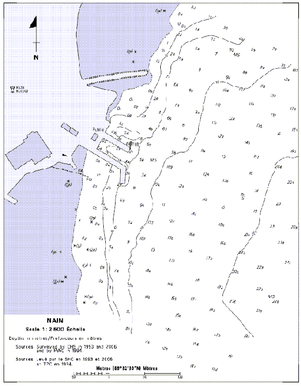
SECTION 5 – Edition 02/2008
LIST OF LIGHTS, BUOYS AND FOG SIGNALS CORRECTIONS
| NEWFOUNDLAND | ||||||||||
216.4 |
Black Duck Cove light buoy XK3 |
51 11 51.7 56 47 53.7 |
Fl |
G |
4s |
..... |
..... |
Green spar, marked "XK3". |
Seasonal. Chart:4667 Edn 02/08(N07-035) |
|
327.5 |
Smiths Harbour Wharf |
On wharf. 49 44 20.9 55 58 05.3 |
Fl |
R |
4s |
3.0 |
4 |
Red cylindrical mast. 2.0 |
Seasonal. Chart:4585 Edn 02/08(N07-059) |
|
465.37 |
Southport Shore |
48 02 43 53 38 47 |
Q |
G |
1s |
..... |
4 |
Cylindrical mast. 2.1 |
Year round. Chart:4852 Edn 02/08 (N07-058) |
|
|
ATLANTIC | ||||||||||
|
239.4 |
Meteghan Inner light buoy HC4 |
44 11 50 66 10 12 |
Fl |
R |
4s |
..... |
..... |
Red spar, marked "HC4". |
Year round. Chart:4118 Edn 02/08 (F07-119) |
|
|
323.5 H3785.4 |
Swims Point |
Outer end of wharf. 43 25 56.9 65 37 54.9 |
LFl |
R |
12s |
8.1 |
4 |
Triangular skeleton tower. 6.6 |
Flash 2 s; eclipse 10 s. Operates at night only. Year round. Chart:4210 Edn 02/08 |
|
|
368.02 |
West Green Harbour Outer light buoy KP56 |
43 43 14.8 65 09 48.2 |
Fl |
R |
4s |
..... |
..... |
Red spar, marked "KP56". |
Year round. Chart:4241 Edn 02/08 |
|
|
405 H3740 |
Western Head |
W. side of entrance to Liverpool Bay. 43 59 20.8 64 39 44.5 |
Fl |
W |
15s |
16.8 |
14 |
White octagonal tower, red upper portion. 13.8 |
Flash 0.5 s; eclipse 14.5 s. Visible from 180° through W. and N. to 062°. Year round. Horn - Blast 6 s; sil. 54 s. Horn points 104°. Chart:4240 Edn 02/08 (F08-003) |
|
|
415 H3722 |
Medway Head |
W. side of entrance. 44 06 10.6 64 32 23.3 |
Fl |
W |
12s |
24.2 |
11 |
White square tower, red upper portion. 8.7 |
Flash 4 s; eclipse 8 s. Year round. Chart:4211 Edn 02/08 (F08-002) |
|
|
416.5 H3725 |
Voglers Cove West Direction |
On outer end of breakwater. 44 09 09.7 64 32 43.4 |
Fl |
R |
3s |
4.5 |
4 |
Cylindrical mast. 3.6 |
Flash 1 s; eclipse 2 s Increased intensity on a bearing of 350°. Operates at night only. Year round. Chart:4211 Edn 02/08 (F07-121) |
|
|
775 H758 |
Low Point |
E. side of entrance to Sydney Harbour. 46 16 01.5 60 07 32.9 |
Fl |
W |
5s |
25.8 |
18 |
White octagonal tower, red upper portion. 20.8 |
Flash 0.5 s; eclipse 4.5 s. Year round. Chart:4266 Edn 02/08 (G07-178) |
|
|
1038 |
North Lake Harbour light and bell buoy JA1 |
Delete from list.. Chart:4023 Edn 02/08 (G07-046) |
||||||||
|
1038.5 |
North Lake Harbour Fairway light buoy JA |
N. of harbour. 46 28 56.2 62 03 27.6 |
Mo(A) |
W |
6s |
..... |
..... |
Red and white vertical stripes, marked "JA". |
Seasonal. Chart:4023 Edn 02/08 (G07-047) |
|
|
1040 |
Naufrage Harbour light and bell buoy JC2 |
Delete from list. Chart:4023 Edn 02/08 (G07-048) |
||||||||
|
1040.05 |
Naufrage Harbour Fairway light buoy JC |
N. of Shipwreck Point. 46 29 00.2 62 24 40.6 |
Mo(A) |
W |
6s |
..... |
..... |
Red and white vertical stripes, marked "JC". |
Seasonal. Chart:4023 Edn 02/08 (G07-049) |
|
|
1065 |
Malpeque light and bell buoy JP2 |
Delete from list. Chart:4491 Edn 02/08 (G07-059) |
||||||||
|
1065.05 |
Malpeque Harbour Fairway light buoy JP |
N.E. of McKay Point. 46 35 00.2 63 37 07.7 |
Mo(A) |
W |
6s |
..... |
..... |
Red and white vertical stripes, marked "JP". |
Seasonal. Chart:4491 Edn 02/87 (G07-060) |
|
|
1071.35 |
Conway Inlet Fairway light buoy JS |
E. of inlet. 46 39 48.2 63 51 09.7 |
Mo(A) |
W |
6s |
..... |
..... |
Red and white vertical stripes, marked "JS". |
Seasonal. Chart:4491 Edn 02/08 (G07-066) |
|
|
1071.4 |
Conway Inlet light and bell buoy JS1 |
Delete from list. Chart:4491 Edn 02/08(G07-065) |
||||||||
|
1075.05 |
Cascumpeque Harbour Fairway light buoy JV |
E. of harbour entrance. 46 47 44.3 63 59 38.2 |
Mo(A) |
W |
6s |
..... |
..... |
Red and white vertical stripes, marked "JV". |
Seasonal. Chart:4492 Edn 02/08 (G07-062) |
|
|
1343.7 H1619 1343.8 H1619.1 |
Dalhousie Harbour East range |
| | | | | | | | | |
48 04 15.2 66 21 57.3 267°30' 55.2m from front. |
Iso Iso |
G G |
1s 4s |
14.0 17.2 |
16 16 |
Square skeleton tower, white daymark, red vertical stripe. 12.7 Square skeleton tower, white daymark, red vertical stripe. 15.8 |
Visible in line of range. Year round. Visible in line of range. Year round. Chart:4426 Edn 02/08 (G07-029) |
|
1967 |
Pointe St-Nicolas light buoy Q19 |
Off the point. 46 42 41.2 71 26 41.8 |
Fl |
G |
4s |
..... |
..... |
Green, marked "Q19". |
Winter spar. Year round. Chart:1315 Edn 02/08 (Q08-003) |
|
|
2031 |
Cap à la Roche Curve light buoy D32 |
46 33 57.8 72 06 50 |
Q |
R |
1s |
..... |
..... |
Red spar, marked "D32". |
Winter spar. Year round. Chart:1314 Edn 02/08 (Q08-005) |
|
|
2108 |
Pointe des Ormes light buoy C70 |
46 18 05.4 72 34 36.1 |
Fl |
R |
4s |
..... |
..... |
Red spar, marked "C70". |
Year round. Chart:1313 Edn 02/08 (Q07-141) |
|
|
2173 |
Île des Barques experimental light buoy S123 |
46 04 57 73 00 37.5 |
Fl |
G |
4s |
..... |
..... |
Green spar, marked "S123". |
Experimental spar. Year round. Chart:1312 Edn 02/08 (Q08-002) |
|
|
INLAND WATERS | ||||||||||
|
36 |
Lighted spar C2 |
45 17 02.1 73 56 30.6 |
Fl |
R |
4s |
..... |
..... |
Red spar, marked "C2". |
Seasonal. (In place Year round.) Chart:1431 Edn 02/08(B08-001) |
|
|
39 |
Lighted spar C6 |
45 16 06.6 73 57 12.1 |
Q |
R |
1s |
..... |
..... |
Red spar, marked "C6". |
Seasonal. (In place Year round.) Chart:1431 Edn 02/08(B08-002) |
|
|
40 |
Lighted spar C7 |
45 15 36.1 73 57 28.1 |
Fl |
G |
4s |
..... |
..... |
Green spar, marked "C7". |
Seasonal. (In place Year round.) Chart:1431 Edn 02/08(B08-003) |
|
|
43 |
Lighted spar C8 |
45 15 25.1 73 57 58.6 |
Fl |
R |
4s |
..... |
..... |
Red spar, marked "C8". |
Seasonal. (In place Year round.) Chart:1431 Edn 02/08(B08-004) |
|
|
44 |
Lighted spar C10 |
45 14 40.1 73 59 04.6 |
Fl |
R |
4s |
..... |
..... |
Red spar, marked "C10". |
Seasonal. (In place Year round.) Chart:1431 Edn 02/08(D08-05) |
|
|
45 |
Lighted spar C11 |
45 14 35.6 73 58 58.6 |
Fl |
G |
4s |
..... |
..... |
Green spar, marked "C11". |
Seasonal. (In place Year round.) Chart:1431 Edn 02/08(B08-006) |
|
|
46 |
Lighted spar C13 |
45 14 14.1 73 59 27.6 |
Fl |
G |
4s |
..... |
..... |
Green spar, marked "C13". |
Seasonal. (In place Year round.) Chart:1431 Edn 02/08(B08-007) |
|
|
47 |
Lighted spar C14 |
45 14 17.1 73 59 38.6 |
Q |
R |
1s |
..... |
..... |
Red spar, marked "C14". |
Seasonal. (In place Year round.) Chart:1431 Edn 02/08(B08-008) |
|
|
49 |
St. Louis Bridge Anchorage lighted spar CK |
45 13 15.2 74 01 41.1 |
Fl |
Y |
4s |
..... |
..... |
Yellow spar, marked "CK". |
Seasonal. (In place Year round.) Chart:1431 Edn 02/08(B08-009) |
|
|
50 |
Lighted spar C20 |
45 13 48.6 74 00 45.8 |
Fl |
R |
4s |
..... |
..... |
Red spar, marked "C20". |
Seasonal. (In place Year round.) Chart:1431 Edn 02/08(B08-010) |
|
|
53 |
Lighted spar C22 |
45 13 26.3 74 02 07.3 |
Q |
R |
1s |
..... |
..... |
Red spar, marked "C22". |
Seasonal. (In place Year round.) Chart:1431 Edn 02/08(B08-011) |
|
|
54 |
Lighted spar C21 |
45 13 24.2 74 01 47.6 |
Fl |
G |
4s |
..... |
..... |
Green spar, marked "C21". |
Seasonal. (In place Year round.) Chart:1431 Edn 02/08(B08-012) |
|
|
55.5 |
Lighted spar C23 |
45 13 14.2 74 02 26.1 |
Q |
G |
1s |
..... |
..... |
Green spar, marked "C23". |
Seasonal. (In place Year round.) Chart:1431 Edn 02/08(B08-013) |
|
|
57 |
Lighted spar C24 |
45 13 20.2 74 02 51.6 |
Fl |
R |
4s |
..... |
..... |
Red spar, marked "C24". |
Seasonal. (In place Year round.) Chart:1431 Edn 02/08(B08-014) |
|
|
58 |
Lighted spar C27 |
45 13 14.7 74 03 42.6 |
Fl |
G |
4s |
..... |
..... |
Green spar, marked "C27". |
Seasonal. (In place Year round.) Chart:1431 Edn 02/08(B08-015) |
|
|
63 |
Lighted spar C28 |
45 13 20.2 74 03 42.6 |
Fl |
R |
4s |
..... |
..... |
Red spar, marked "C28". |
Seasonal. (In place Year round.) Chart:1431 Edn 02/08(B08-016) |
|
|
64 |
Lighted spar C31 |
45 13 15.1 74 04 56.6 |
Fl |
G |
4s |
..... |
..... |
Green spar, marked "C31". |
Seasonal. (In place Year round.) Chart:1431 Edn 02/08(B08-017) |
|
|
65 |
Lighted spar C30 |
45 13 20.2 74 05 04.6 |
Fl |
R |
4s |
..... |
..... |
Red spar, marked "C30". |
Seasonal. (In place Year round.) Chart:1431 Edn 02/08(B08-018) |
|
|
66 |
Lighted spar C37 |
45 13 15.8 74 05 35.7 |
Q |
G |
1s |
..... |
..... |
Green spar, marked "C37". |
Seasonal. (In place Year round.) Chart:1431 Edn 02/08(B08-019) |
|
|
68 |
Lighted spar C39 |
45 13 18 74 05 58.8 |
Fl |
G |
4s |
..... |
..... |
Green spar, marked "C39". |
Seasonal. (In place Year round.) Chart:1431 Edn 02/08(B08-020) |
|
|
69 |
Lighted spar C38 |
45 13 24.2 74 05 56.6 |
Q |
R |
1s |
..... |
..... |
Red spar, marked "C38". |
Seasonal. (In place Year round.) Chart:1431 Edn 02/08(B08-021) |
|
|
72 |
Lighted spar C45 |
45 13 47.2 74 08 14.1 |
Fl |
G |
4s |
..... |
..... |
Green spar, marked "C45". |
Seasonal. (In place Year round.) Chart:1431 Edn 02/08(B08-022) |
|
|
73 |
Beauharnois Anchorage Area lighted spar CN |
45 13 34.2 74 08 19.1 |
Fl |
Y |
4s |
..... |
..... |
Yellow spar, marked "CN". |
Seasonal. (In place Year round.) Chart:1431 Edn 02/08(B08-023) |
|
|
74 |
Lighted spar C46 |
45 13 59.2 74 08 37.6 |
Q |
R |
1s |
..... |
..... |
Red spar, marked "C46". |
Seasonal. (In place Year round.) Chart:1431 Edn 02/08(B08-024) |
|
|
77 |
Lighted spar C48 |
45 14 03.2 74 09 14.1 |
Fl |
R |
4s |
..... |
..... |
Red spar, marked "C48". |
Seasonal. (In place Year round.) Chart:1431 Edn 02/08(B08-025) |
|
|
78 |
Lighted spar C49 |
45 13 55.2 74 09 35.6 |
Q |
G |
1s |
..... |
..... |
Green spar, marked "C49". |
Seasonal. (In place Year round.) Chart:1431 Edn 02/08(B08-026) |
|
|
86 |
Valleyfield lighted spar DVB |
45 13 52.2 74 11 20.1 |
Fl (2+1) |
R |
6s |
..... |
..... |
Red, green and red spar, marked "DVB". |
Seasonal. (In place Year round.) Chart:1431 Edn 02/08(B08-027) |
|
|
87 |
Lighted spar D3 |
45 13 48.2 74 11 19.6 |
Fl |
G |
4s |
..... |
..... |
Green spar, marked "D3". |
Seasonal. (In place Year round.) Chart:1431 Edn 02/08(B08-028) |
|
|
160.5 |
Light buoy DC6 |
Delete from list. Chart:1433 Edn 02/08 (B07-060) |
||||||||
|
161 |
Light buoy DC7 |
Delete from list. Chart:1433 Edn 02/08 (B07-068) |
||||||||
|
162 |
Light buoy DC10 |
Delete from list. Chart:1433 Edn 02/08 (B07-065) |
||||||||
|
162.5 |
Light buoy DC11 |
Delete from list. Chart:1433 Edn 02/08 (B07-066) |
||||||||
|
163 |
Light buoy DC12 |
Delete from list. Chart:1433 Edn 02/08 (B07-067) |
||||||||
|
834.6 |
Morrison Marina |
On breakwater. 44 35 49.1 80 56 34.8 |
F |
W |
..... |
4.6 |
..... |
Cylindrical mast. 2.3 |
Privately maintained. Seasonal. Chart:2283 Edn 02/08 | |

