Reference chart: 1410
The following un-lighted buoys are now private and have been transferred to the city of Beauharnois.
Green spar buoy AH21 (45° 19' 41"N 73° 51' 2"W)
Red spar buoy AH22 (45° 19' 41"N 73° 51' 3"W)
Green spar buoy AH23 (45° 19' 38.9"N 73° 51' 4"W)
Red spar buoy AH24 (45° 19' 38.9"N 73° 51' 3.9"W)
Green spar buoy AH25 (45° 19' 32.9 "N 73° 51' 12.6 "W)
Red spar buoy AH26 (45° 19' 33.6 "N 73° 51' 13.2 "W)
Green spar buoy AH27 (45° 19' 00 "N 73° 51' 00 "W) (approx)
Red spar buoy AH28 (45° 19' 00 "N 73° 51' 00 "W)
SECTION 2 – Edition 04/2007
CHART CORRECTIONS
1315 - Québec à/to Donnacona - New Edition - 21-JUN-2002 - NAD 1983
|
13-APR-2007
|
|
LNM/D. 23-MAR-2007 |
|
Delete
|
depth of 14 metres 9 decimetres
|
46°49'36.8"N 071°11'43.4"W |
|
DFO(6407426-01)
|
|
|
|
|
Delete
|
depth of 16 metres 0 decimetre
|
46°49'33.9"N 071°11'29.6"W |
|
DFO(6407426-03)
|
|
|
|
|
Add
|
depth of 14 metres 1 decimetre
|
46°49'36.8"N 071°11'44.1"W |
|
DFO(6407426-02)
|
|
|
|
|
Add
|
depth of 15 metres 1 decimetre
|
46°49'34.8"N 071°11'30.0"W |
|
DFO(6407426-04)
|
|
|
|
|
Add
|
depth of 14 metres 7 decimetres
|
46°49'40.4"N 071°11'36.0"W |
|
DFO(6407426-18)
|
|
|
|
1316 - Port de Québec - New Edition - 23-JUN-2006 - NAD 1983
|
13-APR-2007
|
|
LNM/D. 23-MAR-2007 |
|
Delete
|
depth of 14 metres 9 decimetres
|
46°49'36.9"N 071°11'44.1"W |
|
DFO(6407426-01)
|
|
|
|
|
Delete
|
depth of 16 metres 0 decimetre
|
46°49'33.3"N 071°11'30.4"W |
|
DFO(6407426-03)
|
|
|
|
|
Delete
|
depth of 9 metres 8 decimetres
|
46°49'20.0"N 071°12'34.9"W |
|
DFO(6407426-05)
|
|
|
|
|
Delete
|
depth of 11 metres 6 decimetres
|
46°49'22.4"N 071°12'01.0"W |
|
DFO(6407426-07)
|
|
|
|
|
Delete
|
depth of 14 metres 8 decimetres
|
46°49'28.4"N 071°12'04.7"W |
|
DFO(6407426-09)
|
|
|
|
|
Delete
|
depth of 17 metres 2 decimetres
|
46°49'35.4"N 071°11'59.6"W |
|
DFO(6407426-11)
|
|
|
|
|
Delete
|
depth of 12 metres 8 decimetres
|
46°49'34.0"N 071°11'51.6"W |
|
DFO(6407426-13)
|
|
|
|
|
Delete
|
depth of 15 metres 2 decimetres
|
46°49'38.9"N 071°11'36.9"W |
|
DFO(6407426-17)
|
|
|
|
|
Delete
|
depth of 17 metres 0 decimetre
|
46°50'00.2"N 071°11'18.4"W |
|
DFO(6407426-19)
|
|
|
|
|
Delete
|
depth of 5 metres 2 decimetres
|
46°50'08.9"N 071°11'10.8"W |
|
DFO(6407426-21)
|
|
|
|
|
Add
|
depth of 14 metres 1 decimetre
|
46°49'36.8"N 071°11'44.1"W |
|
DFO(6407426-02)
|
|
|
|
|
Add
|
depth of 15 metres 1 decimetre
|
46°49'34.8"N 071°11'30.0"W |
|
DFO(6407426-04)
|
|
|
|
|
Add
|
depth of 9 metres 3 decimetres
|
46°49'19.8"N 071°12'34.1"W |
|
DFO(6407426-06)
|
|
|
|
|
Add
|
depth of 11 metres 2 decimetres
|
46°49'22.0"N 071°12'01.7"W |
|
DFO(6407426-08)
|
|
|
|
|
Add
|
depth of 13 metres 0 decimetre
|
46°49'28.0"N 071°12'05.2"W |
|
DFO(6407426-10)
|
|
|
|
|
Add
|
depth of 14 metres 2 decimetres
|
46°49'35.9"N 071°11'59.5"W |
|
DFO(6407426-12)
|
|
|
|
|
Add
|
depth of 12 metres 1 decimetre
|
46°49'33.9"N 071°11'49.9"W |
|
DFO(6407426-14)
|
|
|
|
|
Add
|
depth of 13 metres 9 decimetres
|
46°49'39.5"N 071°11'51.4"W |
|
DFO(6407426-16)
|
|
|
|
|
Add
|
depth of 14 metres 7 decimetres
|
46°49'40.4"N 071°11'36.0"W |
|
DFO(6407426-18)
|
|
|
|
|
Add
|
depth of 12 metres 8 decimetres
|
46°50'00.4"N 071°11'19.2"W |
|
DFO(6407426-20)
|
|
|
|
|
Add
|
depth of 4 metres 4 decimetres
|
46°50'08.9"N 071°11'09.5"W |
|
DFO(6407426-22)
|
|
|
|
|
Add
|
depth of 7 metres 8 decimetres
|
46°50'04.3"N 071°11'20.8"W |
|
DFO(6407426-23)
|
|
|
|
1317 - Continuation A - New Edition - 17-AUG-2001 - NAD 1983
|
13-APR-2007
|
|
LNM/D. 30-MAR-2007 |
|
Delete
|
depth of 14 metres 9 decimetres
|
46°49'36.6"N 071°11'44.5"W |
|
DFO(6407426-01)
|
|
|
|
|
Delete
|
depth of 16 metres 0 decimetre
|
46°49'33.5"N 071°11'30.7"W |
|
DFO(6407426-03)
|
|
|
|
|
Amend
|
legend F G 50m 18M to read F G 76m 18M against light
|
46°58'03.7"N 070°58'11.4"W |
|
(Q2007010) LL(1942) DFO(6407425-01)
|
|
|
|
|
Add
|
depth of 14 metres 1 decimetre
|
46°49'36.8"N 071°11'44.1"W |
|
DFO(6407426-02)
|
|
|
|
|
Add
|
depth of 15 metres 1 decimetre
|
46°49'34.8"N 071°11'30.0"W |
|
DFO(6407426-04)
|
|
|
|
|
Add
|
depth of 14 metres 7 decimetres
|
46°49'40.4"N 071°11'36.0"W |
|
DFO(6407426-18)
|
|
|
|
|
Add
|
depth of 13 metres 9 decimetres
|
46°49'30.6"N 071°11'38.5"W |
|
DFO(6407426-24)
|
|
|
|
1410 - Lac Saint-Louis - New Edition - 26-APR-2002 - NAD 1983
|
06-APR-2007
|
|
LNM/D. 23-MAR-2007 |
|
Delete
|
depth of 4 feet
|
45°21'23.5"N 073°59'13.4"W |
|
DFO(6407435-09)
|
|
|
|
|
Delete
|
depth of 5 feet
|
45°21'19.7"N 073°59'10.4"W |
|
DFO(6407435-10)
|
|
|
|
|
Delete
|
depth of 5 feet
|
45°21'20.2"N 073°59'03.7"W |
|
DFO(6407435-11)
|
|
|
|
|
Delete
|
depth of 1 foot
|
45°21'17.5"N 073°59'04.8"W |
|
DFO(6407435-12)
|
|
|
|
|
Delete
|
depth of 8 feet
|
45°21'14.2"N 073°59'01.9"W |
|
DFO(6407435-13)
|
|
|
|
|
Delete
|
depth of 7 feet
|
45°20'32.9"N 073°57'54.1"W |
|
DFO(6407435-14)
|
|
|
|
|
Delete
|
depth of 8 feet
|
45°20'28.8"N 073°57'42.4"W |
|
DFO(6407435-15)
|
|
|
|
|
Delete
|
depth of 7 feet
|
45°20'13.0"N 073°57'38.8"W |
|
DFO(6407435-16)
|
|
|
|
|
Delete
|
depth of 4 feet
|
45°21'23.9"N 073°48'09.6"W |
|
DFO(6407443-02)
|
|
|
|
|
Amend
|
legend 4 ft (1969) to read 3 ft (2006)
|
45°21'53.1"N 073°48'48.1"W |
|
DFO(6407443-03)
|
|
|
|
|
Add
|
depth of 1 foot
|
45°21'23.8"N 073°59'14.2"W |
|
DFO(6407435-01)
|
|
|
|
|
Add
|
depth of 3 feet
|
45°21'20.3"N 073°59'11.5"W |
|
DFO(6407435-02)
|
|
|
|
|
Add
|
depth of 2 feet
|
45°21'18.8"N 073°59'04.8"W |
|
DFO(6407435-03)
|
|
|
|
|
Add
|
depth of 4 feet
|
45°21'13.2"N 073°59'01.6"W |
|
DFO(6407435-04)
|
|
|
|
|
Add
|
depth of 3 feet
|
45°20'32.6"N 073°57'55.2"W |
|
DFO(6407435-05)
|
|
|
|
|
Add
|
depth of 6 feet
|
45°20'28.6"N 073°57'40.9"W |
|
DFO(6407435-06)
|
|
|
|
|
Add
|
depth of 2 feet
|
45°20'12.8"N 073°57'37.5"W |
|
DFO(6407435-07)
|
|
|
|
|
Add
|
depth of 4 feet
|
45°20'10.3"N 073°57'42.9"W |
|
DFO(6407435-08)
|
|
|
|
|
Add
|
water intake
|
between 45°25'44.7"N 073°49'14.6"W |
|
|
and 45°25'38.6"N 073°49'09.4"W |
|
DFO(6407440-01)
|
|
|
|
|
Add
|
depth of 3 feet over the intake
|
45°25'38.6"N 073°49'09.4"W |
|
DFO(6407440-02)
|
|
|
|
|
Add
|
depth of 1 foot
|
45°25'32.4"N 073°49'10.4"W |
|
DFO(6407440-03)
|
|
|
|
|
Add
|
drying height of 0 feet
|
45°19'04.2"N 073°52'37.9"W |
|
DFO(6407441-01)
|
|
|
|
|
Add
|
depth of 2 feet
|
45°21'24.6"N 073°48'09.3"W |
|
DFO(6407443-01)
|
|
|
|
|
13-APR-2007
|
|
LNM/D. 06-APR-2007 |
|
Delete
|
depth of 6 feet
|
45°23'37.4"N 073°45'03.9"W |
|
DFO(6407437-05)
|
|
|
|
|
Add
|
depth of 7 feet
|
45°24'55.4"N 073°51'25.9"W |
|
DFO(6407436-01)
|
|
|
|
|
Add
|
depth of 4 feet
|
45°23'49.1"N 073°45'06.8"W |
|
DFO(6407437-01)
|
|
|
|
|
Add
|
depth of 1 foot
|
45°23'36.8"N 073°45'04.0"W |
|
DFO(6407437-02)
|
|
|
|
|
Add
|
depth of 4 feet
|
45°23'15.6"N 073°44'51.4"W |
|
DFO(6407437-03)
|
|
|
|
|
Add
|
depth of 3 feet
|
45°22'56.0"N 073°45'01.9"W |
|
DFO(6407437-04)
|
|
|
|
|
Add
|
depth of 5 feet
|
45°21'58.0"N 073°50'39.3"W |
|
DFO(6407438-01)
|
|
|
|
|
Add
|
depth of 7 feet
|
45°24'10.5"N 073°46'12.6"W |
|
DFO(6407439-01)
|
|
|
|
1510 - Lac Saint-Louis à/to Carillon - Compartment B-C - Sheet 1 - New Edition - 25-JUL-2003 - NAD 1983
|
06-APR-2007
|
|
LNM/D. 22-SEP-2006 |
|
Delete
|
depth of 1 metre 2 decimetres
|
45°21'23.5"N 073°59'13.4"W |
|
DFO(6407435-09)
|
|
|
|
|
Delete
|
depth of 1 metre 5 decimetres
|
45°21'19.7"N 073°59'10.4"W |
|
DFO(6407435-10)
|
|
|
|
|
Delete
|
depth of 1 metre 5 decimetres
|
45°21'20.2"N 073°59'03.7"W |
|
DFO(6407435-11)
|
|
|
|
|
Delete
|
depth of 0 metre 3 decimetres
|
45°21'17.5"N 073°59'04.8"W |
|
DFO(6407435-12)
|
|
|
|
|
Delete
|
depth of 2 metres 4 decimetres
|
45°21'14.2"N 073°59'01.9"W |
|
DFO(6407435-13)
|
|
|
|
|
Delete
|
depth of 2 metres 1 decimetres
|
45°20'32.9"N 073°57'54.1"W |
|
DFO(6407435-14)
|
|
|
|
|
Delete
|
depth of 2 metres 4 decimetres
|
45°20'28.8"N 073°57'42.4"W |
|
DFO(6407435-15)
|
|
|
|
|
Delete
|
depth of 2 metres 1 decimetres
|
45°20'13.0"N 073°57'38.8"W |
|
DFO(6407435-16)
|
|
|
|
|
Add
|
depth of 0 metre 3 decimetres
|
45°21'23.8"N 073°59'14.2"W |
|
DFO(6407435-01)
|
|
|
|
|
Add
|
depth of 1 metre
|
45°21'20.3"N 073°59'11.5"W |
|
DFO(6407435-02)
|
|
|
|
|
Add
|
depth of 0 metre 6 decimetres
|
45°21'18.8"N 073°59'04.8"W |
|
DFO(6407435-03)
|
|
|
|
|
Add
|
depth of 1 metre 1 decimetre
|
45°21'13.2"N 073°59'01.6"W |
|
DFO(6407435-04)
|
|
|
|
|
Add
|
depth of 1 metre
|
45°20'32.6"N 073°57'55.2"W |
|
DFO(6407435-05)
|
|
|
|
|
Add
|
depth of 1 metre 9 decimetres
|
45°20'28.6"N 073°57'40.9"W |
|
DFO(6407435-06)
|
|
|
|
|
Add
|
depth of 0 metre 6 decimetres
|
45°20'12.8"N 073°57'37.5"W |
|
DFO(6407435-07)
|
|
|
|
|
Add
|
depth of 1 metre 3 decimetres
|
45°20'10.3"N 073°57'42.9"W |
|
DFO(6407435-08)
|
|
|
|
2023 - Lakefield to/à Burleigh Falls - Sheet 2 - New Edition - 14-JUL-2006 - NAD 1983
|
13-APR-2007
|
|
LNM/D. 30-MAR-2007 |
|
Delete
|
depth of 4 feet
|
44°26'29.7"N 078°16'31.0"W |
|
DFO(6602820-01)
|
|
|
|
|
Delete
|
depth of 8ft
|
44°26'21.6"N 078°16'27.6"W |
|
DFO(6602820-03)
|
|
|
|
|
Delete
|
depth of 9ft
|
44°26'15.5"N 078°16'26.1"W |
|
DFO(6602820-04)
|
|
|
|
|
Delete
|
depth of 6ft
|
44°26'25.0"N 078°16'29.5"W |
|
DFO(6602820-06)
|
|
|
|
|
Add
|
dangerous underwater rock with depth of 8ft
|
44°26'22.9"N 078°16'32.8"W |
|
DFO(6602820-02)
|
|
|
|
|
Add
|
rock awash
|
44°26'29.5"N 078°16'31.5"W |
|
DFO(6602820-05)
|
|
|
|
|
Add
|
depth of 3ft
|
44°26'27.3"N 078°16'32.5"W |
|
DFO(6602820-07)
|
|
|
|
|
Add
|
depth of 5ft
|
44°26'24.8"N 078°16'29.1"W |
|
DFO(6602820-08)
|
|
|
|
|
Add
|
depth of 5ft
|
44°26'22.1"N 078°16'28.7"W |
|
DFO(6602820-09)
|
|
|
|
|
Add
|
depth of 6ft
|
44°26'18.9"N 078°16'28.1"W |
|
DFO(6602820-10)
|
|
|
|
|
Add
|
depth of 6ft
|
44°26'15.6"N 078°16'26.8"W |
|
DFO(6602820-11)
|
|
|
|
2023 - Youngs Point Lock / Écluse 27 - Sheet 2 - New Edition - 14-JUL-2006 - NAD 1983
|
13-APR-2007
|
|
LNM/D. 30-MAR-2007 |
|
Amend
|
graticule from 14" to 12"
|
44°29'12.0"N 078°14'01.0"W |
|
DFO(6602904-01)
|
|
|
|
L/C2110 - Long Point Bay - New Edition - 29-MAY-1998 - NAD 1983
|
20-APR-2007
|
|
LNM/D. 29-DEC-2006 |
|
ON CERTAIN COPIES
|
|
|
Delete
|
pipeline, Gas/Gaz
|
between 42°47'31.4"N 079°52'48.4"W |
|
|
and 42°47'22.0"N 079°52'42.0"W |
|
DFO(6602896-03)
|
|
|
|
|
ON CERTAIN COPIES
|
|
|
Add
|
abandoned pipeline
|
between 42°46'50.6"N 079°54'21.9"W |
|
|
and 42°46'19.5"N 079°54'15.5"W |
|
DFO(6602896-01)
|
|
|
|
|
ON CERTAIN COPIES
|
|
|
Add
|
abandoned pipeline
|
joining 42°46'29.3"N 079°54'17.5"W |
|
|
42°46'32.0"N 079°53'36.0"W |
|
|
and 42°46'30.0"N 079°52'42.0"W |
|
DFO(6602896-02)
|
|
|
|
|
ON CERTAIN COPIES
|
|
|
Add
|
pipeline, Gas/Gaz
|
between 42°47'31.4"N 079°52'48.4"W |
|
|
and 42°47'27.0"N 079°52'42.0"W |
|
DFO(6602896-04)
|
|
|
|
|
ON CERTAIN COPIES
|
|
|
Add
|
abandoned pipeline
|
between 42°47'31.4"N 079°52'48.4"W |
|
|
and 42°47'31.5"N 079°52'42.0"W |
|
DFO(6602896-05)
|
|
|
|
|
ON CERTAIN COPIES
|
|
|
Add
|
abandoned pipeline
|
between 42°47'31.4"N 079°52'48.4"W |
|
|
and 42°47'04.6"N 079°52'53.6"W |
|
DFO(6602896-06)
|
L/C2201 - Georgian Bay / Baie Georgienne - New Edition - 18-NOV-1998 - NAD 1983
|
13-APR-2007
|
|
LNM/D. 13-OCT-2006 |
|
Amend
|
Fl (2) 5s 61ft 24M to read Iso against light.
|
44°57'28.0"N 080°57'35.0"W |
|
(D2006090) LL(828) DFO(6602900-01)
|
|
|
|
2259 - John Island to/à Blind River - New Edition - 26-JUL-2002 - NAD 1983
|
13-APR-2007
|
|
LNM/D. 30-MAR-2007 |
|
Delete
|
sounding of 2ft
|
46°10'47.0"N 082°57'03.0"W |
|
DFO(6602880-01)
|
|
|
|
|
Delete
|
tower, RLts (240) Ro
|
46°10'41.0"N 082°58'56.0"W |
|
DFO(6602880-03)
|
|
|
|
|
Delete
|
tower, RLts Ro (242)
|
46°10'38.0"N 082°58'54.5"W |
|
DFO(6602880-04)
|
|
|
|
|
Add
|
sounding of 1ft with bottom quality of Bo
|
46°10'47.2"N 082°57'01.3"W |
|
DFO(6602880-02)
|
|
|
|
2268 - Blind River - New Edition - 31-MAR-1989 - NAD 1927
|
13-APR-2007
|
|
LNM/D. 16-JUL-2004 |
|
Delete
|
sounding of 2 ft
|
46°10'47.0"N 082°57'02.0"W |
|
DFO(6602880-01)
|
|
|
|
|
Delete
|
tower, Tr
|
46°10'40.0"N 082°58'56.5"W |
|
DFO(6602880-03)
|
|
|
|
|
Delete
|
tower, Tr
|
46°10'37.0"N 082°58'55.0"W |
|
DFO(6602880-04)
|
|
|
|
|
Replace
|
green, red and green port bifurcation can buoy, marked UN with green, red and green port bifurcation spar buoy, marked UN
|
46°10'31.2"N 082°57'54.8"W |
|
DFO(6602879-01)
|
|
|
|
|
Replace
|
green port hand can buoy, marked UP3 with green port hand spar buoy, marked UP3
|
46°10'21.0"N 082°57'55.0"W |
|
DFO(6602879-02)
|
|
|
|
|
Replace
|
red starboard hand conical buoy, marked UP4 with red starboard hand spar buoy, marked UP4
|
46°10'20.9"N 082°57'50.0"W |
|
DFO(6602879-03)
|
|
|
|
|
Add
|
sounding of 1ft with bottom quality of Bo
|
46°10'47.1"N 082°57'01.6"W |
|
DFO(6602880-02)
|
|
|
|
L/C2282 - Owen Sound to/à Cabot Head - New Edition - 07-JUN-1996 - NAD 1983
|
13-APR-2007
|
|
LNM/D. 28-JAN-2005 |
|
Amend
|
Fl (2) 5s 19m 24M to read Iso against light.
|
44°57'21.3"N 080°57'38.1"W |
|
(D2006090) LL(828) DFO(6602900-01)
|
|
|
|
2283 - Owen Sound to/à Giants Tomb Island - Sheet 1 - New Chart - 30-JUL-1999 - NAD 1983
|
13-APR-2007
|
|
LNM/D. 10-FEB-2006 |
|
Amend
|
Fl (2) 5s 19m 24M to read Iso against light.
|
44°57'21.3"N 080°57'38.1"W |
|
(D2006090) LL(828) DFO(6602900-01)
|
|
|
|
2299 - Clapperton Island to/à Meldrum Bay - New Edition - 25-MAY-2001 - NAD 1983
|
13-APR-2007
|
|
LNM/D. 30-MAR-2007 |
|
Delete
|
tower, Trs PA
|
46°10'40.0"N 082°58'57.0"W |
|
DFO(6602880-03)
|
|
|
|
|
Delete
|
tower, Trs PA
|
46°10'36.0"N 082°58'55.0"W |
|
DFO(6602880-04)
|
|
|
|
|
20-APR-2007
|
|
LNM/D. 13-APR-2007 |
|
Reposition
|
red starboard hand spar buoy, marked JK2
|
from 45°57'13.0"N 082°58'12.0"W |
|
|
to 45°57'18.4"N 082°58'07.8"W |
|
(D2006088) DFO(6602898-01)
|
|
|
|
|
Reposition
|
red starboard hand spar buoy, marked JK6
|
from 45°57'58.0"N 083°05'03.0"W |
|
|
to 45°58'02.6"N 083°04'54.9"W |
|
(D2006089) DFO(6602899-01)
|
|
|
|
L/C4002 - Golfe du Saint-Laurent / Gulf of St. Lawrence - New Edition - 27-DEC-1991 - NAD 1927
|
20-APR-2007
|
|
LNM/D. 16-MAR-2007 |
|
Delete
|
light Fl
|
47°36'57.9"N 061°23'28.3"W |
|
DFO(6407416-05)
|
|
|
|
|
Delete
|
radar transponder beacon
|
47°36'57.9"N 061°23'28.3"W |
|
DFO(6407416-06)
|
|
|
|
|
Amend
|
legend Fl 18M to read Fl 19M against light
|
47°23'04.9"N 061°57'35.6"W |
|
DFO(6407416-01)
|
|
|
|
|
Amend
|
legend Fl (3) 20M to read Fl 22M against light
|
47°12'44.6"N 061°58'21.5"W |
|
DFO(6407416-02)
|
|
|
|
|
Amend
|
legend Fl 19M to read Fl 20M against light
|
47°16'03.3"N 061°42'20.7"W |
|
DFO(6407416-03)
|
|
|
|
|
Amend
|
legend Fl 10M to read LFl 10M against light
|
47°50'18.7"N 061°08'43.2"W |
|
DFO(6407416-13)
|
|
|
|
4003 - Cape Breton to/à Cape Cod - New Edition - 21-MAR-2003 - NAD 1983
|
06-APR-2007
|
|
LNM/D. 09-FEB-2007 |
|
CANCELS
|
yellow ODAS/SADO light buoy, Fl (4s) Y
|
43°30'46.2"N 067°36'42.0"W |
|
This buoy is permanently discontinued. Notice 25-July-2003(T), DFO(6300915-02) is now cancelled.
|
|
|
DFO(6300915-02)
|
|
|
|
4020 - Strait of Belle Isle/Détroit de Belle Isle - New Edition - 26-JUL-2002 - NAD 1983
|
06-APR-2007
|
|
LNM/D. 01-DEC-2006 |
|
Delete
|
depth of 45 fathoms
|
51°54'00.0"N 055°51'37.0"W |
|
DFO(6303366-01)
|
|
|
|
|
Delete
|
depth of 40 fathoms
|
51°49'40.0"N 056°00'15.0"W |
|
DFO(6303366-03)
|
|
|
|
|
Delete
|
depth of 29 fathoms
|
51°49'15.0"N 055°34'06.0"W |
|
DFO(6303366-05)
|
|
|
|
|
Add
|
depth of 39 fathoms
|
51°54'00.0"N 055°51'49.0"W |
|
DFO(6303366-02)
|
|
|
|
|
Add
|
depth of 32 fathoms
|
51°49'43.0"N 055°59'58.0"W |
|
DFO(6303366-04)
|
|
|
|
|
Add
|
depth of 24 fathoms
|
51°49'17.0"N 055°34'33.0"W |
|
DFO(6303366-06)
|
|
|
|
|
Add
|
depth of 24 fathoms
|
51°58'46.0"N 055°26'48.0"W |
|
DFO(6303366-07)
|
|
|
|
|
Add
|
depth of 19 fathoms
|
51°58'24.0"N 055°25'56.0"W |
|
DFO(6303366-08)
|
|
|
|
|
Add
|
depth of 22 fathoms
|
51°55'27.0"N 055°30'33.0"W |
|
DFO(6303366-09)
|
|
|
|
|
Add
|
depth of 20 fathoms
|
51°50'25.0"N 055°31'48.0"W |
|
DFO(6303366-11)
|
|
|
|
|
Add
|
depth of 30 fathoms
|
51°49'24.0"N 055°27'12.0"W |
|
DFO(6303366-12)
|
|
|
|
4024 - Baie des Chaleurs/Chaleur Bay aux/to Îles de la Madeleine - New Edition - 03-MAR-2000 - NAD 1983
|
20-APR-2007
|
|
LNM/D. 04-AUG-2006 |
|
Delete
|
light Fl 4s 22m 10M
|
47°36'58.1"N 061°23'25.7"W |
|
DFO(6407416-05)
|
|
|
|
|
Delete
|
radar transponder beacon
|
47°36'58.1"N 061°23'25.7"W |
|
DFO(6407416-06)
|
|
|
|
|
Delete
|
depth of 14 metres 5 decimetres
|
47°24'24.4"N 061°30'47.3"W |
|
DFO(6407416-09)
|
|
|
|
|
Delete
|
depth of 10 metres 8 decimetres
|
47°23'51.5"N 061°34'58.9"W |
|
DFO(6407416-11)
|
|
|
|
|
Amend
|
legend Fl 6s 28m 18M to read Fl 6s 29m 19M against light
|
47°23'05.1"N 061°57'33.1"W |
|
DFO(6407416-01)
|
|
|
|
|
Amend
|
legend Fl (3) 20s 31m 20M to read Fl 20s 31m 22M against light
|
47°12'44.8"N 061°58'18.9"W |
|
DFO(6407416-02)
|
|
|
|
|
Amend
|
legend Fl 2½s 31m 19M to read Fl 2½s 31m 20M against light
|
47°16'03.5"N 061°42'18.1"W |
|
DFO(6407416-03)
|
|
|
|
|
Amend
|
legend Fl 6s 24m 20M to read Fl 6s 24m 19M against light
|
47°23'27.2"N 061°46'24.7"W |
|
DFO(6407416-04)
|
|
|
|
|
Add
|
depth of 19 metres 2 decimetres
|
47°05'03.3"N 061°47'49.5"W |
|
DFO(6407416-07)
|
|
|
|
|
Add
|
depth of 17 metres 8 decimetres
|
47°24'38.7"N 061°38'35.7"W |
|
DFO(6407416-08)
|
|
|
|
|
Add
|
depth of 15 metres 0 decimetre
|
47°24'25.2"N 061°30'45.5"W |
|
DFO(6407416-10)
|
|
|
|
|
Add
|
depth of 10 metres 6 decimetres
|
47°23'51.4"N 061°35'02.0"W |
|
DFO(6407416-12)
|
|
|
|
4201 - Halifax Harbour - Bedford Basin - New Edition - 11-AUG-2000 - NAD 1983
|
20-APR-2007
|
|
LNM/D. 09-MAR-2007 |
|
Add
|
light 'FlY' against orange and white mooring barrel buoy, marked NAVY
|
44°41'00.4"N 063°39'00.1"W |
|
DFO(6303398-01)
|
|
|
|
4211 - Cape Lahave to/à Liverpool Bay - New Edition - 20-JUN-2003 - NAD 1983
|
20-APR-2007
|
|
LNM/D. 09-FEB-2007 |
|
Delete
|
red and white fairway lighted pillar bell buoy Mo(A), marked UC
|
44°05'16.3"N 064°32'21.3"W |
|
(F2007049) LL(414.5) DFO(6303397-01)
|
|
|
|
|
Add
|
black, yellow and black East cardinal lighted pillar buoy Q(3) 10s, marked UC
|
44°05'12.0"N 064°32'14.0"W |
|
(F2007049) LL(414.5) DFO(6303397-02)
|
|
|
|
4237 - Approaches to/Approches de Halifax Harbour - New Edition - 02-JUN-2000 - NAD 1983
|
06-APR-2007
|
|
LNM/D. 05-NOV-2004 |
|
Delete
|
legend "WHIS" against green port hand lighted pillar whistle buoy FlG, marked HE19
|
44°28'19.6"N 063°32'16.0"W |
|
(F2007028) LL(511) DFO(6303378-01)
|
|
|
|
4241 - Lockport to/à Cape Sable - New Edition - 08-NOV-2002 - NAD 1983
|
06-APR-2007
|
|
LNM/D. 23-MAR-2007 |
|
Delete
|
red and white fairway lighted pillar buoy Mo(A), marked KSB
|
43°40'38.5"N 065°13'44.5"W |
|
(F2007026) LL(366.3) DFO(6303376-01)
|
|
|
|
|
Add
|
green port hand lighted spar buoy QG, marked KS53
|
43°40'37.0"N 065°13'45.5"W |
|
(F2007027) LL(366.35) DFO(6303377-01)
|
|
|
|
L/C4320 - Egg Island to/à West ironbound Island - New Edition - 26-SEP-1997 - NAD 1983
|
06-APR-2007
|
|
LNM/D. 05-NOV-2004 |
|
Delete
|
legend "WHIS" against green port hand lighted pillar whistle buoy FlG, marked HE19
|
44°28'19.6"N 063°32'16.0"W |
|
(F2007028) LL(511) DFO(6303378-01)
|
|
|
|
4385 - Chebucto Head to/à Betty Island - New Edition - 07-JUN-1996 - NAD 1983
|
06-APR-2007
|
|
LNM/D. 12-AUG-2005 |
|
Delete
|
legend "WHIS" against green port hand lighted pillar whistle buoy FlG, marked HE19
|
44°28'19.6"N 063°32'16.0"W |
|
(F2007028) LL(511) DFO(6303378-01)
|
|
|
|
4617 - Red Island to Pinchgut Point - New Edition - 17-MAY-2002 - NAD 1983
|
06-APR-2007
|
|
LNM/D. 28-OCT-2005 |
|
Delete
|
islet
|
47°31'44.4"N 053°54'08.3"W |
|
DFO(6303351-01)
|
|
|
|
|
Delete
|
depth of 4 metres 9 decimetres
|
47°31'43.3"N 053°54'03.3"W |
|
DFO(6303351-02)
|
|
|
|
|
Add
|
depth of 0 metres 7 decimetres, with a bottom quality "R"
|
47°31'43.6"N 053°54'05.1"W |
|
DFO(6303351-03)
|
|
|
|
4731 - Forteau Bay to/à Domino Run - New Edition - 13-JUN-2003 - NAD 1983
|
06-APR-2007
|
|
LNM/D. 24-SEP-2004 |
|
Delete
|
depth of 45 fathoms
|
51°54'00.0"N 055°51'45.0"W |
|
DFO(6303366-01)
|
|
|
|
|
Delete
|
depth of 40 fathoms
|
51°49'28.0"N 056°00'35.0"W |
|
DFO(6303366-03)
|
|
|
|
|
Delete
|
depth of 29 fathoms
|
51°50'45.0"N 055°31'15.0"W |
|
DFO(6303366-10)
|
|
|
|
|
Add
|
depth of 39 fathoms
|
51°54'00.0"N 055°51'49.0"W |
|
DFO(6303366-02)
|
|
|
|
|
Add
|
depth of 32 fathoms
|
51°49'43.0"N 055°59'58.0"W |
|
DFO(6303366-04)
|
|
|
|
|
Add
|
depth of 24 fathoms
|
51°49'17.0"N 055°34'33.0"W |
|
DFO(6303366-06)
|
|
|
|
|
Add
|
depth of 19 fathoms
|
51°58'24.0"N 055°25'56.0"W |
|
DFO(6303366-08)
|
|
|
|
|
Add
|
depth of 22 fathoms
|
51°55'27.0"N 055°30'33.0"W |
|
DFO(6303366-09)
|
|
|
|
|
Add
|
depth of 20 fathoms
|
51°50'25.0"N 055°31'48.0"W |
|
DFO(6303366-11)
|
|
|
|
|
Add
|
depth of 30 fathoms
|
51°49'24.0"N 055°27'12.0"W |
|
DFO(6303366-12)
|
|
|
|
4921 - Quai/ Wharf Newport-Point - Sheet 1 - New Edition - 06-MAR-1998 - NAD 1983
|
13-APR-2007
|
|
LNM/D. 23-MAR-2007 |
|
Delete
|
depth of 3 metres 2 decimetres
|
48°17'10.4"N 064°43'13.7"W |
|
DFO(6407422-01)
|
|
|
|
|
Delete
|
depth of 2 metres 1 decimetre
|
48°17'08.4"N 064°43'12.6"W |
|
DFO(6407422-02)
|
|
|
|
|
Add
|
depth of 2 metres 5 decimetres
|
48°17'10.3"N 064°43'13.4"W |
|
DFO(6407422-03)
|
|
|
|
|
Add
|
depth of 0 metre 4 decimetres
|
48°17'10.1"N 064°43'11.0"W |
|
DFO(6407422-04)
|
|
|
|
|
Add
|
depth of 1 metre 7 decimetres
|
48°17'08.2"N 064°43'13.1"W |
|
DFO(6407422-05)
|
|
|
|
|
Add
|
depth of 1 metre 6 decimetres
|
48°17'08.1"N 064°43'11.9"W |
|
DFO(6407422-06)
|
|
|
|
4954 - Chenal du Havre de la Grande Entrée - New Edition - 21-FEB-2003 - NAD 1983
|
20-APR-2007
|
|
LNM/D. 26-AUG-2005 |
|
Amend
|
legend Carte adjacente / Adjoining Chart 4951 to read Carte adjacente / Adjoining Chart 4950
|
left side of south border |
|
DFO(6407416-15)
|
|
|
|
4955 - Havre-aux-Maisons - New Chart - 15-FEB-1991 - NAD 1983
|
20-APR-2007
|
|
LNM/D. 27-AUG-2004 |
|
Amend
|
legend Carte adjacente / Adjoining Chart 4951 to read Carte adjacente / Adjoining Chart 4950
|
right side of south border |
|
DFO(6407416-16)
|
|
|
|
|
Amend
|
legend Carte adjacente / Adjoining Chart 4951 to read Carte adjacente / Adjoining Chart 4950
|
centre of east border |
|
DFO(6407416-17)
|
|
|
|
4956 - Cap-aux-Meules - New Edition - 21-FEB-2003 - NAD 1983
|
20-APR-2007
|
|
LNM/D. 10-JUN-2005 |
|
Delete
|
red starboard hand lighted pillar buoy Fl R, marked YE2
|
47°23'08.8"N 061°50'10.7"W |
|
DFO(6407416-14)
|
|
|
|
|
Amend
|
legend Carte adjacente / Adjoining Chart 4951 to read Carte adjacente / Adjoining Chart 4950
|
right side of north border |
|
DFO(6407416-18)
|
|
|
|
|
Amend
|
legend Carte adjacente / Adjoining Chart 4951 to read Carte adjacente / Adjoining Chart 4950
|
right side of south border |
|
DFO(6407416-19)
|
|
|
|
|
Amend
|
legend Carte adjacente / Adjoining Chart 4951 to read Carte adjacente / Adjoining Chart 4950
|
centre of east border |
|
DFO(6407416-22)
|
|
|
|
|
Add
|
red starboard hand lighted pillar buoy Fl R, marked YE2
|
47°23'09.1"N 061°50'27.5"W |
|
DFO(6407416-24)
|
|
|
|
4957 - Havre-Aubert - New Edition - 21-OCT-2005 - NAD 1983
|
20-APR-2007
|
|
LNM/D. 20-OCT-2006 |
|
Amend
|
legend Carte adjacente / Adjoining Chart 4951 to read Carte adjacente / Adjoining Chart 4950
|
right side of south border |
|
DFO(6407416-20)
|
|
|
|
|
Amend
|
legend Carte adjacente / Adjoining Chart 4951 to read Carte adjacente / Adjoining Chart 4950
|
centre of north border |
|
DFO(6407416-21)
|
|
|
|
|
Amend
|
legend Carte adjacente / Adjoining Chart 4951 to read Carte adjacente / Adjoining Chart 4950
|
top of west border |
|
DFO(6407416-23)
|
|
|
|
6241 - Berens River to/à Nelson River - New Edition - 27-MAY-2005 - Unknown
|
27-APR-2007
|
|
LNM/D. 12-JAN-2007 |
|
Amend
|
F to read Fl against light
|
53°00'05.0"N 097°40'29.0"W |
|
LL(1611) DFO(6602910-01)
|
|
|
|
6310 - Lake Athabaska (Fond-du-lac-to Stony Rapids) - New Edition - 08-JUL-2005 - Unknown
|
20-APR-2007
|
|
LNM/D. 16-JUN-2006 |
|
Delete
|
red starboard hand barrel buoy
|
59°16'10.0"N 106°00'10.0"W |
|
DFO(6602874-01)
|
|
|
|
|
Delete
|
green port hand barrel buoy
|
59°16'22.0"N 106°00'10.0"W |
|
DFO(6602874-02)
|
|
|
|
|
Delete
|
green port hand barrel buoy
|
59°16'20.0"N 106°00'35.0"W |
|
DFO(6602874-03)
|
|
|
|
|
Delete
|
red starboard hand barrel buoy
|
59°16'10.0"N 106°01'00.0"W |
|
DFO(6602874-04)
|
|
|
|
6311 - Continuation C/D - New Edition - 08-JUL-2005 - NAD 1983
|
20-APR-2007
|
|
|
|
Delete
|
red starboard hand barrel buoy
|
59°16'10.0"N 106°00'12.0"W |
|
DFO(6602874-01)
|
|
|
|
|
Delete
|
green port hand barrel buoy
|
59°16'22.0"N 106°00'10.0"W |
|
DFO(6602874-02)
|
|
|
|
|
Delete
|
green port hand barrel buoy
|
59°16'21.0"N 106°00'37.0"W |
|
DFO(6602874-03)
|
|
|
|
|
Delete
|
red starboard hand barrel buoy
|
59°16'10.0"N 106°01'00.0"W |
|
DFO(6602874-04)
|
|
|
|
6408 - Cache Island to/à Rabbitskin River - New Edition - 25-OCT-2002 - Unknown
|
13-APR-2007
|
|
|
|
Delete
|
note
AIDS TO NAVIGATION
Owing to changing conditions of the river, aids to navigation may be moved to indicate the best channels.
AIDES À LA NAVIGATION
En raison des conditions changeantes de la rivière, les aides à la navigation peuvent être déplacées pour indiquer les meilleurs chenaux.
|
61°28'03.0"N 120°12'52.0"W |
|
DFO(6602907-01)
|
|
|
|
|
Add
|
note
AIDS TO NAVIGATION AND DEPTHS
Mariners are cautioned that owing to continuous
silting, depths are constantly changing. Aids to
navigation and the "Track usually followed" are
revised to indicate the best channels via Notices to
Shipping or Notices to Mariners. New Editions
incorporate these changes but do not attempt to
revise other depth information unless specifically
mentioned in a notice.
AIDES À LA NAVIGATION ET PROFONDEURS
Nous avisons les navigateurs que les profondeurs
sont constamment modifiées, en raison de
l'ensablement continu. Les aides à la navigation et
la "Route généralement suivie" ont été révisées, afin
de publiciser les meilleurs chenaux par voie d'Aides
à la navigation ou d'Avis aux navigateurs. Ces
modifications ont été incorporées dans les nouvelles
éditions, mais ces dernières ne comportent pas
d'autres révisions de profondeurs, à moins qu'une
note en fasse expressément la mention.
|
61°25'50.0"N 120°07'54.0"W |
|
DFO(6602907-02)
|
|
|
|
6409 - Rabbitskin River to Fort Simpson (Kilometre 300 to Killometre 330) - New Edition - 25-OCT-2002 - Unknown
|
13-APR-2007
|
|
|
|
Delete
|
note
AIDS TO NAVIGATION
Owing to changing conditions of the river, aids to navigation may be moved to indicate the best channels.
AIDES À LA NAVIGATION
En raison des conditions changeantes de la rivière, les aides à la navigation peuvent être déplacées pour indiquer les meilleurs chenaux.
|
61°54'13.0"N 121°18'39.0"W |
|
DFO(6602907-01)
|
|
|
|
|
Add
|
note
AIDS TO NAVIGATION AND DEPTHS
Mariners are cautioned that owing to continuous
silting, depths are constantly changing. Aids to
navigation and the "Track usually followed" are
revised to indicate the best channels via Notices to
Shipping or Notices to Mariners. New Editions
incorporate these changes but do not attempt to
revise other depth information unless specifically
mentioned in a notice.
AIDES À LA NAVIGATION ET PROFONDEURS
Nous avisons les navigateurs que les profondeurs
sont constamment modifiées, en raison de
l'ensablement continu. Les aides à la navigation et
la "Route généralement suivie" ont été révisées, afin
de publiciser les meilleurs chenaux par voie d'Aides
à la navigation ou d'Avis aux navigateurs. Ces
modifications ont été incorporées dans les nouvelles
éditions, mais ces dernières ne comportent pas
d'autres révisions de profondeurs, à moins qu'une
note en fasse expressément la mention.
|
61°49'13.0"N 121°08'09.5"W |
|
DFO(6602907-02)
|
|
|
|
6410 - Fort Simpson to/à Trail River - New Edition - 25-OCT-2002 - Unknown
|
13-APR-2007
|
|
|
|
Delete
|
note
AIDS TO NAVIGATION
Owing to changing conditions of the river, aids to navigation may be moved to indicate the best channels.
AIDES À LA NAVIGATION
En raison des conditions changeantes de la rivière, les aides à la navigation peuvent être déplacées pour indiquer les meilleurs chenaux.
|
62°02'40.0"N 122°08'24.0"W |
|
DFO(6602907-01)
|
|
|
|
|
Add
|
note
AIDS TO NAVIGATION AND DEPTHS
Mariners are cautioned that owing to continuous
silting, depths are constantly changing. Aids to
navigation and the "Track usually followed" are
revised to indicate the best channels via Notices to
Shipping or Notices to Mariners. New Editions
incorporate these changes but do not attempt to
revise other depth information unless specifically
mentioned in a notice.
AIDES À LA NAVIGATION ET PROFONDEURS
Nous avisons les navigateurs que les profondeurs
sont constamment modifiées, en raison de
l'ensablement continu. Les aides à la navigation et
la "Route généralement suivie" ont été révisées, afin
de publiciser les meilleurs chenaux par voie d'Aides
à la navigation ou d'Avis aux navigateurs. Ces
modifications ont été incorporées dans les nouvelles
éditions, mais ces dernières ne comportent pas
d'autres révisions de profondeurs, à moins qu'une
note en fasse expressément la mention.
|
62°06'42.0"N 122°01'57.0"W |
|
DFO(6602907-02)
|
|
|
|
6411 - Trail River to/à Camsell Bend - New Edition - 26-JAN-2007 - Unknown
|
13-APR-2007
|
|
|
|
Delete
|
note
AIDS TO NAVIGATION
Owing to changing conditions of the river, aids to navigation may be moved to indicate the best channels.
AIDES À LA NAVIGATION
En raison des conditions changeantes de la rivière, les aides à la navigation peuvent être déplacées pour indiquer les meilleurs chenaux.
|
62°08'49.0"N 122°12'09.0"W |
|
DFO(6602907-01)
|
|
|
|
|
Add
|
note
AIDS TO NAVIGATION AND DEPTHS
Mariners are cautioned that owing to continuous
silting, depths are constantly changing. Aids to
navigation and the "Track usually followed" are
revised to indicate the best channels via Notices to
Shipping or Notices to Mariners. New Editions
incorporate these changes but do not attempt to
revise other depth information unless specifically
mentioned in a notice.
AIDES À LA NAVIGATION ET PROFONDEURS
Nous avisons les navigateurs que les profondeurs
sont constamment modifiées, en raison de
l'ensablement continu. Les aides à la navigation et
la "Route généralement suivie" ont été révisées, afin
de publiciser les meilleurs chenaux par voie d'Aides
à la navigation ou d'Avis aux navigateurs. Ces
modifications ont été incorporées dans les nouvelles
éditions, mais ces dernières ne comportent pas
d'autres révisions de profondeurs, à moins qu'une
note en fasse expressément la mention.
|
62°11'11.5"N 122°25'11.0"W |
|
DFO(6602907-02)
|
|
|
|
6412 - Camsell Bend to/à McGern Island - New Edition - 29-APR-2005 - Unknown
|
06-APR-2007
|
|
|
|
Delete
|
leading line
|
between 62°14'14.0"N 123°15'00.0"W |
|
|
and 62°13'59.0"N 123°13'54.0"W |
|
DFO(6602883-02)
|
|
|
|
|
Add
|
recommended track
|
between 62°14'14.0"N 123°15'00.0"W |
|
|
and 62°14'01.0"N 123°14'48.0"W |
|
DFO(6602883-03)
|
|
|
|
|
13-APR-2007
|
|
LNM/D. 06-APR-2007 |
|
Delete
|
note
AIDS TO NAVIGATION
Owing to changing conditions of the river, aids to navigation may be moved to indicate the best channels.
AIDES À LA NAVIGATION
En raison des conditions changeantes de la rivière, les aides à la navigation peuvent être déplacées pour indiquer les meilleurs chenaux.
|
62°41'18.5"N 123°21'08.0"W |
|
DFO(6602907-01)
|
|
|
|
|
Add
|
note
AIDS TO NAVIGATION AND DEPTHS
Mariners are cautioned that owing to continuous
silting, depths are constantly changing. Aids to
navigation and the "Track usually followed" are
revised to indicate the best channels via Notices to
Shipping or Notices to Mariners. New Editions
incorporate these changes but do not attempt to
revise other depth information unless specifically
mentioned in a notice.
AIDES À LA NAVIGATION ET PROFONDEURS
Nous avisons les navigateurs que les profondeurs
sont constamment modifiées, en raison de
l'ensablement continu. Les aides à la navigation et
la "Route généralement suivie" ont été révisées, afin
de publiciser les meilleurs chenaux par voie d'Aides
à la navigation ou d'Avis aux navigateurs. Ces
modifications ont été incorporées dans les nouvelles
éditions, mais ces dernières ne comportent pas
d'autres révisions de profondeurs, à moins qu'une
note en fasse expressément la mention.
|
64°26'01.0"N 123°26'12.0"W |
|
DFO(6602907-02)
|
|
|
|
6413 - McGern Island to/à Wrigley River - New Edition - 25-OCT-2002 - Unknown
|
13-APR-2007
|
|
LNM/D. 29-APR-2005 |
|
Delete
|
note
AIDS TO NAVIGATION
Owing to changing conditions of the river, aids to navigation may be moved to indicate the best channels.
AIDES À LA NAVIGATION
En raison des conditions changeantes de la rivière, les aides à la navigation peuvent être déplacées pour indiquer les meilleurs chenaux.
|
62°41'30.0"N 123°17'06.0"W |
|
DFO(6602907-01)
|
|
|
|
|
Add
|
note
AIDS TO NAVIGATION AND DEPTHS
Mariners are cautioned that owing to continuous
silting, depths are constantly changing. Aids to
navigation and the "Track usually followed" are
revised to indicate the best channels via Notices to
Shipping or Notices to Mariners. New Editions
incorporate these changes but do not attempt to
revise other depth information unless specifically
mentioned in a notice.
AIDES À LA NAVIGATION ET PROFONDEURS
Nous avisons les navigateurs que les profondeurs
sont constamment modifiées, en raison de
l'ensablement continu. Les aides à la navigation et
la "Route généralement suivie" ont été révisées, afin
de publiciser les meilleurs chenaux par voie d'Aides
à la navigation ou d'Avis aux navigateurs. Ces
modifications ont été incorporées dans les nouvelles
éditions, mais ces dernières ne comportent pas
d'autres révisions de profondeurs, à moins qu'une
note en fasse expressément la mention.
|
62°57'22.0"N 123°23'39.0"W |
|
DFO(6602907-02)
|
|
|
|
6414 - Wrigley River to/à Three Finger Creek - New Edition - 29-APR-2005 - Unknown
|
13-APR-2007
|
|
|
|
Delete
|
note
AIDS TO NAVIGATION
Owing to changing conditions of the river, aids to navigation may be moved to indicate the best channels.
AIDES À LA NAVIGATION
En raison des conditions changeantes de la rivière, les aides à la navigation peuvent être déplacées pour indiquer les meilleurs chenaux.
|
63°47'08.0"N 123°52'32.0"W |
|
DFO(6602907-01)
|
|
|
|
|
Add
|
note
AIDS TO NAVIGATION AND DEPTHS
Mariners are cautioned that owing to continuous
silting, depths are constantly changing. Aids to
navigation and the "Track usually followed" are
revised to indicate the best channels via Notices to
Shipping or Notices to Mariners. New Editions
incorporate these changes but do not attempt to
revise other depth information unless specifically
mentioned in a notice.
AIDES À LA NAVIGATION ET PROFONDEURS
Nous avisons les navigateurs que les profondeurs
sont constamment modifiées, en raison de
l'ensablement continu. Les aides à la navigation et
la "Route généralement suivie" ont été révisées, afin
de publiciser les meilleurs chenaux par voie d'Aides
à la navigation ou d'Avis aux navigateurs. Ces
modifications ont été incorporées dans les nouvelles
éditions, mais ces dernières ne comportent pas
d'autres révisions de profondeurs, à moins qu'une
note en fasse expressément la mention.
|
63°50'00.0"N 123°56'24.0"W |
|
DFO(6602907-02)
|
|
|
|
6415 - Three Finger Creek to/à Saline Island - New Edition - 29-APR-2005 - Unknown
|
13-APR-2007
|
|
|
|
Delete
|
note
AIDS TO NAVIGATION
Owing to changing conditions of the river, aids to navigation may be moved to indicate the best channels.
AIDES À LA NAVIGATION
En raison des conditions changeantes de la rivière, les aides à la navigation peuvent être déplacées pour indiquer les meilleurs chenaux.
|
63°53'16.0"N 124°14'17.0"W |
|
DFO(6602907-01)
|
|
|
|
|
Add
|
note
AIDS TO NAVIGATION AND DEPTHS
Mariners are cautioned that owing to continuous
silting, depths are constantly changing. Aids to
navigation and the "Track usually followed" are
revised to indicate the best channels via Notices to
Shipping or Notices to Mariners. New Editions
incorporate these changes but do not attempt to
revise other depth information unless specifically
mentioned in a notice.
AIDES À LA NAVIGATION ET PROFONDEURS
Nous avisons les navigateurs que les profondeurs
sont constamment modifiées, en raison de
l'ensablement continu. Les aides à la navigation et
la "Route généralement suivie" ont été révisées, afin
de publiciser les meilleurs chenaux par voie d'Aides
à la navigation ou d'Avis aux navigateurs. Ces
modifications ont été incorporées dans les nouvelles
éditions, mais ces dernières ne comportent pas
d'autres révisions de profondeurs, à moins qu'une
note en fasse expressément la mention.
|
64°01'18.0"N 124°15'57.0"W |
|
DFO(6602907-02)
|
|
|
|
6416 - Saline Island to/à Police Island - New Edition - 29-APR-2005 - Unknown
|
13-APR-2007
|
|
|
|
Delete
|
note
AIDS TO NAVIGATION
Owing to changing conditions of the river, aids to navigation may be moved to indicate the best channels.
AIDES À LA NAVIGATION
En raison des conditions changeantes de la rivière, les aides à la navigation peuvent être déplacées pour indiquer les meilleurs chenaux.
|
64°19'09.0"N 124°45'06.0"W |
|
DFO(6602907-01)
|
|
|
|
|
Add
|
note
AIDS TO NAVIGATION AND DEPTHS
Mariners are cautioned that owing to continuous
silting, depths are constantly changing. Aids to
navigation and the "Track usually followed" are
revised to indicate the best channels via Notices to
Shipping or Notices to Mariners. New Editions
incorporate these changes but do not attempt to
revise other depth information unless specifically
mentioned in a notice.
AIDES À LA NAVIGATION ET PROFONDEURS
Nous avisons les navigateurs que les profondeurs
sont constamment modifiées, en raison de
l'ensablement continu. Les aides à la navigation et
la "Route généralement suivie" ont été révisées, afin
de publiciser les meilleurs chenaux par voie d'Aides
à la navigation ou d'Avis aux navigateurs. Ces
modifications ont été incorporées dans les nouvelles
éditions, mais ces dernières ne comportent pas
d'autres révisions de profondeurs, à moins qu'une
note en fasse expressément la mention.
|
64°33'35.0"N 124°44'09.0"W |
|
DFO(6602907-02)
|
|
|
|
|
20-APR-2007
|
|
LNM/D. 13-APR-2007 |
|
Delete
|
sounding of 4 metres
|
64°31'45.0"N 124°56'17.4"W |
|
DFO(6602901-01)
|
|
|
|
|
Delete
|
sounding of 2 metres
|
64°39'38.4"N 124°53'14.4"W |
|
DFO(6602901-02)
|
|
|
|
6417 - Tulita (Fort Norman), Police Island to/aux Halfway Islands - New Edition - 25-OCT-2002 - Unknown
|
13-APR-2007
|
|
LNM/D. 20-FEB-2004 |
|
Delete
|
note
AIDS TO NAVIGATION
Owing to changing conditions of the river, aids to navigation may be moved to indicate the best channels.
AIDES À LA NAVIGATION
En raison des conditions changeantes de la rivière, les aides à la navigation peuvent être déplacées pour indiquer les meilleurs chenaux.
|
64°59'28.5"N 125°34'54.0"W |
|
DFO(6602907-01)
|
|
|
|
|
Add
|
note
AIDS TO NAVIGATION AND DEPTHS
Mariners are cautioned that owing to continuous
silting, depths are constantly changing. Aids to
navigation and the "Track usually followed" are
revised to indicate the best channels via Notices to
Shipping or Notices to Mariners. New Editions
incorporate these changes but do not attempt to
revise other depth information unless specifically
mentioned in a notice.
AIDES À LA NAVIGATION ET PROFONDEURS
Nous avisons les navigateurs que les profondeurs
sont constamment modifiées, en raison de
l'ensablement continu. Les aides à la navigation et
la "Route généralement suivie" ont été révisées, afin
de publiciser les meilleurs chenaux par voie d'Aides
à la navigation ou d'Avis aux navigateurs. Ces
modifications ont été incorporées dans les nouvelles
éditions, mais ces dernières ne comportent pas
d'autres révisions de profondeurs, à moins qu'une
note en fasse expressément la mention.
|
64°53'24.0"N 125°57'25.0"W |
|
DFO(6602907-02)
|
|
|
|
6418 - Norman Wells, Halfway Islands to/à Rader Island - New Edition - 25-OCT-2002 - Unknown
|
13-APR-2007
|
|
LNM/D. 11-JUL-2003 |
|
Delete
|
note
AIDS TO NAVIGATION
Owing to changing conditions of the river, aids to navigation may be moved to indicate the best channels.
AIDES À LA NAVIGATION
En raison des conditions changeantes de la rivière, les aides à la navigation peuvent être déplacées pour indiquer les meilleurs chenaux.
|
65°01'36.0"N 126°15'57.0"W |
|
DFO(6602907-01)
|
|
|
|
|
Add
|
note
AIDS TO NAVIGATION AND DEPTHS
Mariners are cautioned that owing to continuous
silting, depths are constantly changing. Aids to
navigation and the "Track usually followed" are
revised to indicate the best channels via Notices to
Shipping or Notices to Mariners. New Editions
incorporate these changes but do not attempt to
revise other depth information unless specifically
mentioned in a notice.
AIDES À LA NAVIGATION ET PROFONDEURS
Nous avisons les navigateurs que les profondeurs
sont constamment modifiées, en raison de
l'ensablement continu. Les aides à la navigation et
la "Route généralement suivie" ont été révisées, afin
de publiciser les meilleurs chenaux par voie d'Aides
à la navigation ou d'Avis aux navigateurs. Ces
modifications ont été incorporées dans les nouvelles
éditions, mais ces dernières ne comportent pas
d'autres révisions de profondeurs, à moins qu'une
note en fasse expressément la mention.
|
65°08'33.0"N 126°13'20.0"W |
|
DFO(6602907-02)
|
|
|
|
6419 - Norman Wells to/à Carcajou Ridge - New Edition - 26-JAN-2007 - Unknown
|
13-APR-2007
|
|
|
|
Delete
|
note
AIDS TO NAVIGATION
Owing to changing conditions of the river, aids to navigation may be moved to indicate the best channels.
AIDES À LA NAVIGATION
En raison des conditions changeantes de la rivière, les aides à la navigation peuvent être déplacées pour indiquer les meilleurs chenaux.
|
65°34'42.0"N 128°04'06.0"W |
|
DFO(6602907-01)
|
|
|
|
|
Add
|
note
AIDS TO NAVIGATION AND DEPTHS
Mariners are cautioned that owing to continuous
silting, depths are constantly changing. Aids to
navigation and the "Track usually followed" are
revised to indicate the best channels via Notices to
Shipping or Notices to Mariners. New Editions
incorporate these changes but do not attempt to
revise other depth information unless specifically
mentioned in a notice.
AIDES À LA NAVIGATION ET PROFONDEURS
Nous avisons les navigateurs que les profondeurs
sont constamment modifiées, en raison de
l'ensablement continu. Les aides à la navigation et
la "Route généralement suivie" ont été révisées, afin
de publiciser les meilleurs chenaux par voie d'Aides
à la navigation ou d'Avis aux navigateurs. Ces
modifications ont été incorporées dans les nouvelles
éditions, mais ces dernières ne comportent pas
d'autres révisions de profondeurs, à moins qu'une
note en fasse expressément la mention.
|
65°31'01.0"N 127°26'00.0"W |
|
DFO(6602907-02)
|
|
|
|
6420 - Carcajou Ridge to/à Hardie Island - New Edition - 27-JAN-2006 - Unknown
|
13-APR-2007
|
|
|
|
Delete
|
AIDS TO NAVIGATION
Owing to changing conditions of the river, aids to navigation may be moved to indicate the best channels.
AIDES À LA NAVIGATION
En raison des conditions changeantes de la rivière, les aides à la navigation peuvent être déplacées pour indiquer les meilleurs chenaux.
|
65°47'54.0"N 129°04'45.0"W |
|
DFO(6602907-01)
|
|
|
|
|
Add
|
note
AIDS TO NAVIGATION AND DEPTHS
Mariners are cautioned that owing to continuous
silting, depths are constantly changing. Aids to
navigation and the "Track usually followed" are
revised to indicate the best channels via Notices to
Shipping or Notices to Mariners. New Editions
incorporate these changes but do not attempt to
revise other depth information unless specifically
mentioned in a notice.
AIDES À LA NAVIGATION ET PROFONDEURS
Nous avisons les navigateurs que les profondeurs
sont constamment modifiées, en raison de
l'ensablement continu. Les aides à la navigation et
la "Route généralement suivie" ont été révisées, afin
de publiciser les meilleurs chenaux par voie d'Aides
à la navigation ou d'Avis aux navigateurs. Ces
modifications ont été incorporées dans les nouvelles
éditions, mais ces dernières ne comportent pas
d'autres révisions de profondeurs, à moins qu'une
note en fasse expressément la mention.
|
65°40'00.0"N 128°15'46.0"W |
|
DFO(6602907-02)
|
|
|
|
6421 - Hardie Island to/à Fort Good Hope - New Edition - 26-JAN-2007 - Unknown
|
13-APR-2007
|
|
|
|
Delete
|
note
AIDS TO NAVIGATION
Owing to changing conditions of the river, aids to navigation may be moved to indicate the best channels.
AIDES À LA NAVIGATION
En raison des conditions changeantes de la rivière, les aides à la navigation peuvent être déplacées pour indiquer les meilleurs chenaux.
|
65°57'02.0"N 129°10'09.0"W |
|
DFO(6602907-01)
|
|
|
|
|
Add
|
note
AIDS TO NAVIGATION AND DEPTHS
Mariners are cautioned that owing to continuous
silting, depths are constantly changing. Aids to
navigation and the "Track usually followed" are
revised to indicate the best channels via Notices to
Shipping or Notices to Mariners. New Editions
incorporate these changes but do not attempt to
revise other depth information unless specifically
mentioned in a notice.
AIDES À LA NAVIGATION ET PROFONDEURS
Nous avisons les navigateurs que les profondeurs
sont constamment modifiées, en raison de
l'ensablement continu. Les aides à la navigation et
la "Route généralement suivie" ont été révisées, afin
de publiciser les meilleurs chenaux par voie d'Aides
à la navigation ou d'Avis aux navigateurs. Ces
modifications ont été incorporées dans les nouvelles
éditions, mais ces dernières ne comportent pas
d'autres révisions de profondeurs, à moins qu'une
note en fasse expressément la mention.
|
66°08'48.0"N 128°53'08.0"W |
|
DFO(6602907-02)
|
|
|
|
6422 - Fort Good Hope to/à Askew Islands - New Edition - 26-JAN-2007 - Unknown
|
13-APR-2007
|
|
|
|
Delete
|
note
AIDS TO NAVIGATION
Owing to changing conditions of the river, aids to navigation may be moved to indicate the best channels.
AIDES À LA NAVIGATION
En raison des conditions changeantes de la rivière, les aides à la navigation peuvent être déplacées pour indiquer les meilleurs chenaux.
|
66°42'49.0"N 129°21'14.0"W |
|
DFO(6602907-01)
|
|
|
|
|
Add
|
note
AIDS TO NAVIGATION AND DEPTHS
Mariners are cautioned that owing to continuous
silting, depths are constantly changing. Aids to
navigation and the "Track usually followed" are
revised to indicate the best channels via Notices to
Shipping or Notices to Mariners. New Editions
incorporate these changes but do not attempt to
revise other depth information unless specifically
mentioned in a notice.
AIDES À LA NAVIGATION ET PROFONDEURS
Nous avisons les navigateurs que les profondeurs
sont constamment modifiées, en raison de
l'ensablement continu. Les aides à la navigation et
la "Route généralement suivie" ont été révisées, afin
de publiciser les meilleurs chenaux par voie d'Aides
à la navigation ou d'Avis aux navigateurs. Ces
modifications ont été incorporées dans les nouvelles
éditions, mais ces dernières ne comportent pas
d'autres révisions de profondeurs, à moins qu'une
note en fasse expressément la mention.
|
66°31'30.0"N 129°15'54.0"W |
|
DFO(6602907-02)
|
|
|
|
6423 - Askew Islands to/à Bryan Island - New Edition - 26-JAN-2007 - Unknown
|
13-APR-2007
|
|
|
|
Delete
|
note
AIDS TO NAVIGATION
Owing to changing conditions of the river, aids to navigation may be moved to indicate the best channels.
AIDES À LA NAVIGATION
En raison des conditions changeantes de la rivière, les aides à la navigation peuvent être déplacées pour indiquer les meilleurs chenaux.
|
66°59'52.0"N 130°24'42.0"W |
|
DFO(6602907-01)
|
|
|
|
|
Add
|
note
AIDS TO NAVIGATION AND DEPTHS
Mariners are cautioned that owing to continuous
silting, depths are constantly changing. Aids to
navigation and the "Track usually followed" are
revised to indicate the best channels via Notices to
Shipping or Notices to Mariners. New Editions
incorporate these changes but do not attempt to
revise other depth information unless specifically
mentioned in a notice.
AIDES À LA NAVIGATION ET PROFONDEURS
Nous avisons les navigateurs que les profondeurs
sont constamment modifiées, en raison de
l'ensablement continu. Les aides à la navigation et
la "Route généralement suivie" ont été révisées, afin
de publiciser les meilleurs chenaux par voie d'Aides
à la navigation ou d'Avis aux navigateurs. Ces
modifications ont été incorporées dans les nouvelles
éditions, mais ces dernières ne comportent pas
d'autres révisions de profondeurs, à moins qu'une
note en fasse expressément la mention.
|
66°53'34.5"N 130°15'55.0"W |
|
DFO(6602907-02)
|
|
|
|
6424 - Bryan Island to/à Travaillant River - New Edition - 26-JAN-2007 - Unknown
|
13-APR-2007
|
|
|
|
Delete
|
note
AIDS TO NAVIGATION
Owing to changing conditions of the river, aids to navigation may be moved to indicate the best channels.
AIDES À LA NAVIGATION
En raison des conditions changeantes de la rivière, les aides à la navigation peuvent être déplacées pour indiquer les meilleurs chenaux.
|
67°08'44.0"N 130°07'00.0"W |
|
DFO(6602907-01)
|
|
|
|
|
Add
|
note
AIDS TO NAVIGATION AND DEPTHS
Mariners are cautioned that owing to continuous
silting, depths are constantly changing. Aids to
navigation and the "Track usually followed" are
revised to indicate the best channels via Notices to
Shipping or Notices to Mariners. New Editions
incorporate these changes but do not attempt to
revise other depth information unless specifically
mentioned in a notice.
AIDES À LA NAVIGATION ET PROFONDEURS
Nous avisons les navigateurs que les profondeurs
sont constamment modifiées, en raison de
l'ensablement continu. Les aides à la navigation et
la "Route généralement suivie" ont été révisées, afin
de publiciser les meilleurs chenaux par voie d'Aides
à la navigation ou d'Avis aux navigateurs. Ces
modifications ont été incorporées dans les nouvelles
éditions, mais ces dernières ne comportent pas
d'autres révisions de profondeurs, à moins qu'une
note en fasse expressément la mention.
|
67°13'38.0"N 130°26'20.0"W |
|
DFO(6602907-02)
|
|
|
|
6425 - Travaillant River to/à Adam Cabin Creek - New Edition - 26-JAN-2007 - Unknown
|
13-APR-2007
|
|
|
|
Delete
|
note
AIDS TO NAVIGATION
Owing to changing conditions of the river, aids to navigation may be moved to indicate the best channels.
AIDES À LA NAVIGATION
En raison des conditions changeantes de la rivière, les aides à la navigation peuvent être déplacées pour indiquer les meilleurs chenaux.
|
67°21'38.0"N 131°41'04.0"W |
|
DFO(6602907-01)
|
|
|
|
|
Add
|
note
AIDS TO NAVIGATION AND DEPTHS
Mariners are cautioned that owing to continuous
silting, depths are constantly changing. Aids to
navigation and the "Track usually followed" are
revised to indicate the best channels via Notices to
Shipping or Notices to Mariners. New Editions
incorporate these changes but do not attempt to
revise other depth information unless specifically
mentioned in a notice.
AIDES À LA NAVIGATION ET PROFONDEURS
Nous avisons les navigateurs que les profondeurs
sont constamment modifiées, en raison de
l'ensablement continu. Les aides à la navigation et
la "Route généralement suivie" ont été révisées, afin
de publiciser les meilleurs chenaux par voie d'Aides
à la navigation ou d'Avis aux navigateurs. Ces
modifications ont été incorporées dans les nouvelles
éditions, mais ces dernières ne comportent pas
d'autres révisions de profondeurs, à moins qu'une
note en fasse expressément la mention.
|
67°18'37.0"N 131°56'30.0"W |
|
DFO(6602907-02)
|
|
|
|
6426 - Adam Cabin Creek to/à Point Separation - New Edition - 16-JAN-2004 - Unknown
|
13-APR-2007
|
|
LNM/D. 19-JAN-2007 |
|
Delete
|
note
AIDS TO NAVIGATION
Owing to changing conditions of the river, aids to navigation may be moved to indicate the best channels.
AIDES À LA NAVIGATION
En raison des conditions changeantes de la rivière, les aides à la navigation peuvent être déplacées pour indiquer les meilleurs chenaux.
|
67°14'57.0"N 133°10'56.0"W |
|
DFO(6602907-01)
|
|
|
|
|
Add
|
note
AIDS TO NAVIGATION AND DEPTHS
Mariners are cautioned that owing to continuous
silting, depths are constantly changing. Aids to
navigation and the "Track usually followed" are
revised to indicate the best channels via Notices to
Shipping or Notices to Mariners. New Editions
incorporate these changes but do not attempt to
revise other depth information unless specifically
mentioned in a notice.
AIDES À LA NAVIGATION ET PROFONDEURS
Nous avisons les navigateurs que les profondeurs
sont constamment modifiées, en raison de
l'ensablement continu. Les aides à la navigation et
la "Route généralement suivie" ont été révisées, afin
de publiciser les meilleurs chenaux par voie d'Aides
à la navigation ou d'Avis aux navigateurs. Ces
modifications ont été incorporées dans les nouvelles
éditions, mais ces dernières ne comportent pas
d'autres révisions de profondeurs, à moins qu'une
note en fasse expressément la mention.
|
67°33'00.0"N 133°43'36.0"W |
|
DFO(6602907-02)
|
|
|
|
6427 - Point Separation to/au Aklavik Channel - New Edition - 26-JAN-2007 - Unknown
|
13-APR-2007
|
|
|
|
Delete
|
note
AIDS TO NAVIGATION
Owing to changing conditions of the river, aids to navigation may be moved to indicate the best channels.
AIDES À LA NAVIGATION
En raison des conditions changeantes de la rivière, les aides à la navigation peuvent être déplacées pour indiquer les meilleurs chenaux.
|
68°01'15.0"N 134°35'10.0"W |
|
DFO(6602907-01)
|
|
|
|
|
Add
|
note
AIDS TO NAVIGATION AND DEPTHS
Mariners are cautioned that owing to continuous
silting, depths are constantly changing. Aids to
navigation and the "Track usually followed" are
revised to indicate the best channels via Notices to
Shipping or Notices to Mariners. New Editions
incorporate these changes but do not attempt to
revise other depth information unless specifically
mentioned in a notice.
AIDES À LA NAVIGATION ET PROFONDEURS
Nous avisons les navigateurs que les profondeurs
sont constamment modifiées, en raison de
l'ensablement continu. Les aides à la navigation et
la "Route généralement suivie" ont été révisées, afin
de publiciser les meilleurs chenaux par voie d'Aides
à la navigation ou d'Avis aux navigateurs. Ces
modifications ont été incorporées dans les nouvelles
éditions, mais ces dernières ne comportent pas
d'autres révisions de profondeurs, à moins qu'une
note en fasse expressément la mention.
|
68°02'07.0"N 134°19'20.0"W |
|
DFO(6602907-02)
|
|
|
|
6428 - Aklavik Channel to Napoiak Channel Including Aklavik Channel to Aklavik (Kilometre 1530 to Kilometre 1597) - New Edition - 26-JAN-2007 - Unknown
|
13-APR-2007
|
|
|
|
Delete
|
note
AIDS TO NAVIGATION
Owing to changing conditions of the river, aids to navigation may be moved to indicate the best channels.
AIDES À LA NAVIGATION
En raison des conditions changeantes de la rivière, les aides à la navigation peuvent être déplacées pour indiquer les meilleurs chenaux.
|
68°12'55.5"N 134°23'22.0"W |
|
DFO(6602907-01)
|
|
|
|
|
Add
|
note
AIDS TO NAVIGATION AND DEPTHS
Mariners are cautioned that owing to continuous
silting, depths are constantly changing. Aids to
navigation and the "Track usually followed" are
revised to indicate the best channels via Notices to
Shipping or Notices to Mariners. New Editions
incorporate these changes but do not attempt to
revise other depth information unless specifically
mentioned in a notice.
AIDES À LA NAVIGATION ET PROFONDEURS
Nous avisons les navigateurs que les profondeurs
sont constamment modifiées, en raison de
l'ensablement continu. Les aides à la navigation et
la "Route généralement suivie" ont été révisées, afin
de publiciser les meilleurs chenaux par voie d'Aides
à la navigation ou d'Avis aux navigateurs. Ces
modifications ont été incorporées dans les nouvelles
éditions, mais ces dernières ne comportent pas
d'autres révisions de profondeurs, à moins qu'une
note en fasse expressément la mention.
|
68°11'28.0"N 134°21'57.0"W |
|
DFO(6602907-02)
|
|
|
|
6429 - Kilometre/Kilomètre 1580 - 1645 including/y compris East Channel, Inuvik to/au Kilometre/Kilomètre 1645 - New Edition - 16-JAN-2004 - Unknown
|
13-APR-2007
|
|
|
|
Delete
|
note
AIDS TO NAVIGATION
Owing to changing conditions of the river, aids to navigation may be moved to indicate the best channels.
AIDES À LA NAVIGATION
En raison des conditions changeantes de la rivière, les aides à la navigation peuvent être déplacées pour indiquer les meilleurs chenaux.
|
68°38'56.0"N 134°14'14.0"W |
|
DFO(6602907-01)
|
|
|
|
|
Add
|
note
AIDS TO NAVIGATION AND DEPTHS
Mariners are cautioned that owing to continuous
silting, depths are constantly changing. Aids to
navigation and the "Track usually followed" are
revised to indicate the best channels via Notices to
Shipping or Notices to Mariners. New Editions
incorporate these changes but do not attempt to
revise other depth information unless specifically
mentioned in a notice.
AIDES À LA NAVIGATION ET PROFONDEURS
Nous avisons les navigateurs que les profondeurs
sont constamment modifiées, en raison de
l'ensablement continu. Les aides à la navigation et
la "Route généralement suivie" ont été révisées, afin
de publiciser les meilleurs chenaux par voie d'Aides
à la navigation ou d'Avis aux navigateurs. Ces
modifications ont été incorporées dans les nouvelles
éditions, mais ces dernières ne comportent pas
d'autres révisions de profondeurs, à moins qu'une
note en fasse expressément la mention.
|
68°33'36.0"N 134°07'27.0"W |
|
DFO(6602907-02)
|
|
|
|
6430 - East Channel, Kilometre/Kilomètre 1645 - 1710 - New Edition - 16-JAN-2004 - Unknown
|
13-APR-2007
|
|
|
|
Delete
|
note
AIDS TO NAVIGATION
Owing to changing conditions of the river, aids to navigation may be moved to indicate the best channels.
AIDES À LA NAVIGATION
En raison des conditions changeantes de la rivière, les aides à la navigation peuvent être déplacées pour indiquer les meilleurs chenaux.
|
69°07'03.0"N 134°13'15.0"W |
|
DFO(6602907-01)
|
|
|
|
|
Add
|
note
AIDS TO NAVIGATION AND DEPTHS
Mariners are cautioned that owing to continuous
silting, depths are constantly changing. Aids to
navigation and the "Track usually followed" are
revised to indicate the best channels via Notices to
Shipping or Notices to Mariners. New Editions
incorporate these changes but do not attempt to
revise other depth information unless specifically
mentioned in a notice.
AIDES À LA NAVIGATION ET PROFONDEURS
Nous avisons les navigateurs que les profondeurs
sont constamment modifiées, en raison de
l'ensablement continu. Les aides à la navigation et
la "Route généralement suivie" ont été révisées, afin
de publiciser les meilleurs chenaux par voie d'Aides
à la navigation ou d'Avis aux navigateurs. Ces
modifications ont été incorporées dans les nouvelles
éditions, mais ces dernières ne comportent pas
d'autres révisions de profondeurs, à moins qu'une
note en fasse expressément la mention.
|
69°03'44.0"N 134°27'49.0"W |
|
DFO(6602907-02)
|
|
|
|
6431 - East Channel, Lousy Point to/à Tuktoyaktuk - New Edition - 27-JAN-2006 - Unknown
|
13-APR-2007
|
|
|
|
Delete
|
note
AIDS TO NAVIGATION
Owing to changing conditions of the river, aids to navigation may be moved to indicate the best channels.
AIDES À LA NAVIGATION
En raison des conditions changeantes de la rivière, les aides à la navigation peuvent être déplacées pour indiquer les meilleurs chenaux.
|
69°20'58.0"N 134°05'36.0"W |
|
DFO(6602907-01)
|
|
|
|
|
Add
|
note
AIDS TO NAVIGATION AND DEPTHS
Mariners are cautioned that owing to continuous
silting, depths are constantly changing. Aids to
navigation and the "Track usually followed" are
revised to indicate the best channels via Notices to
Shipping or Notices to Mariners. New Editions
incorporate these changes but do not attempt to
revise other depth information unless specifically
mentioned in a notice.
AIDES À LA NAVIGATION ET PROFONDEURS
Nous avisons les navigateurs que les profondeurs
sont constamment modifiées, en raison de
l'ensablement continu. Les aides à la navigation et
la "Route généralement suivie" ont été révisées, afin
de publiciser les meilleurs chenaux par voie d'Aides
à la navigation ou d'Avis aux navigateurs. Ces
modifications ont été incorporées dans les nouvelles
éditions, mais ces dernières ne comportent pas
d'autres révisions de profondeurs, à moins qu'une
note en fasse expressément la mention.
|
69°14'19.0"N 134°00'00.0"W |
|
DFO(6602907-02)
|
|
|
|
6432 - Chart 6427 to continuation A - New Edition - 26-JAN-2007 - Unknown
|
13-APR-2007
|
|
|
|
Delete
|
note
AIDS TO NAVIGATION
Owing to changing conditions of the river, aids to navigation may be moved to indicate the best channels.
AIDES À LA NAVIGATION
En raison des conditions changeantes de la rivière, les aides à la navigation peuvent être déplacées pour indiquer les meilleurs chenaux.
|
68°02'45.0"N 133°55'04.0"W |
|
DFO(6602907-01)
|
|
|
|
|
Add
|
note
AIDS TO NAVIGATION AND DEPTHS
Mariners are cautioned that owing to continuous
silting, depths are constantly changing. Aids to
navigation and the "Track usually followed" are
revised to indicate the best channels via Notices to
Shipping or Notices to Mariners. New Editions
incorporate these changes but do not attempt to
revise other depth information unless specifically
mentioned in a notice.
AIDES À LA NAVIGATION ET PROFONDEURS
Nous avisons les navigateurs que les profondeurs
sont constamment modifiées, en raison de
l'ensablement continu. Les aides à la navigation et
la "Route généralement suivie" ont été révisées, afin
de publiciser les meilleurs chenaux par voie d'Aides
à la navigation ou d'Avis aux navigateurs. Ces
modifications ont été incorporées dans les nouvelles
éditions, mais ces dernières ne comportent pas
d'autres révisions de profondeurs, à moins qu'une
note en fasse expressément la mention.
|
67°55'56.0"N 133°57'57.0"W |
|
DFO(6602907-02)
|
|
|
|
6433 - West Channel, Aklavik to/à Shallow Bay - New Edition - 25-OCT-2002 - Unknown
|
13-APR-2007
|
|
|
|
Delete
|
note
AIDS TO NAVIGATION
Owing to changing conditions of the river, aids to navigation may be moved to indicate the best channels.
AIDES À LA NAVIGATION
En raison des conditions changeantes de la rivière, les aides à la navigation peuvent être déplacées pour indiquer les meilleurs chenaux.
|
68°31'13.0"N 135°25'41.0"W |
|
DFO(6602907-01)
|
|
|
|
|
Add
|
note
AIDS TO NAVIGATION AND DEPTHS
Mariners are cautioned that owing to continuous
silting, depths are constantly changing. Aids to
navigation and the "Track usually followed" are
revised to indicate the best channels via Notices to
Shipping or Notices to Mariners. New Editions
incorporate these changes but do not attempt to
revise other depth information unless specifically
mentioned in a notice.
AIDES À LA NAVIGATION ET PROFONDEURS
Nous avisons les navigateurs que les profondeurs
sont constamment modifiées, en raison de
l'ensablement continu. Les aides à la navigation et
la "Route généralement suivie" ont été révisées, afin
de publiciser les meilleurs chenaux par voie d'Aides
à la navigation ou d'Avis aux navigateurs. Ces
modifications ont été incorporées dans les nouvelles
éditions, mais ces dernières ne comportent pas
d'autres révisions de profondeurs, à moins qu'une
note en fasse expressément la mention.
|
68°39'04.0"N 135°30'38.0"W |
|
DFO(6602907-02)
|
|
|
|
6435 - Middle Channel, Tununuk Point to/à Mackenzie Bay - New Edition - 29-APR-2005 - Unknown
|
13-APR-2007
|
|
|
|
Delete
|
note
AIDS TO NAVIGATION
Owing to changing conditions of the river, aids to navigation may be moved to indicate the best channels.
AIDES À LA NAVIGATION
En raison des conditions changeantes de la rivière, les aides à la navigation peuvent être déplacées pour indiquer les meilleurs chenaux.
|
69°17'27.0"N 135°43'42.0"W |
|
DFO(6602907-01)
|
|
|
|
|
Add
|
note
AIDS TO NAVIGATION AND DEPTHS
Mariners are cautioned that owing to continuous
silting, depths are constantly changing. Aids to
navigation and the "Track usually followed" are
revised to indicate the best channels via Notices to
Shipping or Notices to Mariners. New Editions
incorporate these changes but do not attempt to
revise other depth information unless specifically
mentioned in a notice.
AIDES À LA NAVIGATION ET PROFONDEURS
Nous avisons les navigateurs que les profondeurs
sont constamment modifiées, en raison de
l'ensablement continu. Les aides à la navigation et
la "Route généralement suivie" ont été révisées, afin
de publiciser les meilleurs chenaux par voie d'Aides
à la navigation ou d'Avis aux navigateurs. Ces
modifications ont été incorporées dans les nouvelles
éditions, mais ces dernières ne comportent pas
d'autres révisions de profondeurs, à moins qu'une
note en fasse expressément la mention.
|
69°08'21.0"N 134°52'05.0"W |
|
DFO(6602907-02)
|
|
|
|
6436 - Napoiak Channel, including / y compris Schooner and/et Taylor Channels - New Edition - 25-OCT-2002 - Unknown
|
13-APR-2007
|
|
|
|
Delete
|
note
AIDS TO NAVIGATION
Owing to changing conditions of the river, aids to navigation may be moved to indicate the best channels.
AIDES À LA NAVIGATION
En raison des conditions changeantes de la rivière, les aides à la navigation peuvent être déplacées pour indiquer les meilleurs chenaux.
|
68°53'12.5"N 135°09'51.0"W |
|
DFO(6602907-01)
|
|
|
|
|
Add
|
note
AIDS TO NAVIGATION AND DEPTHS
Mariners are cautioned that owing to continuous
silting, depths are constantly changing. Aids to
navigation and the "Track usually followed" are
revised to indicate the best channels via Notices to
Shipping or Notices to Mariners. New Editions
incorporate these changes but do not attempt to
revise other depth information unless specifically
mentioned in a notice.
AIDES À LA NAVIGATION ET PROFONDEURS
Nous avisons les navigateurs que les profondeurs
sont constamment modifiées, en raison de
l'ensablement continu. Les aides à la navigation et
la "Route généralement suivie" ont été révisées, afin
de publiciser les meilleurs chenaux par voie d'Aides
à la navigation ou d'Avis aux navigateurs. Ces
modifications ont été incorporées dans les nouvelles
éditions, mais ces dernières ne comportent pas
d'autres révisions de profondeurs, à moins qu'une
note en fasse expressément la mention.
|
68°48'27.0"N 135°05'43.0"W |
|
DFO(6602907-02)
|
|
|
|
6437 - Peel Channel including/y compris Husky Channel and /et Phillips Channel - New Edition - 25-OCT-2002 - Unknown
|
13-APR-2007
|
|
LNM/D. 19-MAR-2004 |
|
Delete
|
note
AIDS TO NAVIGATION
Owing to changing conditions of the river, aids to navigation may be moved to indicate the best channels.
AIDES À LA NAVIGATION
En raison des conditions changeantes de la rivière, les aides à la navigation peuvent être déplacées pour indiquer les meilleurs chenaux.
|
67°51'04.0"N 135°16'43.0"W |
|
DFO(6602907-01)
|
|
|
|
|
Add
|
note
AIDS TO NAVIGATION AND DEPTHS
Mariners are cautioned that owing to continuous
silting, depths are constantly changing. Aids to
navigation and the "Track usually followed" are
revised to indicate the best channels via Notices to
Shipping or Notices to Mariners. New Editions
incorporate these changes but do not attempt to
revise other depth information unless specifically
mentioned in a notice.
AIDES À LA NAVIGATION ET PROFONDEURS
Nous avisons les navigateurs que les profondeurs
sont constamment modifiées, en raison de
l'ensablement continu. Les aides à la navigation et
la "Route généralement suivie" ont été révisées, afin
de publiciser les meilleurs chenaux par voie d'Aides
à la navigation ou d'Avis aux navigateurs. Ces
modifications ont été incorporées dans les nouvelles
éditions, mais ces dernières ne comportent pas
d'autres révisions de profondeurs, à moins qu'une
note en fasse expressément la mention.
|
67°58'41.0"N 135°13'42.0"W |
|
DFO(6602907-02)
|
|
|
|
6438 - Peel River, Mackenzie River/Fleuve Mackenzie to/à Road Island - New Edition - 25-OCT-2002 - Unknown
|
13-APR-2007
|
|
LNM/D. 19-MAR-2004 |
|
Delete
|
note
AIDS TO NAVIGATION
Owing to changing conditions of the river, aids to navigation may be moved to indicate the best channels.
AIDES À LA NAVIGATION
En raison des conditions changeantes de la rivière, les aides à la navigation peuvent être déplacées pour indiquer les meilleurs chenaux.
|
67°31'56.0"N 134°47'04.0"W |
|
DFO(6602907-01)
|
|
|
|
6438 - Peel River, Mackenzie River/Fleuve Mackenzie to/à Road Island Continuation A - New Edition - 25-OCT-2002 - Unknown
|
13-APR-2007
|
|
LNM/D. 19-MAR-2004 |
|
Add
|
note
AIDS TO NAVIGATION AND DEPTHS
Mariners are cautioned that owing to continuous
silting, depths are constantly changing. Aids to
navigation and the "Track usually followed" are
revised to indicate the best channels via Notices to
Shipping or Notices to Mariners. New Editions
incorporate these changes but do not attempt to
revise other depth information unless specifically
mentioned in a notice.
AIDES À LA NAVIGATION ET PROFONDEURS
Nous avisons les navigateurs que les profondeurs
sont constamment modifiées, en raison de
l'ensablement continu. Les aides à la navigation et
la "Route généralement suivie" ont été révisées, afin
de publiciser les meilleurs chenaux par voie d'Aides
à la navigation ou d'Avis aux navigateurs. Ces
modifications ont été incorporées dans les nouvelles
éditions, mais ces dernières ne comportent pas
d'autres révisions de profondeurs, à moins qu'une
note en fasse expressément la mention.
|
67°01'27.0"N 135°04'19.0"W |
|
DFO(6602907-02)
|
|
|
|
6441 - West Channel including/y compris Anderton Channel, Ministicog Channel and/et Moose Channel to/à Shoalwater Bay - New Edition - 25-OCT-2002 - Unknown
|
13-APR-2007
|
|
|
|
Delete
|
note
AIDS TO NAVIGATION
Owing to changing conditions of the river, aids to navigation may be moved to indicate the best channels.
AIDES À LA NAVIGATION
En raison des conditions changeantes de la rivière, les aides à la navigation peuvent être déplacées pour indiquer les meilleurs chenaux.
|
68°47'38.0"N 136°20'42.0"W |
|
DFO(6602907-01)
|
|
|
|
|
Add
|
note
AIDS TO NAVIGATION AND DEPTHS
Mariners are cautioned that owing to continuous
silting, depths are constantly changing. Aids to
navigation and the "Track usually followed" are
revised to indicate the best channels via Notices to
Shipping or Notices to Mariners. New Editions
incorporate these changes but do not attempt to
revise other depth information unless specifically
mentioned in a notice.
AIDES À LA NAVIGATION ET PROFONDEURS
Nous avisons les navigateurs que les profondeurs
sont constamment modifiées, en raison de
l'ensablement continu. Les aides à la navigation et
la "Route généralement suivie" ont été révisées, afin
de publiciser les meilleurs chenaux par voie d'Aides
à la navigation ou d'Avis aux navigateurs. Ces
modifications ont été incorporées dans les nouvelles
éditions, mais ces dernières ne comportent pas
d'autres révisions de profondeurs, à moins qu'une
note en fasse expressément la mention.
|
68°48'40.0"N 136°33'30.0"W |
|
DFO(6602907-02)
|
|
|
|
6451 - Sans Sault Rapids - New Edition - 27-JAN-2006 - Unknown
|
13-APR-2007
|
|
|
|
Delete
|
note
AIDS TO NAVIGATION
Owing to changing conditions of the river, aids to navigation may be moved to indicate the best channels.
AIDES À LA NAVIGATION
En raison des conditions changeantes de la rivière, les aides à la navigation peuvent être déplacées pour indiquer les meilleurs chenaux.
|
65°46'14.5"N 128°50'39.0"W |
|
DFO(6602907-01)
|
|
|
|
|
Delete
|
note
CABLES
The symbols for submarine and overhead cables do not
differentiate between cables conducting electric power,
often at high voltages, and other types of utility cables.
Mariners are advised to exercise caution when passing
under all overhead cables and to avoid anchoring or
conducting seabed operations in the vicinity of
submarine cables. The clearance of an overhead cable
may differ from its charted value due to changes in
atmospheric conditions, water levels and other factors.
For additional information, consult Notice No.16 in the
Notices to Mariners, Annual Edition and the appropriate
volume of CHS Sailing Directions.
CÂBLES
Les signes conventionnels des câbles sous-marins et
aériens ne différencient pas les câbles conducteurs
d'électricité, souvent à haute tension, des autres câbles
de service. Les navigateurs prendront garde en passant
sous tous les câbles aériens et éviteront de jeter l'ancre
ou d'effectuer des opérations de fond à proximité des
câbles sous-marins. La hauteur libre d'un câble aérien
peut varier de sa valeur cartographiée à cause des
changements dans les conditions atmosphériques, les
niveaux d'eau et autres facteurs. Pour plus de
renseignements, consulter l'avis n° 16 des Avis aux
navigateurs, édition annuelle et le volume approprié des
Instructions nautiques du SHC.
|
65°46'53.5"N 128°46'10.0"W |
|
DFO(6602907-03)
|
|
|
|
|
Add
|
note
AIDS TO NAVIGATION AND DEPTHS
Mariners are cautioned that owing to continuous
silting, depths are constantly changing. Aids to
navigation and the "Track usually followed" are
revised to indicate the best channels via Notices to
Shipping or Notices to Mariners. New Editions
incorporate these changes but do not attempt to
revise other depth information unless specifically
mentioned in a notice.
AIDES À LA NAVIGATION ET PROFONDEURS
Nous avisons les navigateurs que les profondeurs
sont constamment modifiées, en raison de
l'ensablement continu. Les aides à la navigation et
la "Route généralement suivie" ont été révisées, afin
de publiciser les meilleurs chenaux par voie d'Aides
à la navigation ou d'Avis aux navigateurs. Ces
modifications ont été incorporées dans les nouvelles
éditions, mais ces dernières ne comportent pas
d'autres révisions de profondeurs, à moins qu'une
note en fasse expressément la mention.
|
65°46'53.5"N 128°46'10.0"W |
|
DFO(6602907-04)
|
|
|
|
6452 - Mackenzie River / Fleuve Mackenzie (Kilometre / Kilomètre 0-58) - New Edition - 25-OCT-2002 - Unknown
|
13-APR-2007
|
|
LNM/D. 22-AUG-2003 |
|
Delete
|
note
AIDS TO NAVIGATION
Owing to changing conditions of the river, aids to navigation may be moved to indicate the best channels.
AIDES À LA NAVIGATION
En raison des conditions changeantes de la rivière, les aides à la navigation peuvent être déplacées pour indiquer les meilleurs chenaux.
|
61°13'20.0"N 117°15'07.0"W |
|
DFO(6602907-01)
|
|
|
|
|
Add
|
note
AIDS TO NAVIGATION AND DEPTHS
Mariners are cautioned that owing to continuous
silting, depths are constantly changing. Aids to
navigation and the "Track usually followed" are
revised to indicate the best channels via Notices to
Shipping or Notices to Mariners. New Editions
incorporate these changes but do not attempt to
revise other depth information unless specifically
mentioned in a notice.
AIDES À LA NAVIGATION ET PROFONDEURS
Nous avisons les navigateurs que les profondeurs
sont constamment modifiées, en raison de
l'ensablement continu. Les aides à la navigation et
la "Route généralement suivie" ont été révisées, afin
de publiciser les meilleurs chenaux par voie d'Aides
à la navigation ou d'Avis aux navigateurs. Ces
modifications ont été incorporées dans les nouvelles
éditions, mais ces dernières ne comportent pas
d'autres révisions de profondeurs, à moins qu'une
note en fasse expressément la mention.
|
61°10'13.0"N 117°25'00.0"W |
|
DFO(6602907-02)
|
|
|
|
6453 - Mackenzie River/Fleuve Mackenzie (Kilometre Kilomètre 58-90) - New Edition - 25-OCT-2002 - Unknown
|
13-APR-2007
|
|
LNM/D. 27-FEB-2004 |
|
Delete
|
note
AIDS TO NAVIGATION
Owing to changing conditions of the river, aids to navigation may be moved to indicate the best channels.
AIDES À LA NAVIGATION
En raison des conditions changeantes de la rivière, les aides à la navigation peuvent être déplacées pour indiquer les meilleurs chenaux.
|
61°19'56.0"N 117°40'07.0"W |
|
DFO(6602907-01)
|
|
|
|
|
Add
|
note
AIDS TO NAVIGATION AND DEPTHS
Mariners are cautioned that owing to continuous
silting, depths are constantly changing. Aids to
navigation and the "Track usually followed" are
revised to indicate the best channels via Notices to
Shipping or Notices to Mariners. New Editions
incorporate these changes but do not attempt to
revise other depth information unless specifically
mentioned in a notice.
AIDES À LA NAVIGATION ET PROFONDEURS
Nous avisons les navigateurs que les profondeurs
sont constamment modifiées, en raison de
l'ensablement continu. Les aides à la navigation et
la "Route généralement suivie" ont été révisées, afin
de publiciser les meilleurs chenaux par voie d'Aides
à la navigation ou d'Avis aux navigateurs. Ces
modifications ont été incorporées dans les nouvelles
éditions, mais ces dernières ne comportent pas
d'autres révisions de profondeurs, à moins qu'une
note en fasse expressément la mention.
|
61°20'55.0"N 117°46'13.0"W |
|
DFO(6602907-02)
|
|
|
|
6454 - Mackenzie River / Fleuve Mackenzie (Kilometre / Kilomètre 90-147) - New Edition - 16-JAN-2004 - Unknown
|
13-APR-2007
|
|
|
|
Delete
|
note
AIDS TO NAVIGATION
Owing to changing conditions of the river, aids to navigation may be moved to indicate the best channels.
AIDES À LA NAVIGATION
En raison des conditions changeantes de la rivière, les aides à la navigation peuvent être déplacées pour indiquer les meilleurs chenaux.
|
61°21'15.0"N 118°34'56.0"W |
|
DFO(6602907-01)
|
|
|
|
|
Add
|
note
AIDS TO NAVIGATION AND DEPTHS
Mariners are cautioned that owing to continuous
silting, depths are constantly changing. Aids to
navigation and the "Track usually followed" are
revised to indicate the best channels via Notices to
Shipping or Notices to Mariners. New Editions
incorporate these changes but do not attempt to
revise other depth information unless specifically
mentioned in a notice.
AIDES À LA NAVIGATION ET PROFONDEURS
Nous avisons les navigateurs que les profondeurs
sont constamment modifiées, en raison de
l'ensablement continu. Les aides à la navigation et
la "Route généralement suivie" ont été révisées, afin
de publiciser les meilleurs chenaux par voie d'Aides
à la navigation ou d'Avis aux navigateurs. Ces
modifications ont été incorporées dans les nouvelles
éditions, mais ces dernières ne comportent pas
d'autres révisions de profondeurs, à moins qu'une
note en fasse expressément la mention.
|
61°24'25.0"N 118°32'03.0"W |
|
DFO(6602907-02)
|
|
|
|
6455 - Mackenzie River / Fleuve Mackenzie (Kilometre / Kilomètre 147-205) - New Edition - 16-JAN-2004 - Unknown
|
13-APR-2007
|
|
LNM/D. 14-MAY-2004 |
|
Delete
|
note
AIDS TO NAVIGATION
Owing to changing conditions of the river, aids to navigation may be moved to indicate the best channels.
AIDES À LA NAVIGATION
En raison des conditions changeantes de la rivière, les aides à la navigation peuvent être déplacées pour indiquer les meilleurs chenaux.
|
61°18'34.0"N 119°04'49.5"W |
|
DFO(6602907-01)
|
|
|
|
|
Add
|
note
AIDS TO NAVIGATION AND DEPTHS
Mariners are cautioned that owing to continuous
silting, depths are constantly changing. Aids to
navigation and the "Track usually followed" are
revised to indicate the best channels via Notices to
Shipping or Notices to Mariners. New Editions
incorporate these changes but do not attempt to
revise other depth information unless specifically
mentioned in a notice.
AIDES À LA NAVIGATION ET PROFONDEURS
Nous avisons les navigateurs que les profondeurs
sont constamment modifiées, en raison de
l'ensablement continu. Les aides à la navigation et
la "Route généralement suivie" ont été révisées, afin
de publiciser les meilleurs chenaux par voie d'Aides
à la navigation ou d'Avis aux navigateurs. Ces
modifications ont été incorporées dans les nouvelles
éditions, mais ces dernières ne comportent pas
d'autres révisions de profondeurs, à moins qu'une
note en fasse expressément la mention.
|
61°16'48.0"N 118°58'52.0"W |
|
DFO(6602907-02)
|
|
|
|
8049 - St. Michael Bay to/aux Gray Islands - New Edition - 07-MAR-2003 - Unknown
|
06-APR-2007
|
|
LNM/D. 28-MAY-2004 |
|
Delete
|
depth of 83 metres
|
51°54'00.0"N 055°51'50.0"W |
|
DFO(6303366-01)
|
|
|
|
|
Delete
|
depth of 73 metres
|
51°49'40.0"N 056°00'30.0"W |
|
DFO(6303366-03)
|
|
|
|
|
Add
|
depth of 71 metres
|
51°54'00.0"N 055°51'49.0"W |
|
DFO(6303366-02)
|
|
|
|
|
Add
|
depth of 59 metres
|
51°49'43.0"N 055°59'58.0"W |
|
DFO(6303366-04)
|
|
|
|
|
Add
|
depth of 34 metres
|
51°58'24.0"N 055°25'56.0"W |
|
DFO(6303366-08)
|
|
|
|
|
Add
|
depth of 41 metres
|
51°55'27.0"N 055°30'33.0"W |
|
DFO(6303366-09)
|
|
|
|
|
Add
|
depth of 37 metres
|
51°50'25.0"N 055°31'48.0"W |
|
DFO(6303366-11)
|
|
|
|
SECTION 4 – Edition 04/2007
SAILING DIRECTIONS AND SMALL CRAFT GUIDE CORRECTIONS
ATL 108 — Gulf of St. Lawrence (Southwest Portion), First Ed ition, 2006 -
Page 39 - Before paragraph 1
Delete: , 4951, 4952
(Q2006-054.1)
Page 40 - Top left column
Delete: , 4951, 4952
(Q2006-054.2)
Page 40 - Before paragraph 17
Delete: 4952
Replace by: 4950
(Q2006-054.3)
Page 40 - Paragraph 18, lines 5 to 7
Delete: ", almost ... racon (- - •)."
(Q2006-054.5)
Page 40 - Delete the light pictograph adjacent to paragraph 18.
(Q2006-054.6)
Page 41 - Top left column
Delete: 4952
Replace by: 4950
(Q2006-054.4)
Page 41 - Before paragraph 24
Delete: Chart 4952
(Q2006-054.7)
Page 41 - Paragraph 27, line 2
Delete: 5.9 m
Replace by: 5.8 m
(Q2006-054.8)
Page 42 - Before paragraph 41
Delete: 4951
Replace by: 4950
(Q2006-054.9)
Page 43 - Top left column
Delete: 4951
Replace by: 4950
(Q2006-054.10)
Page 43 - Before paragraph 50
Delete: Chart 4951
(Q2006-054.12)
Page 44 - Top left column
Delete: 4951
Replace by: 4950
(Q2006-054.11)
Page 44 - Paragraph 56, last line
Add: A buoyed channel, upstream of the bridge, gives access to its facilities.
(Q2006-054.13)
Page 44 - Paragraph 58, lines 4 and 5
Delete: with an elevation of 162 m
(Q2006-054.14)
Page 46 - Before paragraph 68
Delete: 4951
Replace by: 4950
(Q2006-054.15)
Page 47 - Before paragraph 81
Delete: 4951
Replace by: 4950
(Q2006-054.17)
Page 47 - Paragraph 81, line 4
Delete: 158 m
Replace by: 169 m
(Q2006-054.18)
Page 48 - Top left column
Delete: 4951
Replace by: 4950
(Q2006-054.19)
Page 48 - Before paragraph 87
Delete: Chart 4951
(Q2006-054.20)
Page 50 - Top left column
Delete: 4951
Replace by: 4950
(Q2006-054.21)
Page 51 - Before paragraphs 109 and 114
Delete: Chart 4952
(Q2006-054.24)
Page 52 - Top left column
Delete: 4952
Replace by: 4950
(Q2006-054.25)
Page 52 - Paragraph 115, last line
Add: The peninsula at the east extremity is joined by a thin drying sandy run.
(Q2006-054.26)
Page 52 - Paragraph 116, line 6
Delete: close to its centre and is 58 m high
Replace by: in the NE part
(Q2006-054.27)
Page 120 - Paragraph 200, line 4
Delete: lies 443 feet (135 m) south
Replace by: , with a depth of 1 foot (0.2 m), lies 515 feet (157 m) SSE
(Q2007-003.1)
ATL 109 — Gulf of St. Lawrence (Northeast Portion), First Ed ition, 2006 -
Page 86 - After paragraph 66
Insert PLEASANT COVE diagram published in Section IV of this Monthly Edition.
(N2007-03.9)
ATL 110 — St. Lawrence River — Cap Whittle/Cap Gaspé to Les Escoumins and Anticosti Island, Second Ed ition, 2002 -
Page 46 - Delete paragraph 78
Replace by: 78 The ODAS light buoys (1656) , IML-7 , ODAS (1657) , IML-8 and ODAS (1654) , 45138 , are moored respectively at 18.6 miles west, 35.7 miles NW and 19 miles north of Mont-Louis.
(Q2007-006.1)
ATL 112 — St. Lawrence River — Cap-Rouge to Montréal and Rivière Richelieu, Second Ed ition, 2001 -
Page 44 - Table 2.4 Port de Montréal - Wharves (cont'd)
Make the following correction under the "Depth" column.
| Berth |
Depth† |
| |
metres |
| Sections 24 to 37 |
| 31 |
6.0 |
(Q2007-001.1)
CEN 302 — Lake Ontario, First Ed ition, 1996 -
Page 4 - Delete paragraph 41
Replace by: 41 A vehicle and passenger ferry operates on a scheduled service between the public wharf at Stella and Millhaven, on the mainland. See http://www.amherstisland.on.ca/ferry.htm for more information.
(C2007-011.01)
Page 5 - Delete paragraph 69
Replace by: 69 A vehicle and passenger ferry operates on a scheduled service between Millhaven and the public wharf at Stella, on Amherst Island. See http://www.amherstisland.on.ca/ferry.htm for more information.
(C2007-011.02)
Page 21 - Delete paragraph 311
Replace by: 311 Two highway swing bridges span the canal; their positions are shown on the chart. When closed, the west bridge has a vertical clearance of 10 feet (3 m); the east bridge has a vertical clearance of 8 feet (2.4 m). The piers for these bridges are north of the axis of the canal; similar piers of 3 former bridges are 2.4, 1 and 0.8 miles from the east end of the canal. Vessels must pass south of the piers.
(C2007-011.03)
Page 21 - Paragraph 312, lines 5 to 7
Delete: "The railway ... expected."
(C2007-011.04)
Page 21 - Paragraph 313
Cancel correction promulgated in Monthly Edition No. 2/2004.
(C2007-011.05)
Page 22 - Paragraph 314, lines 2 to 4
Delete: "An overhead" to end of paragraph.
(C2007-012.01)
Page 68 - Paragraph 38, lines 1 to 3
Delete: "The best ... approach, a"
Replace by: A
(C2007-012.02)
CEN 303 — Welland Canal and Lake Erie, First Ed ition, 1996 -
Page 31 - Paragraph 141, lines 1 to 3
Delete: "A small ... boats."
Replace by: Dovercraft Marine Ltd. , a boat building and repair facility, is located on the NE shore inside the creek entrance.
(C2007-013.01)
Page 33 - Paragraph 177, line 1
Delete: Dovercraft
Replace by: Riverview
(C2007-013.02)
Page 34 - After paragraph 184
Insert: 184.1 Fishers Glen is 2.5 miles SW of Port Ryerse.
(C2007-013.03)
Page 37 - Paragraph 4, line 5
Delete: "Notice ... year"
Replace by: Radio Aids to Marine Navigation (Atlantic, St. Lawrence, Great Lakes, Lake Winnipeg and Eastern Arctic)
(C2007-013.04)
Page 50 - Delete paragraph 13
Replace by: 13 There is a Sarnia Vessel Traffic Services calling-in point south of Southeast Shoal for upbound and downbound vessels. For details, consult the Radio Aids to Marine Navigation (Atlantic, St. Lawrence, Great Lakes, Lake Winnipeg and Eastern Arctic)
(C2007-013.05)
Small Craft Guide, Trent-Severn Waterway, Seventh Ed ition, 1989 -
Page 78 - Paragraph 25, line 3 - after "Lake"
Insert: , at Coppaway Point,
(C2007-010.01)
Page 83 - Delete paragraph 75.
Replace by: 75 The ramp charted on the east shore of the lake south of Flood's Landing is gravel.
(C2007-010.02)
Page 83 - Paragraph 85, lines 12 to 14
Delete: "A bridge" to end of paragraph.
(C2007-010.03)
Page 84 - Delete paragraph 92.
(C2007-010.04)
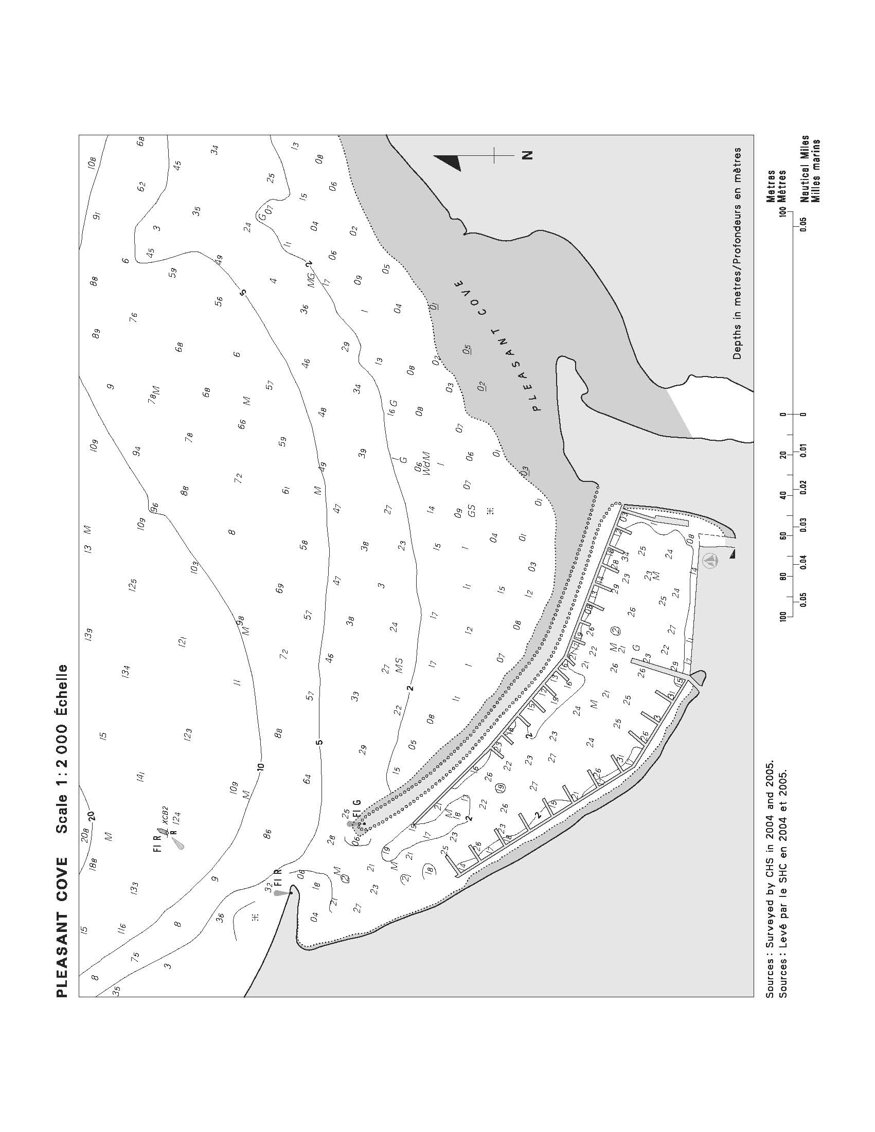
SECTION 5 – Edition 04/2007
LIST OF LIGHTS, BUOYS AND FOG SIGNALS CORRECTIONS
No. |
Name |
Position
-----
Latitude N.
Longitude W. |
Light
Characteristics |
Focal Height in m. above water
|
Nomi-nal Range |
Description
-----
Height in meters above ground |
Remarks
-----
Fog Signals |
ATLANTIC
|
155
H4064 |
Alma |
|
On outer end of public wharf.
45 36 00
64 56 41 |
Iso |
R |
4s |
7.9 |
4 |
Cylindrical mast.
6.0 |
Operates at night only.
Year round.
Chart:4337
Edn 04/07 (F07-039) |
366.3 |
Lower Jordan Bay light buoy KSB |
|
|
|
|
|
|
|
|
Delete from list.
Chart:4241
Edn 04/07 (F07-026) |
366.35 |
Lower Jordan Bay light buoy KS53 |
|
43 40 37
65 13 45.5 |
Q |
G |
1s |
..... |
..... |
Green spar, marked "KS53". |
Year round.
Chart:4241
Edn 04/07 (F07-027) |
382.01 |
Outer Farm Ledge light buoy KE52 |
|
43 38 27
65 02 15 |
Fl |
R |
4s |
..... |
..... |
Red, marked "KE52". |
Year round.
Chart:4209
Edn 04/07 (F07-046) |
398 |
Willow Cove light buoy UT |
|
N. of cove.
43 55 07.2
64 50 09.8 |
Mo( A) |
W |
6s |
..... |
..... |
Spar, red and white vertical stripes, marked "UT". |
Year round.
Chart:4240
Edn. 04/07 (F07-040) |
414.5 |
Long Cove light and bell buoy UC |
|
|
|
|
|
|
|
|
Delete from list.
Chart:4211
Edn. 04/07 (F07-049) |
414.5 |
Long Cove East Cardinal light and bell buoy UC |
|
44 05 12
64 32 14 |
Q(3) |
W |
10s |
..... |
..... |
Black, yellow and black, marked "UC". |
Year round.
Chart:4211
Edn. 04/07 (F07-049) |
511 |
Ketch Harbour light buoy HE19 |
|
Ketch Harbour entrance.
44 28 19.6
63 32 16 |
Fl |
G |
4s |
..... |
..... |
Green, marked "HE19". |
Year round.
Chart:4237
Edn 04/07 (F07-028) |
706
H3416 |
West Arichat Wharf |
|
On outer end of wharf.
45 30 50.7
61 04 59.2 |
F |
W |
..... |
3.1 |
11 |
Skeleton mast, enclosed lower portion.
2.5 |
Operates at night only.
Seasonal.
Chart:4307
Edn 04/07 (G06-010) |
1393
H1706 |
Île Dupuis |
|
On islet.
48 20 23.7
64 40 09.6 |
Fl |
R |
6s |
12.6 |
6 |
Square skeleton tower.
9.4 |
Flash 1 s; eclipse 5 s.
Operates at night only.
Year round.
Chart:4921
Edn 04/07 (Q07-014) |
1639
H1798 |
Anse-à-Valleau East |
|
49 04 49.9
64 32 42.2 |
Iso |
R |
2s |
16.9 |
6 |
Skeleton tower, orange rectangular daymark, black vertical stripe.
6.6 |
Operates at night only.
Year round.
Chart:4026
Edn 04/07 (Q07-012) |
1941
H2294
1942
H2294. 1 |
Ste-Famille range |
|
|
|
|
|
|
|
|
|
|
|
Near stone mill, S. side of channel.
46 57 51.7
70 58 34.3
052°36' 608.8m from front. |
F
F |
G
G |
.....
..... |
18.6
76.0 |
18
18 |
Square skeleton tower, orange daymark, black vertical stripe.
18.5
Square skeleton tower, orange daymark, black vertical stripe.
15.5 |
Visible in line of range.
Year round.
Visible in line of range.
Year round.
Chart:1317
Edn 04/07 (Q07-010) |
INLAND WATERS
|
509.61 |
Toronto East Gap |
|
W. side of Toronto East Gap.
43 37 44.7
79 20 59.4 |
Fl |
G |
4s |
4.7 |
..... |
Cylindrical mast.
3.0 |
Privately maintained.
Seasonal.
Chart:2085
Edn 04/07(B07-005) |
677 |
Livingstone Channel Upper Entrance |
|
On pier at head of channel, near intersection of Ballards Reef and Livingstone channels.
42 08 08.9
83 07 20.8 |
Fl |
Al
W-R |
20s |
12.9 |
5 |
White cylindrical tower on square block. |
Flash 1 s white; eclipse 9 s;
flash 1 s red; eclipse 9 s.
Year round.
Chart:14853(U.S.)
Edn 04/07(B06-81-83) |
828 |
Cape Croker |
|
On the point, SE. of Cape Croker.
44 57 21.3
80 57 38.1 |
Iso |
W |
4s |
18.7 |
13 |
White octagonal tower, red upper portion.
15.9 |
Seasonal.
Chart:2282
Edn 04/07(D06-090) |
1611 |
Poplar Point Reef |
|
On reef, E. side of Lake Winnipeg.
53 00 05
97 40 29 |
Fl |
W |
4s |
14.5 |
6 |
Square tower, red and white rectangular daymark. |
Radar reflector.
Seasonal.
Chart:6241
Edn 04/07 |

|
INSTRUCTIONS: |
|
|
Mariners are requested to notify the responsible authorities when new or suspected dangers to navigation are discovered, changes are observed in aids to navigation, or corrections to publications are seen to be necessary. |
|
|
* In the case of new or suspected dangers to navigation, it is important that all details be given in order to aid with future investigations. Items of interest include heights, depths, physical description, type of bottom and equipment method used to position the item. It is helpful to mark details on chart, which will be promptly replaced by the Canadian Hydrographic Service. |
|
|
Reports should be made to the nearest Marine Communications and Traffic Services Centre and should be confirmed in writing to: |
|
Director, Navigation Systems
Canadian Coast Guard
Department of Fisheries and Oceans
Ottawa, Ontario, K1A 0E6
|
In the case of information concerning navigational aids or the List of Lights, Buoys and Fog Signals. |
OR
|
|
Dominion Hydrographer
Canadian Hydrographic Service
Department of Fisheries and Oceans
Ottawa, Ontario, K1A 0E6
CHSINFO@DFO-MPO.GC.CA |
In the case of new or suspected
dangers to navigation, or where
corrections to "Sailing Directions"
appear to be necessary.
|
For general questions on Coast Guard programs or services, please send an e-mail message to:
info@dfo-mpo.gc.ca
(Please include your postal and e-mail address)
For questions regarding the content of these pages contact:
Theresa Kenney
(613) 990-3016
Site Administrator
|